
Maps of Solar Eclipses from 1760 to 1779

Transito de la sombra y Penumbra de la Luna sobre la superficie de la Tierra, en el Eclipse del dia 24 de Junio de 1778.
This map of the 1778 total solar eclipse is the first created in the Americas. This map made in Mexico came 53 years earlier than the first American eclipse map in 1831. The eclipse hours are marked with curves labeled with roman numerals starting with VII and ending at V. This indicates local time during maximum eclipse based on solar time.

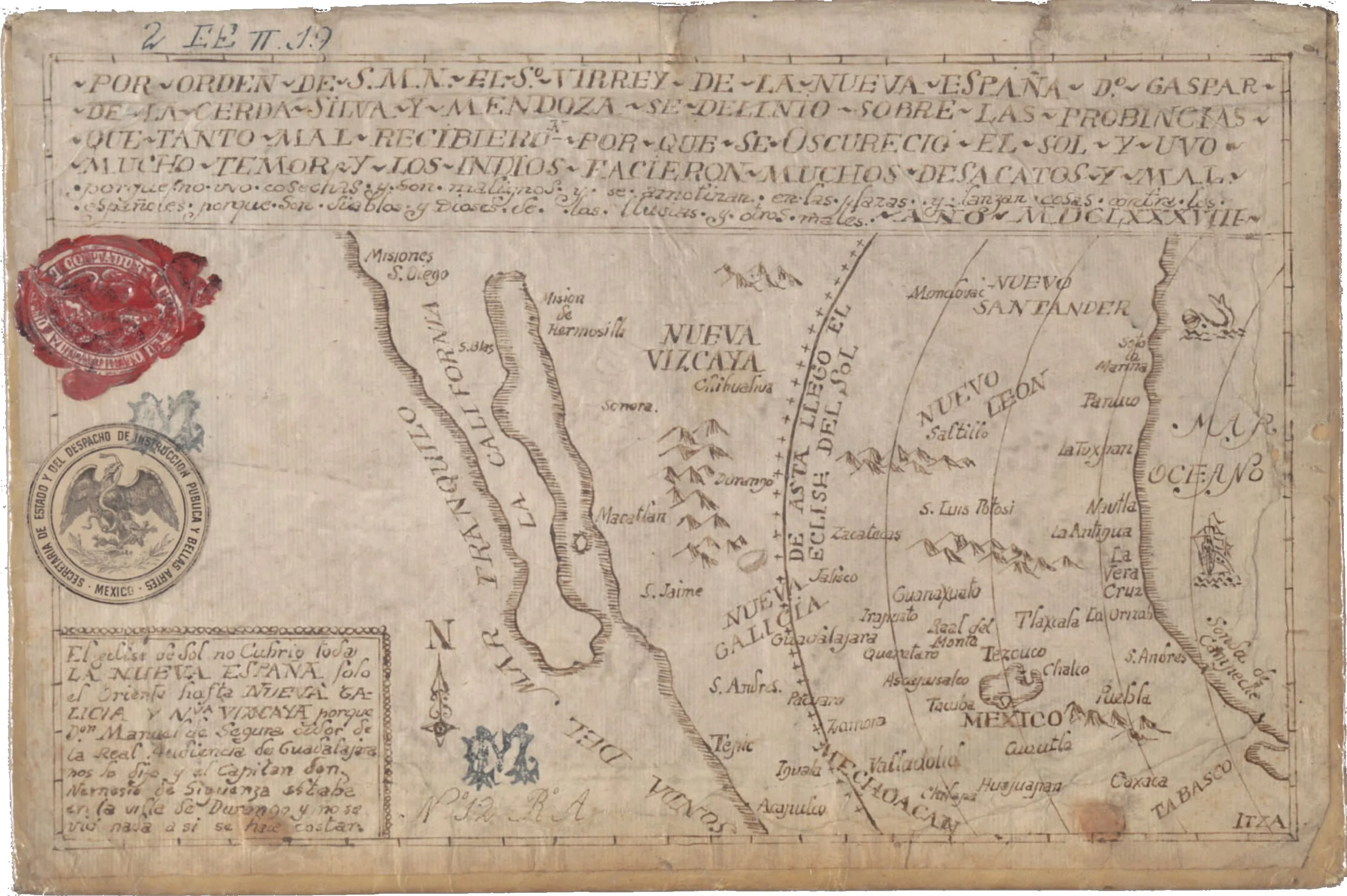
This enigmatic Mexican eclipse map shows a purported penumbral shadow of a solar eclipse dated 1688. There was a total and an annular solar eclipse in 1688, but neither eclipse was close to Mexico. It clearly is an eclipse map, but which eclipse it maps is a mystery!
Total Solar Eclipse of 1760 June 13

Eustachio Zanotti
Title: Eclipsis Telluris XII Juni MDCCLX
Volume: Ephemerides motuum coelestium ex anno 1751 in annum 1762 ad meridianum Bononiae supputatae auctoribus Eustachio Zanotto ... et sociis ad usum Instituti
Source: https://preserver.beic.it/delivery/DeliveryManagerServlet?dps_pid=IE6012336
Total Solar Eclipse of 1762 October 17

Eustachio Manfredi
Title: Eclipsis Telluris XVI Octobris MDCCLXII
Volume: Ephemerides motuum coelestium ex anno 1751 in annum 1762 ad meridianum Bononiae supputatae auctoribus Eustachio Zanotto ... et sociis ad usum Instituti
Source: https://preserver.beic.it/delivery/DeliveryManagerServlet?dps_pid=IE6012336
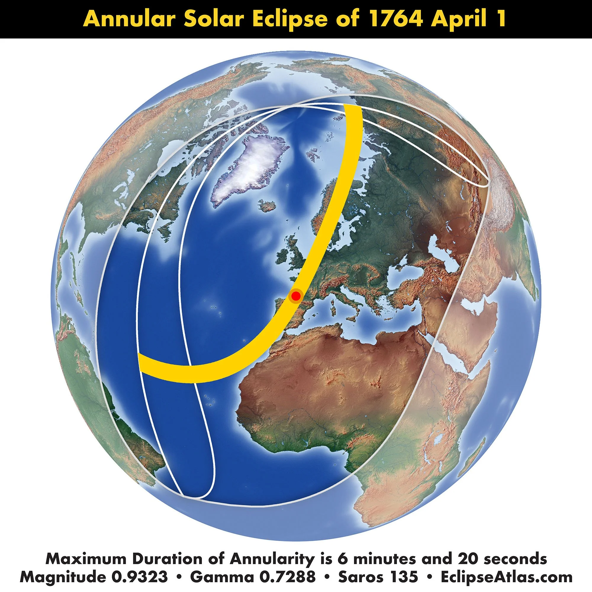
Annular Solar Eclipse of 1764 April 1
Joseph Jerome le Francai
Title: "Carte des Phases de l'Eclipse du I. Avril 1764 et de Tous les Pays de la Terre ou l'on a pu Voir Cette Eclipse", From his book Astronomie published in 1761.
Source: Collection of Michael Zeiler
Unknown
Title: Figure du Passage de la Penombre de la Lune sur la Surface de la Terre pendant l’Eclipse de Soleil du 1 Avril 1764
Source: Collection of Michael Zeiler
This map, created by the French astronomer and mathematician Nicole-Reine Lepaute in 1762, provides a detailed illustration of the predicted path of the solar eclipse across Europe and part of North Africa on April 1, 1764. The map was engraved by Madame Lattre and Madame Elisabeth Clare Tardieu.
What is noteworthy about this map is that it is a collaboration of three women in an era when men dominated astronomy and cartography.
Gentlemen’s Magazine, 1764
Title: Account of the Eclipse of the Sun on the first of April.
Source: Collection of Michael Zeiler
Charles-Louis Desnos
Title: Dans laquelle on voit la Projection que l’ombre de la Lune tracera sur la surface de cette partie de notre Globe dans le celebre Eclipse central et annulaire du Soleil qui arrivera le 1 Avril 1764. A Paris chez Desnos, Ingenieur Geographie, Rue St Jacq. au Globe.
Source: https://americanhistory.si.edu/collections/object/nmah_1451892
Nicole-Reine Lapaute
Title: PASSAGE DE L’OMBRE DE LA LUNE au travers de l’Europe dans l’Eclipse de Soleil Centrale et annulaire qui sobservera le 1er. Avril 1764…
Source:
George Witchell
Title: A map of the Passage of ye Moon’s Shadow which will happen April the 1st 1764.
Source: https://objects.library.uu.nl/reader/index.php?obj=1874-33174&lan=en
Partial Solar Eclipse of 1765 August 16

Eustachio Zanotti
Title: Eclipsis Telluris 16 Augusti 1765.
Volume: Ephemerides motuum caelestium ex anno 1763 in annum 1774 ad meridianum Bononiae ex Halleii tabulis supputatae auctoribus Eustachio Zanotto Bononiensi Scientiarum instituti astronomo et sociis ad usum Instituti
Source: https://preserver.beic.it/delivery/DeliveryManagerServlet?dps_pid=IE6359564
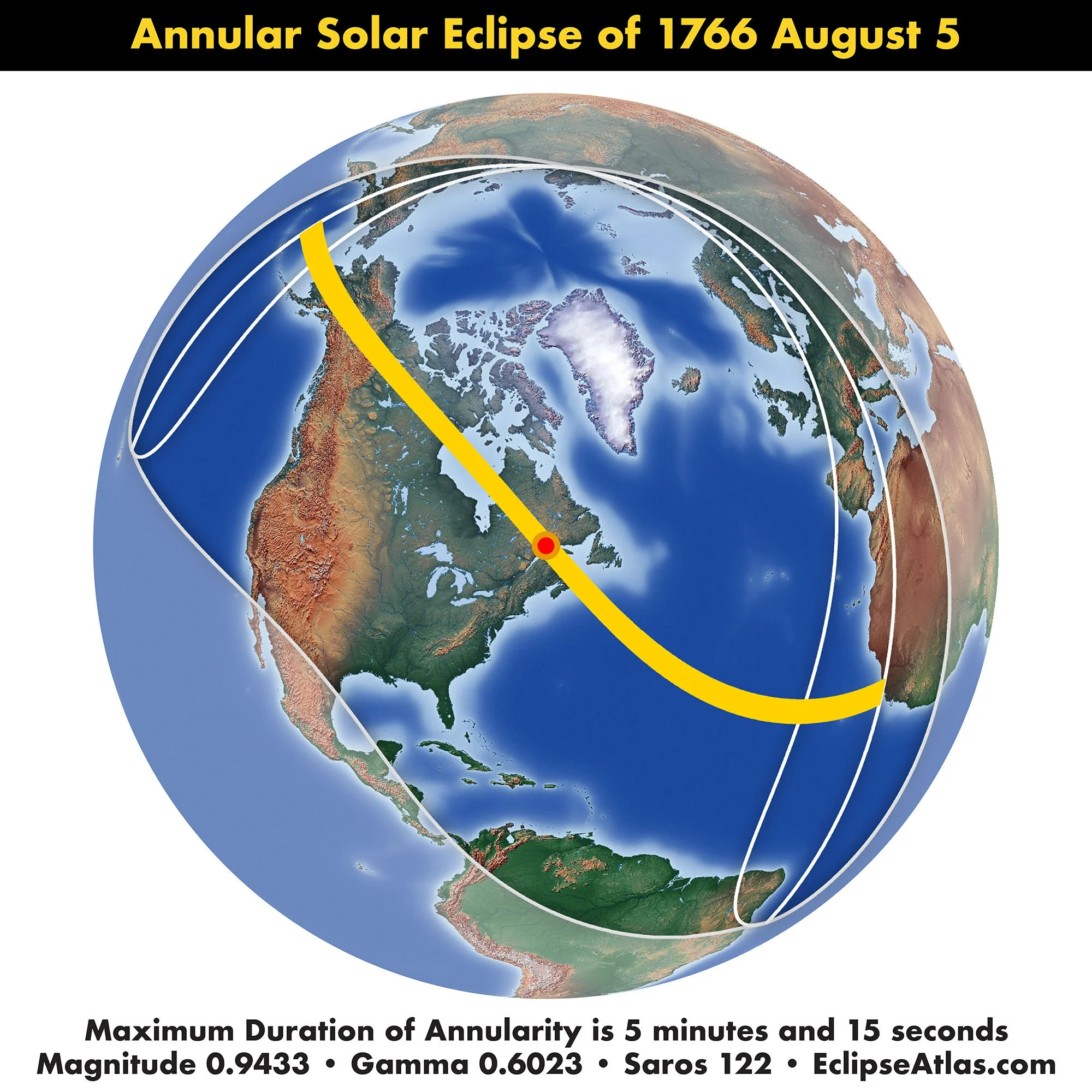
Annular Solar Eclipse of 1766 August 5
Eustachio Zanotti
Title: Eclipsis Telluris 5 Augusti 1766.
Volume: Ephemerides motuum caelestium ex anno 1763 in annum 1774 ad meridianum Bononiae ex Halleii tabulis supputatae auctoribus Eustachio Zanotto Bononiensi Scientiarum instituti astronomo et sociis ad usum Instituti
Source: https://preserver.beic.it/delivery/DeliveryManagerServlet?dps_pid=IE6359564
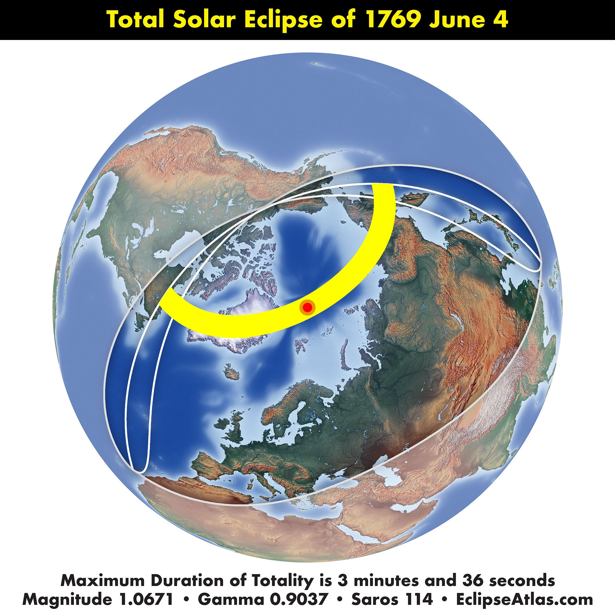
Total Solar Eclipse of 1769 June 4
Eustachio Zanotti
Title: Eclipsis Telluris 3 Junii 1769
Volume: Ephemerides motuum caelestium ex anno 1763 in annum 1774 ad meridianum Bononiae ex Halleii tabulis supputatae auctoribus Eustachio Zanotto Bononiensi Scientiarum instituti astronomo et sociis ad usum Instituti
Source: https://preserver.beic.it/delivery/DeliveryManagerServlet?dps_pid=IE6359564
Annular Solar Eclipse of 1773 March 23
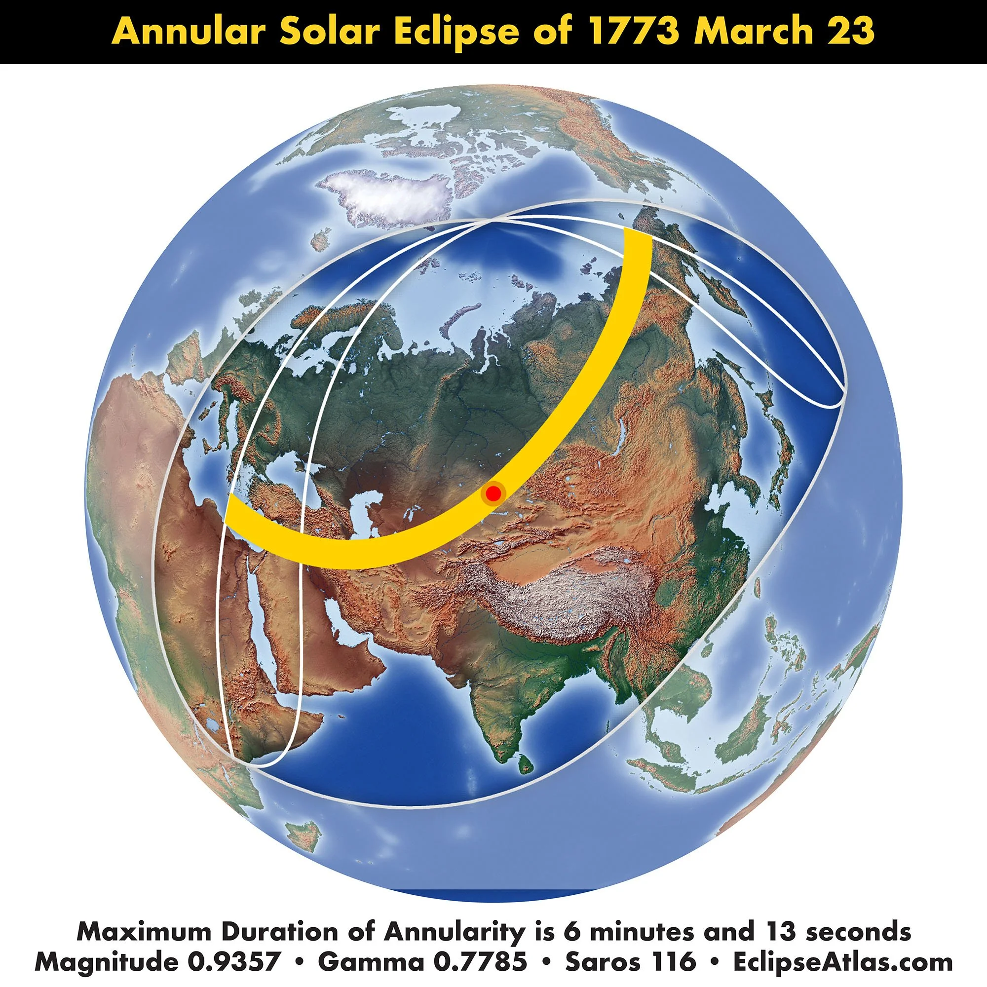
Eustachio Zanotti
Title: Eclipsis Telluris 22 Martii 1773.
Volume: Ephemerides motuum caelestium ex anno 1763 in annum 1774 ad meridianum Bononiae ex Halleii tabulis supputatae auctoribus Eustachio Zanotto Bononiensi Scientiarum instituti astronomo et sociis ad usum Instituti
Source: https://preserver.beic.it/delivery/DeliveryManagerServlet?dps_pid=IE6359564
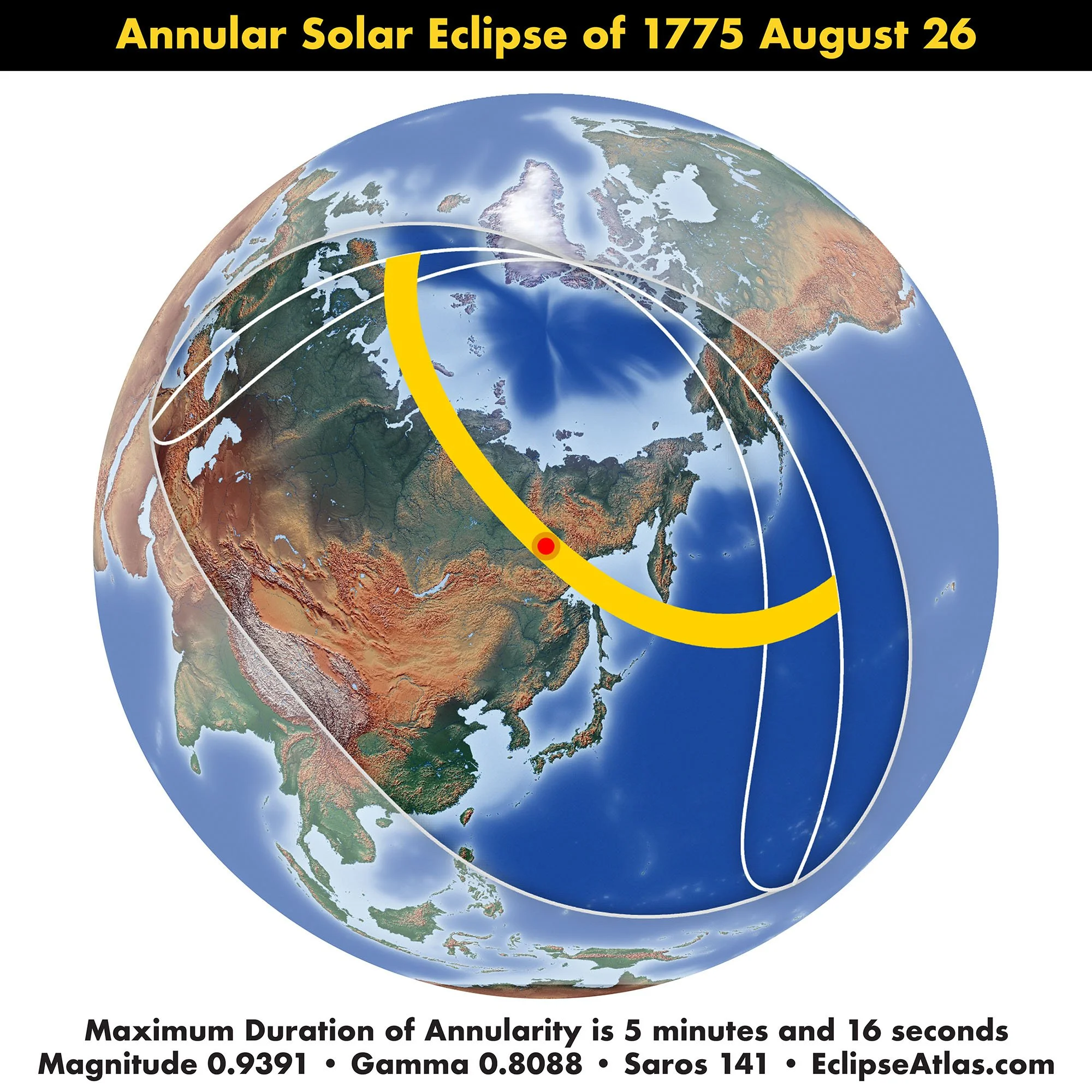
Annular Solar Eclipse of 1775 August 26
This eclipse map is an early example of graduated shading in the penumbral path, giving a realistic idea of the darknesses of obscuration. This is an expressive cartographic technique that is rarely applied in eclipse cartography.
Johann Gottfried Köhler based his eclipse cartography upon the calculations by astronomer Nicolas Louis La Caille with cartography by Tobias Mayer.
Johann Gottfried Köhler
Title: Repraesentation de l'Eclipse du Soleil le 26 Aout 1775 considerée comme Eclipse de la Terre
Source: https://www.deutschefotothek.de/documents/obj/90082409/df_dk_0009959
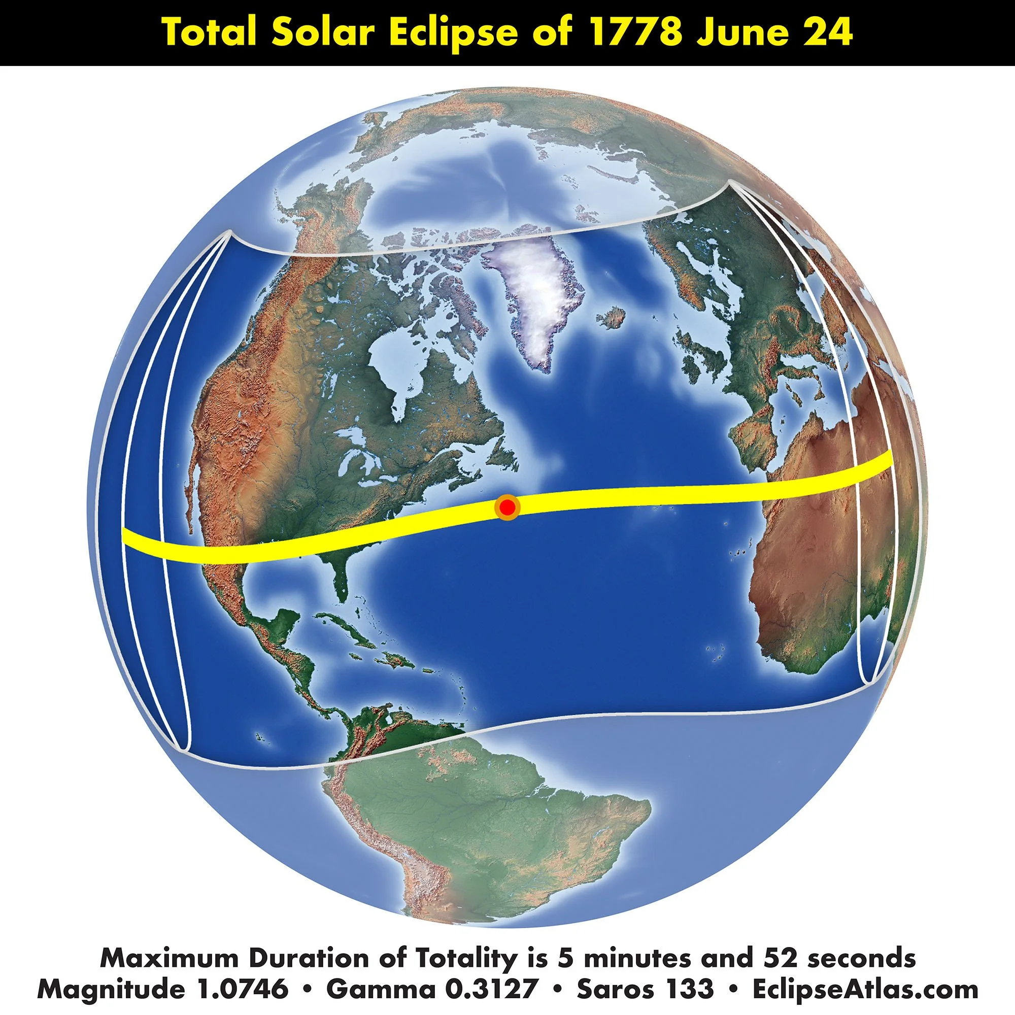
Total Solar Eclipse of 1778 June 24
This total solar eclipse crossed North America from Mexico to the east coast of the USA.
This eclipse map by Antonio de Leon y Gama is the earliest from the Americas and shows the following eclipse features:
Path of totality with central line and northern and southern limit lines
Degrees of eclipse magnitude. The curves that are labeled Dig.3, Dig.6, and Dig.9 represent eclipse magnitudes of 25%, 50%, and 75%. Old eclipse maps express eclipse magnitude by using 12 digits to apportion the Sun’s diameter
Where the eclipse begins and ends at sunrise and sunset
Where the eclipse is at greatest eclipse during sunrise and sunset
Curves showing hours in local solar time, starting at VII through XII to VI
The designation of the key eclipse features is correct but the geographic representations of the Americas, Europe, and Africa are poor given contemporary geographic knowledge.
Antonio de Leon y Gama
Title: Transito de la sombra y penumbra de la Luna sobre la superficie de la Tierra, en el Eclips del dia 24 de Junio de 1778.
Source: https://www.davidrumsey.com/luna/servlet/detail/RUMSEY~8~1~318434~90087380:Transito-de-la-sombra-y-penumbra-de?qvq=q:eclipse;lc:RUMSEY~8~1&mi=34&trs=117
This early Mexican eclipse map is a mystery. By appearance, it maps the
https://digicoll.lib.berkeley.edu/record/153962?v=uv#?xywh=-337%2C0%2C2172%2C1125

Joseph Lepaute Dagelet and Nicole-Reine Lepaute, husband and wife, created these stereographic hemisphere pairs with the 1778 path of totality and extent of the lunar penumbra. The French astronomer Nicole-Reine Lepaute previously created a map of the predicted path of the solar eclipse across Europe and part of North Africa on April 1, 1764.
Joseph Lepaute Dagelet
Nicole-Reine Lepaute
Title: Figure de l'éclipse de soleil du 24 juin 1778 où l'on voit les phases de cette éclipse pour tous les pays de la terre / calculée par M. Le Paute Dagelet
Source: https://gallica.bnf.fr/ark:/12148/btv1b8444065r
Eustachio Zanotti
Title: Eclipsis Telluris 24 Juni 1778.
Volume: Ephemerides motuum caelestium ex anno 1775 in annum 1786 ad meridianum Bononiae ex Halleii tabulis supputatae auctoribus Eustachio Zanotto ... et sociis ad usum Instituti
Source: https://preserver.beic.it/delivery/DeliveryManagerServlet?dps_pid=IE1307050
Partial Solar Eclipse of 1779 June 14
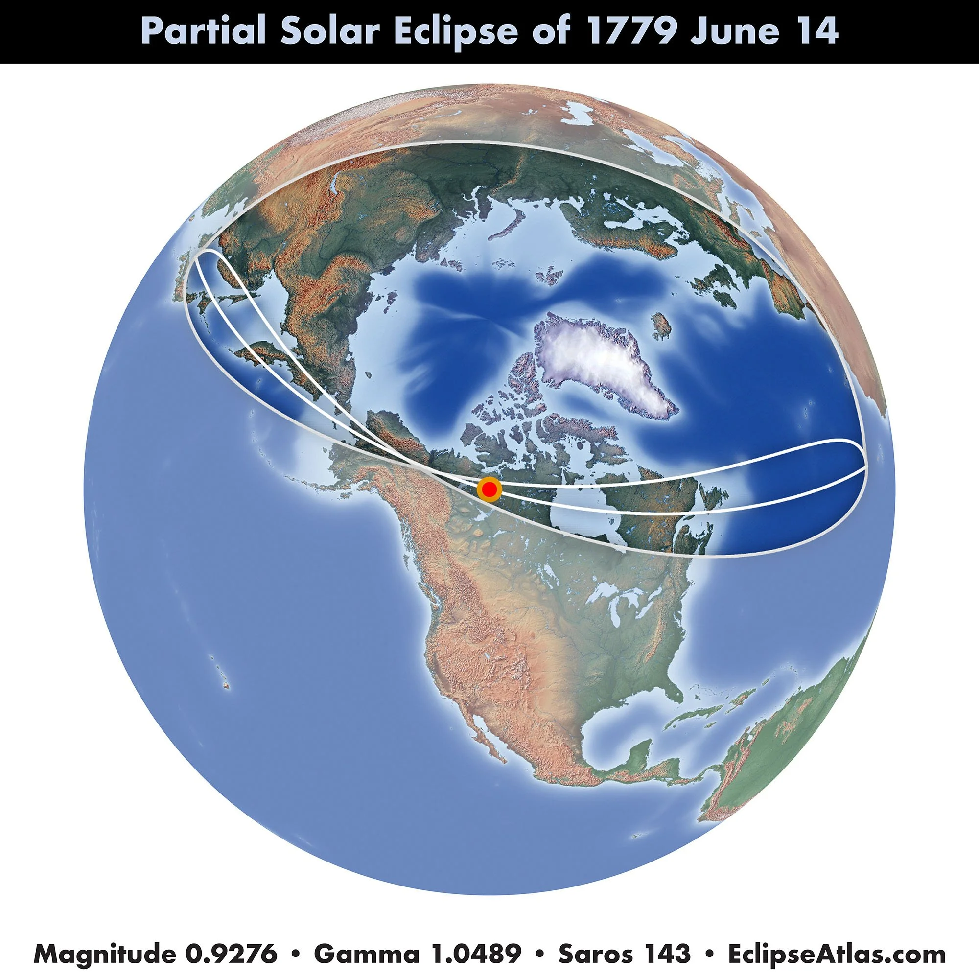
Eustachio Zanotti
Title: Eclipsis Telluris 13 Junii 1779.
Volume: Ephemerides motuum caelestium ex anno 1775 in annum 1786 ad meridianum Bononiae ex Halleii tabulis supputatae auctoribus Eustachio Zanotto ... et sociis ad usum Instituti
Source: https://preserver.beic.it/delivery/DeliveryManagerServlet?dps_pid=IE1307050