
Maps of Solar Eclipses from 1850 to 1854

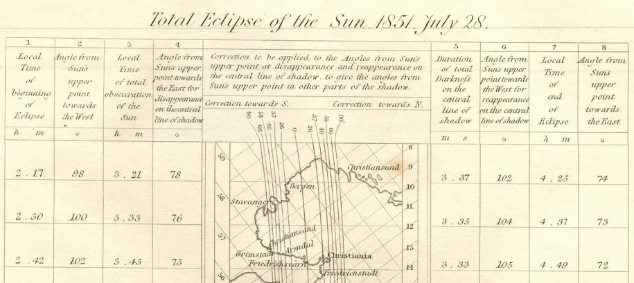
This eclipse map is unique among all the maps on this web site. The interesting feature on this map that is to be found in no other map are local corrections to angle of contact during the eclipse. From the map: “Correction to be applied to the Angles from Sun’s upper point at disappearance and reappearance on the central line of shadow, to give the angles from Sun’s upper point in other parts of the shadow.” Another interesting aspect of this map is that only a narrow strip of land is shown directly on or near the path of totality with the map tilted to follow the general path of eclipse. The full map is presented below.

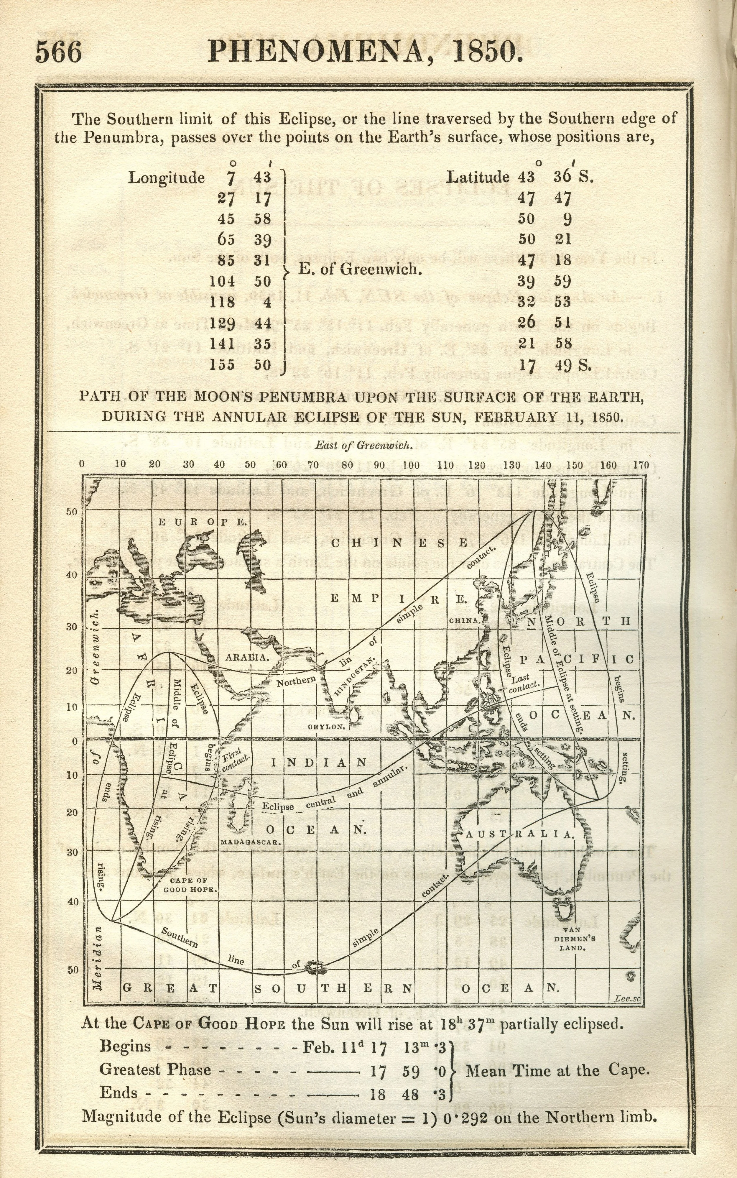
The Nautical Almanac and Astronomical Ephemeris Path of the Moon’s Penumbra upon the Surface of the Earth during the Annular Eclipse of the Sun, February 11, 1850. Source: Scanned at the Federal Repository Library, UC Berkeley


The Nautical Almanac and Astronomical Ephemeris Path of the Moon’s Penumbra upon the Surface of the Earth during the Annular Eclipse of the Sun, February 11, 1850. Scanned at the Federal Repository Library, UC Berkeley

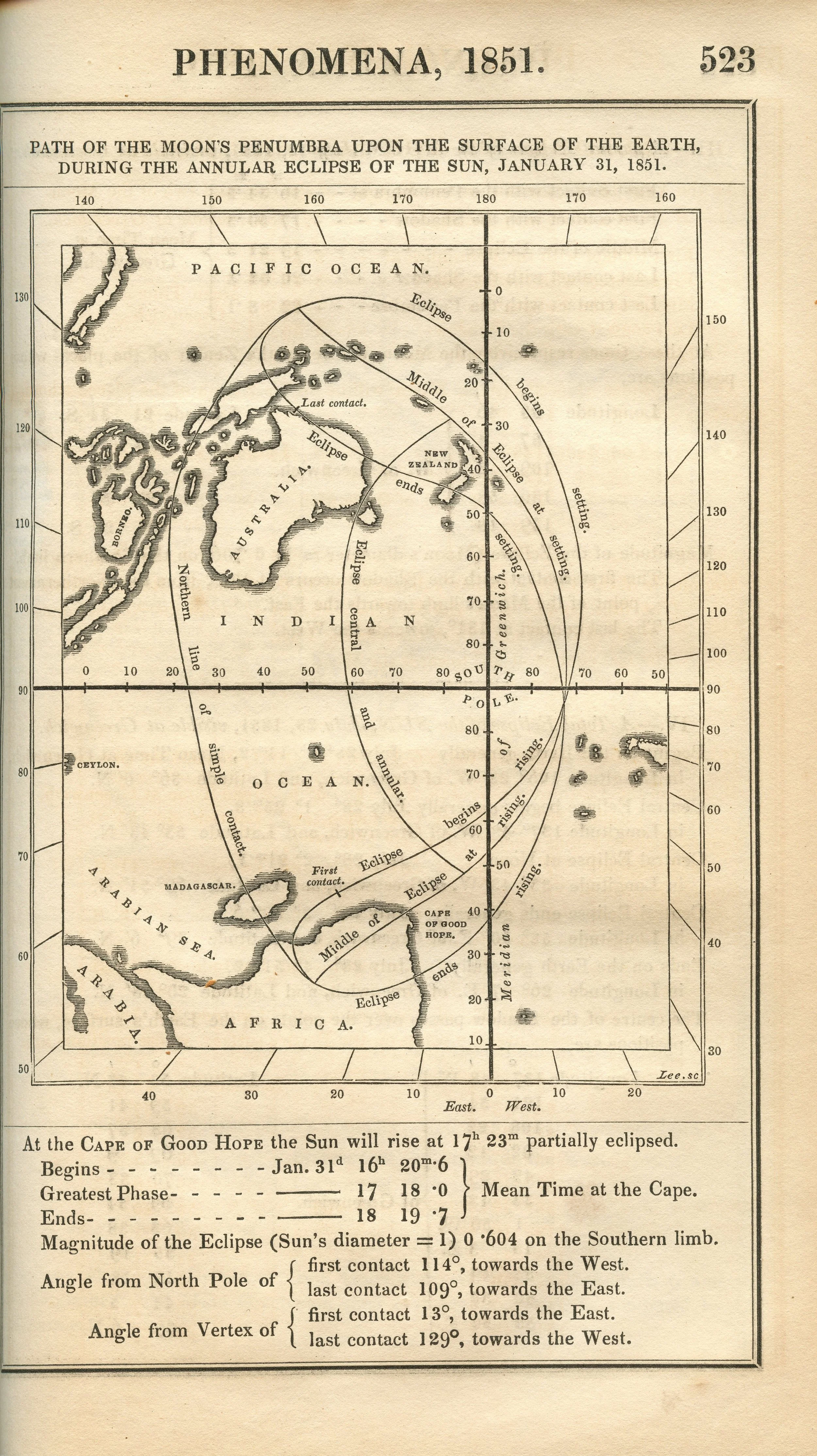
The Nautical Almanac and Astronomical Ephemeris Path of the Moon’s Penumbra upon the Surface of the Earth during the Annular Eclipse of the Sun, January 31, 1851. Scanned at the Federal Repository Library, UC Berkeley


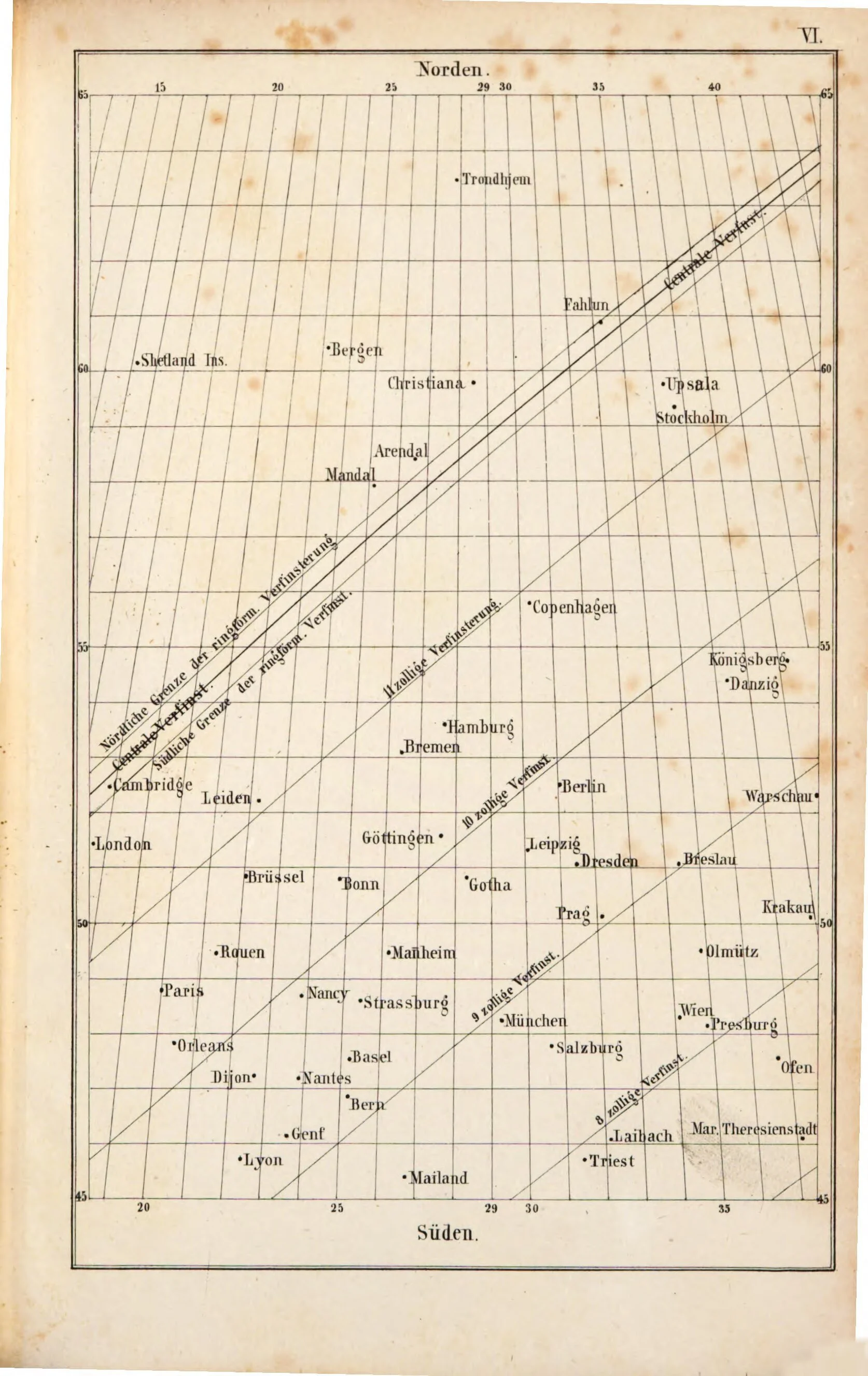
Dr. F. Schorr Karte der totalen Sornenfinsterniss von 16-28 Juli 1851... für Preussen, Polen und die angesnzerden Länder... / von Dr F. Schorr. gallica.bnf.fr
Adolph Drechsler digitale-sammlungen.de

Jacob Heinrich Wilhelm Lehmann Uebersichtstarte der Sonnenfinsterniss am 28. Juli für die Erboberfläche digitale-sammlungen.de

Simon Stampler Die Sonnenfinsterniss am 28 Juli 1851.. digitale-sammlungen.de

Committee of the British Association Suggestions to Astronomers for the Observation of the Total Eclipse of the Sun Collection of Michael Zeiler

Harper’s New Monthly Magazine Collection of Michael Zeiler
Harper’s New Monthly Magazine Collection of Michael Zeiler

Illustrated London News Map of Europe, showing the course of the shadow in the total eclipse of the Sun July 28 1851. Collection of Michael Zeiler
The Nautical Almanac and Astronomical Ephemeris Path of the Moon’s Penumbra upon the Surface of the Earth during the Annular Eclipse of the Sun, February 11, 1850. Scanned at Federal Repository Library, UC Berkeley
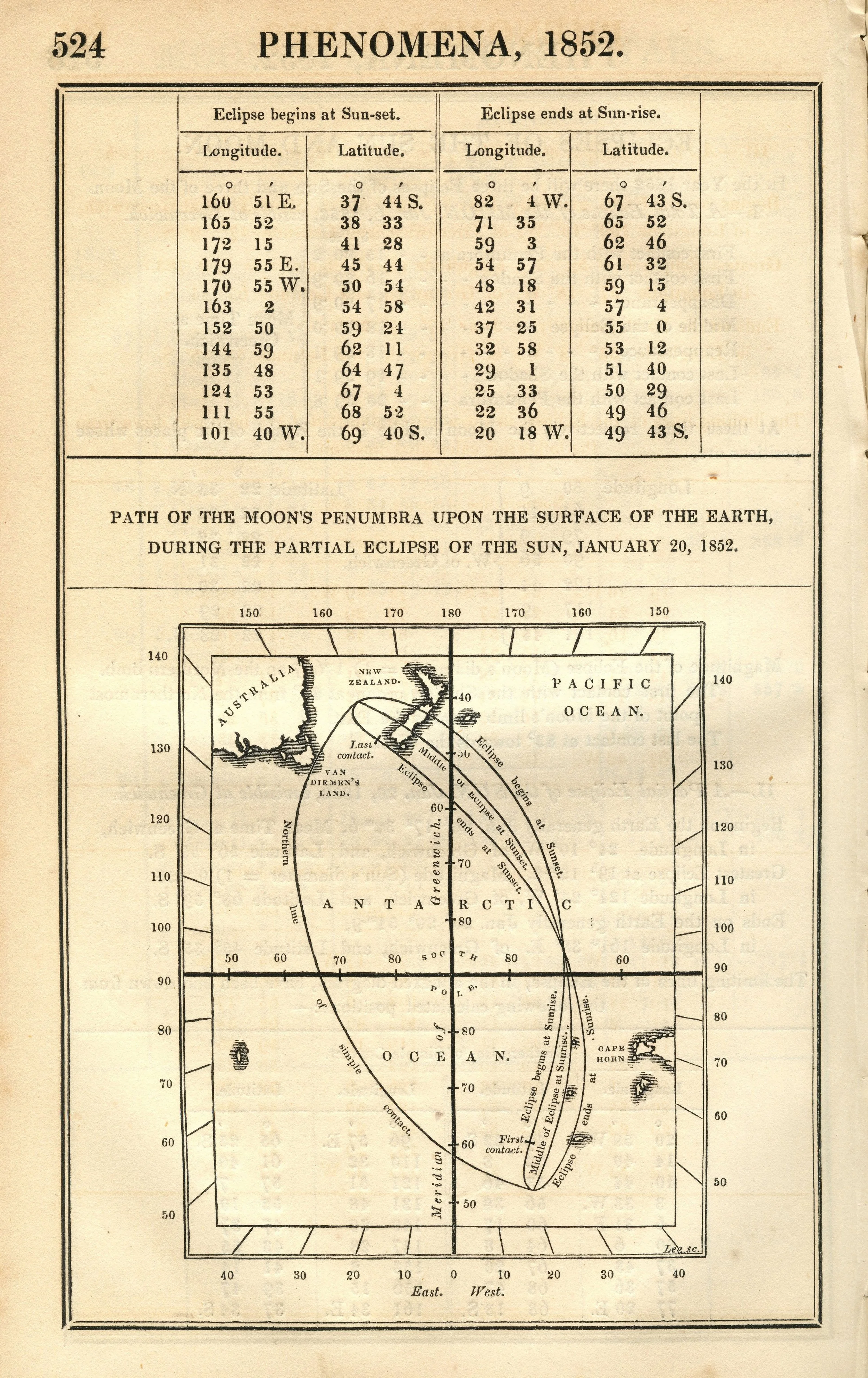
The Nautical Almanac and Astronomical Ephemeris Path of the Moon’s Penumbra upon the Surface of the Earth during the Partial Eclipse of the Sun, January 20, 1852. Scanned at the Federal Repository Library, UC Berkeley
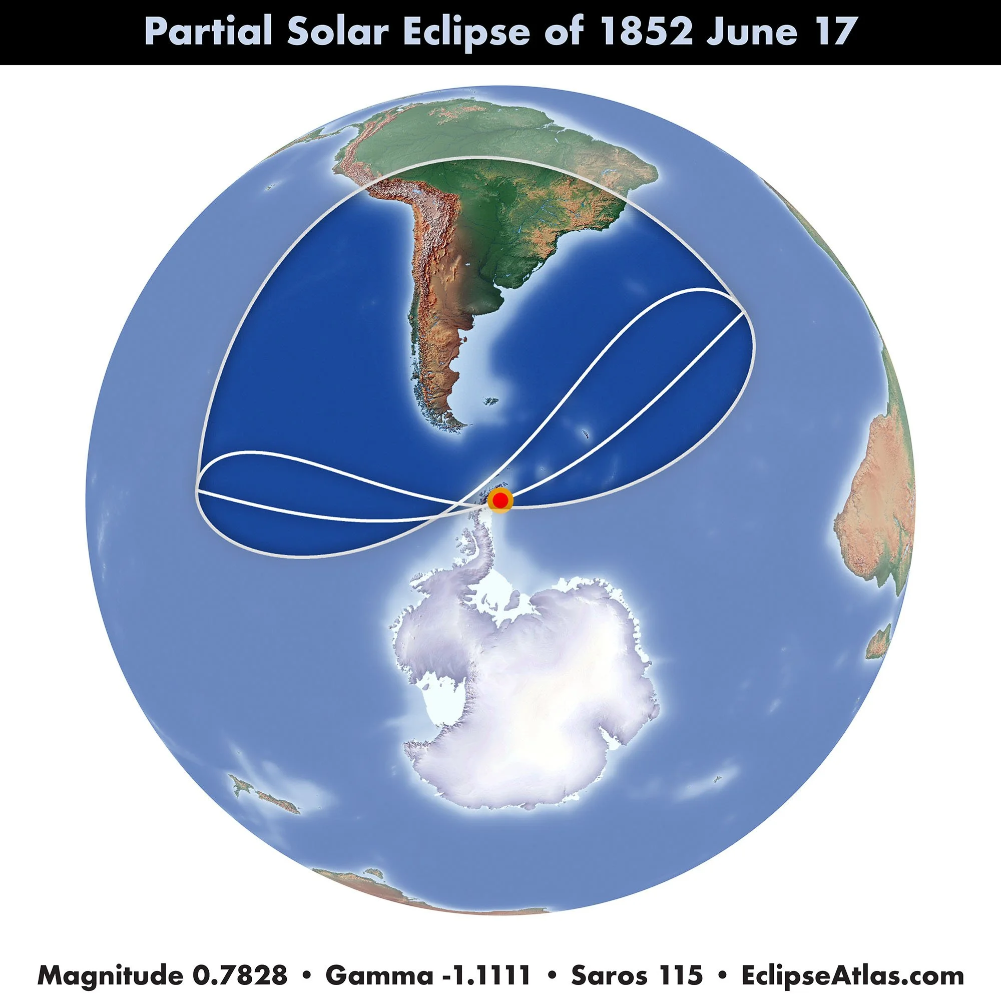

The Nautical Almanac and Astronomical Ephemeris Path of the Moon’s Penumbra upon the Surface of the Earth during the Partial Eclipse of the Sun, June 17, 1852. Scanned at the Federal Repository Library, UC Berkeley

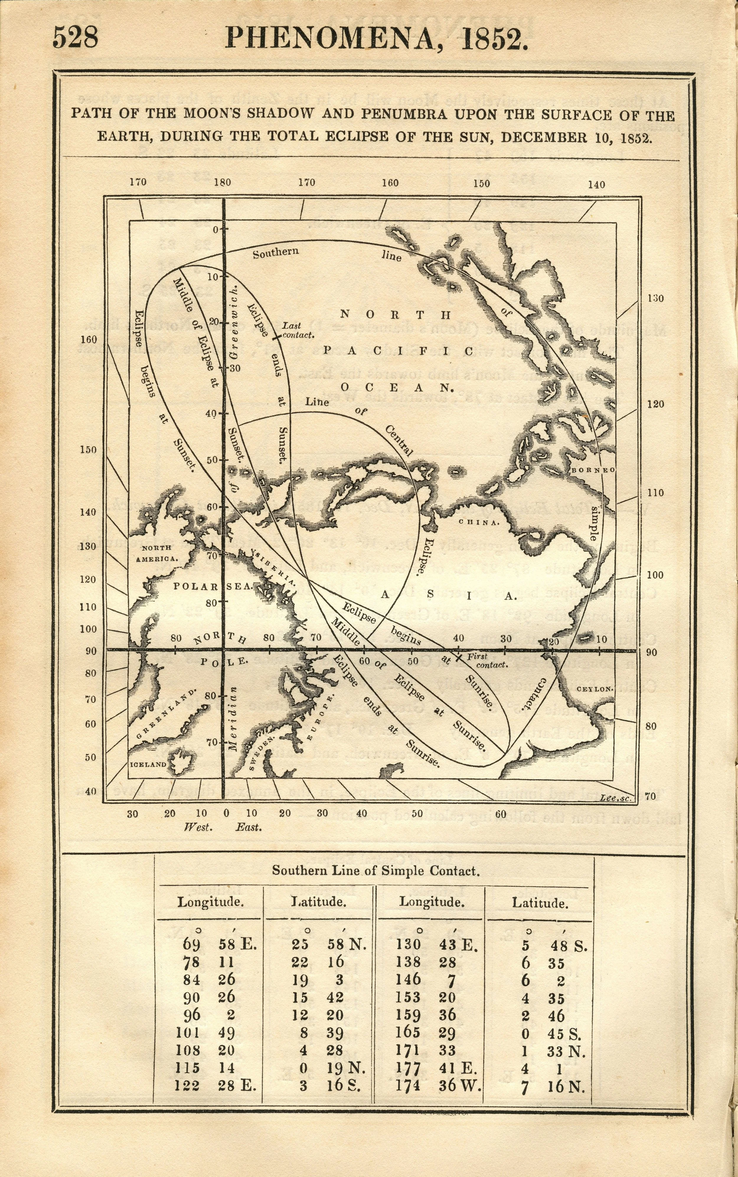
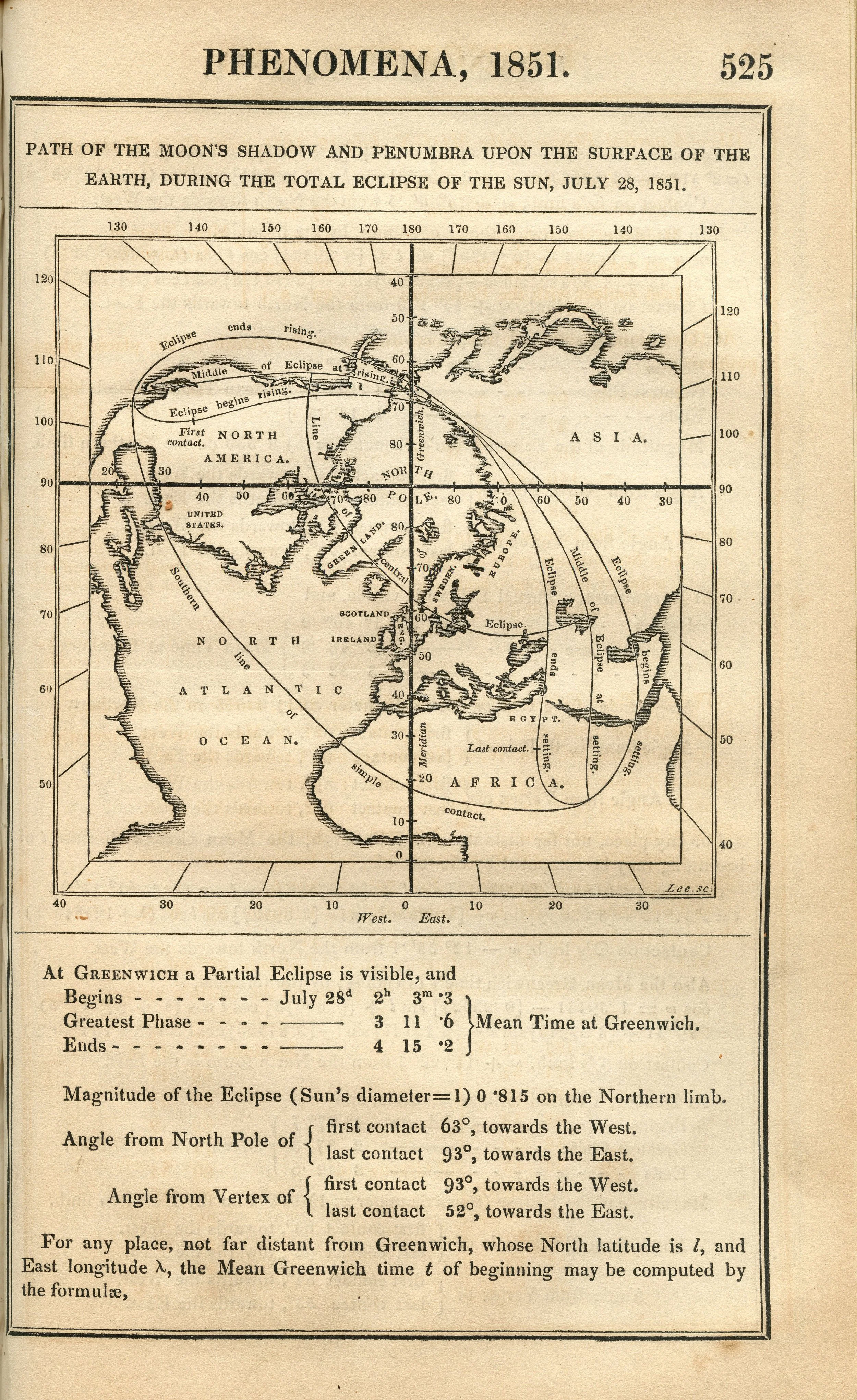
The Nautical Almanac and Astronomical Ephemeris Path of the Moon’s Shadow and Penumbra upon the Surface of the Earth during the Total Eclipse of the Sun, December 10, 1852. Scanned by Michael Zeiler at Federal Repository Library, UC Berkeley
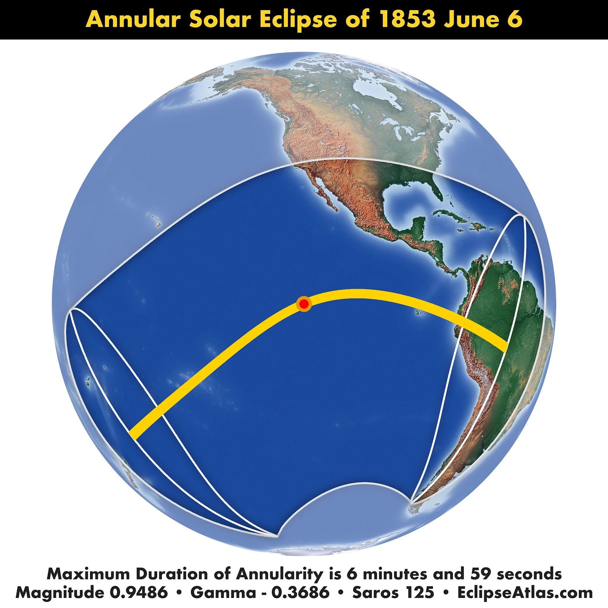
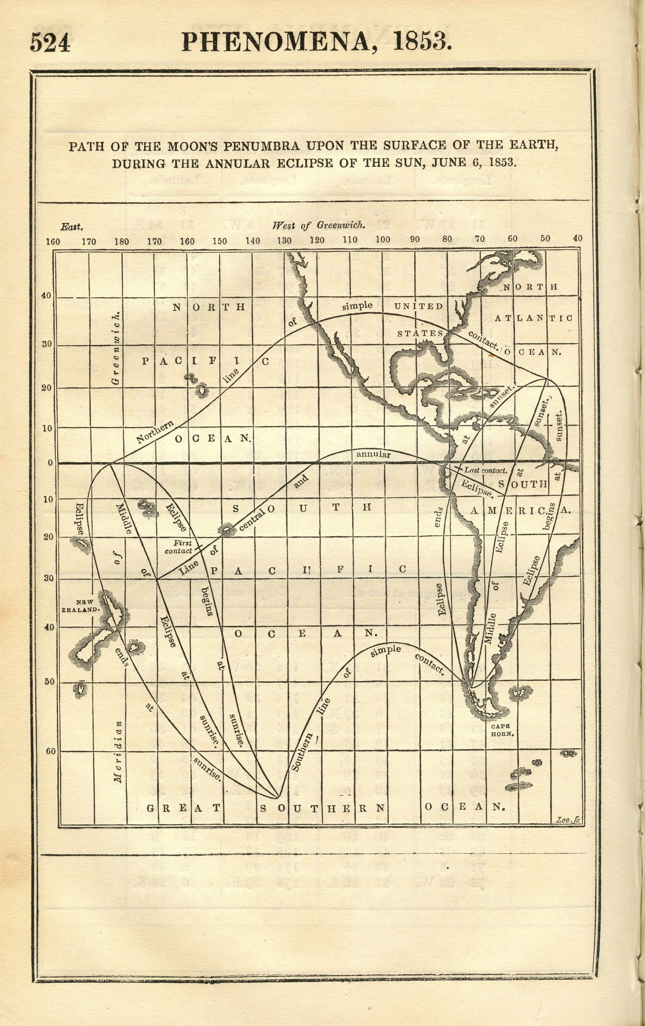
The Nautical Almanac and Astronomical Ephemeris Path of the Moon’s Penumbra upon the Surface of the Earth during the Annular Eclipse of the Sun, June 6, 1853. Scanned at the Federal Repository Library, UC Berkeley

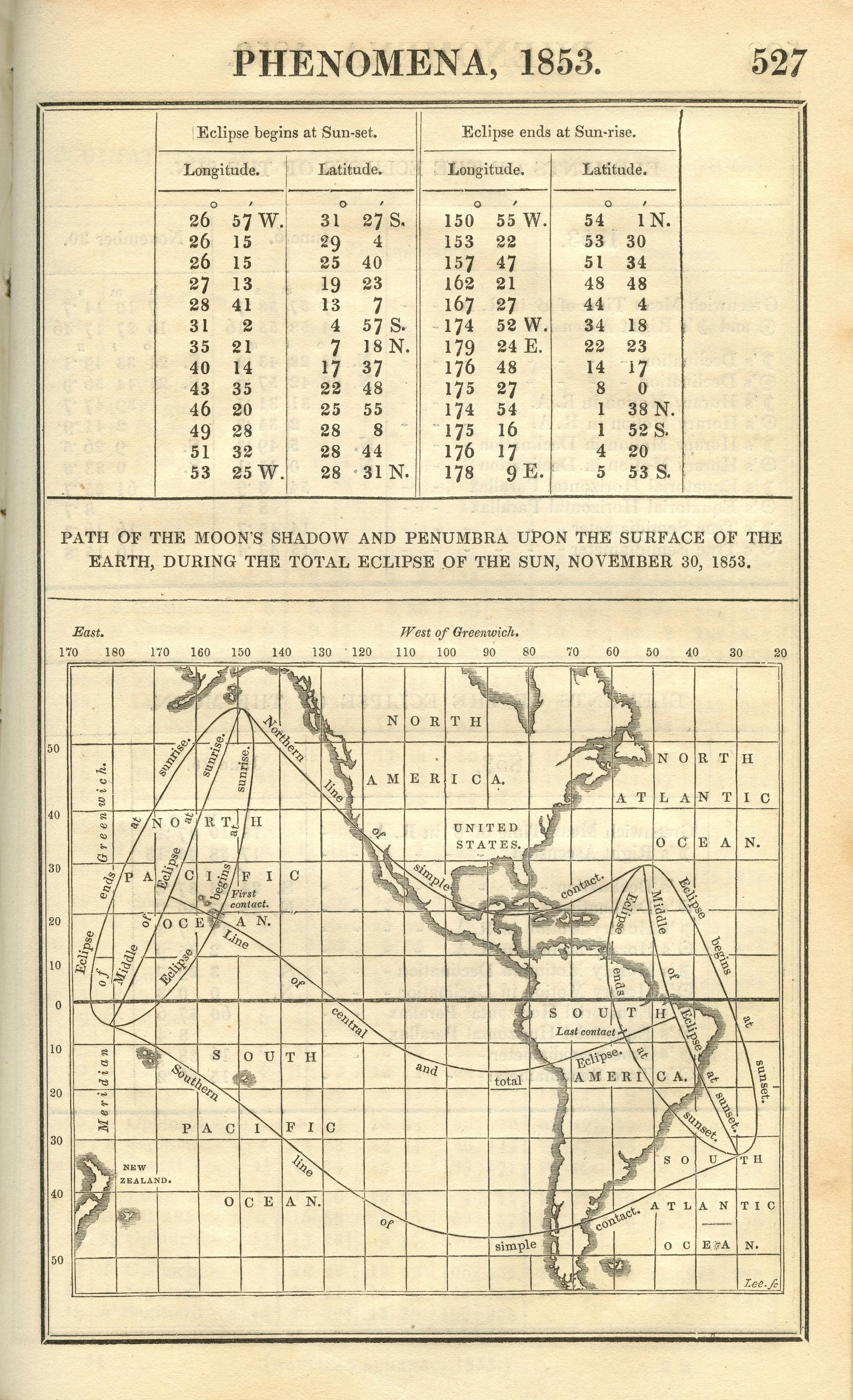
The Nautical Almanac and Astronomical Ephemeris Path of the Moon’s Shadow and Penumbra upon the Surface of the Earth during the Total Eclipse of the Sun, November 30, 1853. Scanned by Michael Zeiler at Federal Repository Library, UC Berkeley

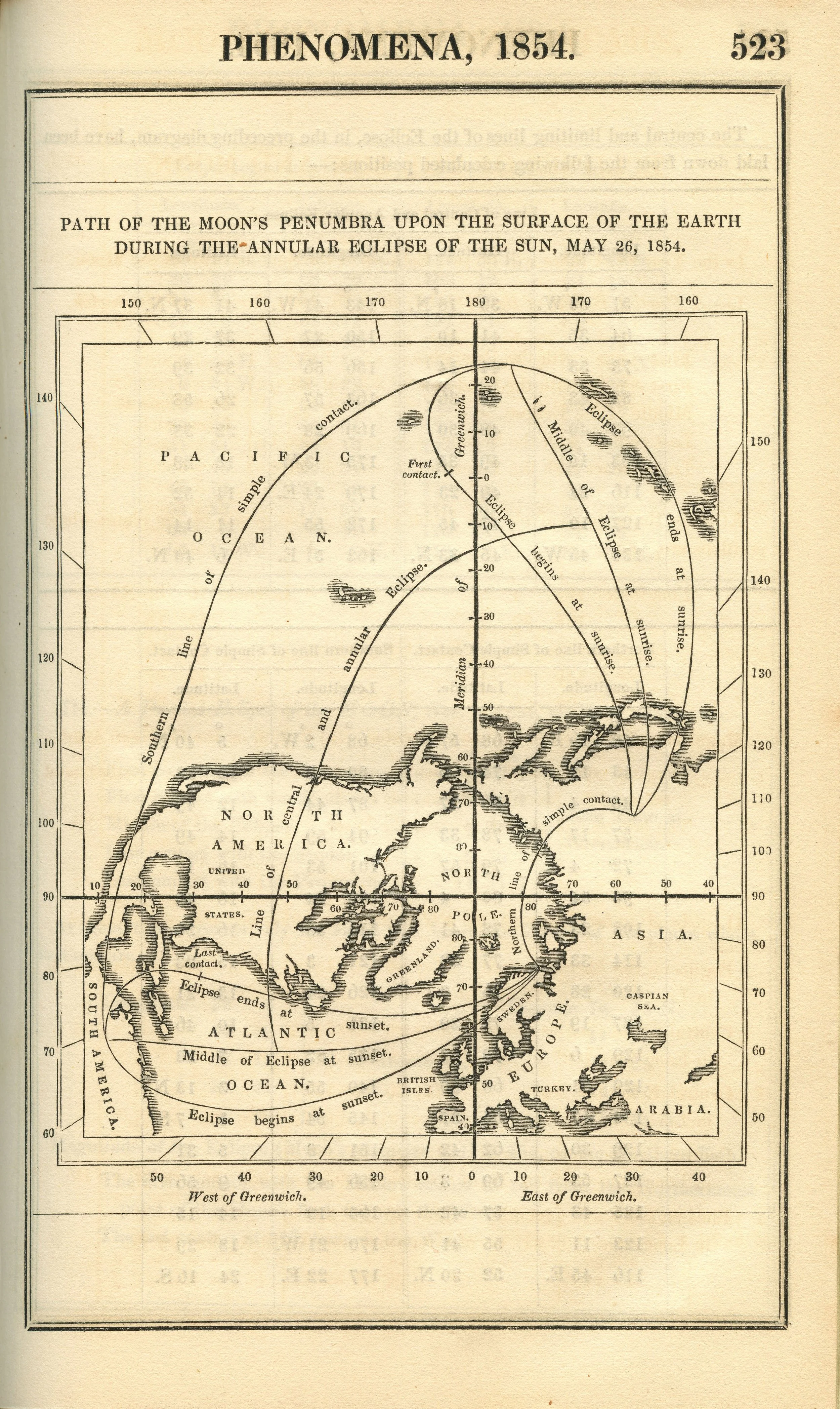
The Nautical Almanac and Astronomical Ephemeris Path of the Moon’s Penumbra upon the Surface of the Earth during the Annular Eclipse of the Sun, May 26, 1854. Scanned by Michael Zeiler at Federal Repository Library, UC Berkeley
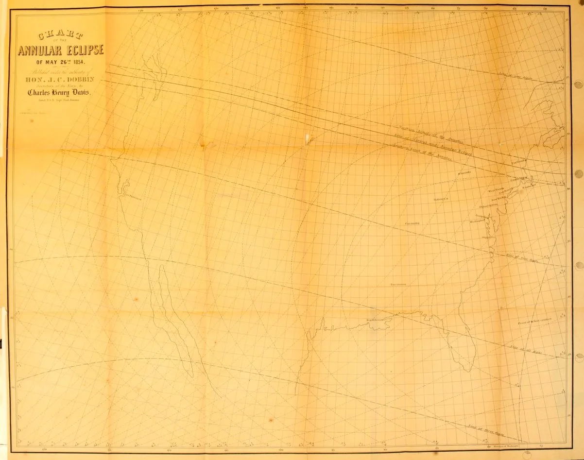
Charles Henry Davis Chart of the Annular Eclipse of May 26, 1854. Smithsonian Institution
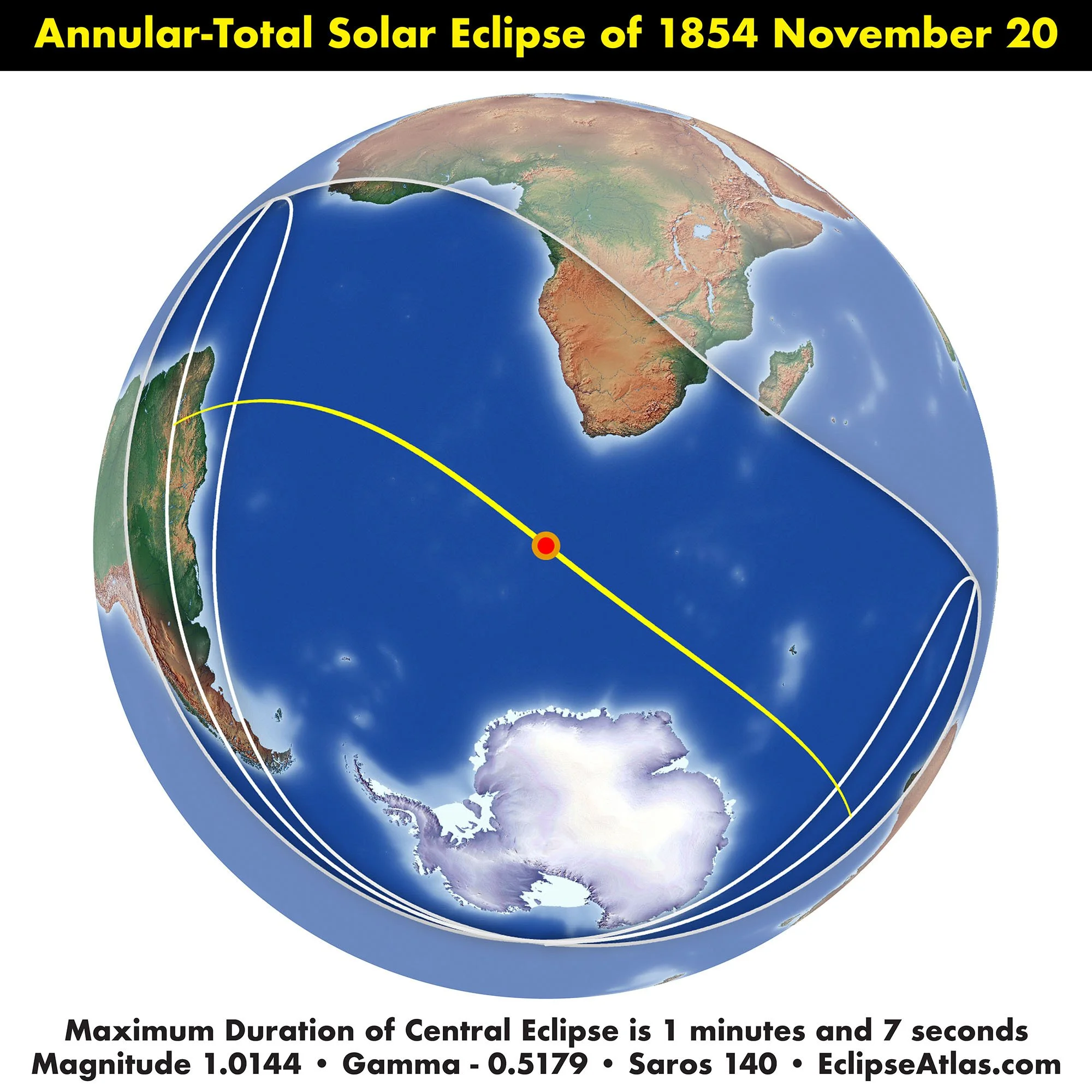
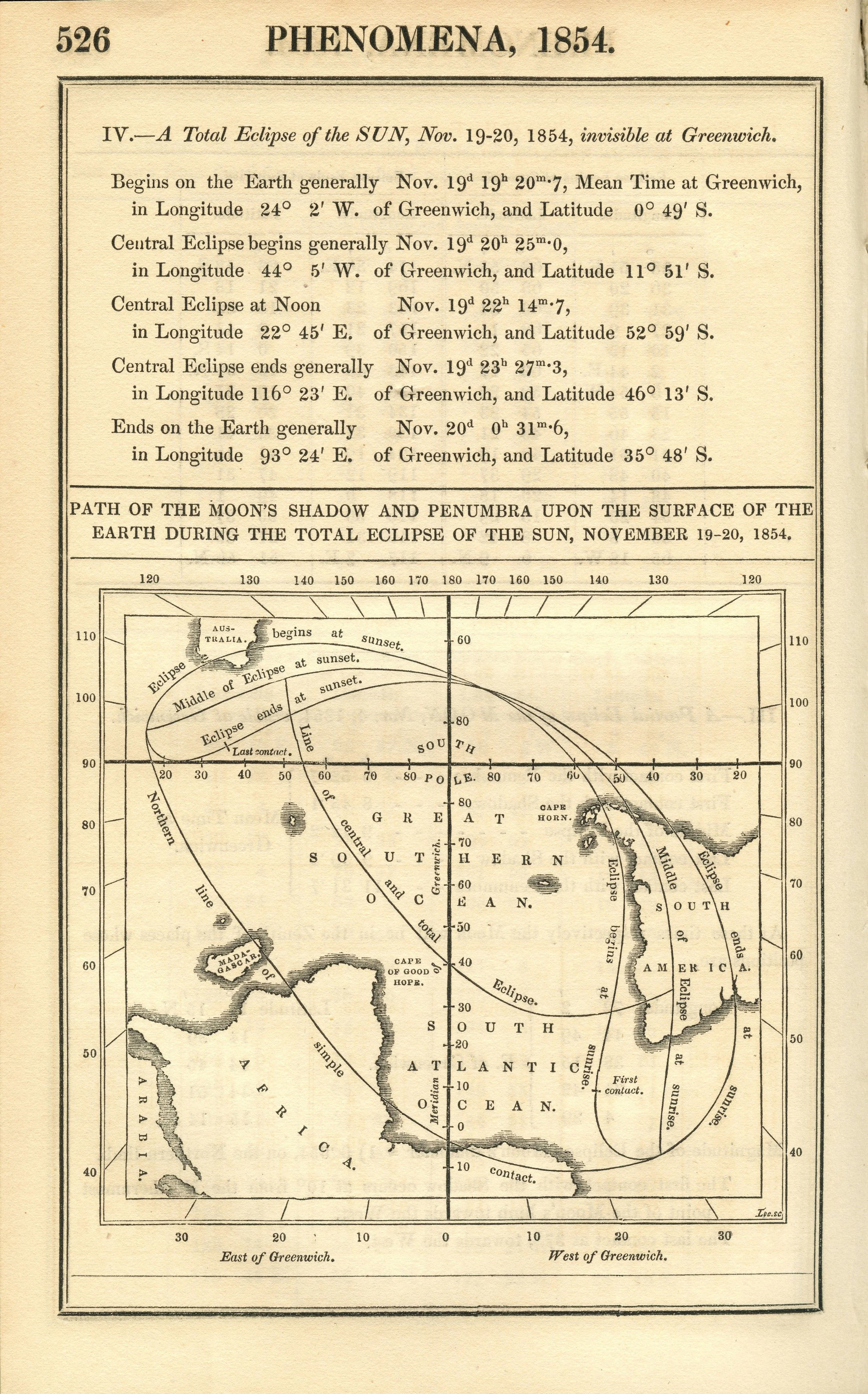
The Nautical Almanac and Astronomical Ephemeris Path of the Moon’s Shadow and Penumbra upon the Surface of the Earth during the Total Eclipse of the Sun, November 19-20, 1854. Scanned by Michael Zeiler at Federal Repository Library, UC Berkeley