
Maps of Solar Eclipses from 1900 to 1904
Beginning this decade, you will find many fine eclipse maps by Fr. William F. Rigge, who wrote many articles for Popular Astronomy, a now defunct magazine for amateur astronomers that was published by Carleton College from 1983 to 1951. About 35 of Rigge’s eclipse maps are found on this and the two succeeding galleries of historical eclipse maps. Father Rigge was a professor of astronomy and physics at Creighton College in Omaha, Nebraska.
Rigge performed his own eclipse calculations and his maps are detailed records of many aspects of eclipses. Unlike many simpler eclipse maps of this era, Rigge mapped many eclipse features such as isochrons for the beginning and ending of eclipse and time of greatest eclipse, isomagnitudes for eclipse, and limit lines for the eclipse. An interesting eclipse feature that Rigge mapped are curves for tenths of eclipse magnitude at sunrise and sunset; I have not seen these curves drawn on any eclipse maps besides Rigge’s.
Despite the advanced characteristics and fine cartographic qualities of Rigge’s maps, they retain a curiously parochial quality: Rigge’s maps consistently span only the 48 coterminus United States. Even his map for the 1905 eclipse, with it’s path beginning near the U.S.-Canada international border, does not stray outside the national border.

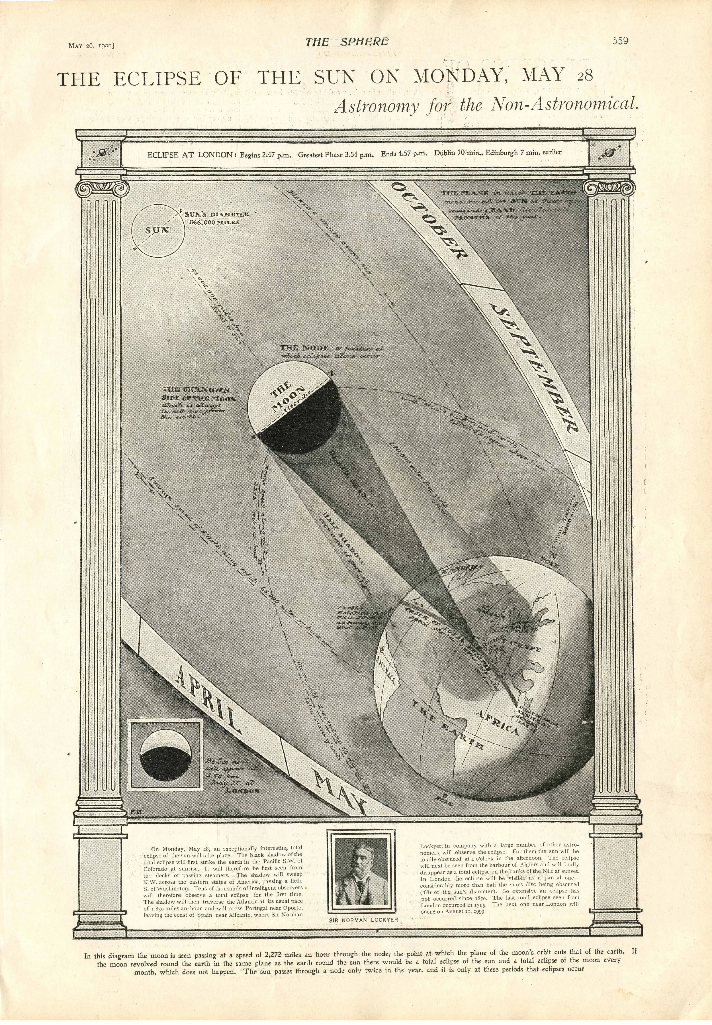
The Sphere The Eclipse of the Sun on Monday, May 28 Collection of Michael Zeiler

Monthly Weather Review, September 1898 The Eclipse Track and Observing Stations in the United States Collection of Michael Zeiler
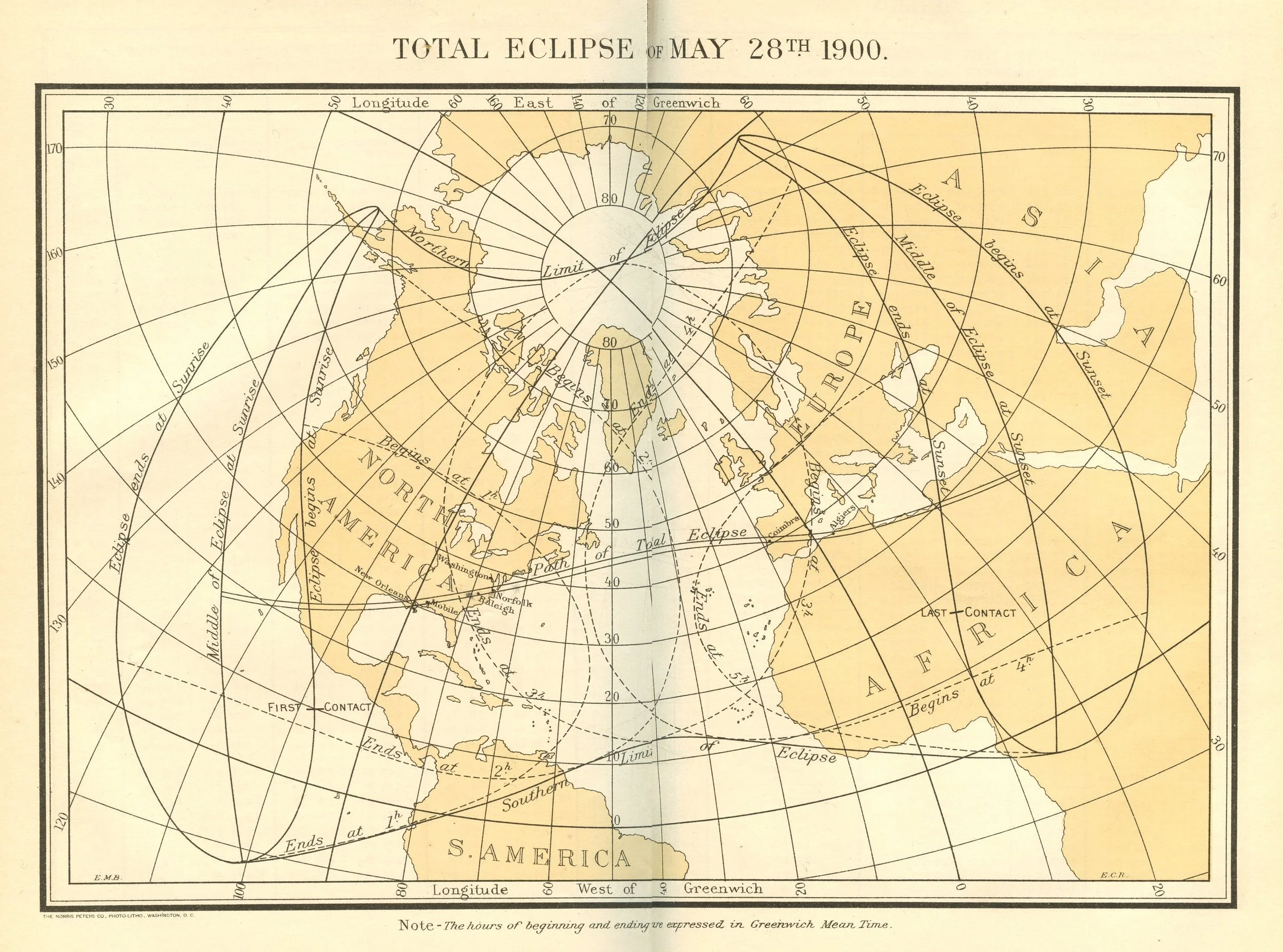
American Ephemeris and Nautical Almanac Total Eclipse of May 28th 1900 Collection of Michael Zeiler

Bulletin de la Société Astronomique de France Eclipse Totale de Soleil du 28 Mai 1900 Région de la péninsule Ibérique pour laquelle l'Éclipse est totale Collection of Michael Zeiler
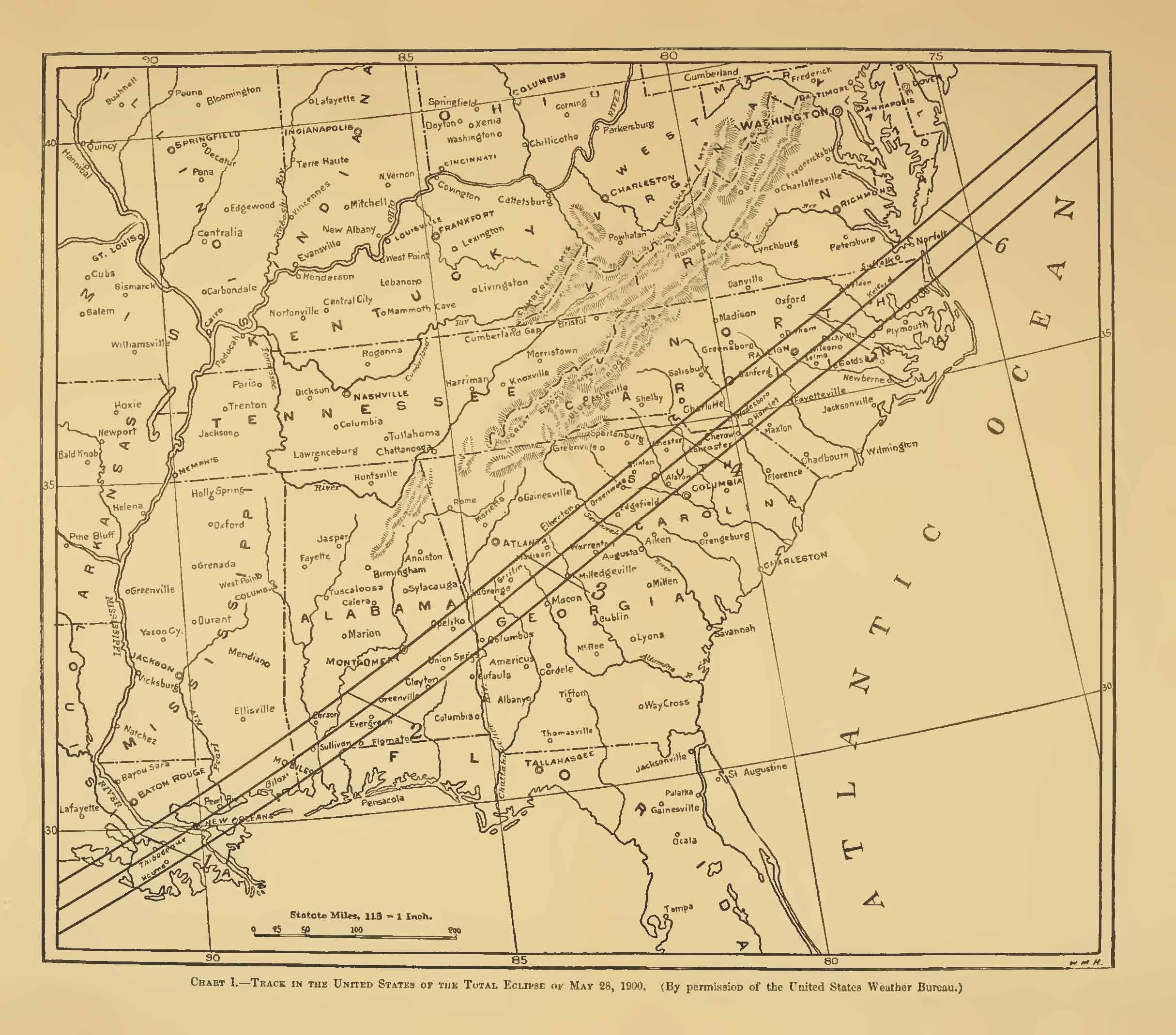
Popular Science Monthly Track in the United States of the Total Eclipse of May 28, 1900 Downloaded from archive.org
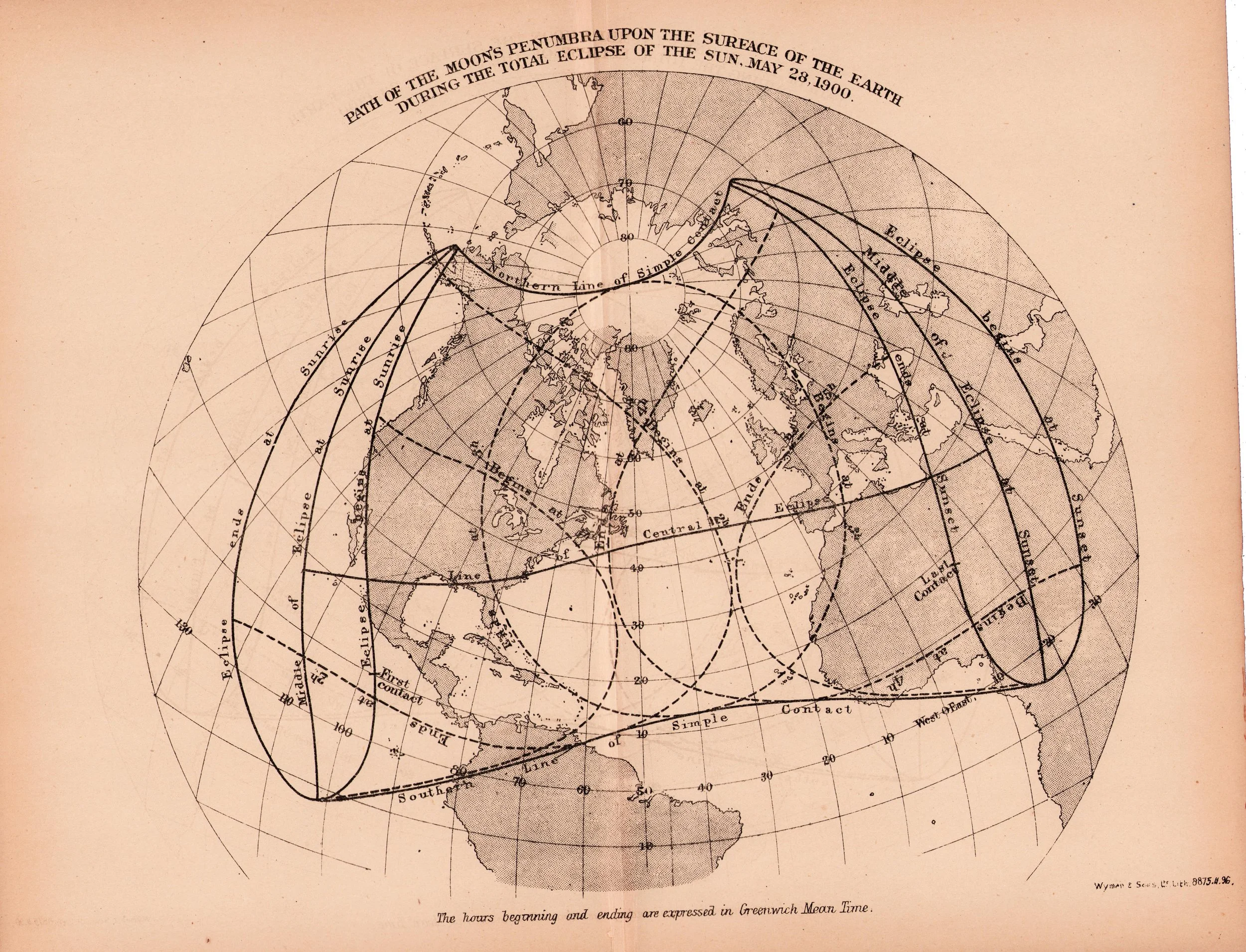
Nautical Almanac and Astronomical Ephemeris Path of the Moon's Penumbra upon the Surface of the Earth during the Total Eclipse of the Sun, May 28, 1900 Collection of Michael Zeiler
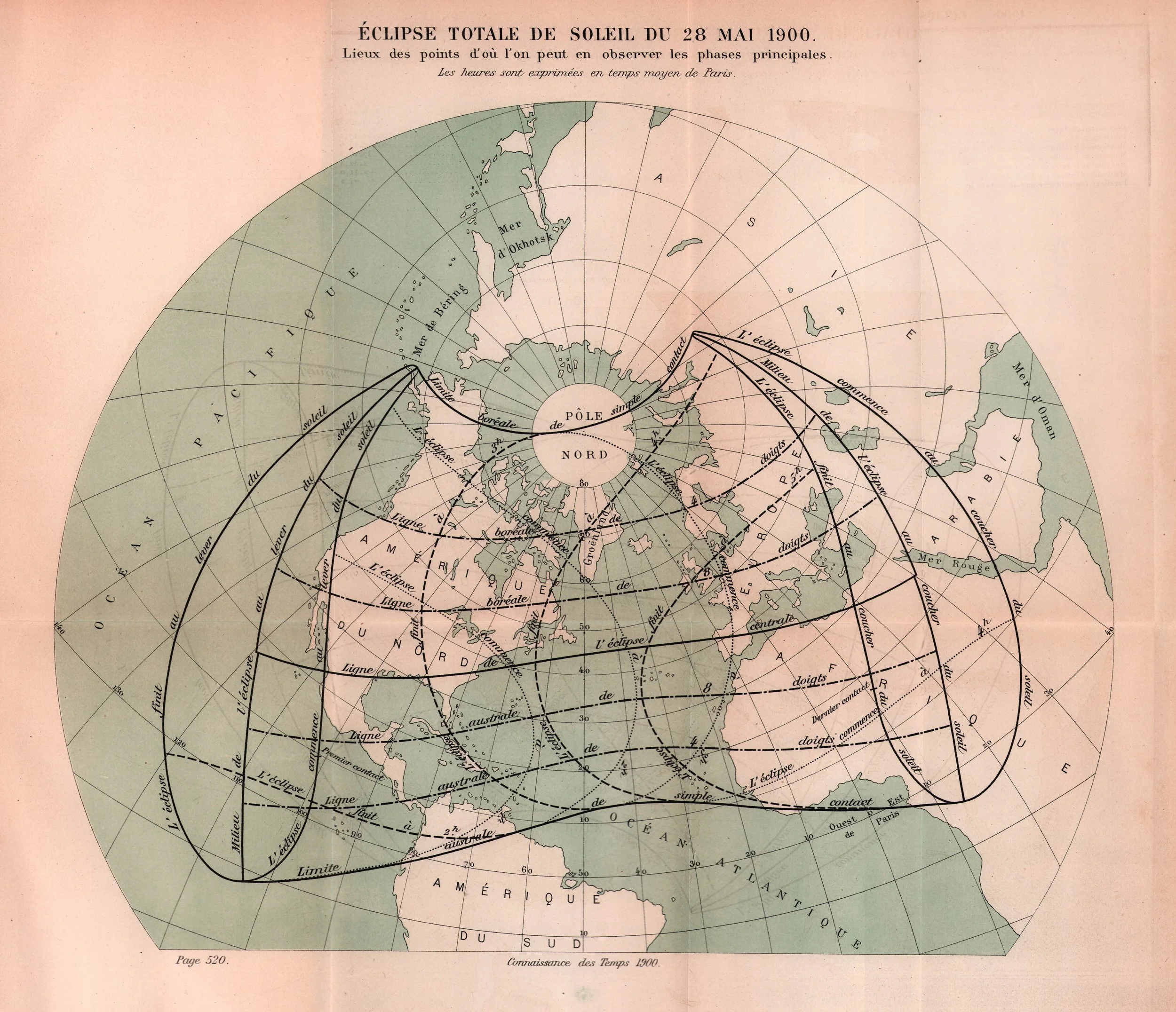
Connaissance des Temp Éclipse Totale de Soleil du 28 Mai 1900. Collection of Michael Zeiler

L'Astronomie Marche de l'éclipse du 28 mai 1900 sur l'Espagne et l'Algèrie Scanned by Michael Zeiler

Nautical Almanac and Astronomical Ephemeris Circular 17, Wyman & Sons Path of the Moon's Shadow during the Solar Eclipse of May 27-28, 1900 Courtesy of Sheridan Williams

Professor Simon Newcomb The Coming Total Eclipse of the Sun Collection of Michael Zeiler
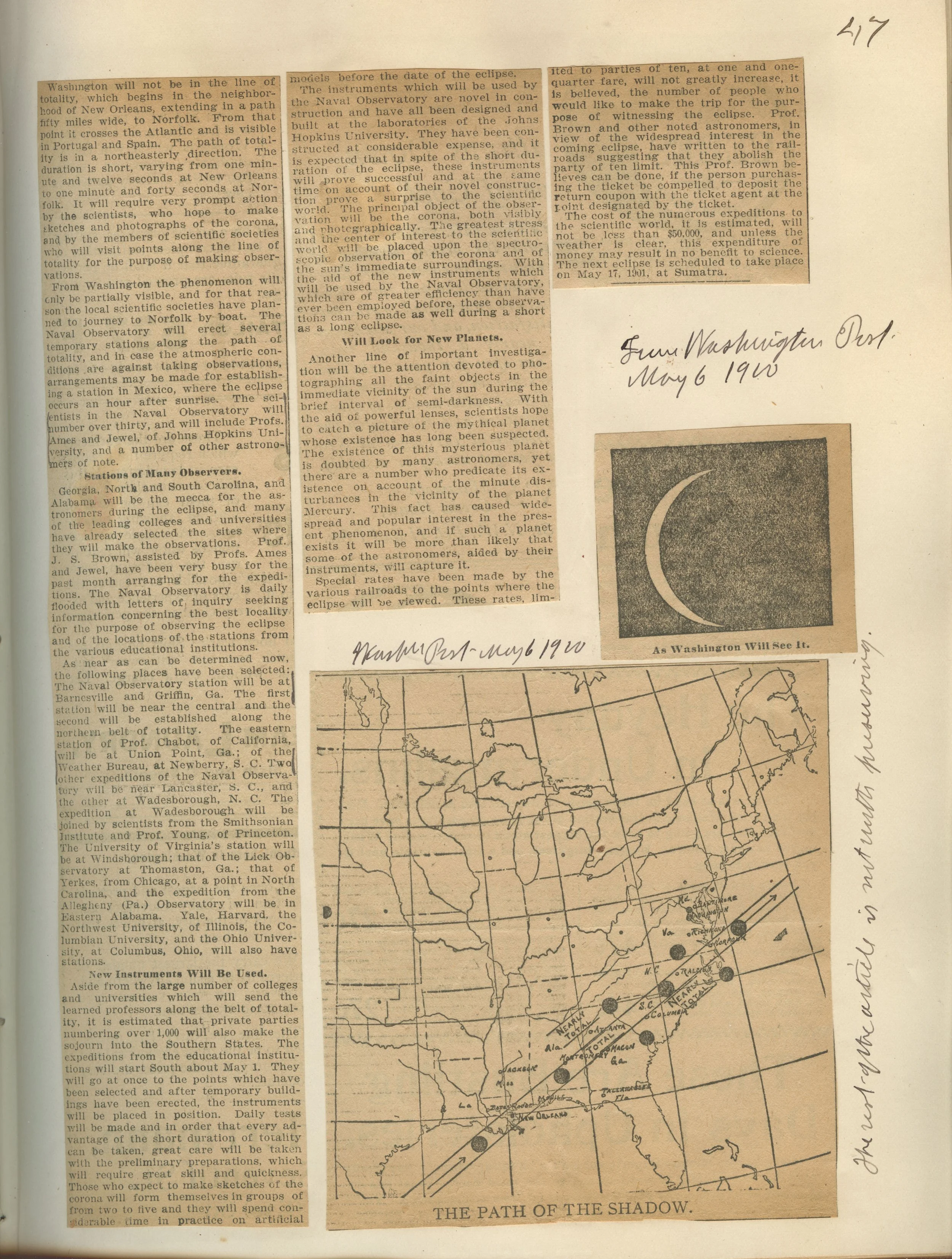
Papers of Roberdeau Buchanan The Path of the Shadow Scanned at James Melville Gillis Library, USNO

Professor A. H. Buchanan The Solar Eclipse of May 25, 1900 Scanned by Michael Zeiler

Eclipse Observations (?) Cloudiness in Path of Total Eclipse of May 28, 1900 Unknown source

Nautical Almanac Circular 17, Wyman & Sons Path of the Moon's Shadow during the Solar Eclipse of May 27-28, 1900. Courtesy of Sheridan Williams

Eclipse Meteorology and Allied Problems, U.S. Dept. of Agriculture Weather map showing the conditions at 8 a.m., May 28, 1900. Collection of Michael Zeiler

Encyclopedia Universal Madrid Eclipse total de Sol del 28 de Mayo de 1900 Collection of Michael Zeiler
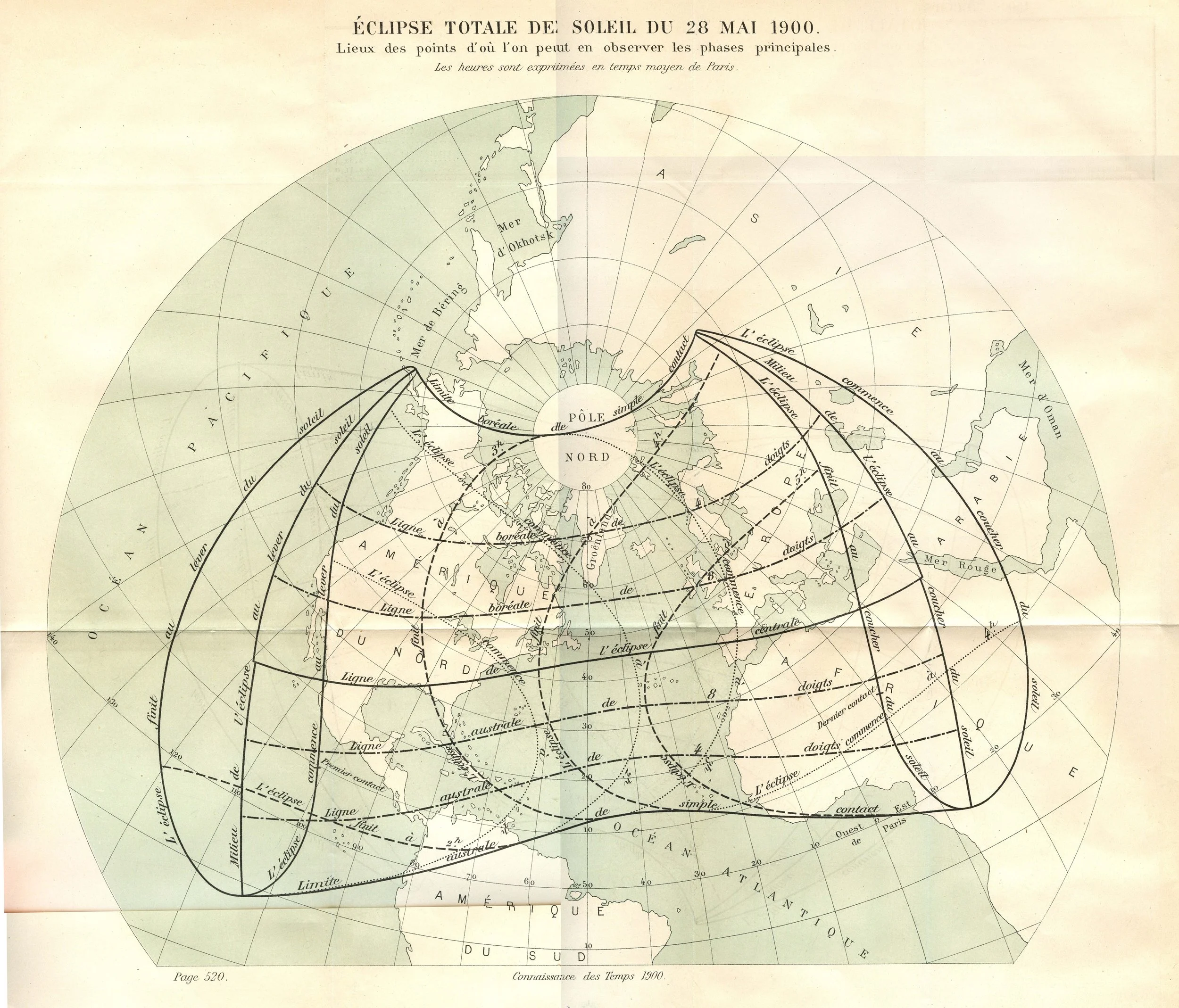
Connaissance des Temps Éclipse Totale de Soleil du 28 Mai 1900. Collection of Michael Zeiler

Real Observatoria Astronomica de Lisboa (Tapada) Horas e Angulos do Começo do Eclipse de 1900 Maio 28 em Portugal Collection of Michael Zeiler
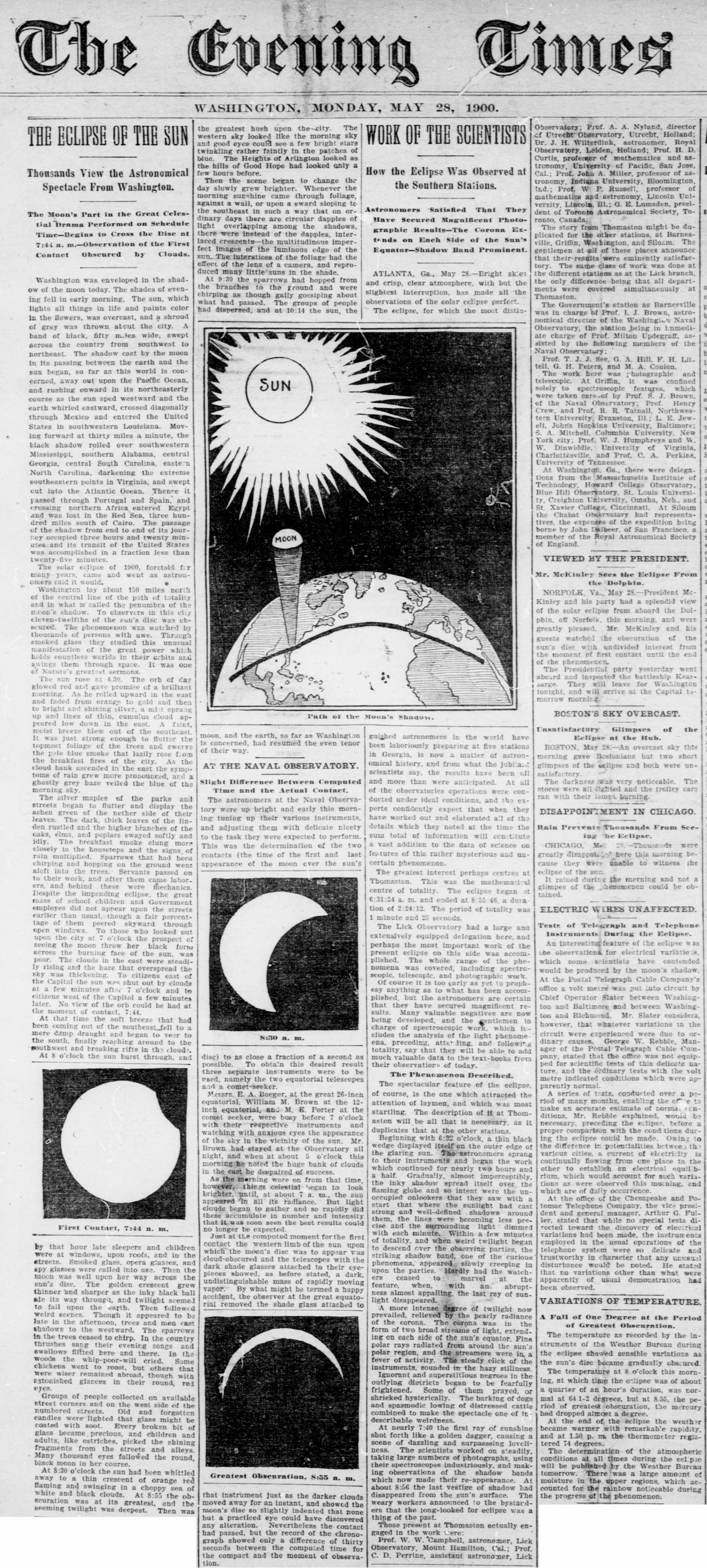
The Evening Times The Eclipse of the Sun U.S. Library of Congress, chroniclingamerica.loc.gov
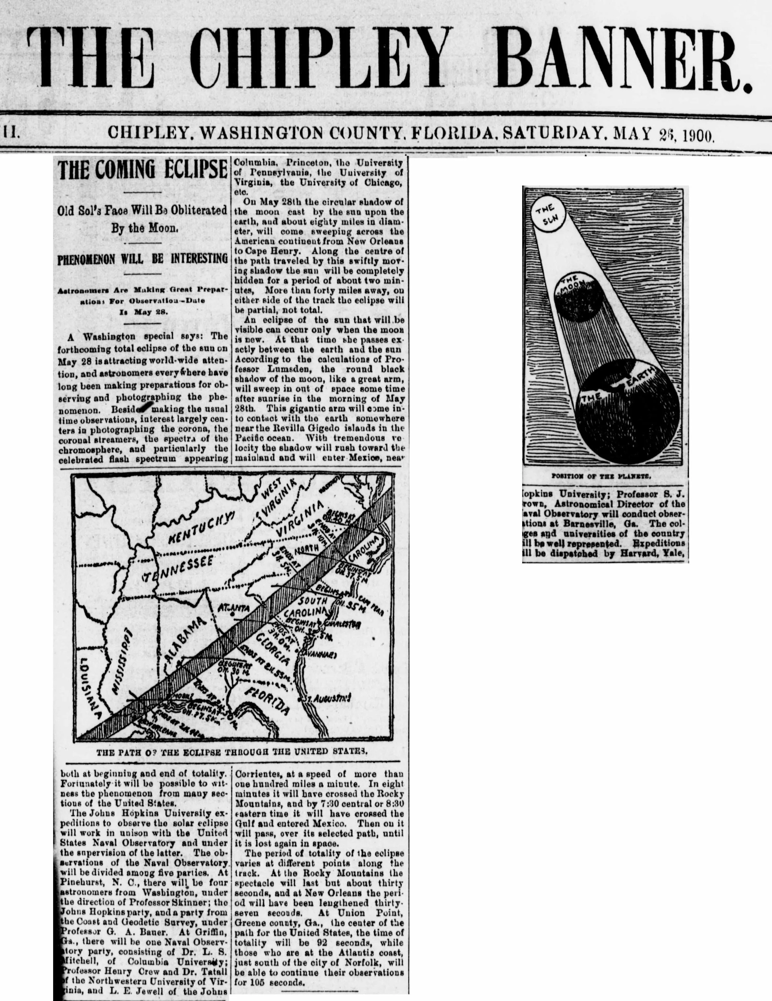
The Chipley Banner The Coming Eclipse U.S. Library of Congress, chroniclingamerica.loc.gov
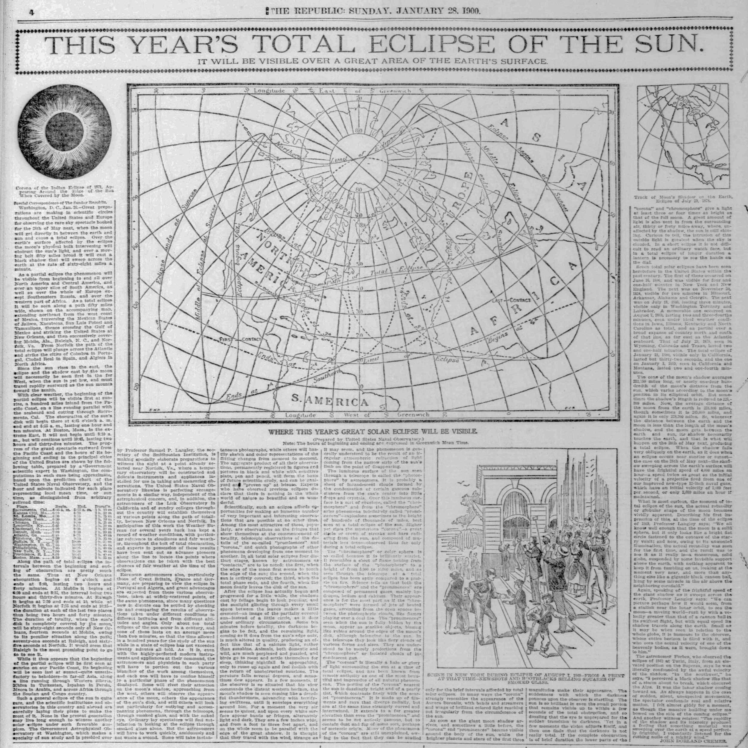
The Republic This Year's Total Eclipse of the Sun U.S. Library of Congress, chroniclingamerica.loc.gov
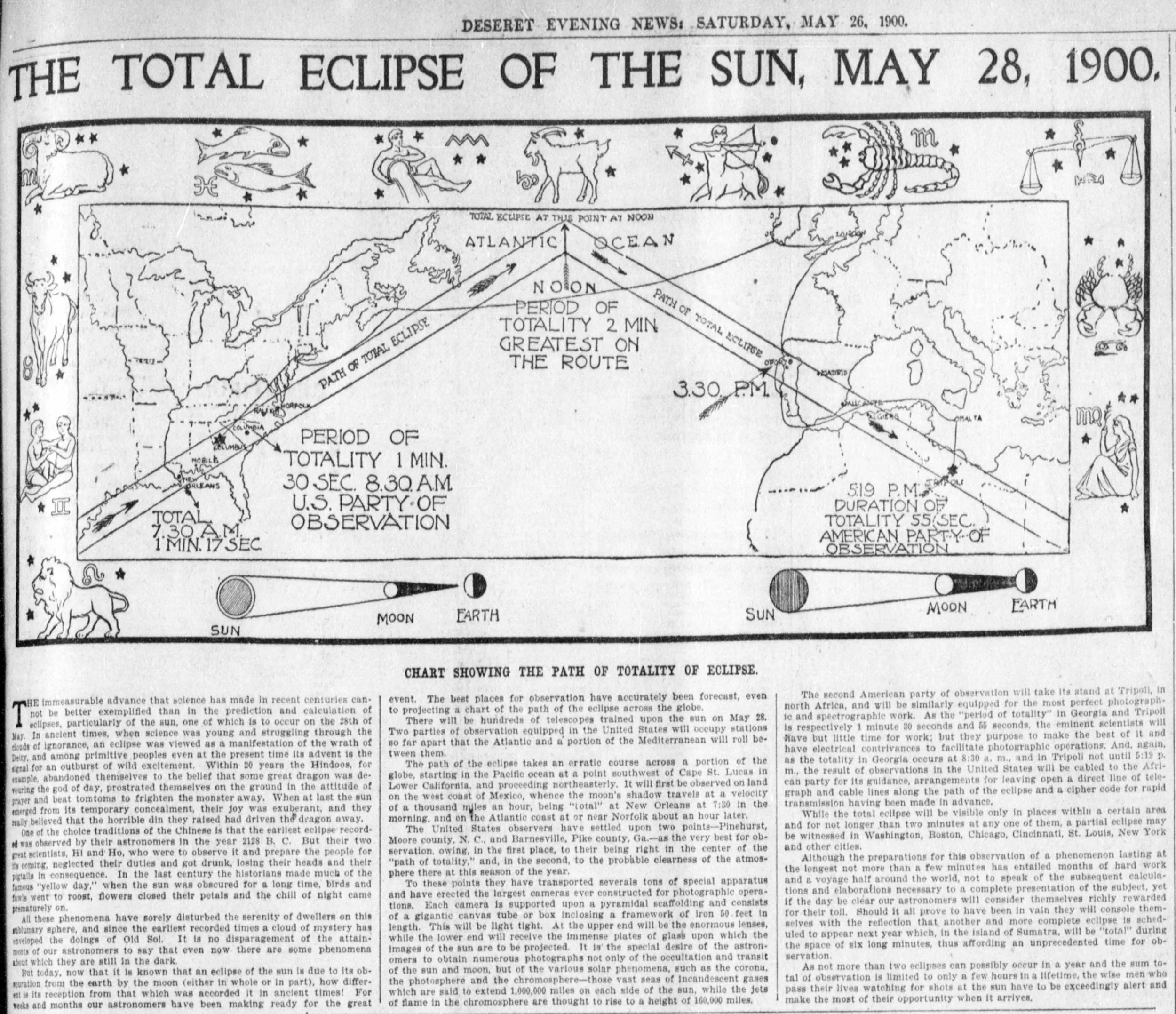
Deseret Evening News The Total Eclipse of the Sun, May 28, 1900 U.S. Library of Congress, chroniclingamerica.loc.gov
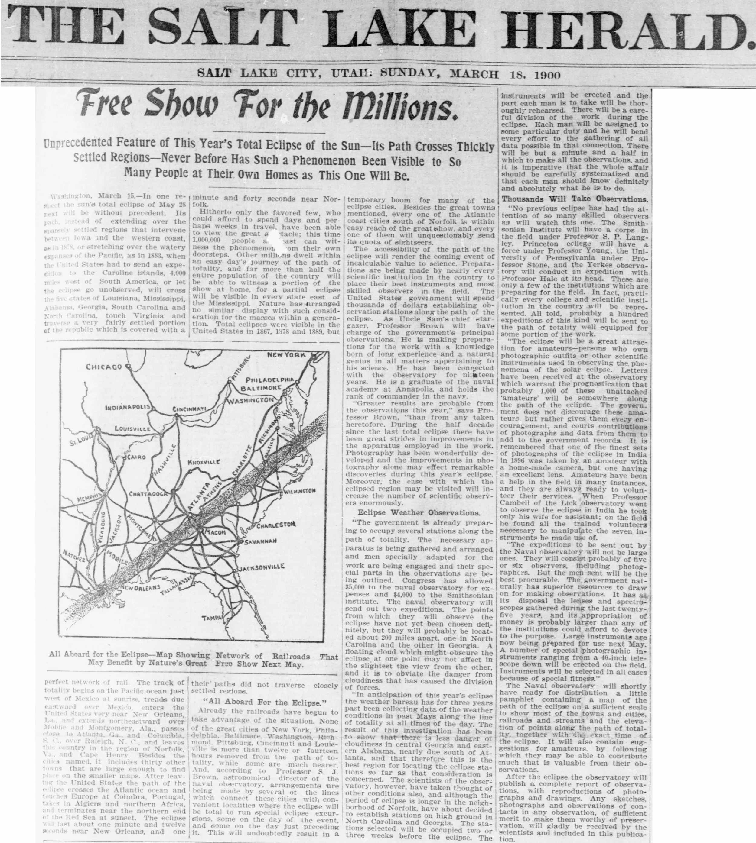
The Salt Lake Herald Free Show for the Millions U.S. Library of Congress, chroniclingamerica.loc.gov

The Sun The Sun's Coming Eclipse U.S. Library of Congress, chroniclingamerica.loc.gov

St Louis Republic Track of the Total Eclipse across the United States U.S. Library of Congress, chroniclingamerica.loc.gov
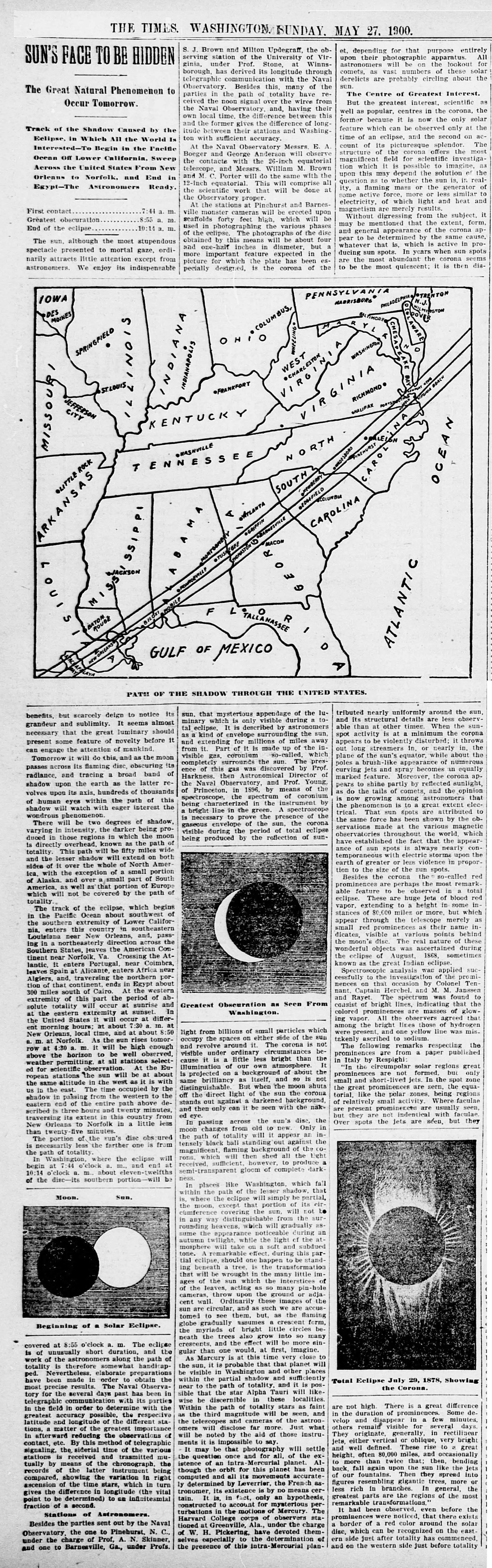
The Washington Times Sun's Face to be Hidden U.S. Library of Congress, chroniclingamerica.loc.gov

New York Tribune Sun's Eclipse To-morrow U.S. Library of Congress, chroniclingamerica.loc.gov

The Richmond Dispatch The Total Eclipse of the Sun, May 28, 1900 U.S. Library of Congress, chroniclingamerica.loc.gov
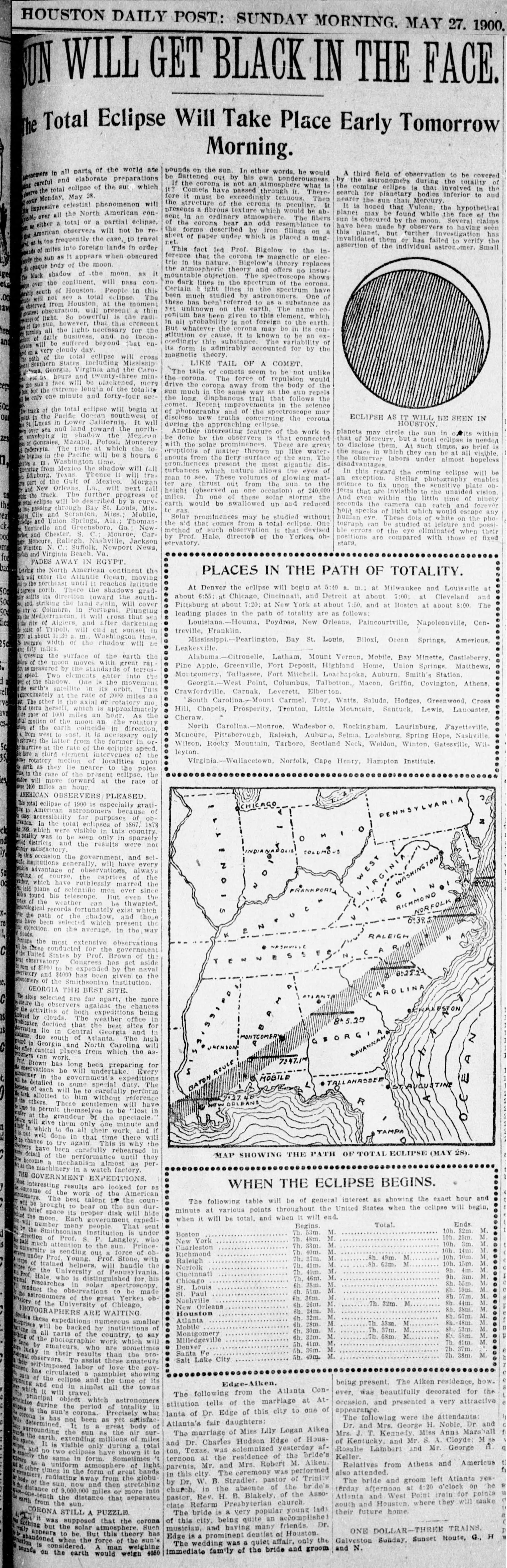
Houston Daily Post Sun will get Black in the Face U.S. Library of Congress, chroniclingamerica.loc.gov
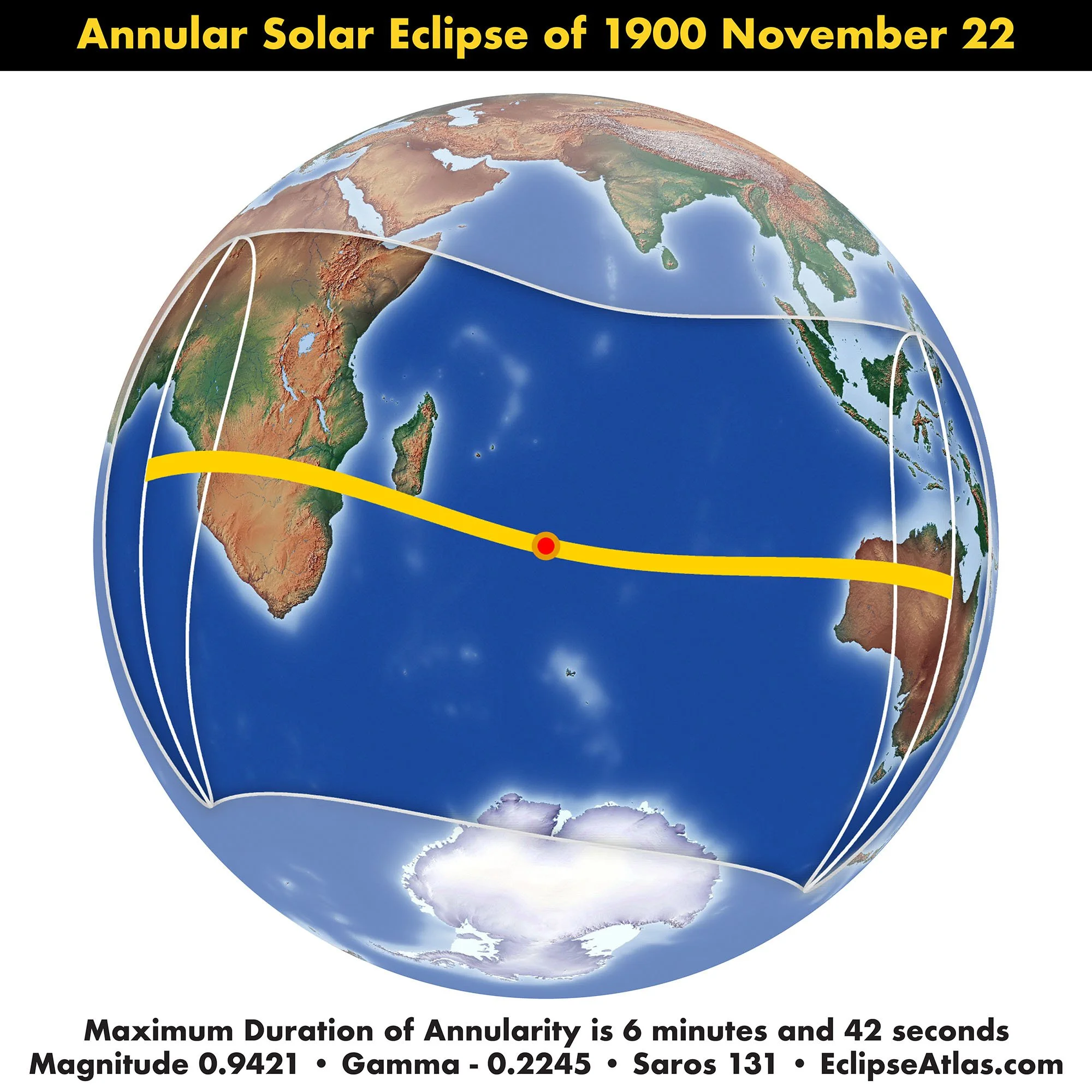
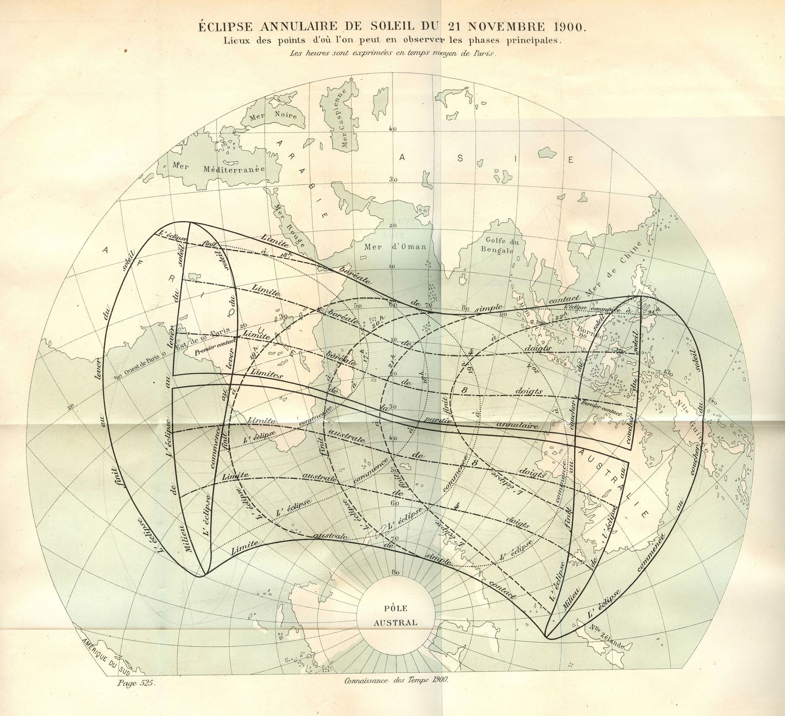
Connaissance des Temp Éclipse Annulaire de Soleil du 21 Novembre 1900 Collection of Michael Zeiler
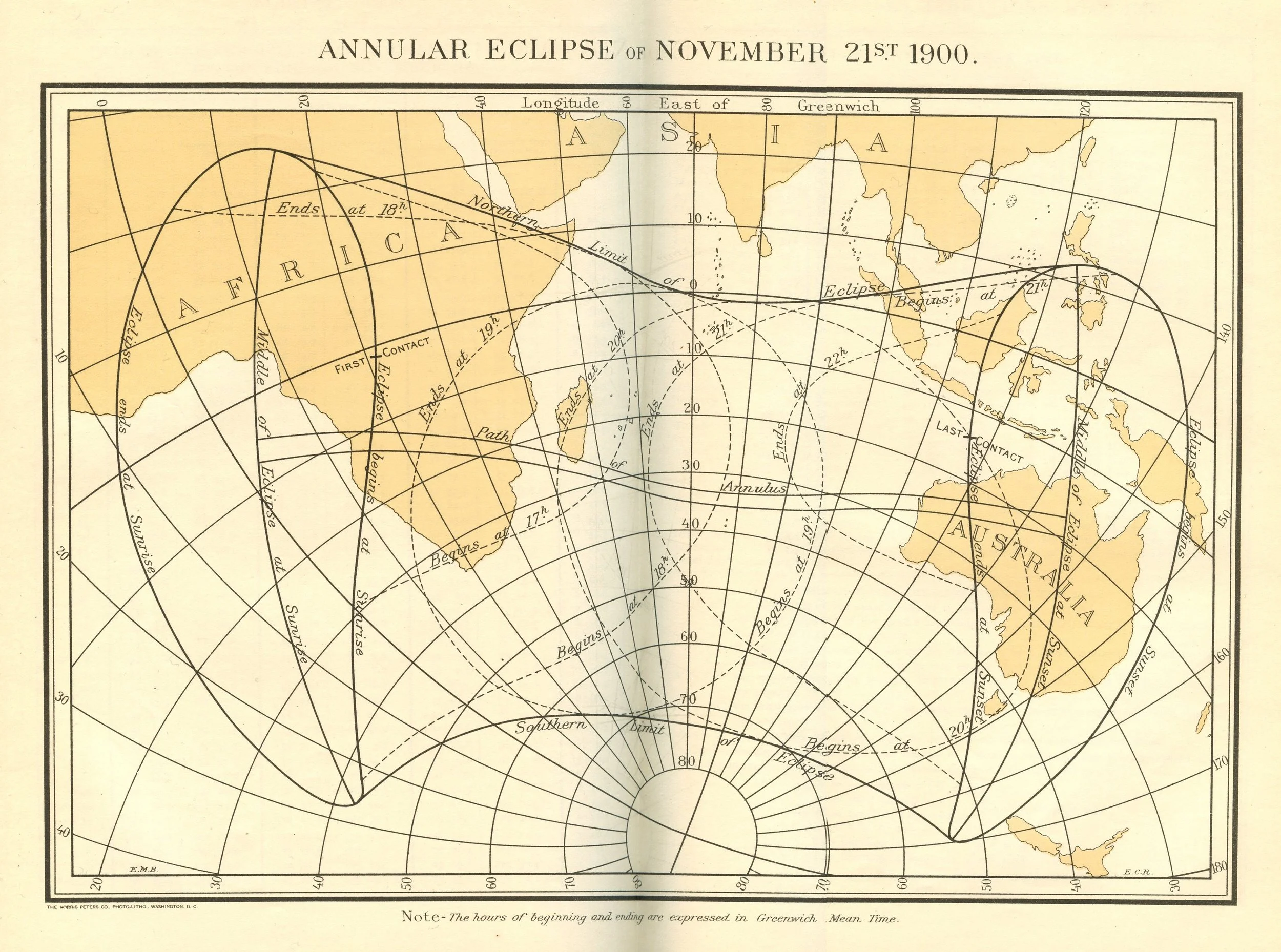
America Ephemeris and Nautical Almanac Annular Eclipse of November 21st 1900 Collection of Michael Zeiler
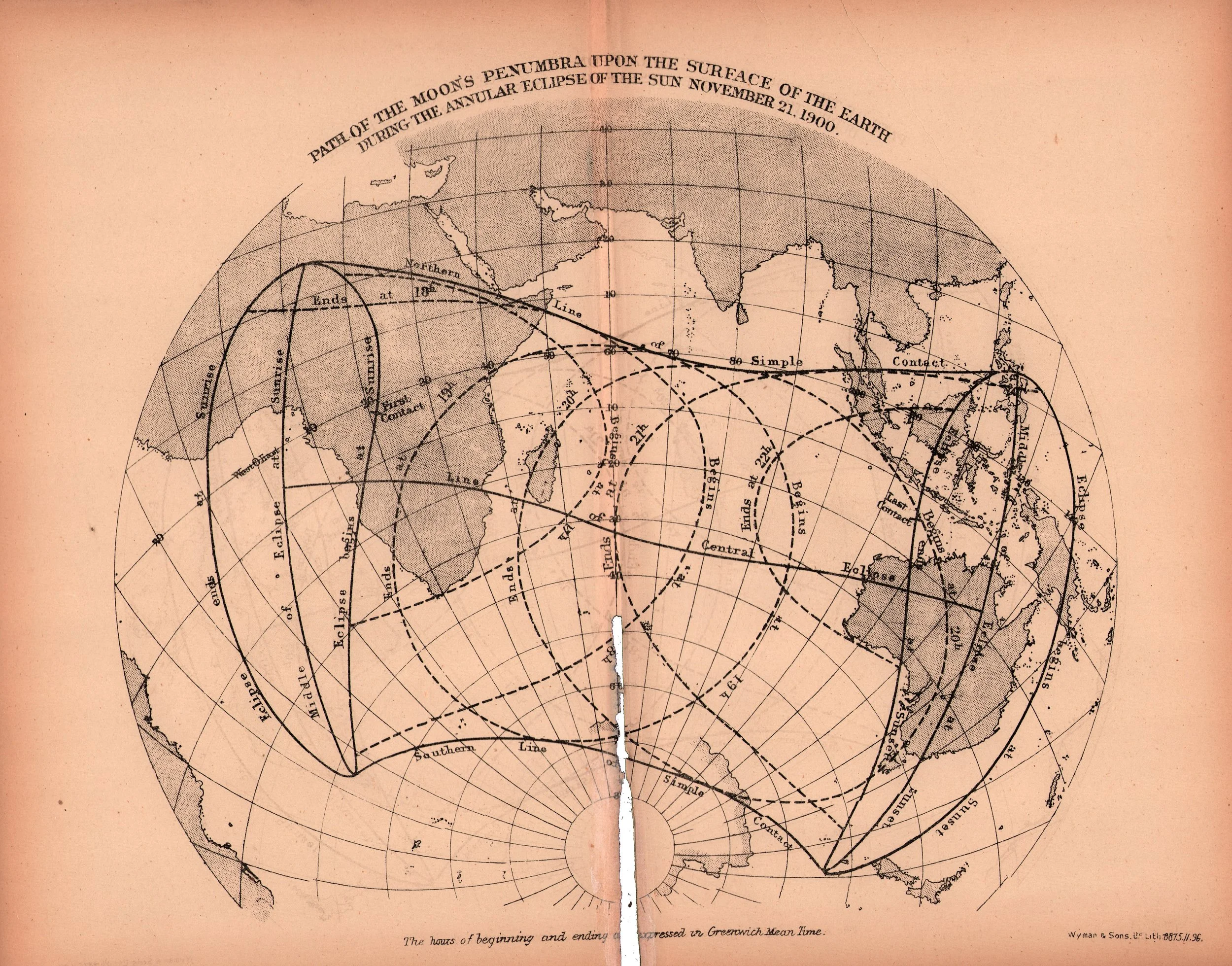
Nautical Almanac and Astronomical Ephemeris Path of the Moon's Penumbra upon the Surface of the Earth During the Annular Eclipse of the Sun November 21, 1900. Collection of Michael Zeiler
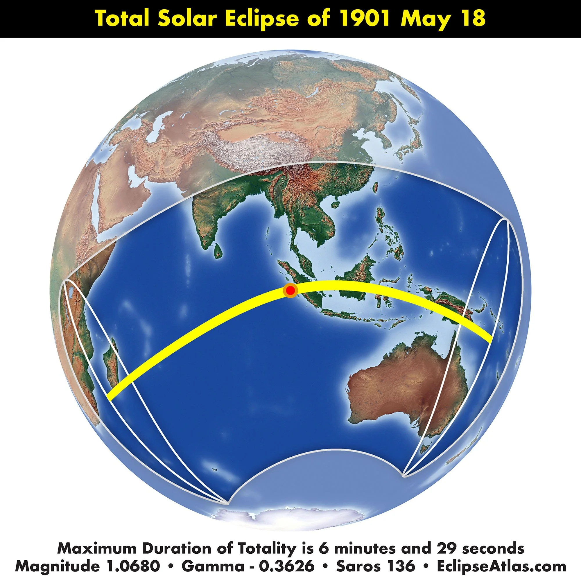
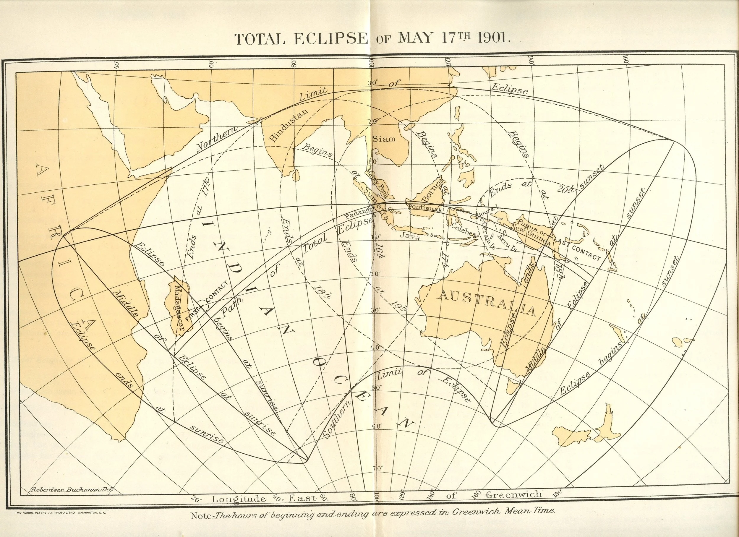
American Ephemeris and Nautical Almanac Total Eclipse of May 17th 1901. Collection of Michael Zeiler

The Sun, New York Sun's Eclipse To-Morrow U.S. Library of Congress, chroniclingamerica.loc.gov

New-York Daily Tribune To Observe the Eclipse U.S. Library of Congress, chroniclingamerica.loc.gov
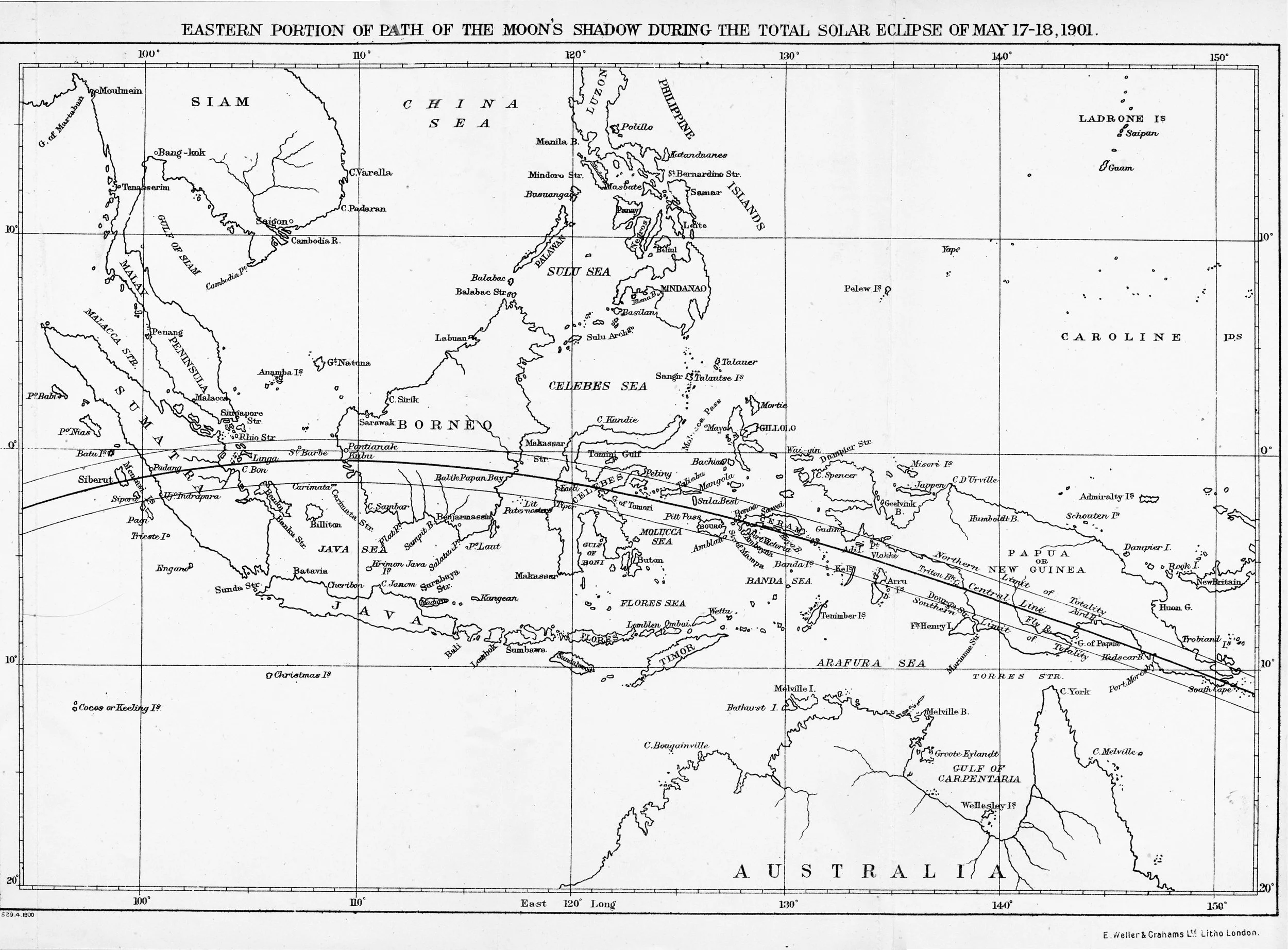
Nautical Almanac Circular Eastern Portion of Path of the Moon's Shadow During the Total Solar Eclipse of May 17-18, 1901. Courtesy of Sheridan Williams

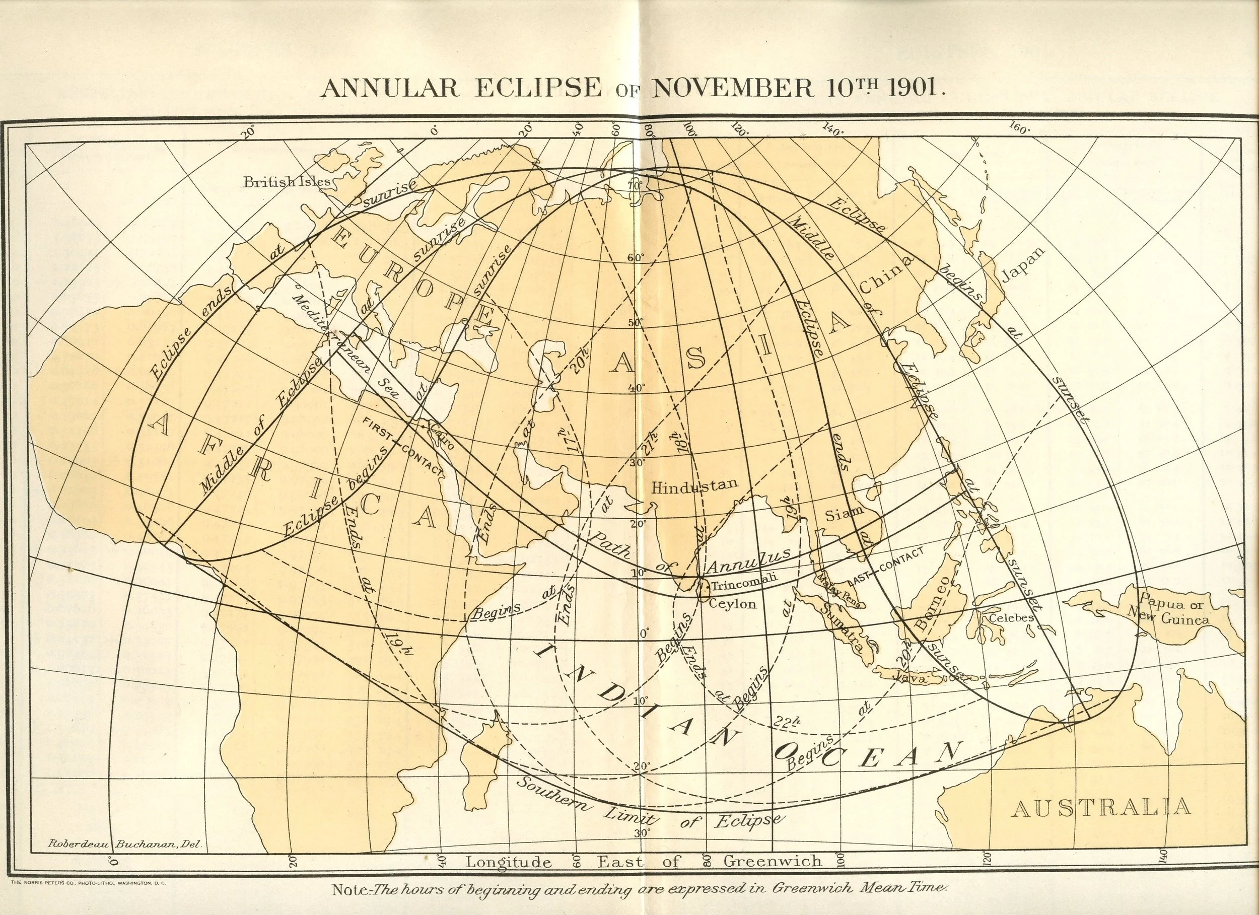
American Ephemeris and Nautical Almanac Annular Eclipse of November 10th 1901. Collection of Michael Zeiler

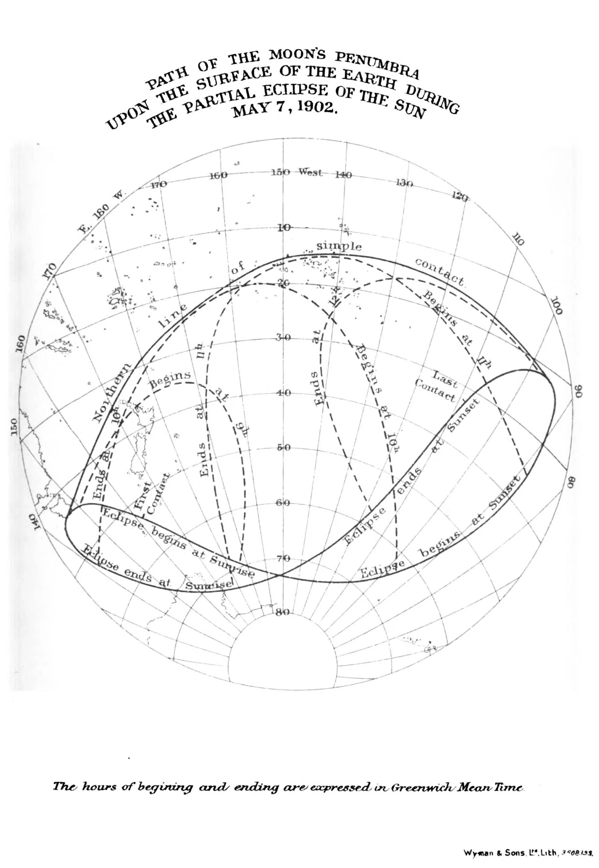
Nautical Almanac and Astronomical Ephemeris Path of the Moon's Penumbra Upon the Surface of the Earth During the Partial Solar Eclipse of Sun May 7, 1902 books.google.com
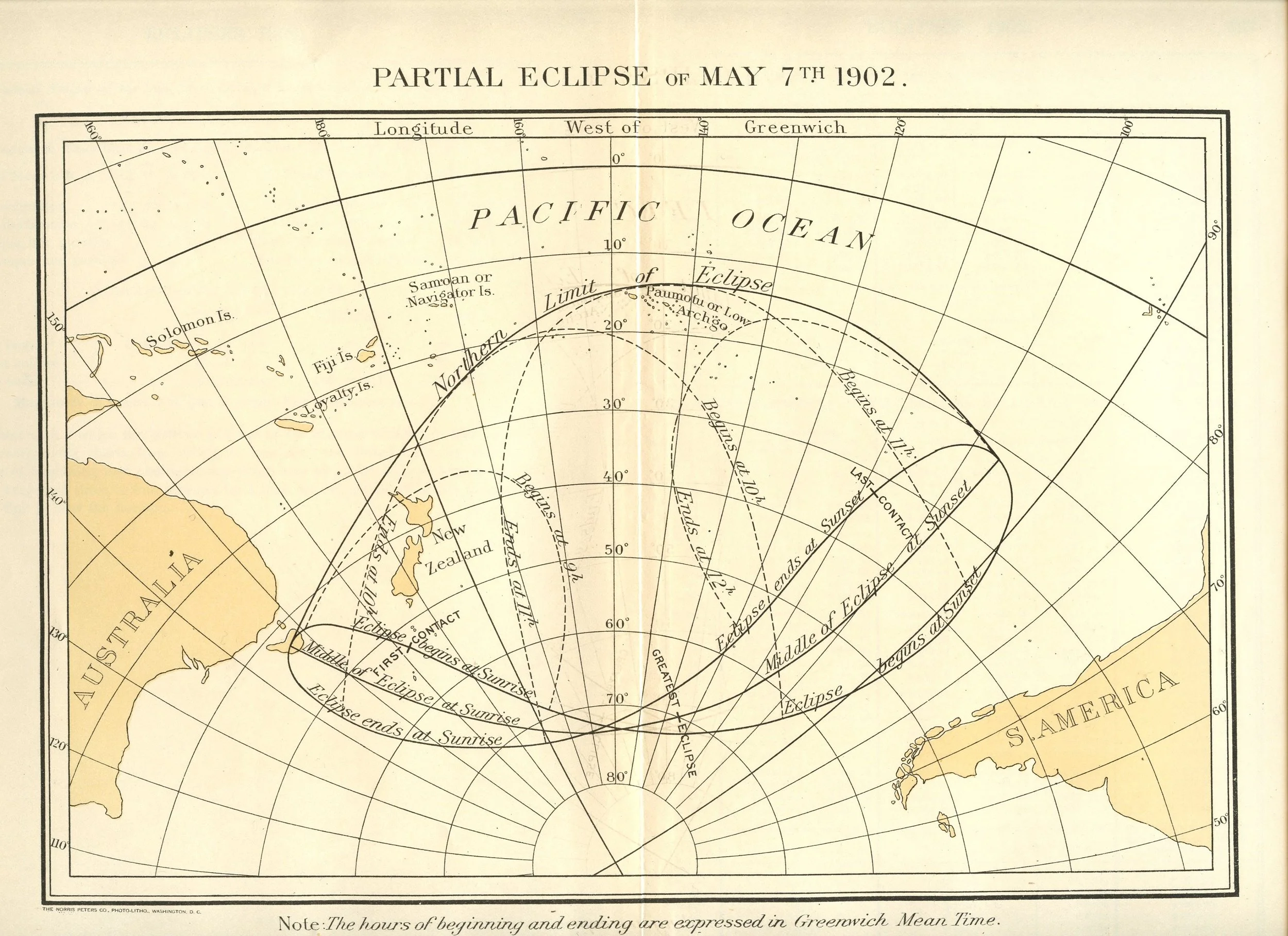
American Ephemeris and Nautical Almanac Partial Eclipse of May 7th 1902. Collection of Michael Zeiler
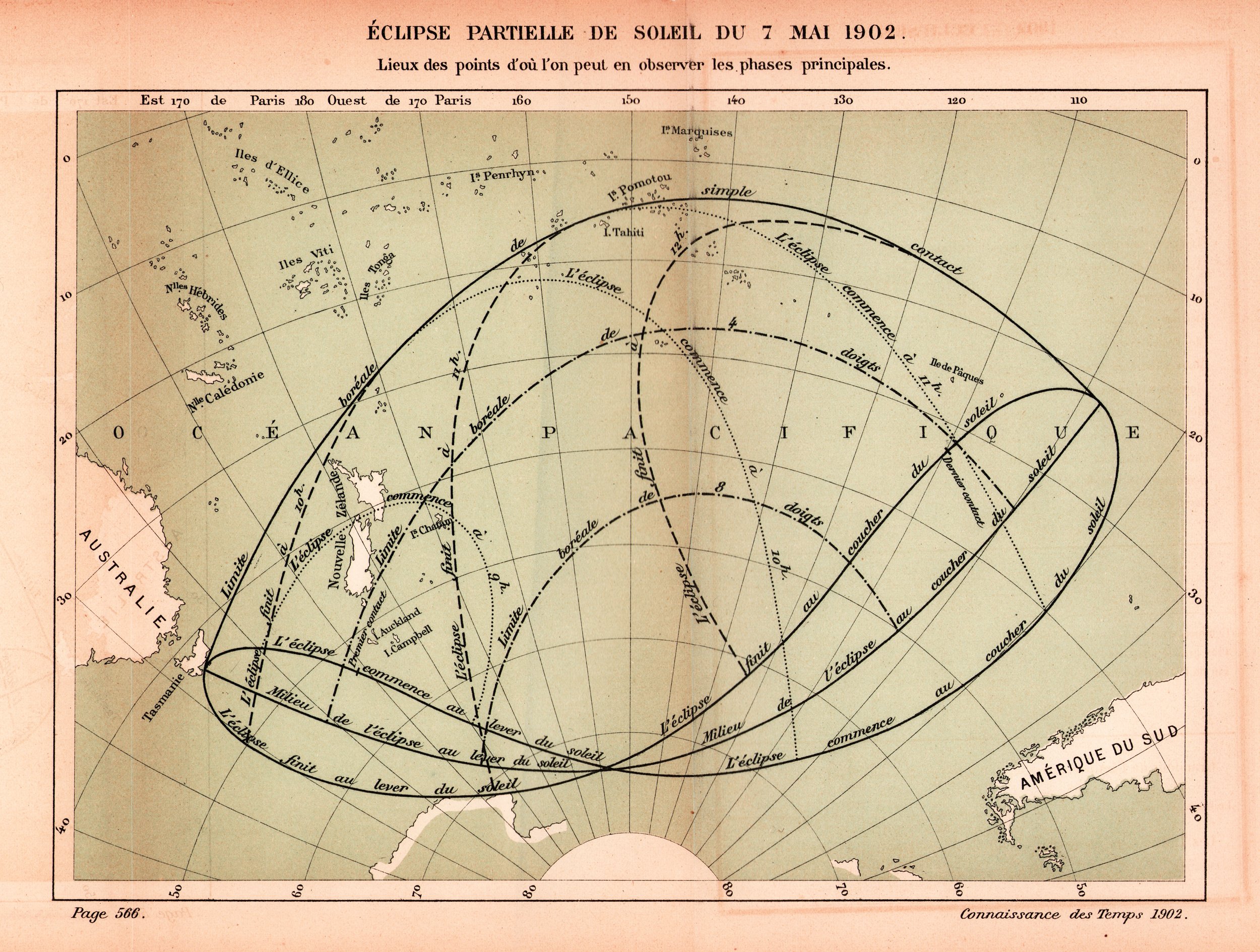
Connaissance des Temps Éclipse Partielle de Soleil du 7 Mai 1902 Collection of Michael Zeiler

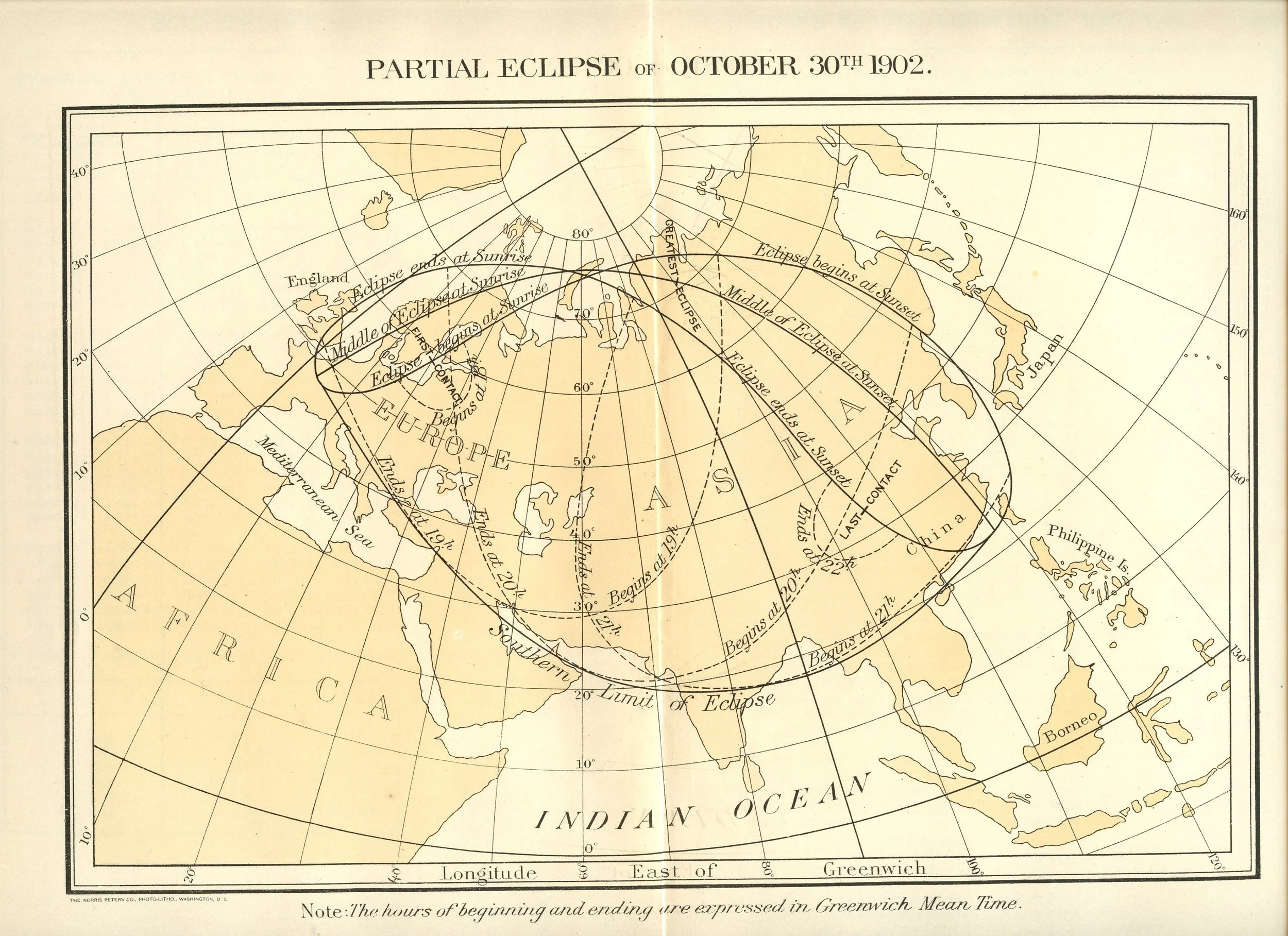
American Ephemeris and Nautical Almanac Partial Eclipse of October 30th 1902. Collection of Michael Zeiler
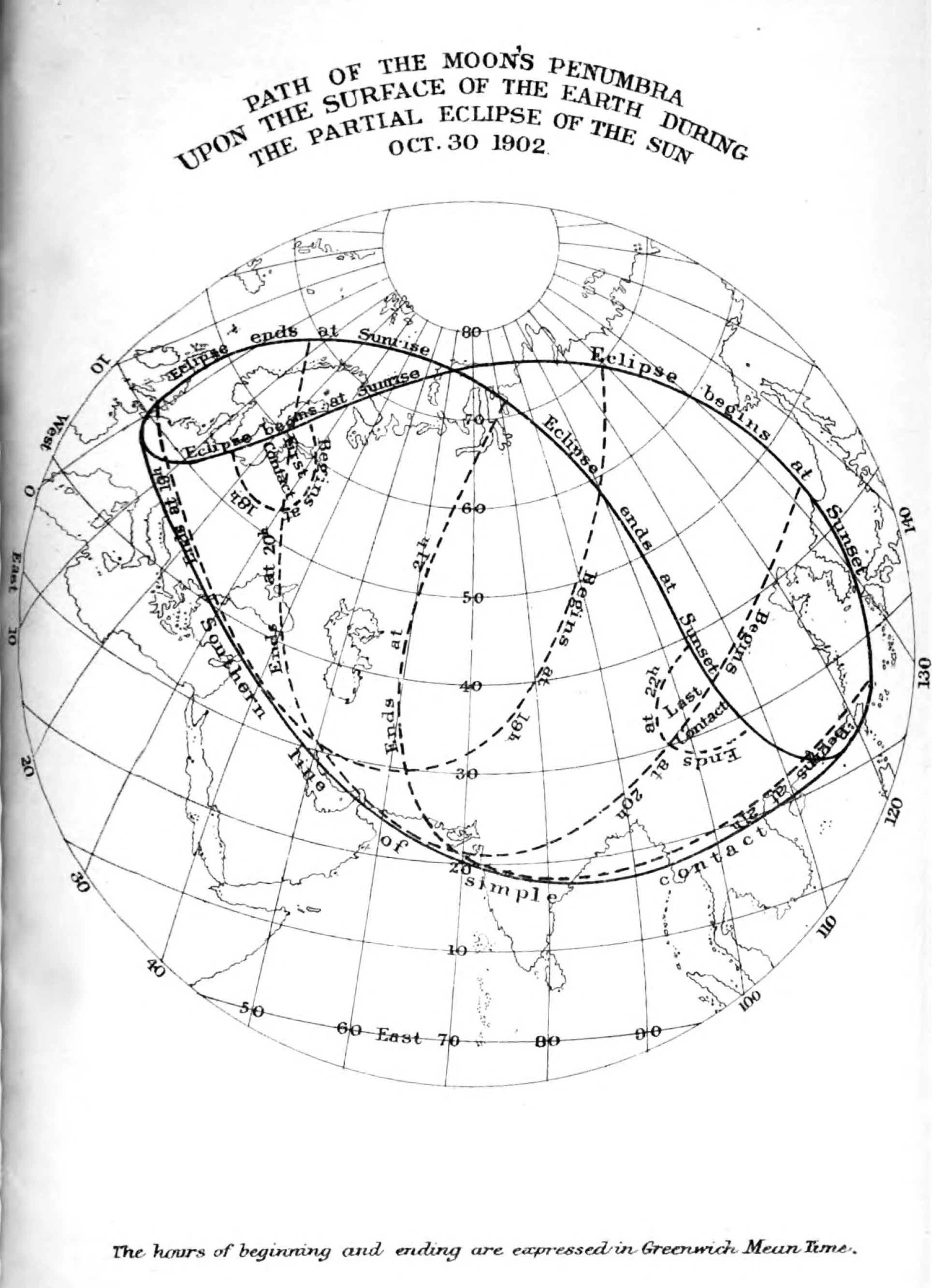
Nautical Almanac and Astronomical Ephemeris Path of the Moon's Penumbra upon the Surface of the Earth During the Partial Eclipse of the Sun Oct. 30 1902. books.google.com
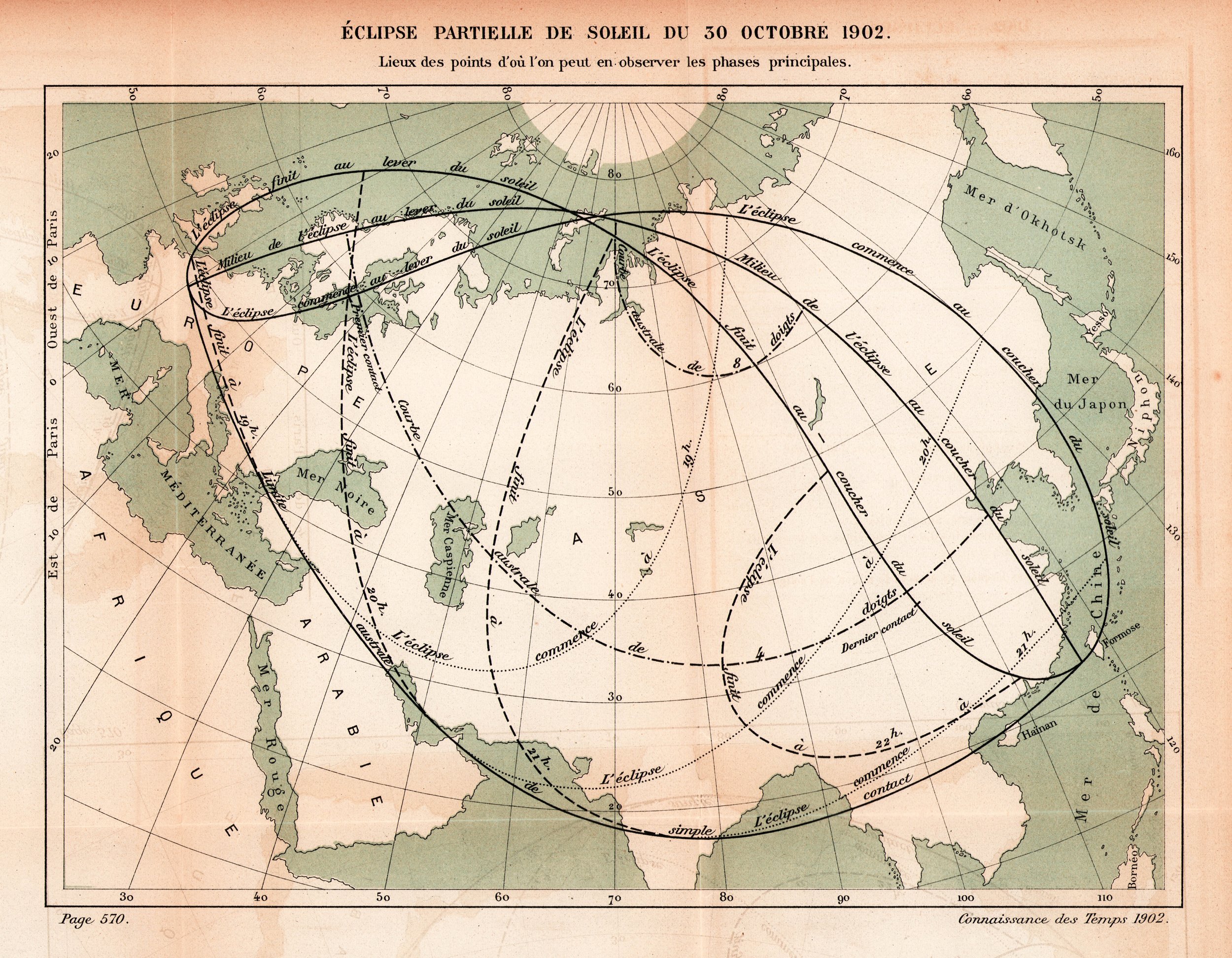
Connaissance des Temps Éclipse Partielle de Soleil du 30 Octobre 1902. Collection of Michael Zeiler

American Ephemeris and Nautical Almanac Annular Eclipse of March 28th 1903. Collection of Michael Zeiler

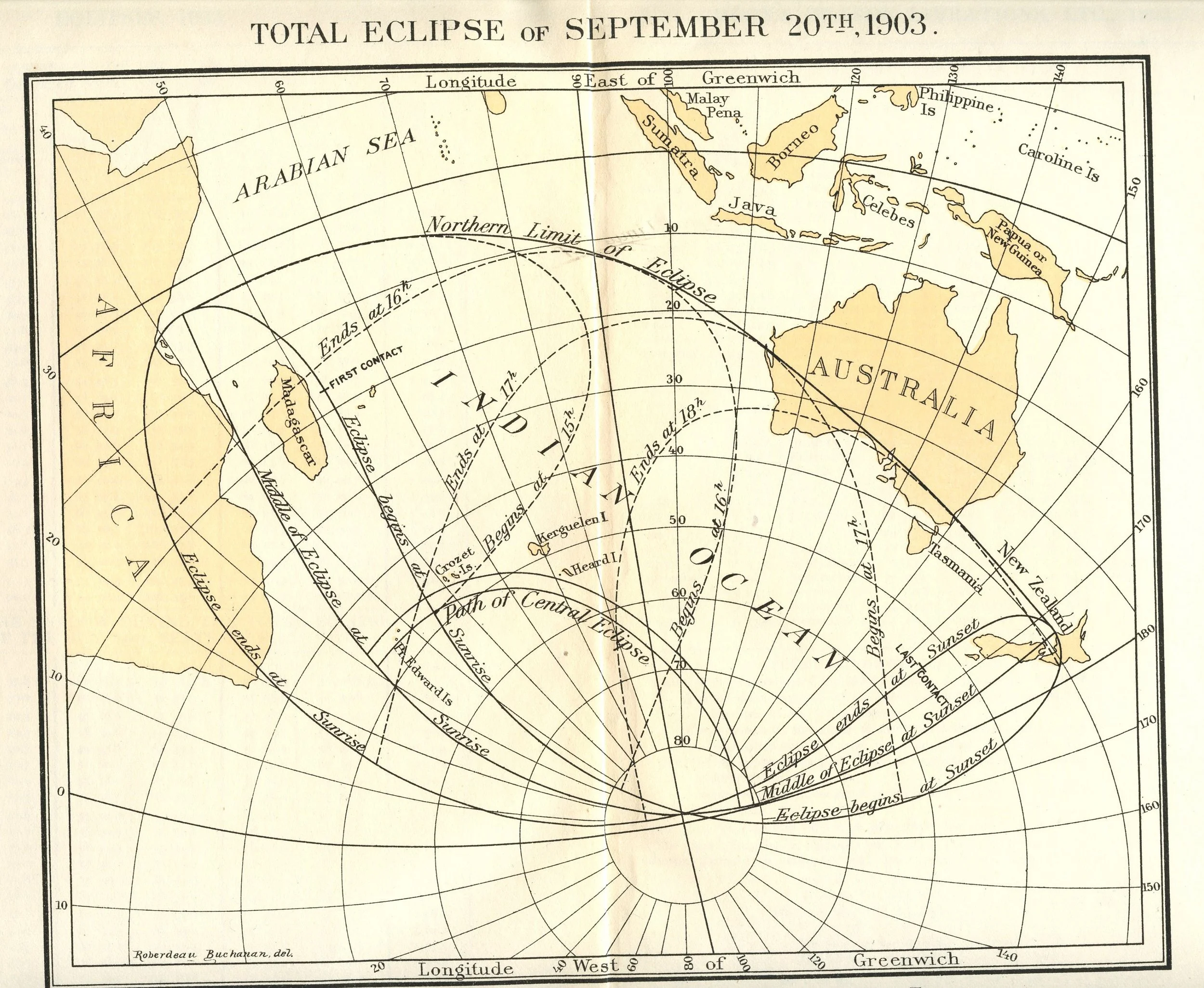
American Ephemeris and Nautical Almanac Total Eclipse Eclipse of September 20th 1903. Collection of Michael Zeiler

American Ephemeris and Nautical Almanac Annular Eclipse of March 16th 1904 Collection of Michael Zeiler


American Ephemeris and Nautical Almanac Total Eclipse of September 9th 1904 Collection of Michael Zeiler