
Maps of Solar Eclipses from 1945 to 1949
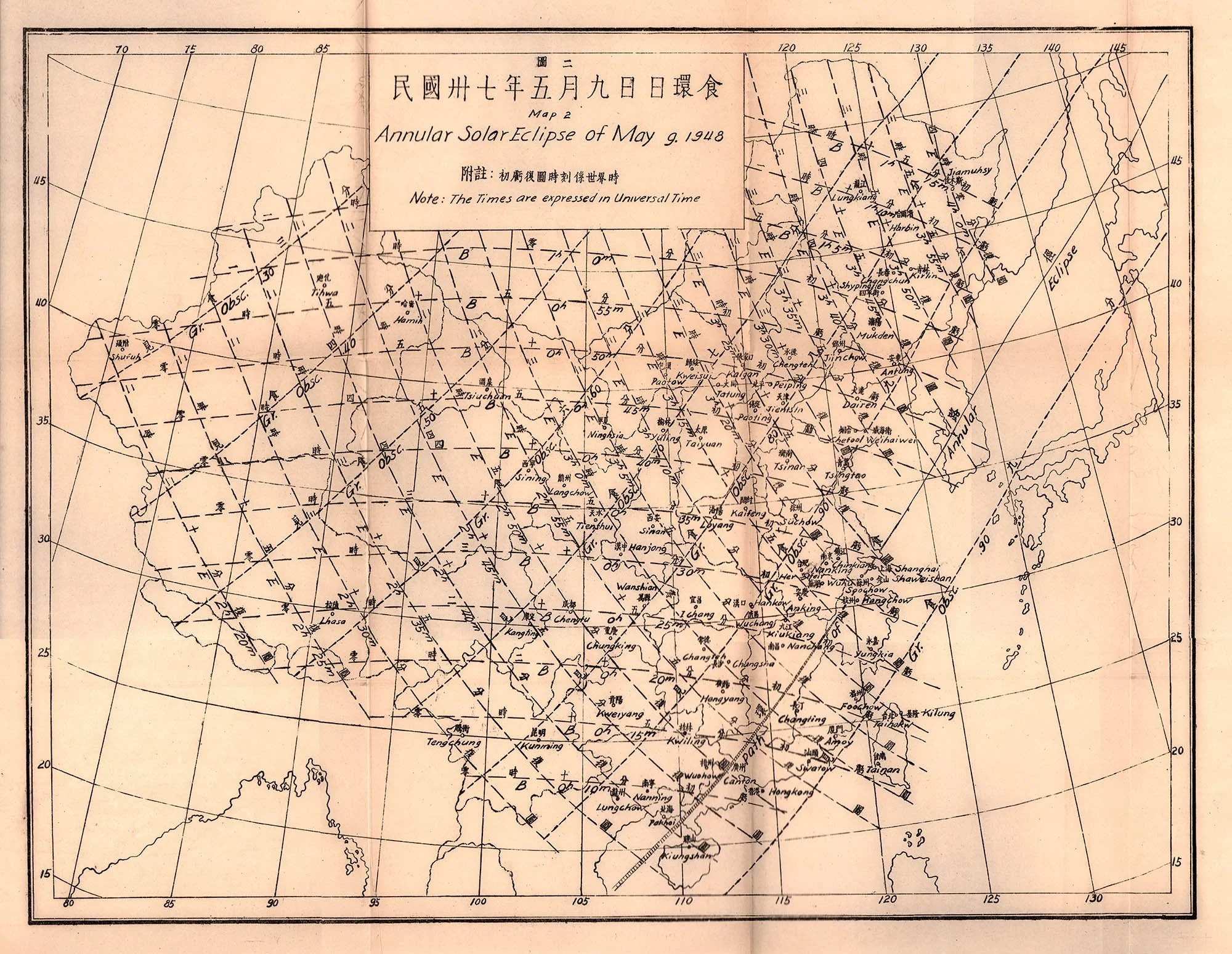
In the midst of revolutionary turmoil, the Tsingtao Observatory published this document containing tables and maps for the annular eclipse of May 9, 1948. The content of this bulletin is in both Chinese and English.
Although ancient Chinese manuscripts contain many of the very oldest records of solar eclipses, the development of Asian eclipse maps seems to have arrived only in the 20th century.
This Chinese eclipse map contains three sets of isolines; isomagnitudes for the eclipse and isochrons for the begin and end of the partial phases of the eclipse. The path of the annular eclipse can be seen sweeping across southeastern China and past Korea. An interesting feature of this map is that all three sets of isolines end abruptly at the Chinese frontier.


Connaissance des Temps Éclipse Annulaire de Soleil le 14 Janvier 1945 gallica.bnf.fr
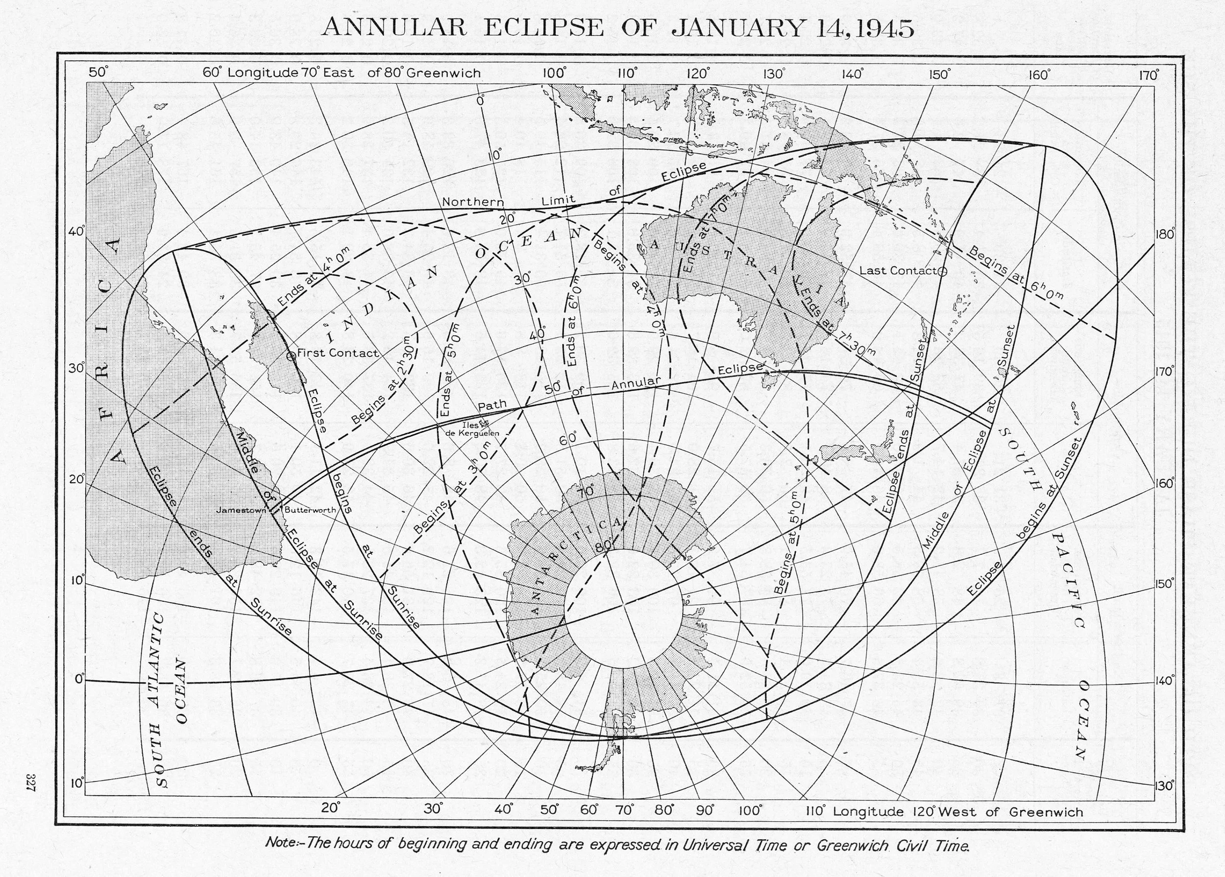
American Ephemeris and Nautical Almanac Annular Eclipse of January 14, 1945 Scanned at Federal Depository Library


Supplement to the American Ephemeris Total Solar Eclipse of July 9, 1945 Collection of Michael Zeiler

Supplement to the American Ephemeris Path of Total Solar Eclipse in the United States and Canada, July 9, 1945 Collection of Michael Zeiler

Connaissance des Temps Éclipse Totale de Soleil le 9 Juillet 1945 gallica.bnf.fr
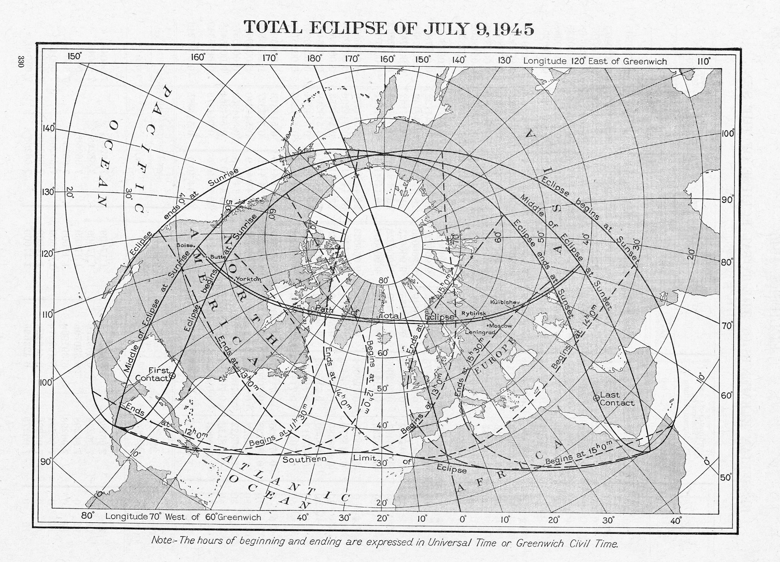
American Ephemeris and Nautical Almanac Total Solar Eclipse of July 9, 1945 Scanned at Federal Depository Library


Connaissance des Temps Éclipse Partielle de Soleil le 30 Mai 1946 Collection of Michael Zeiler
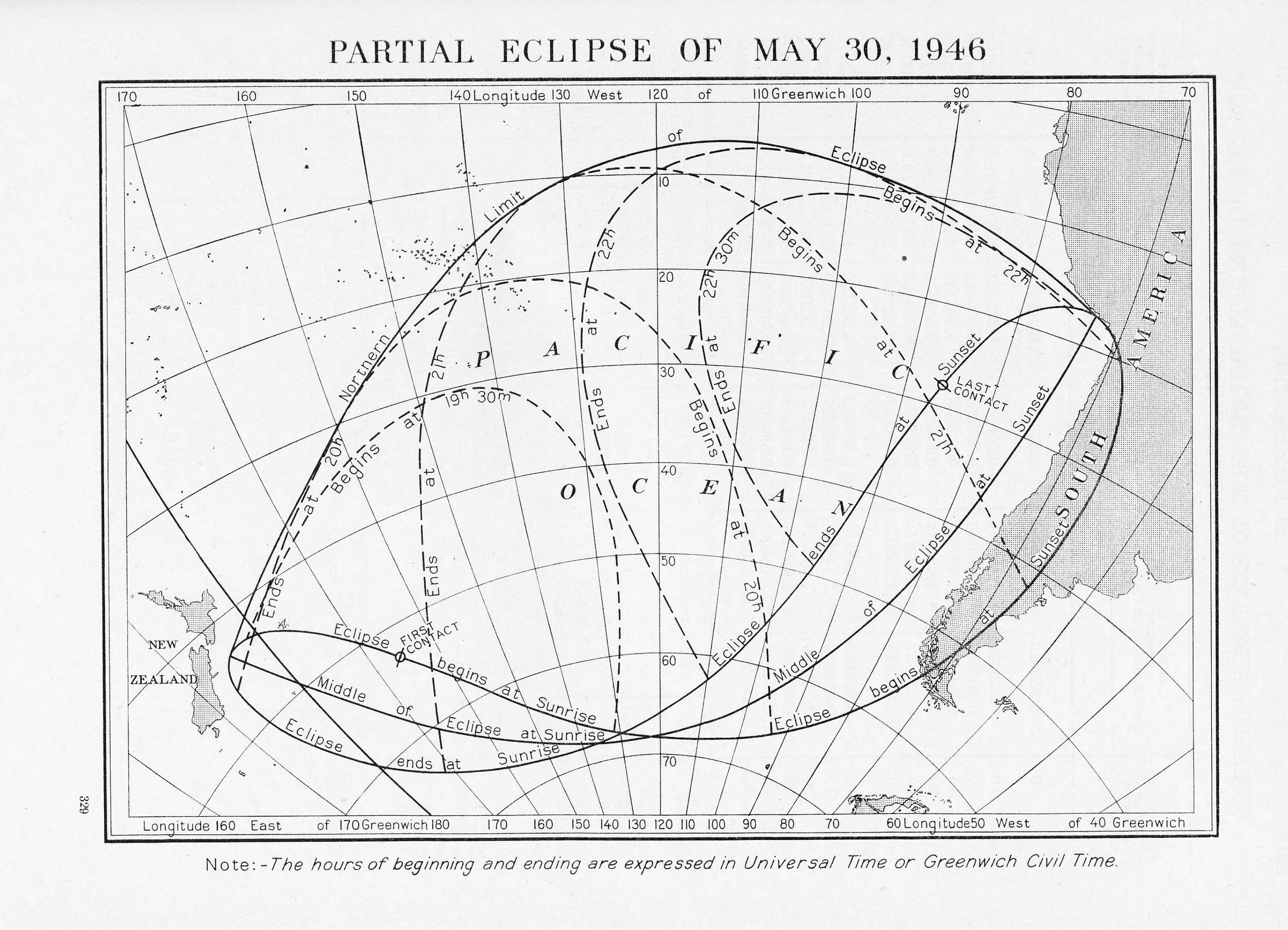
American Ephemeris and Nautical Almanac Partial Solar Eclipse of May 30, 1946 Scanned at Federal Depository Library
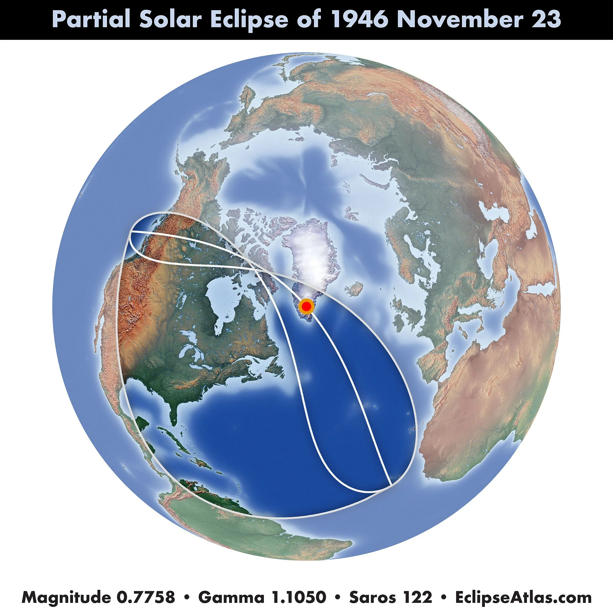
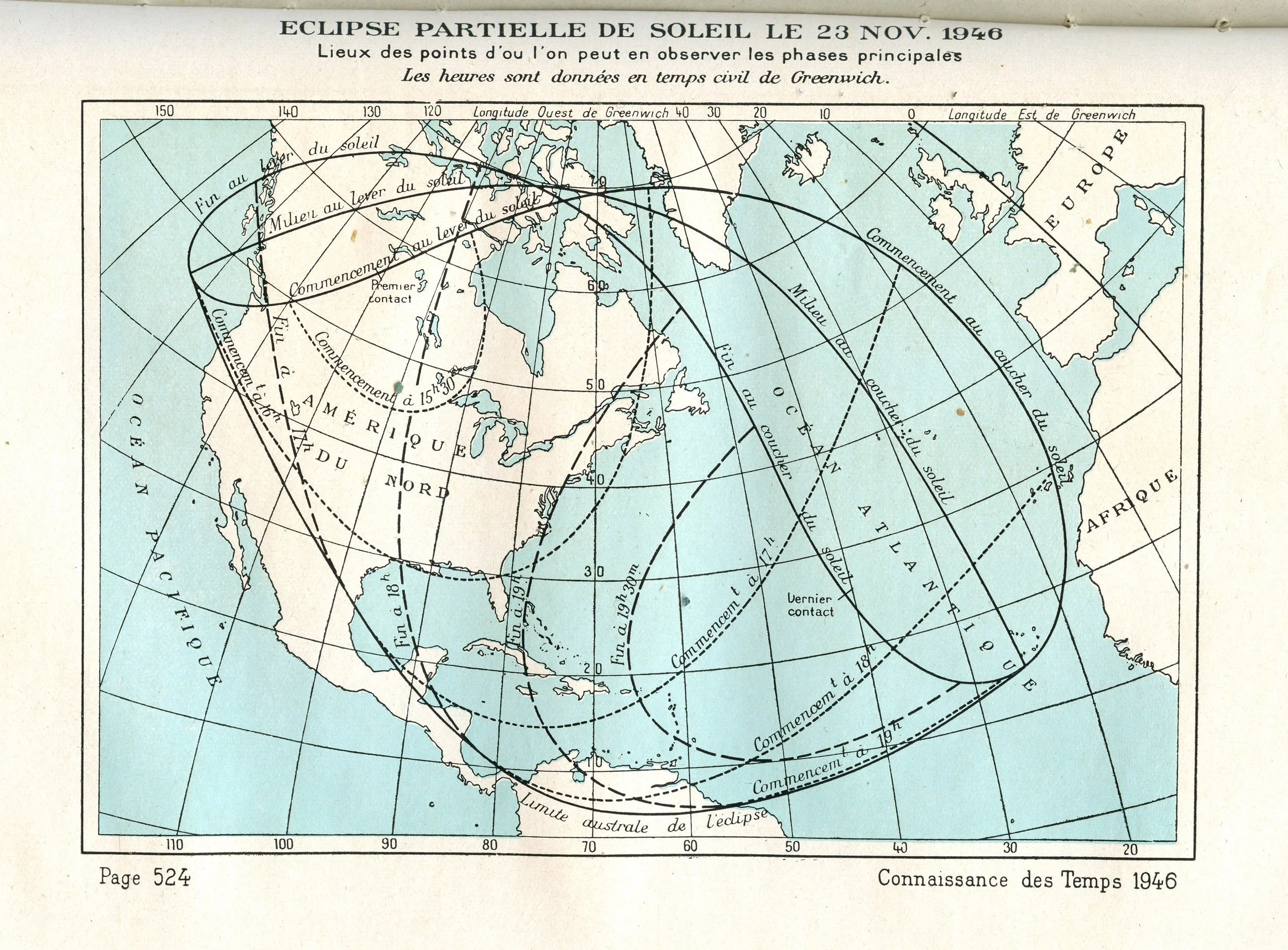
Connaissance des Temps Éclipse Partielle de Soleil le 23 Nov 1946 gallica.bnf.fr

American Ephemeris and Nautical Almanac Partial Solar Eclipse of November 23, 1946 Scanned at Federal Depository Library

Supplement to the American Ephemeris Total Solar Eclipse of May 20, 1947 Collecton of Michael Zeiler

Supplement to the American Ephemeris Path of Total Solar Eclipse in South America and Africa, of May 20, 1947 Collecton of Michael Zeiler

American Ephemeris and Nautical Almanac Total Solar Eclipse of May 20, 1947 Collection of Michael Zeiler

Berliner Astronomische Jahrbuch Totale Sonnenfinsternis 1947 Mai 20 Jagiellion Digital Library, bj.uj.edu.pl
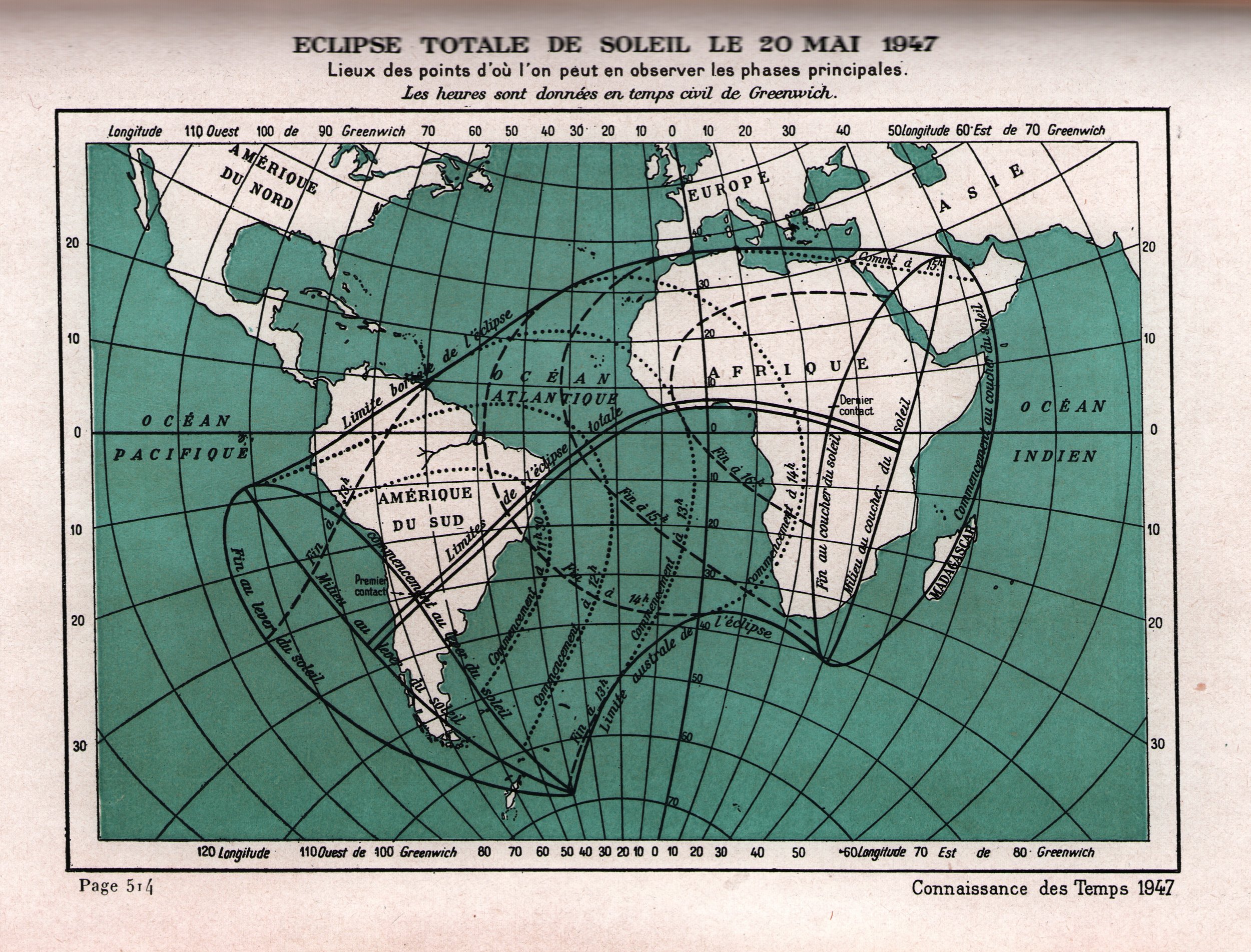
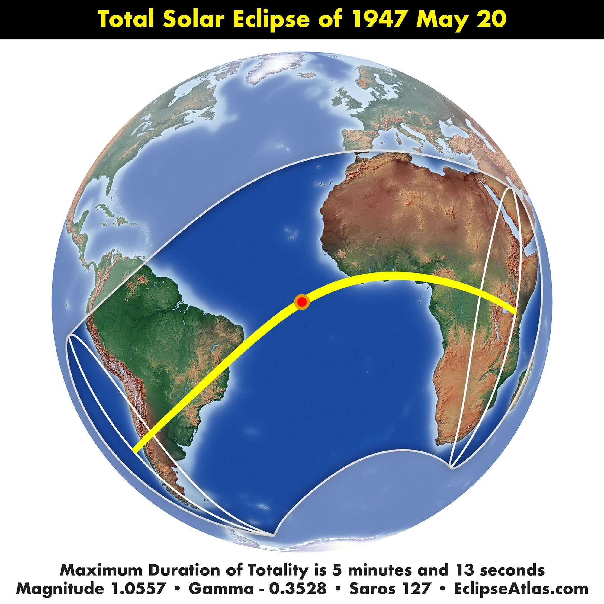
Connaissance des Temps Éclipse Totale de Soleil le 20 Mai 1947 Collection of Michael Zeiler
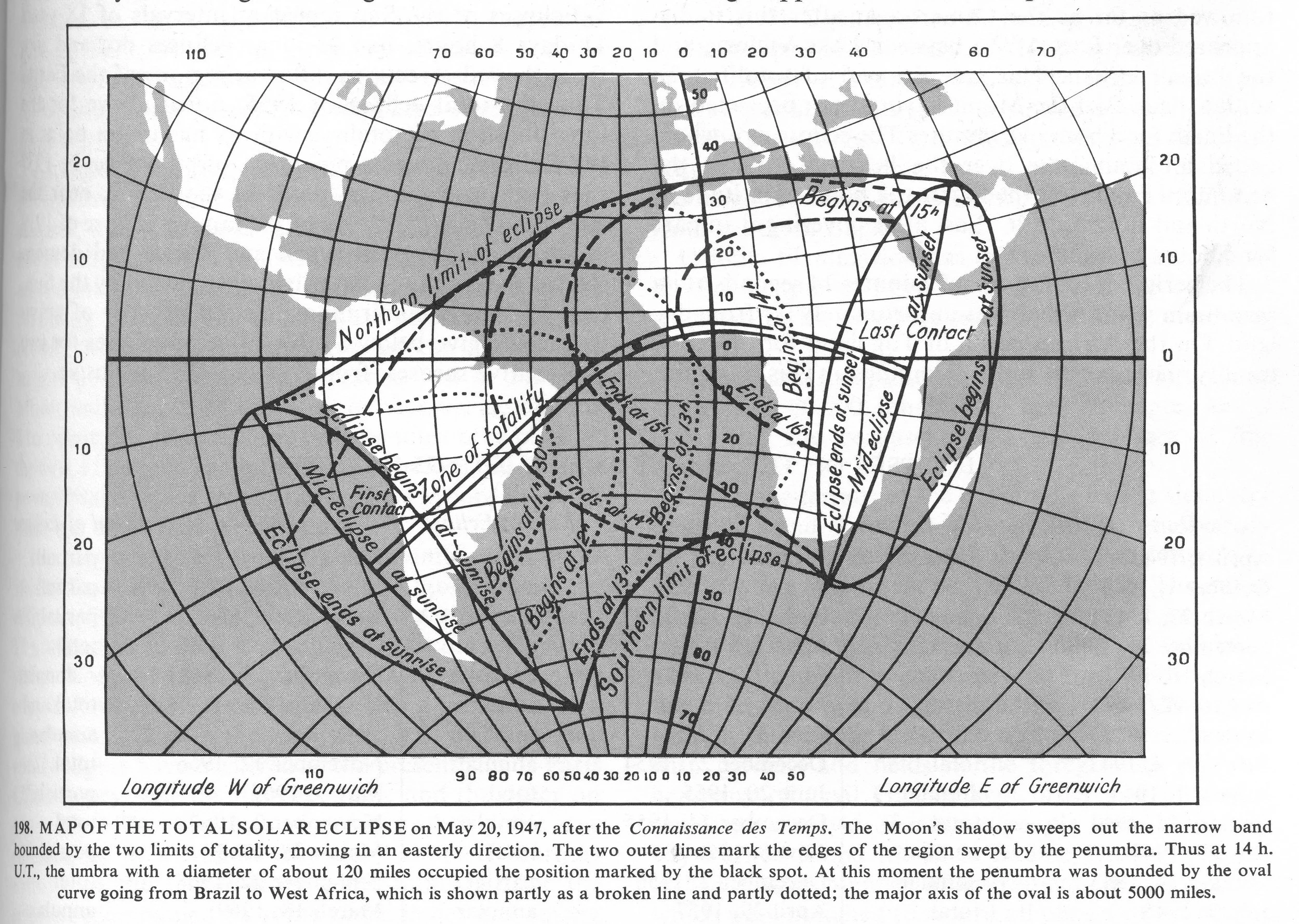
Flammarion Book of Astronomy MAP OF THE TOTAL SOLAR ECLIPSE on May 20, 1947, after the Connaissance des Temps. Scanned at Federal Repository Library

Alfredo Voelsch Eclipse de Sol del 20 de Mayo de 1947 Zona de Totalidad en Sudamerica Scanned at USNO James Melville Gillis Library

Alfredo Voelsch Principio del Eclipse de Sol del 20 de Mayo de 1947 Scanned at USNO James Melville Gillis Library

Alfredo Voelsch Eclipse de Sol del 20 de Mayo de 1947 Scanned at USNO James Melville Gillis Library

Alfredo Voelsch Fin del Eclipse de Sol del 20 de Mayo de 1947 Scanned at USNO James Melville Gillis Library

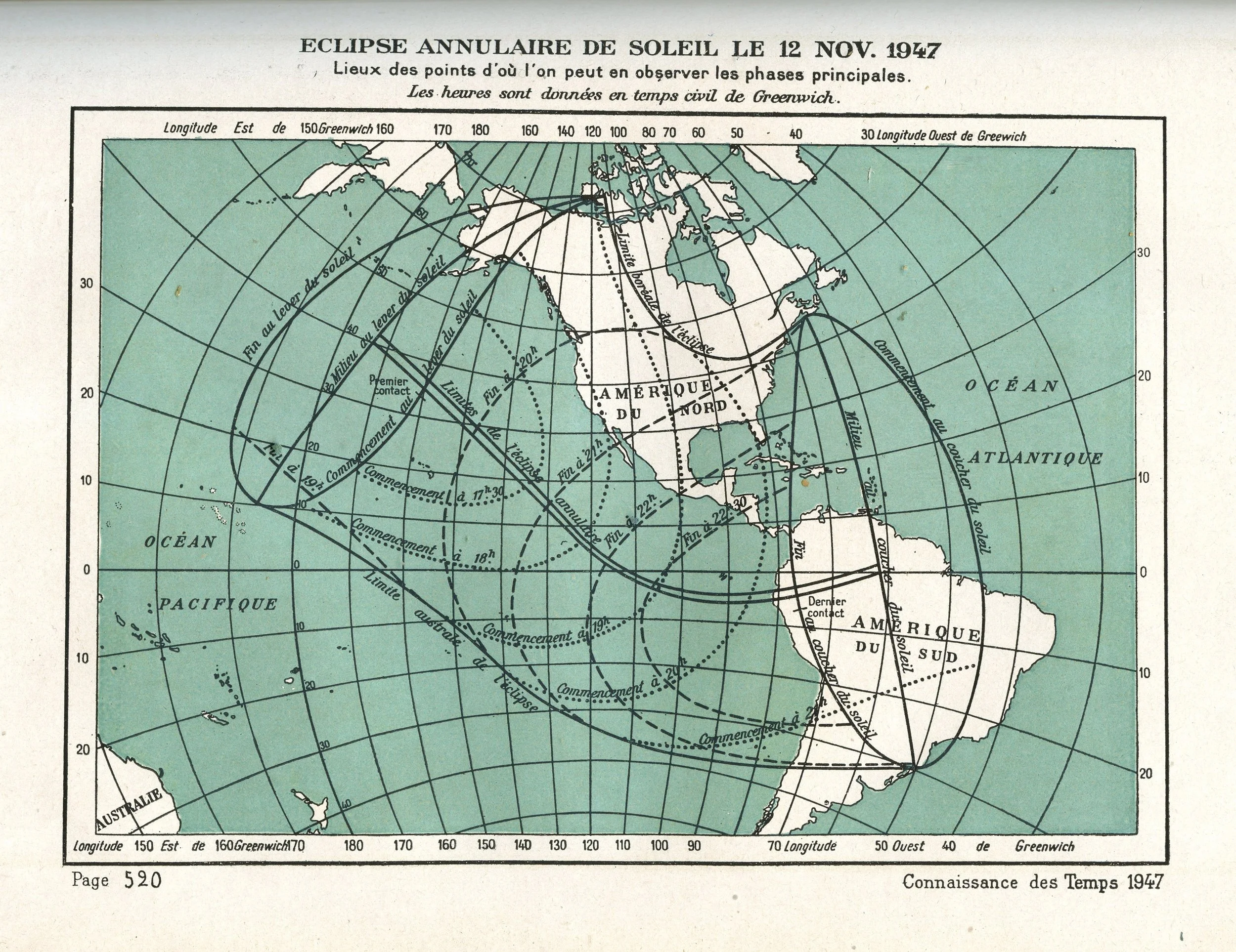
Connaissance des Temps Éclipse Annulaire de Soleil le 12 Nov 1947 Collection of Michael Zeiler

American Ephemeris and Nautical Almanac Annular Solar Eclipse of November 12, 1947 Scanned at Federal Depository Library Collection of Michael Zeiler


Connaissance des Temps Éclipse Annulaire de Soleil les 8 et 9 Mai 1948 gallica.bnf.fr

National Geographic Society The Society Followed the Eclipse from Tropical Burma to the Icy Aleutians Collection of Michael Zeiler
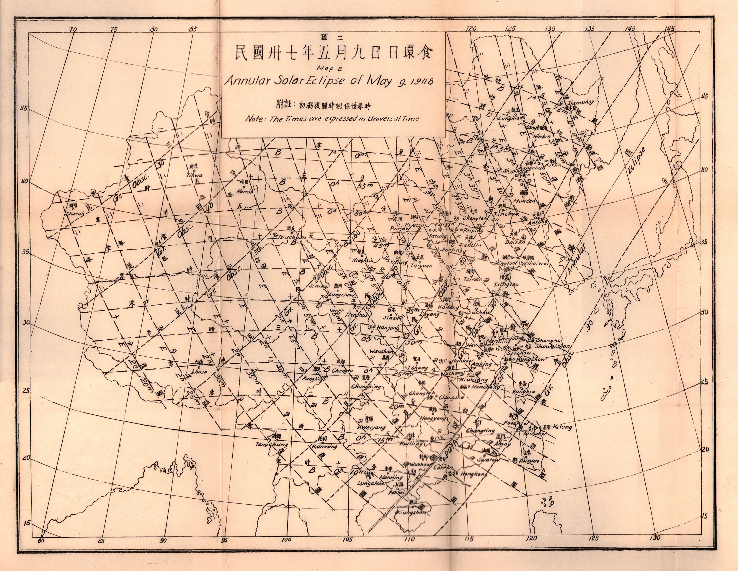
Memoir of the Tsingtao Observatory Annular Solar Eclipse of Maya 9, 1948 Map 2 Collection of Michael Zeiler
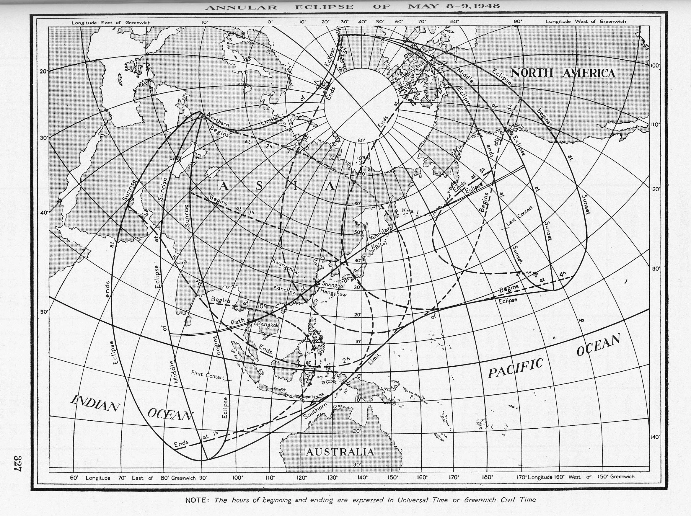
American Ephemeris and Nautical Almanac Annular Solar Eclipse of May 8-9 1948 Scanned at Federal Depository Library
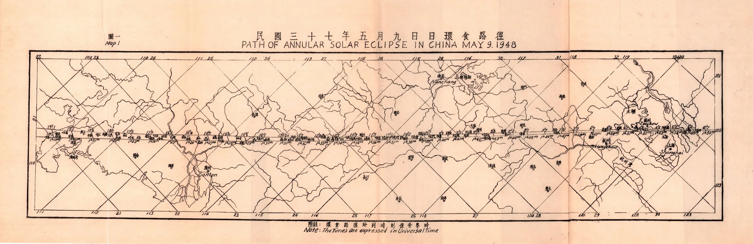
Memoir of the Tsingtao Observatory Annular Solar Eclipse of Maya 9, 1948 Map 1 Collection of Michael Zeiler
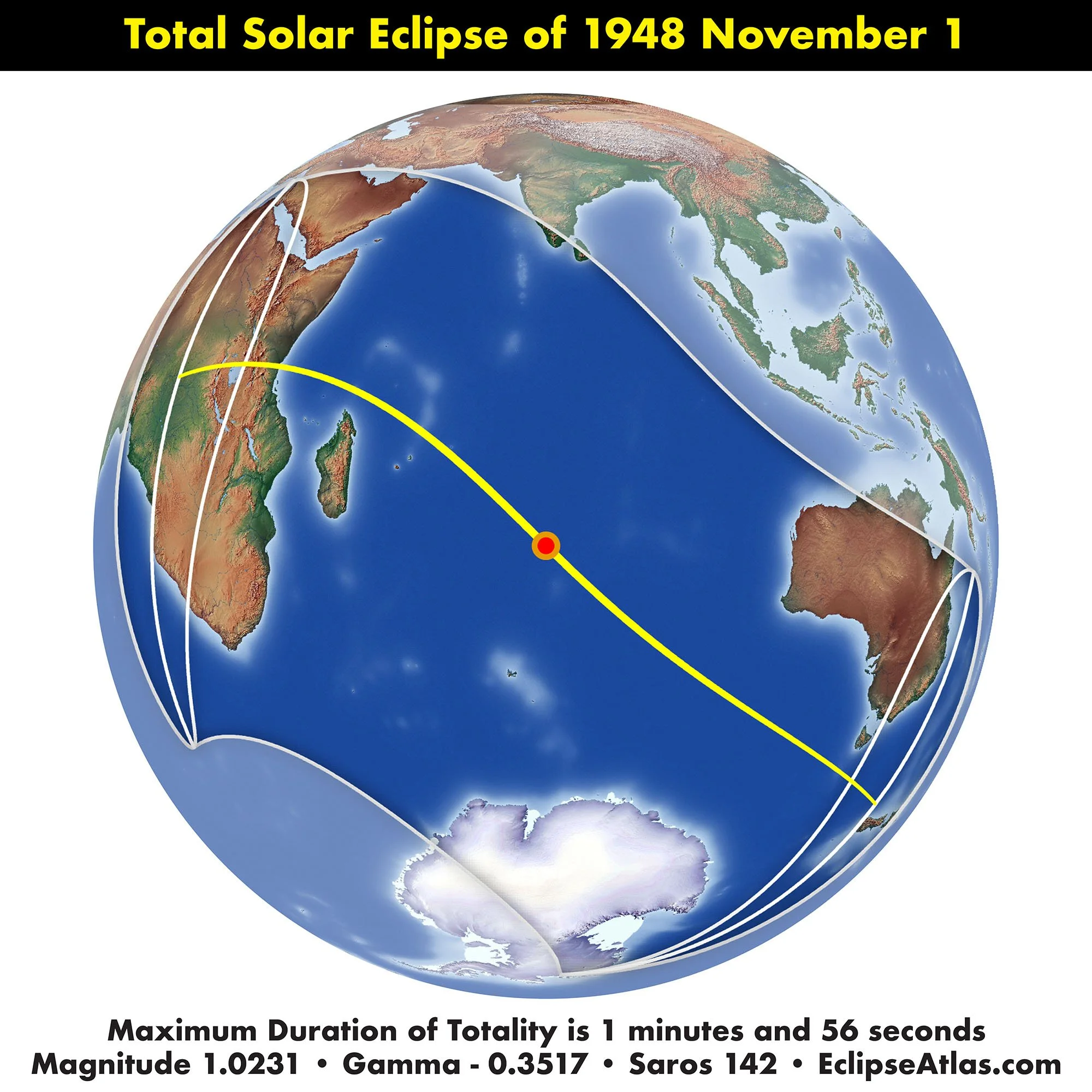
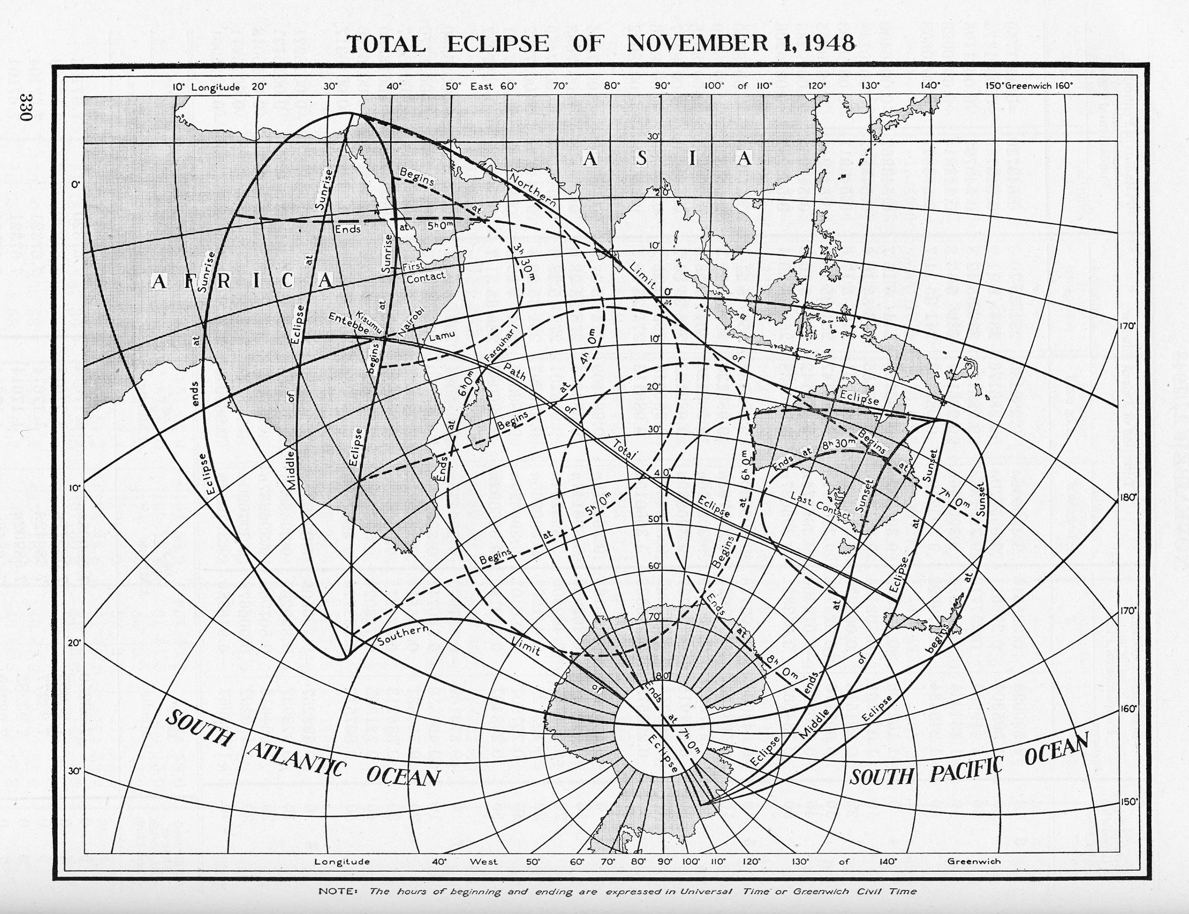
American Ephemeris and Nautical Almanac Total Solar Eclipse of November 1, 1948 Scanned at Federal Depository Library

Connaissance des Temps Éclipse Totale de Soleil le 1 Nov. 1948 Collection of Michael Zeiler
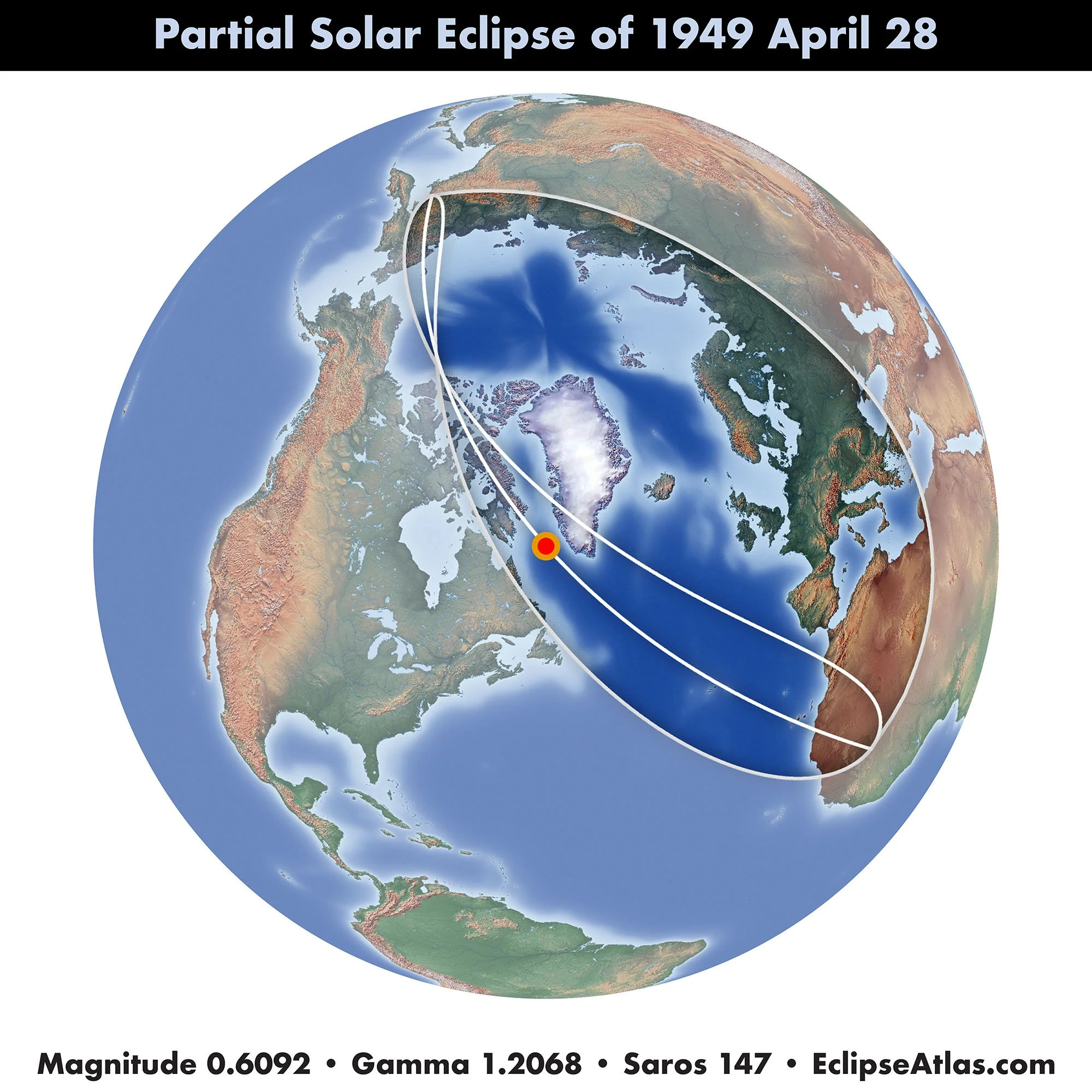
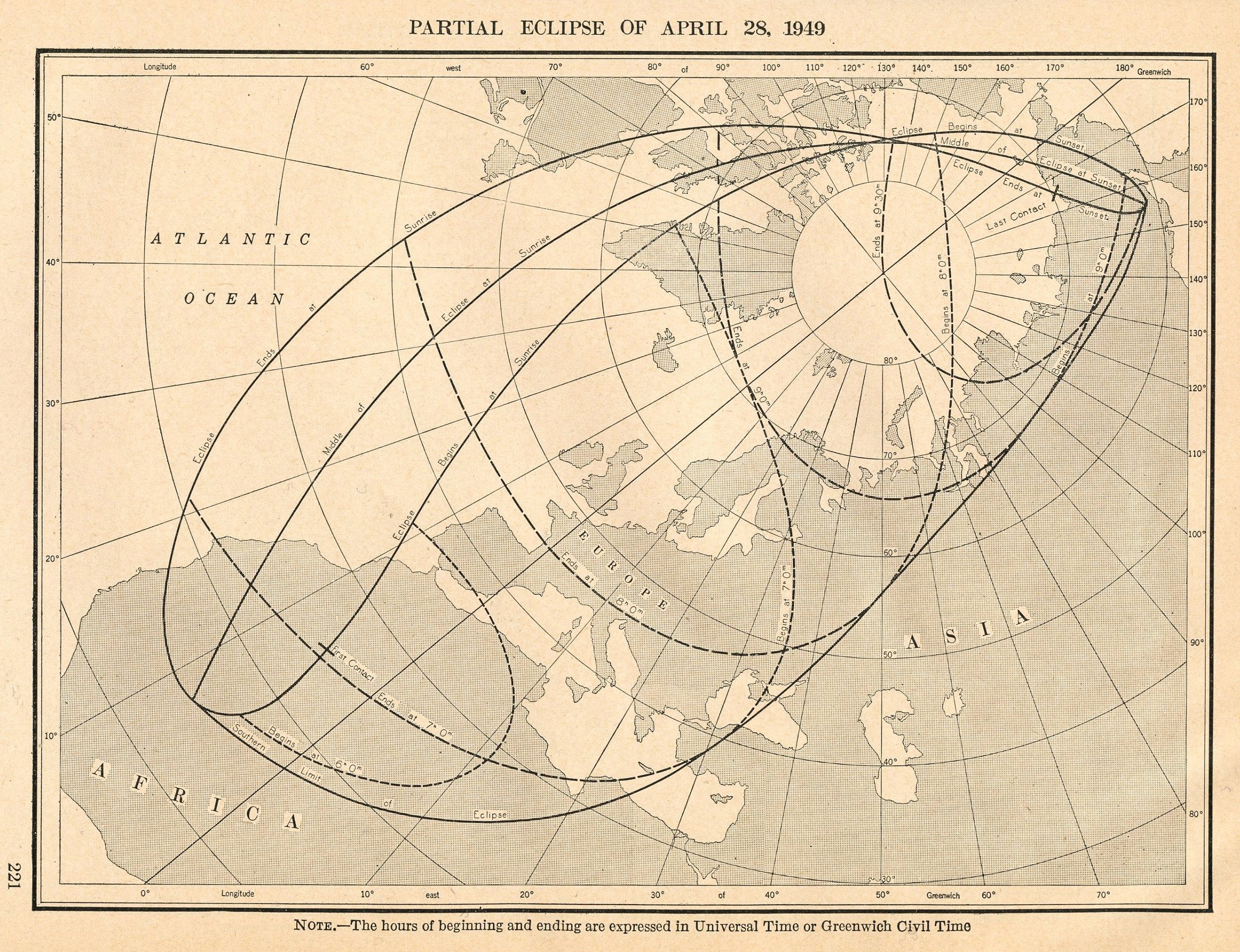
American Ephemeris and Nautical Almanac Partial Solar Eclipse of April 28, 1949 Collection of Michael Zeiler

Connaissance des Temps Éclipse Partielle de Soleil le 28 Avril 1949 gallica.bnf.fr

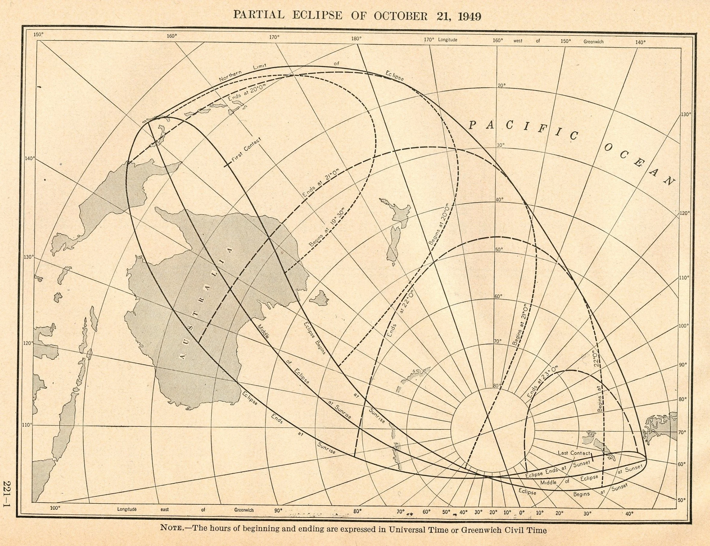
American Ephemeris and Nautical Almanac Partial Solar Eclipse of October 21, 1949 Collection of Michael Zeiler