
Maps of Solar Eclipses from 1950 to 1954
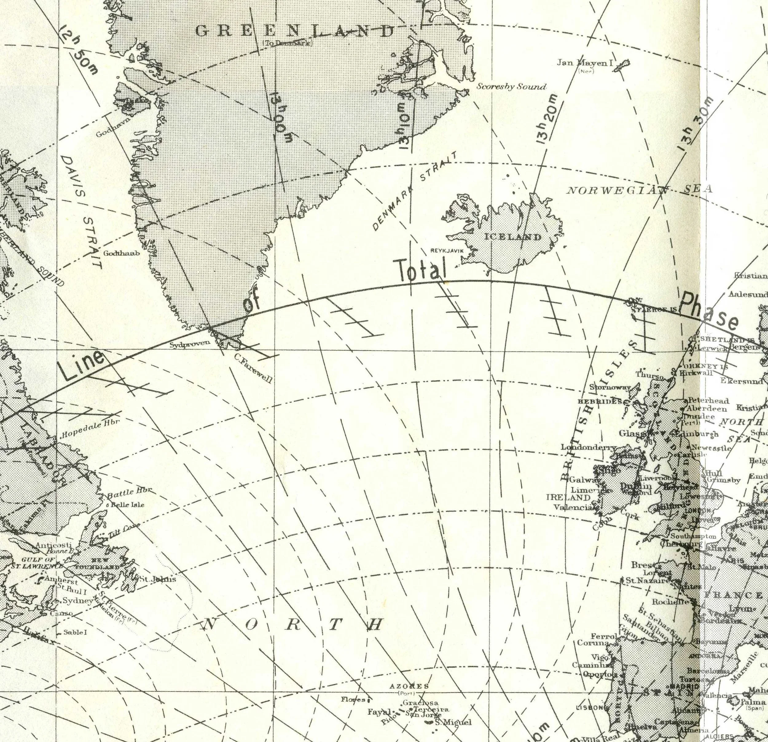
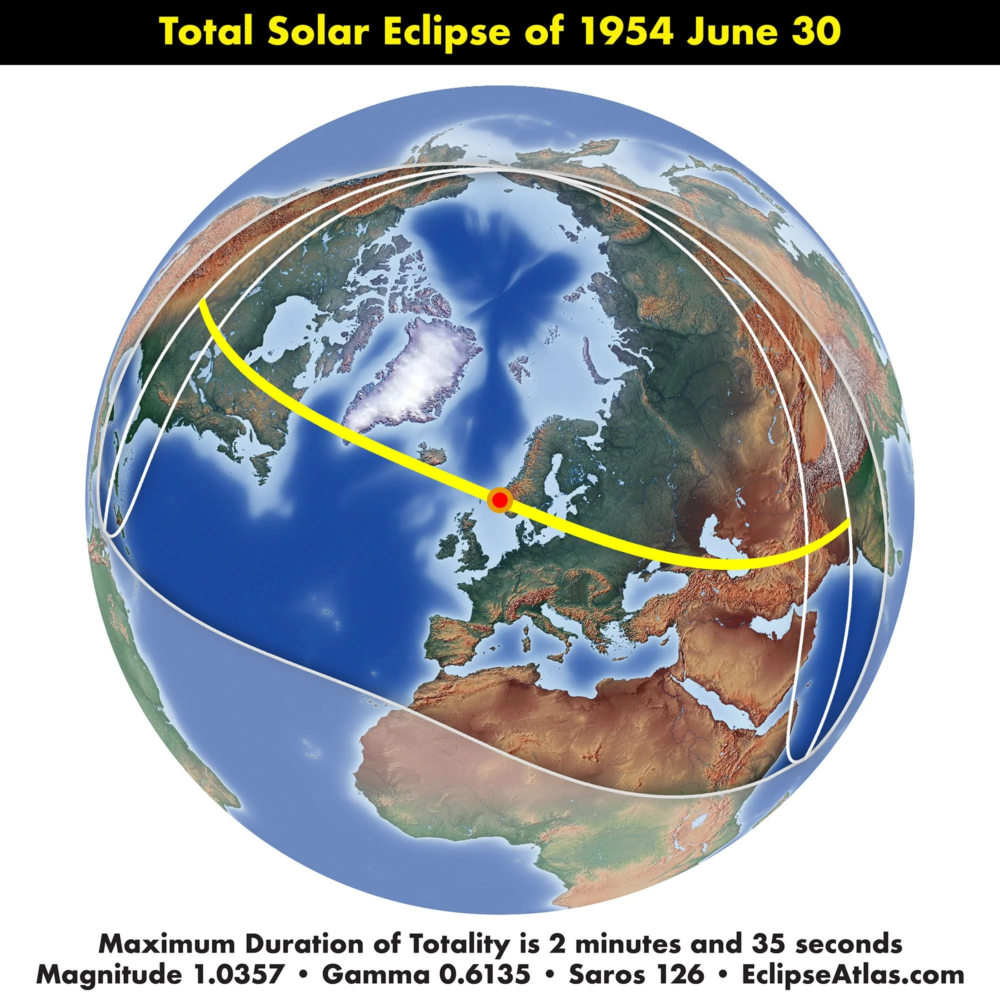
The United States Naval Observatory published a supplement to the American Ephemeris and Nautical Almanac for the total eclipse on June 30, 1954. The path of the total eclipse swept over three continents; North America, Europe, and then Asia.
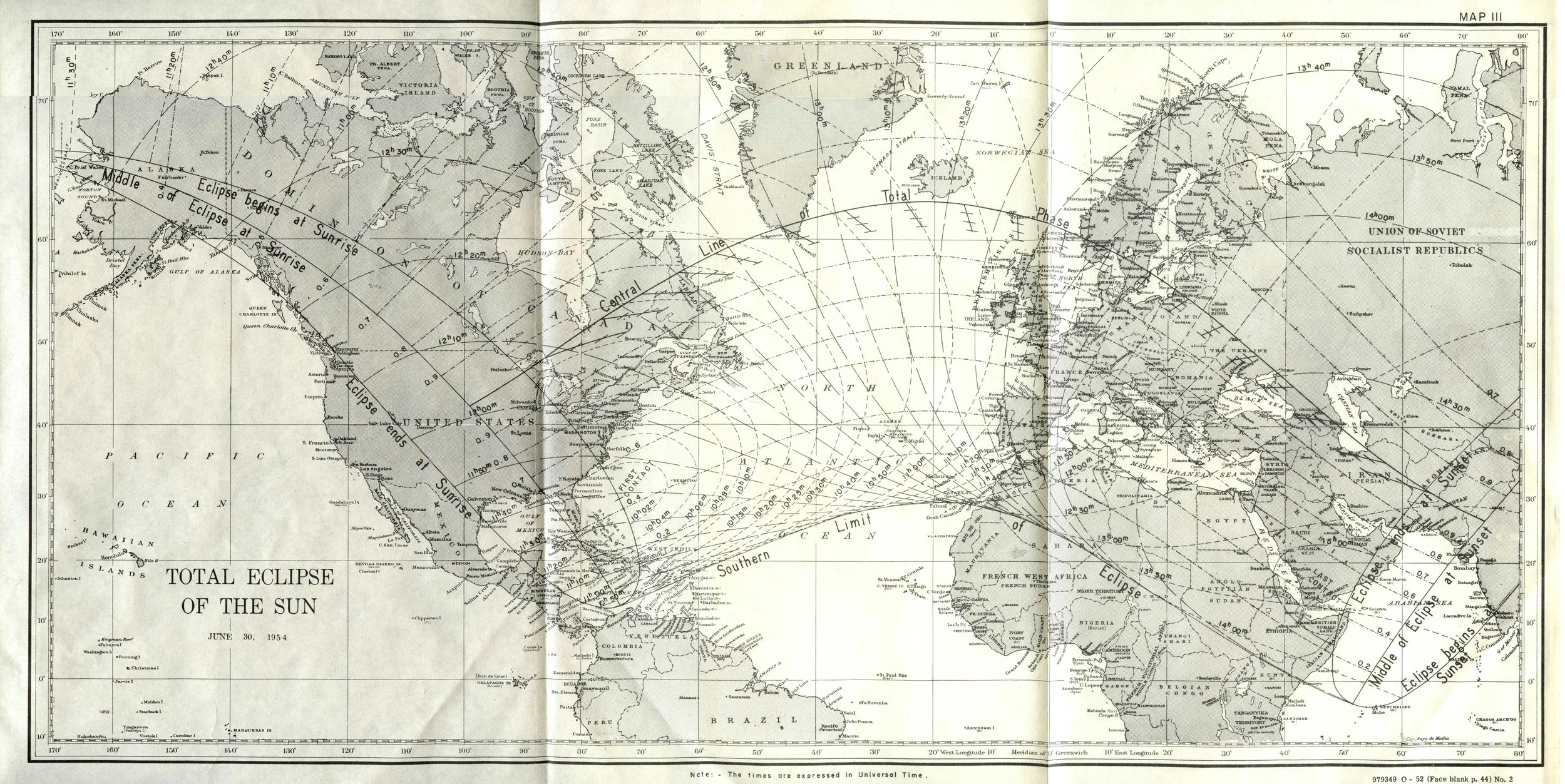
Close examination of the overview map contained within the supplement shows a curious feature not seen on any earlier eclipse map. What are these features south of the central line with an angled line and three short line segments roughly parallel to the path of total solar eclipse?
A careful reading of the USNO supplement reveals that these lines are the paths of the eclipse at elevations of 100 km, 200 km, and 300 km above the surface of the earth.
1954 is just before the dawn of the space age. So why were these lines for the path at elevations added? A reading of another document for the same eclipse from Norway gives the answer: “Of recent years, the ionization of the upper atmospheric layers and the so-called radio noise from the Sun have been made the object of a great number of investigations.”
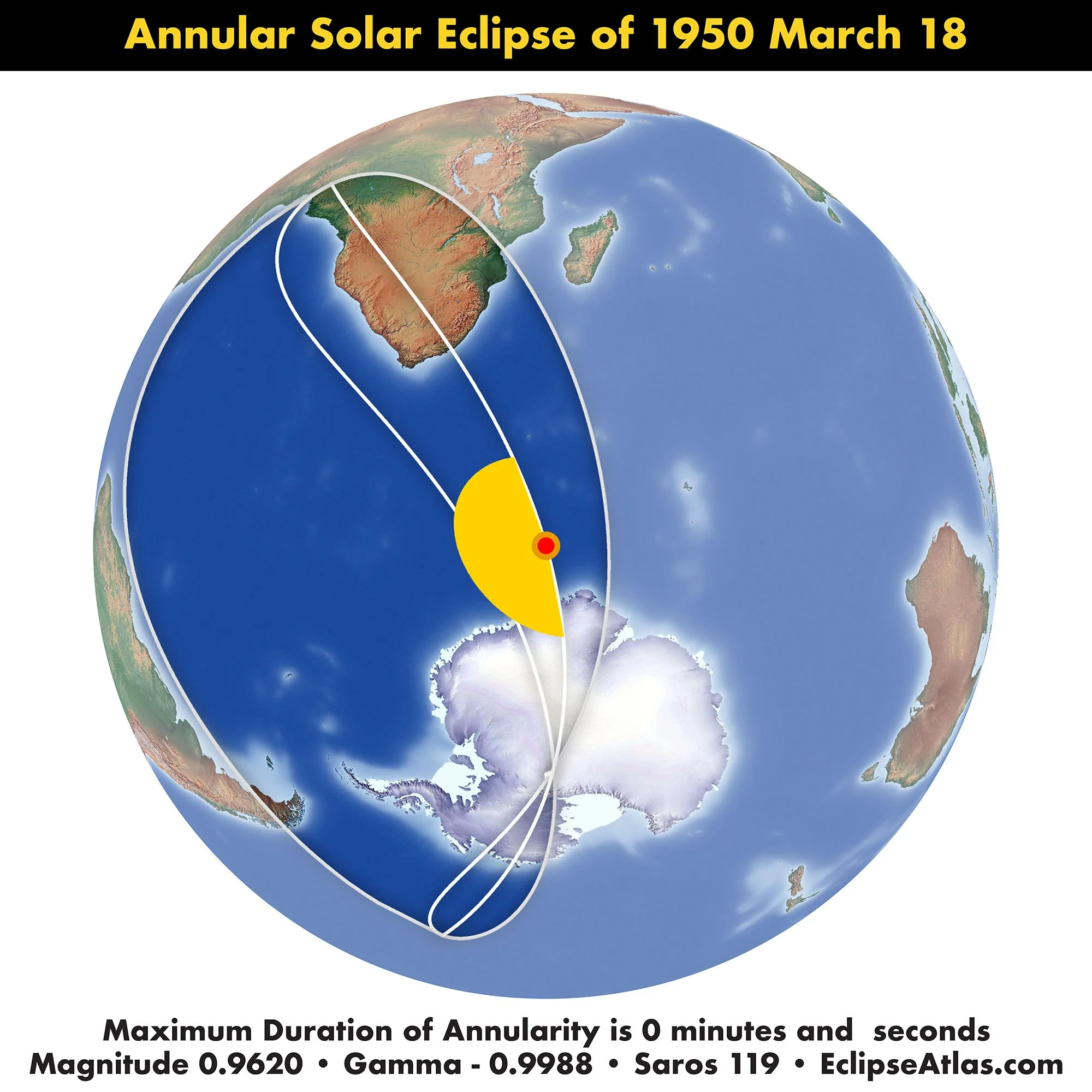

American Ephemeris and Nautical Almanac Annular Eclipse of March 18, 1950. Scanned at Federal Depository Library

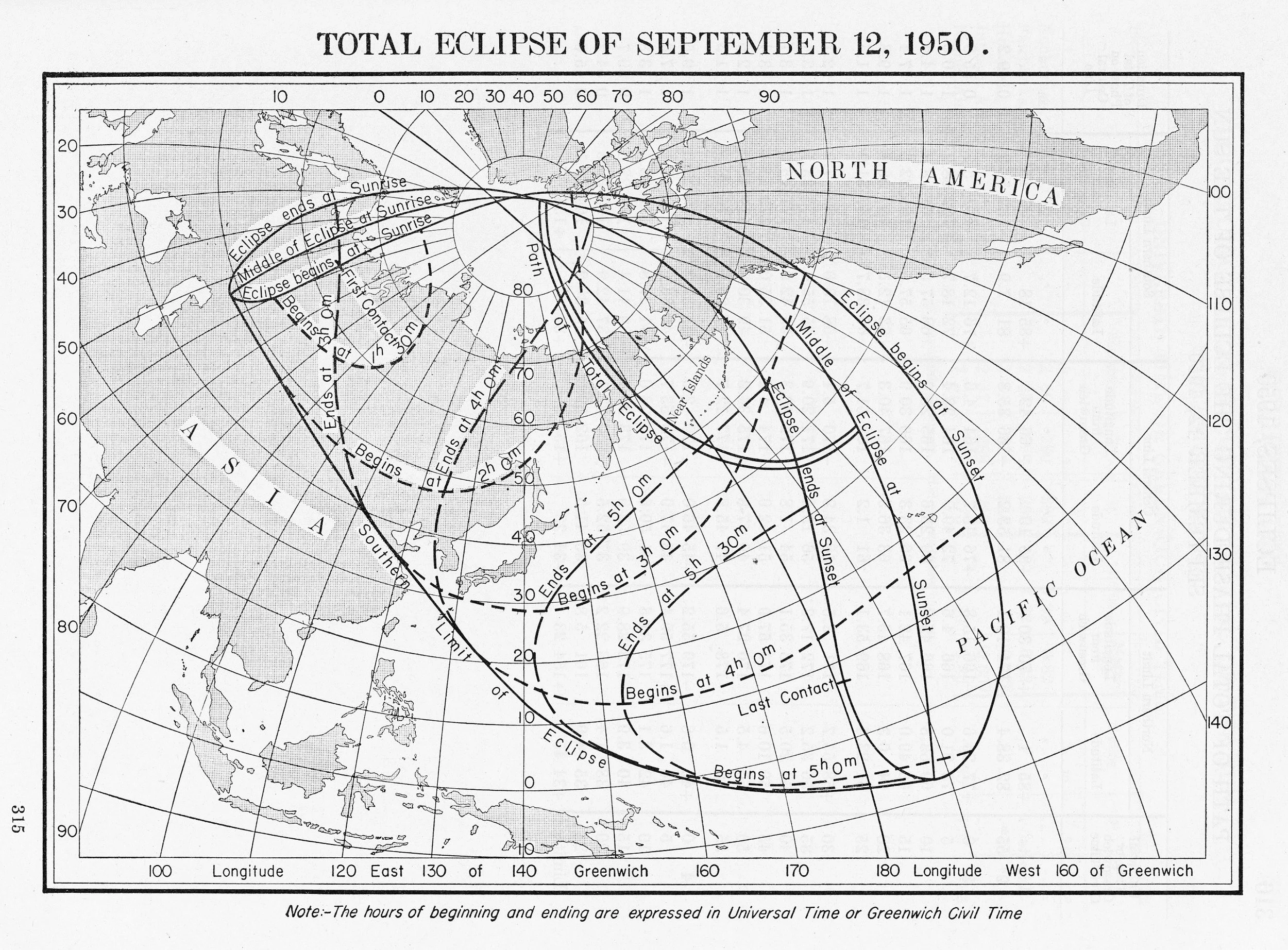
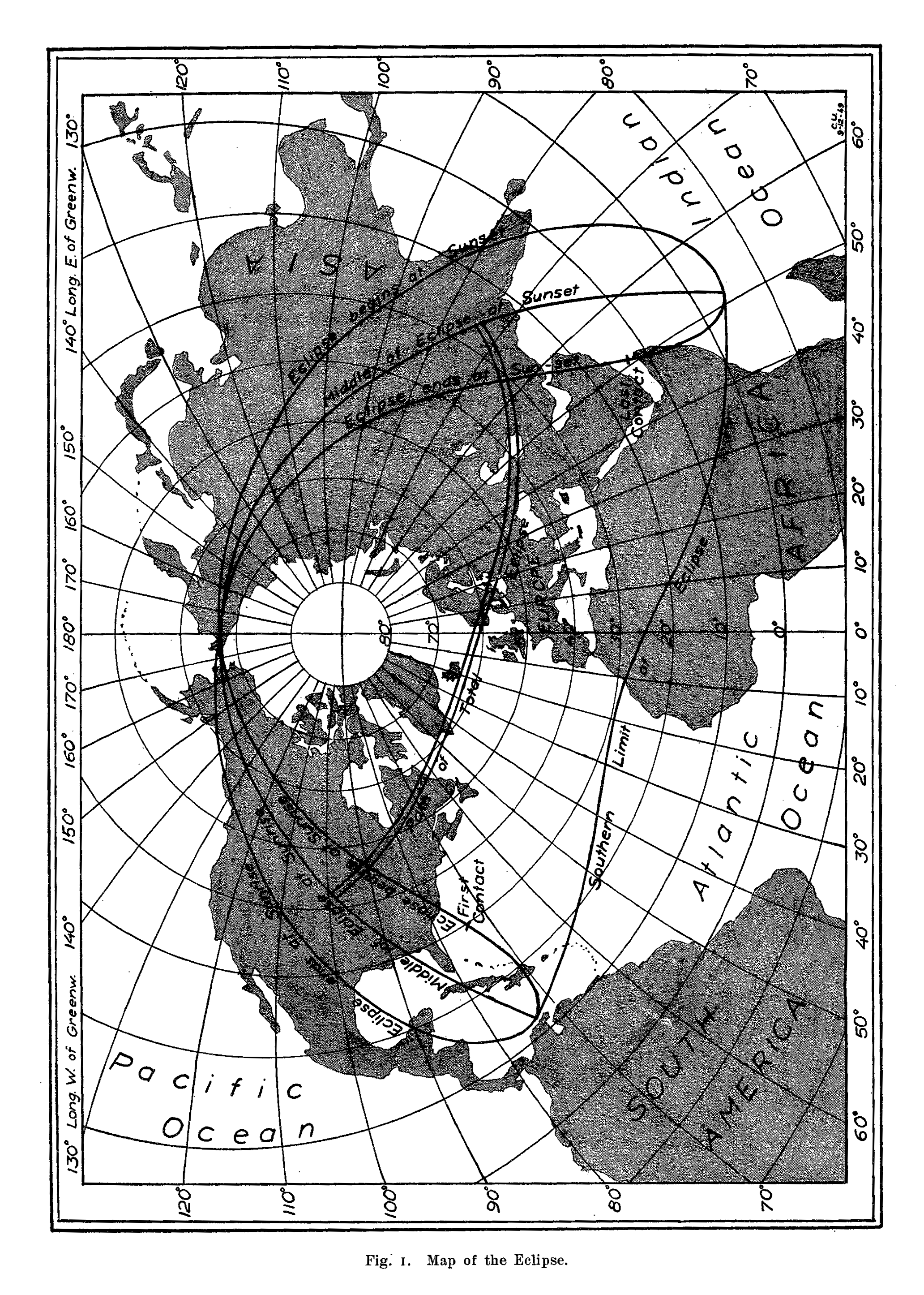
American Ephemeris and Nautical Almanac Total Eclipse of September 12, 1950. Scanned at Federal Depository Library
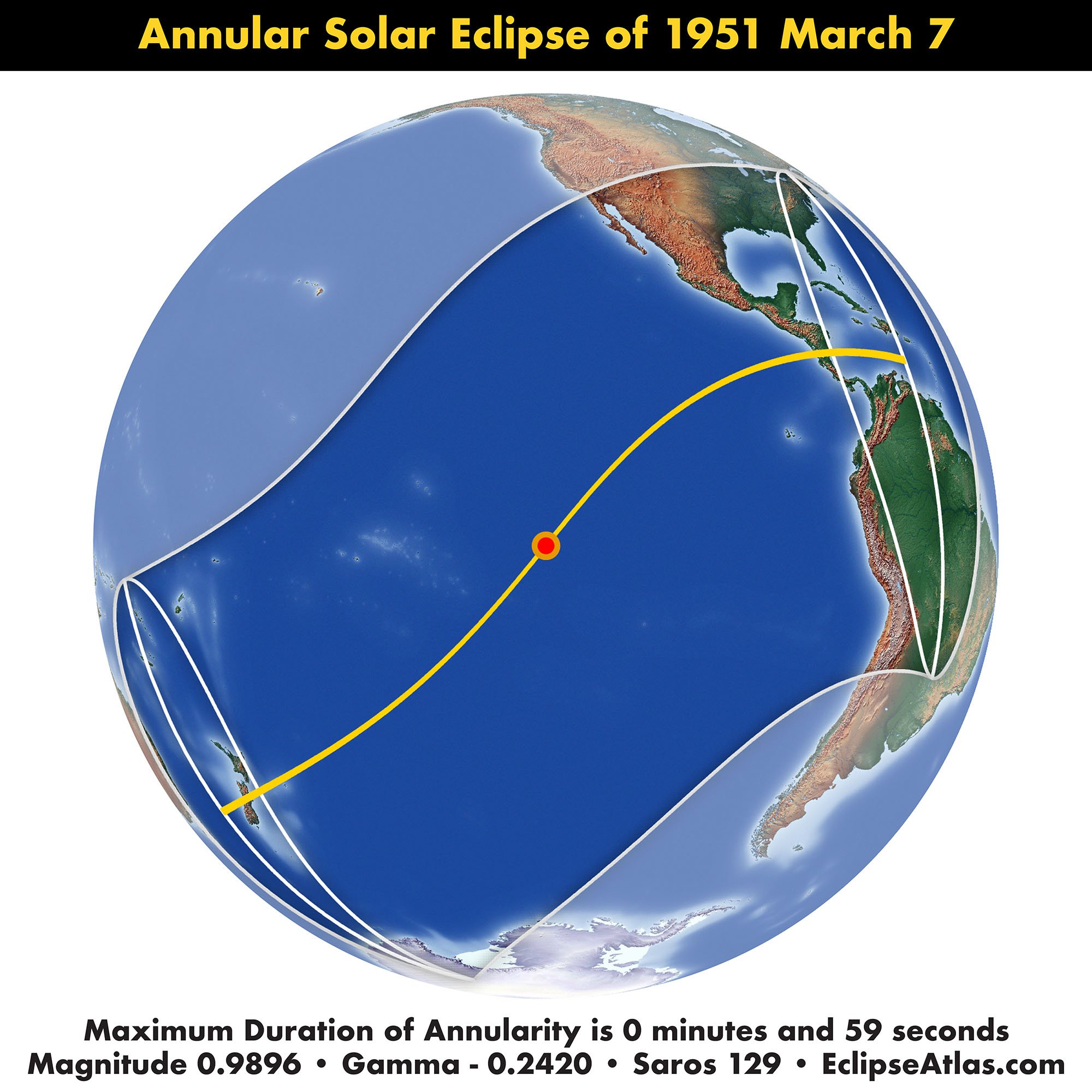

American Ephemeris and Nautical Almanac Annular Eclipse of March 7, 1951. Collection of Michael Zeiler

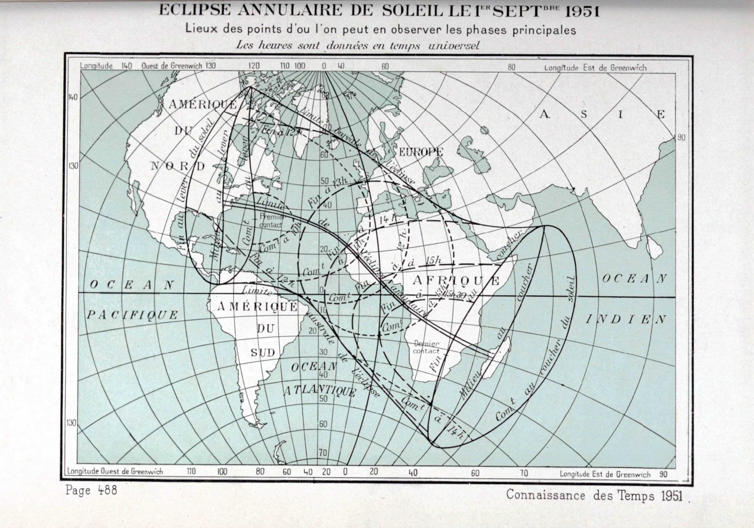
Connaissance des Temps Eclipse Annulaire de Soleil le 1er Septbre 1951 gallica.bnf.fr
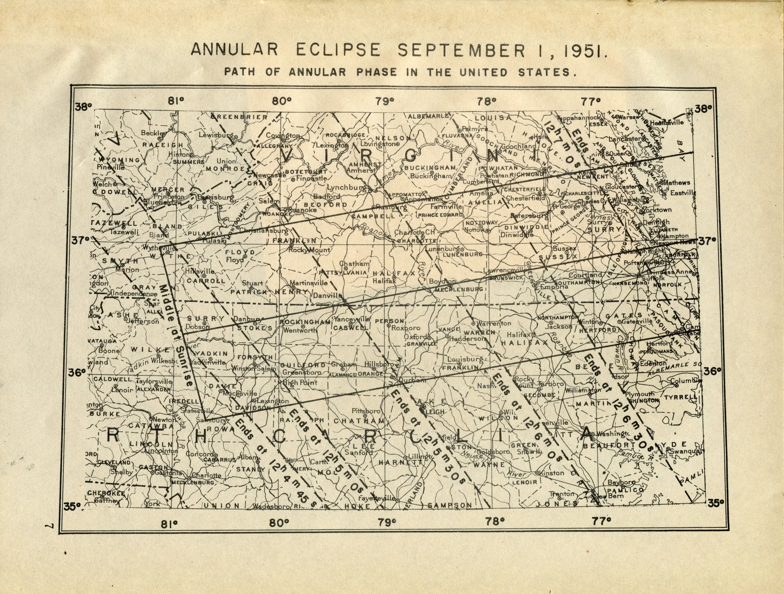
US Naval Observatory Eclipse Circular 27 Annular Eclipse September 1, 1951. Scanned at USNO James Melville Gillis Library

American Ephemeris and Nautical Almanac Annular Eclipse of September 1, 1951 Collection of Michael Zeiler


Ceccini il Cielo Grafico orario, relativo ai luoghi terrestri dai quali erano visibili le fasi principali dell'eclisse totale di Sole del 25 febbraio I952.
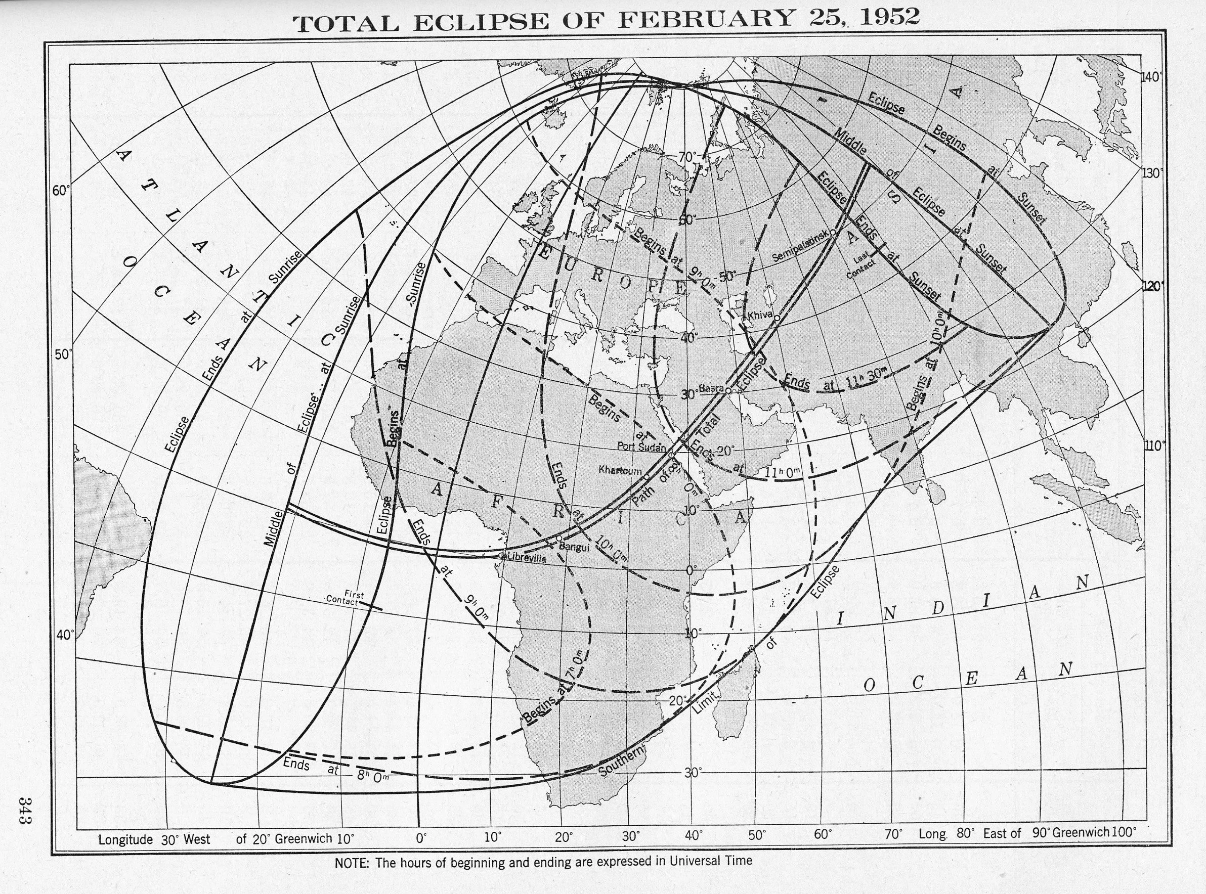
American Ephemeris and Nautical Almanac Total Eclipse of February 25, 1952 Scanned at Federal Repository Library

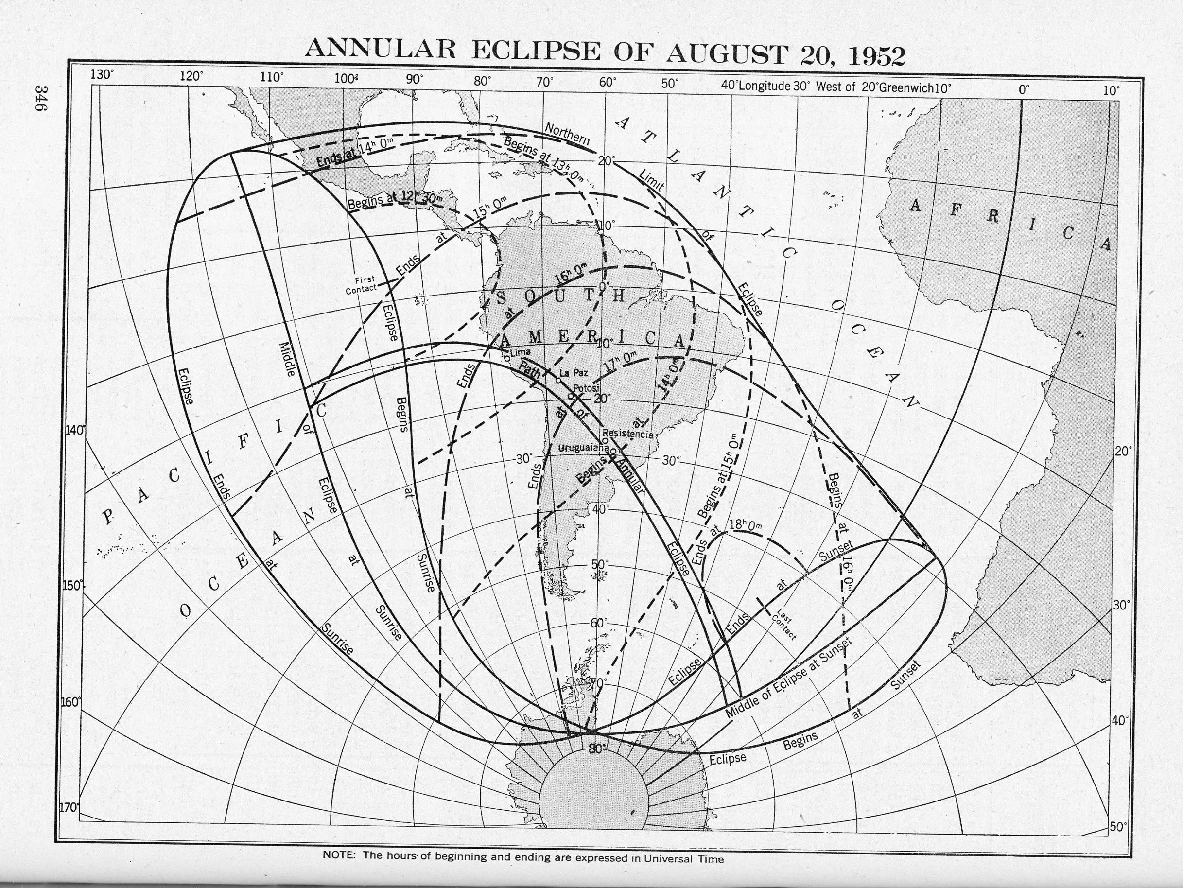
American Ephemeris and Nautical Almanac Annular Eclipse of August 20, 1952 Scanned at Federal Depository Library

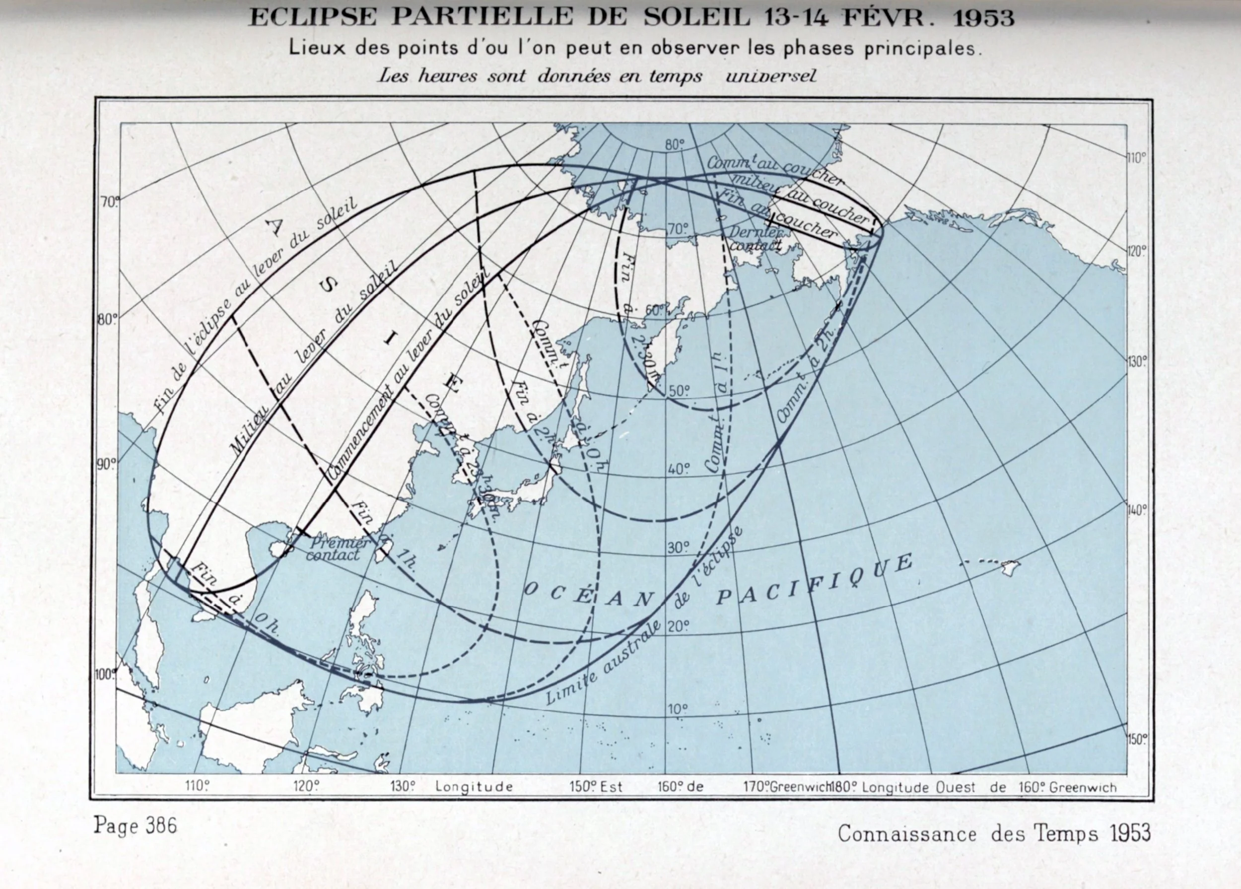
onnaissance des Temps Éclipse Partielle de Soleil 13-14 Fer. 1953 gallica.bnf.fr
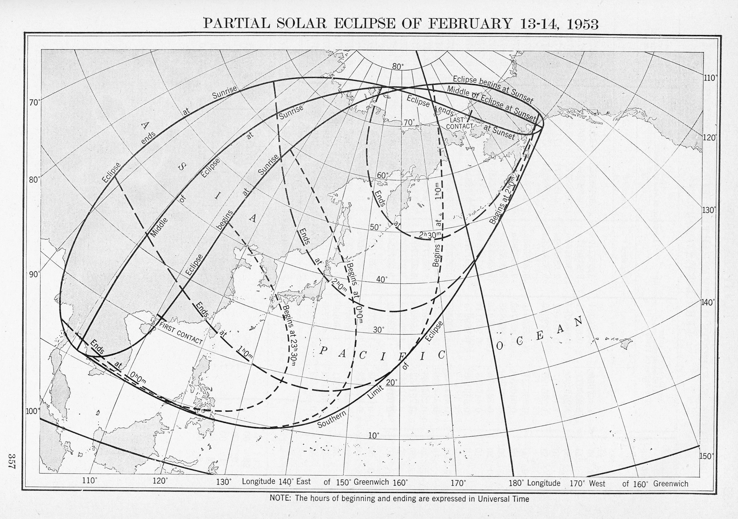
American Ephemeris and Nautical Almanac Partial Solar Eclipse of February 13-14, 1953 Scanned at Federal Depository Library

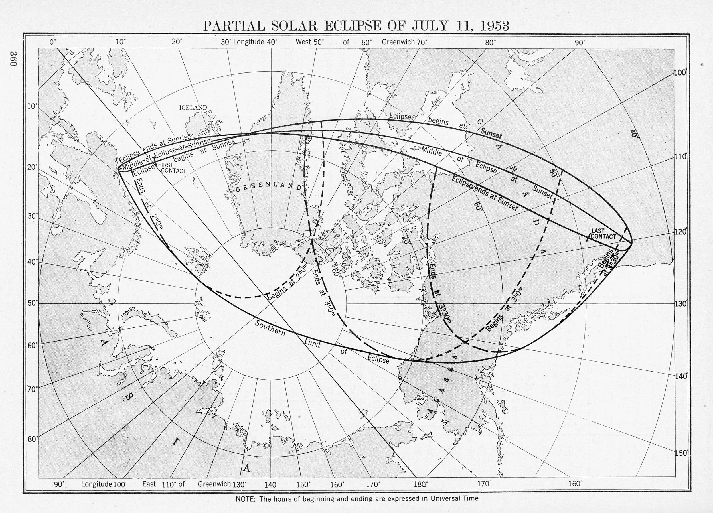
American Ephemeris and Nautical Almanac Partial Solar Eclipse of July 11, 1953 Scanned at Federal Depository Library
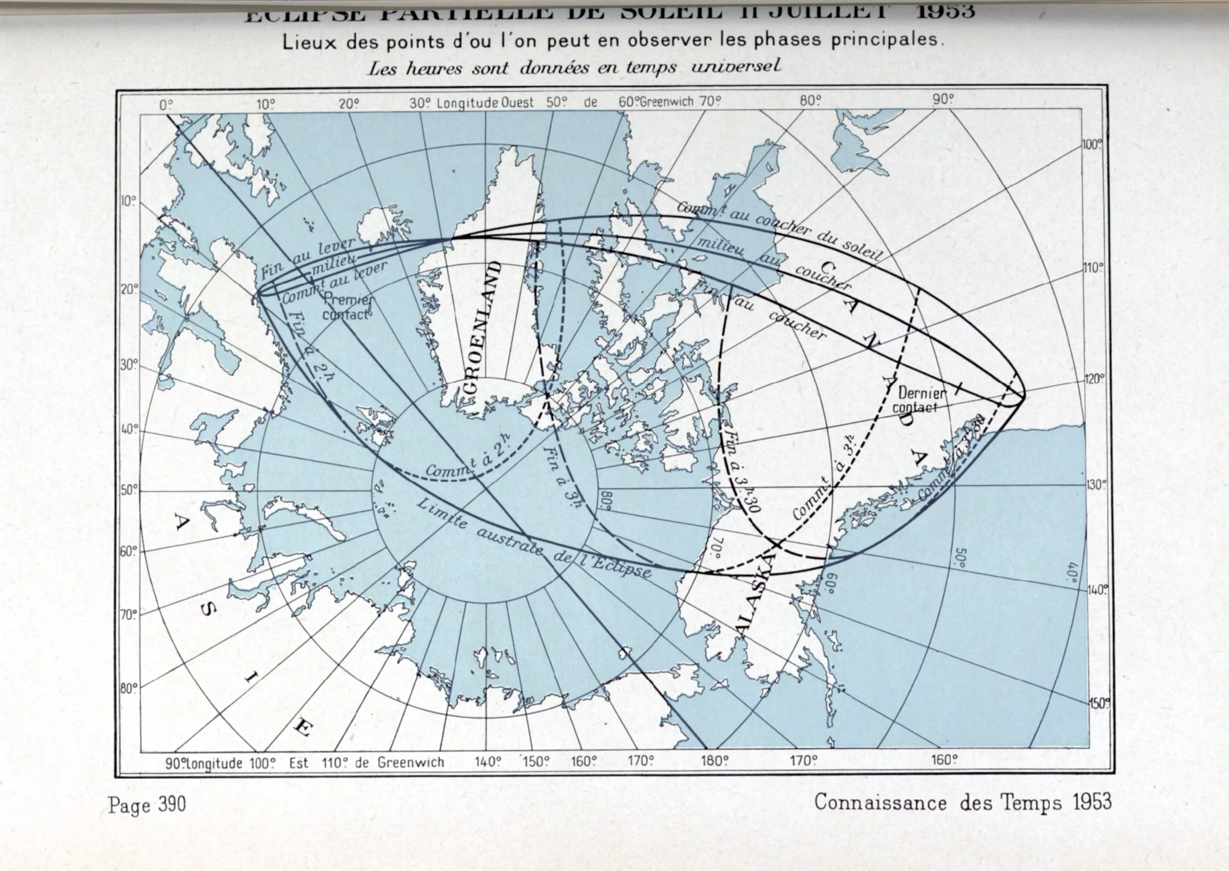
Connaissance des Temps Éclipse Partielle de Soleil 11 Juillet 1953 gallica.bnf.fr

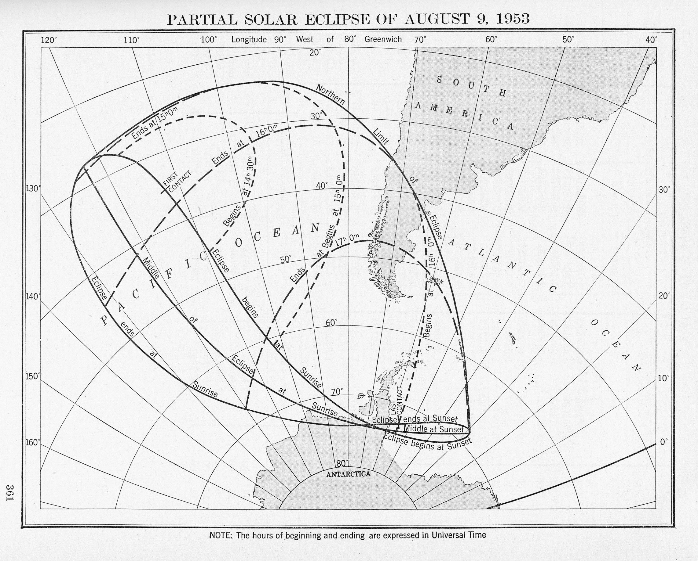
American Ephemeris and Nautical Almanac Partial Solar Eclipse of August 9, 1953 Scanned at Federal Depository Library
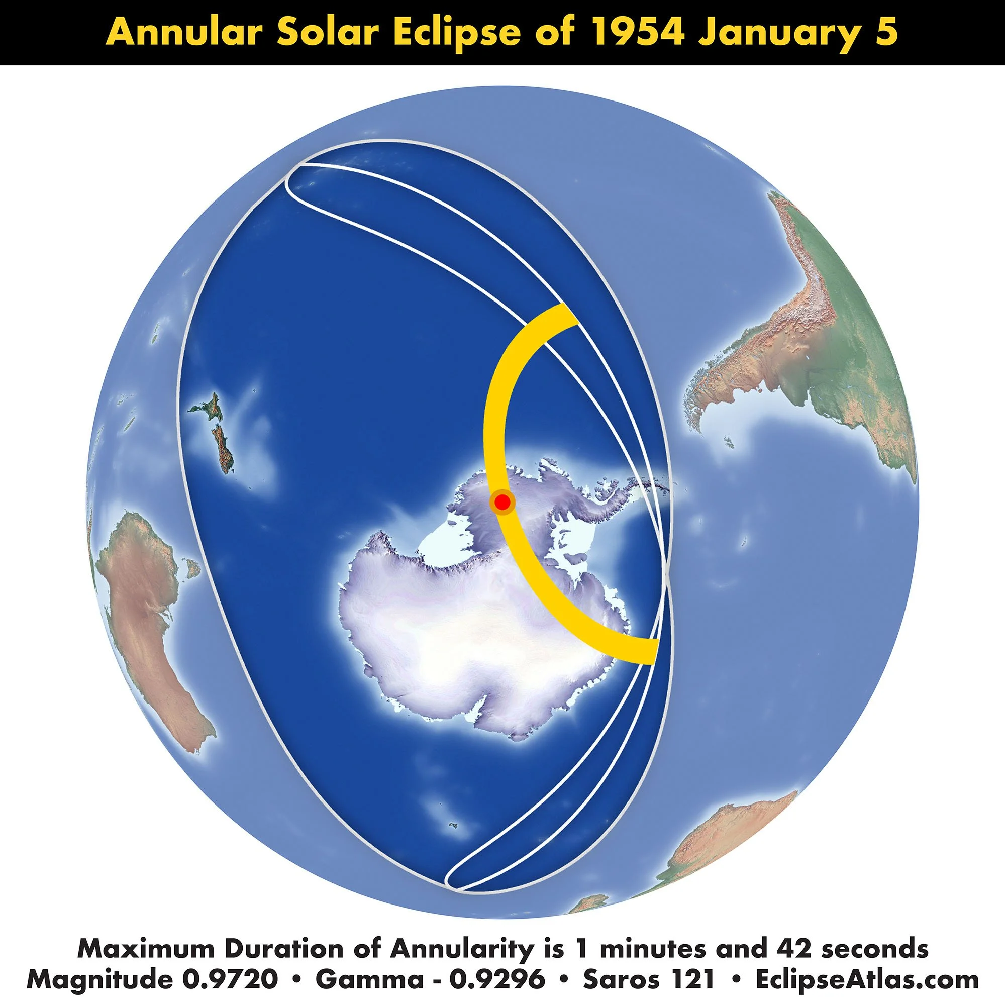
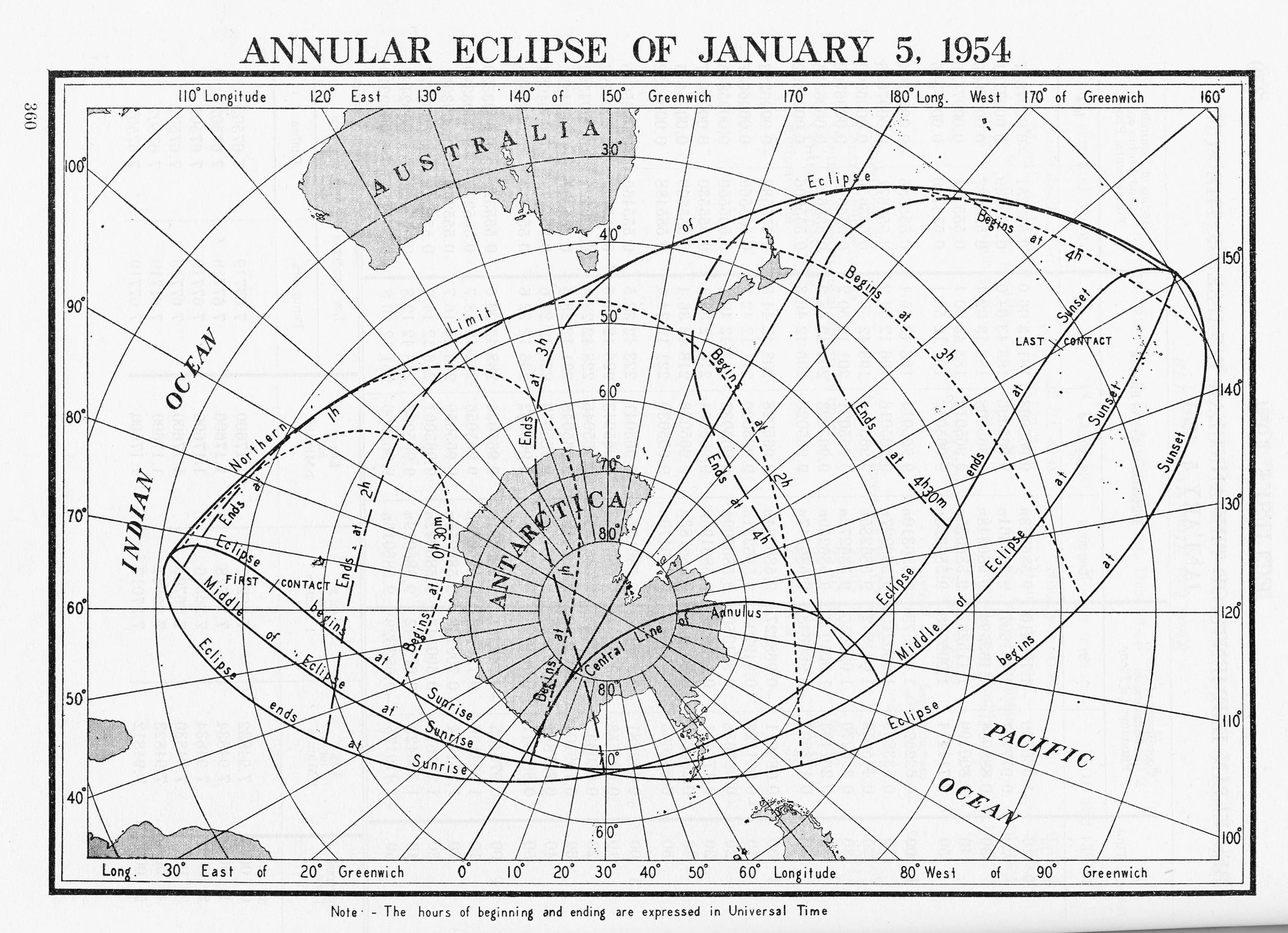
American Ephemeris and Nautical Almanac Annular Eclipse of January 5, 1954 Scanned at Federal Depository Library

Connaissance des Temps Éclipse Totale de Soleil le 30 Juin 1954 gallica.bnf.fr
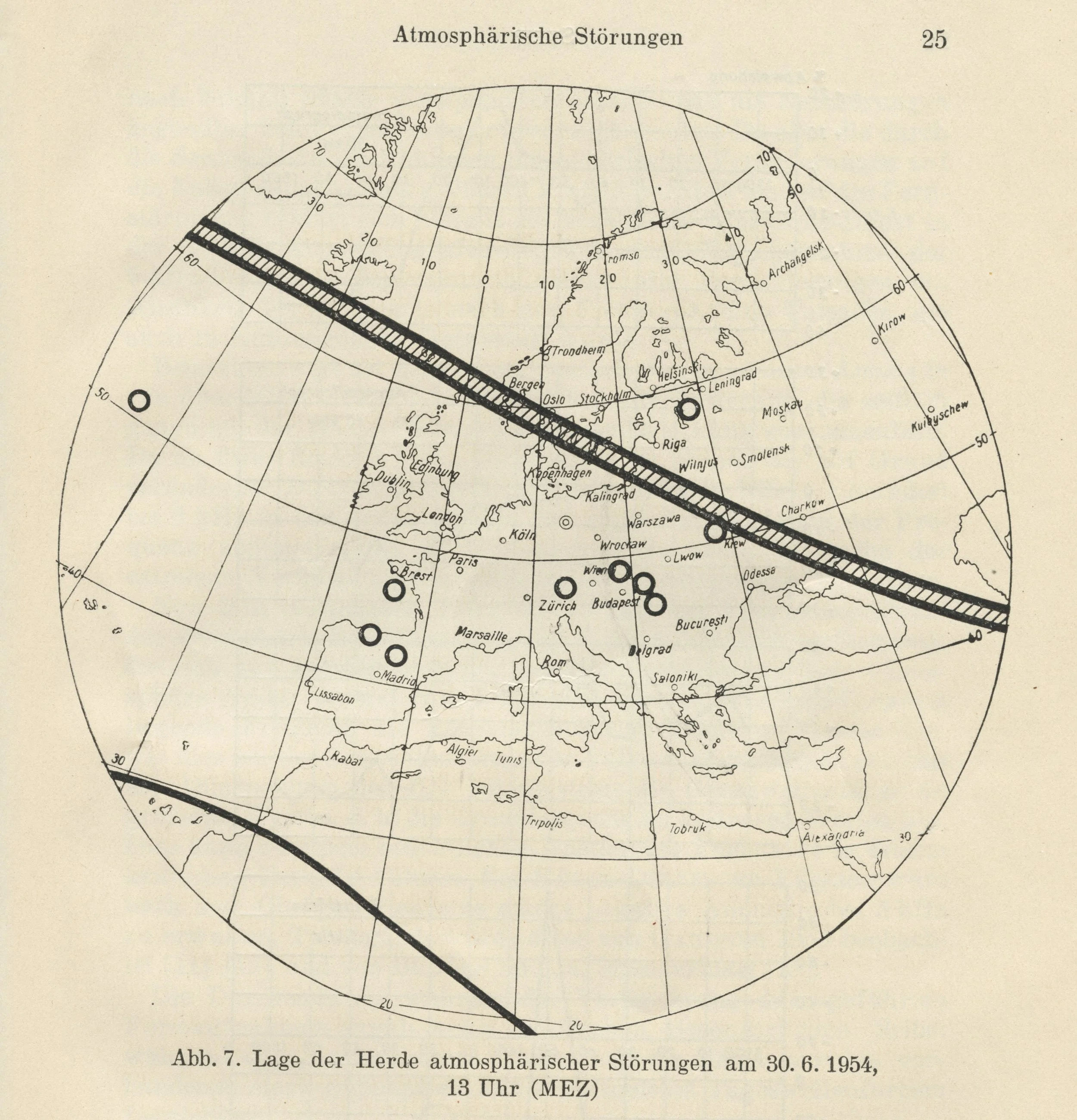
Skeib Lage der Herde atmosphärischer Störungen am 30. 6. 1954
Supplement to the American Ephemeris Total Eclipse of the Sun June 30, 1954 Collection of Michael Zeiler

Supplement to the American Ephemeris Path of Total Solar Eclipse of the United States, Canada, and Greenland June 30, 1954 Collection of Michael Zeiler

Les Eclipses Carte typique d'éclipse totale de Soleil atteignant les régions polaires Eclipse du 30 juin 1954. Scanned at University of New Mexico
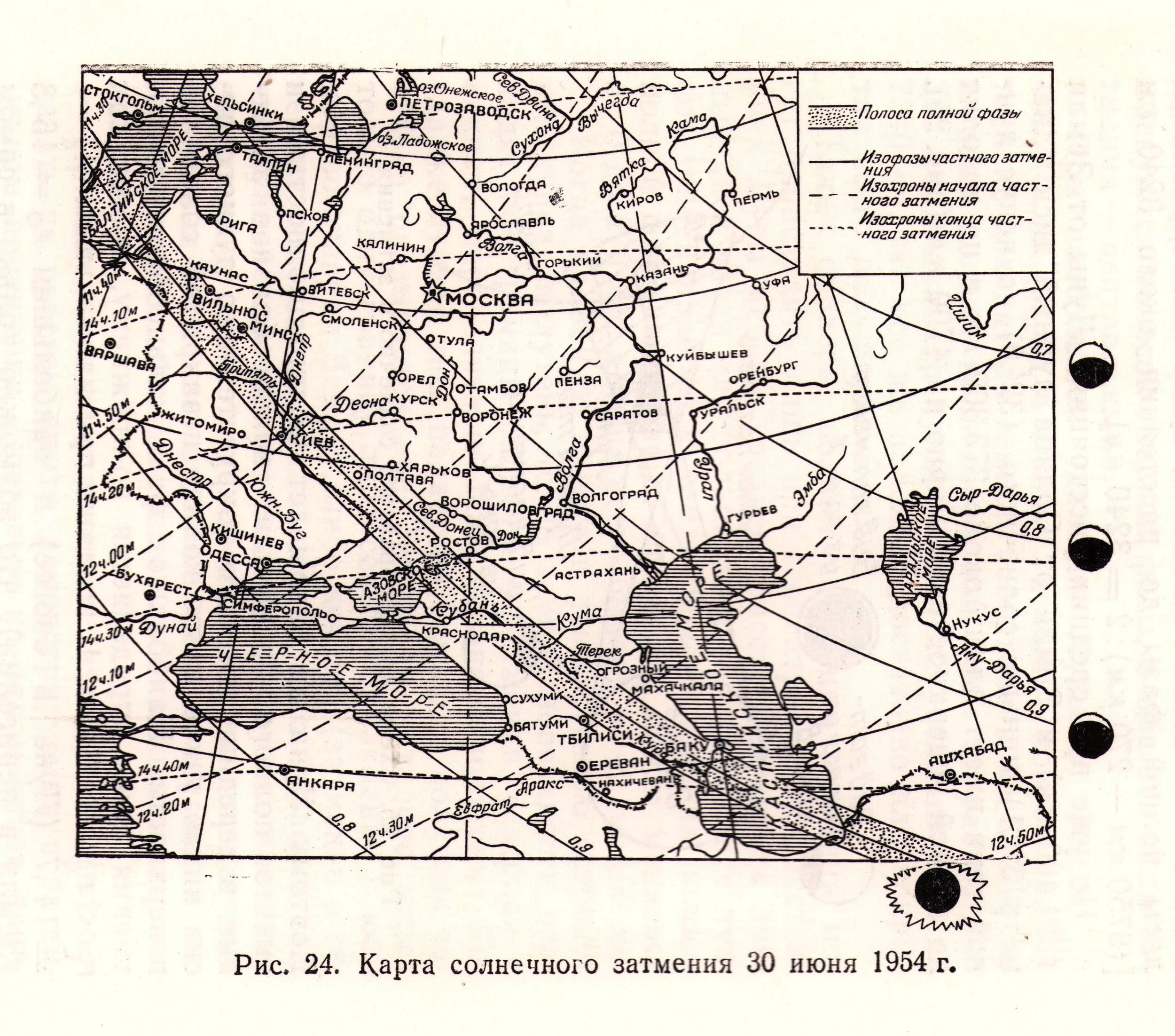
Dageav, Solar and Lunar Eclipses Карта солнечного затмения 30 июня 1954 г. Collection of Michael Zeiler
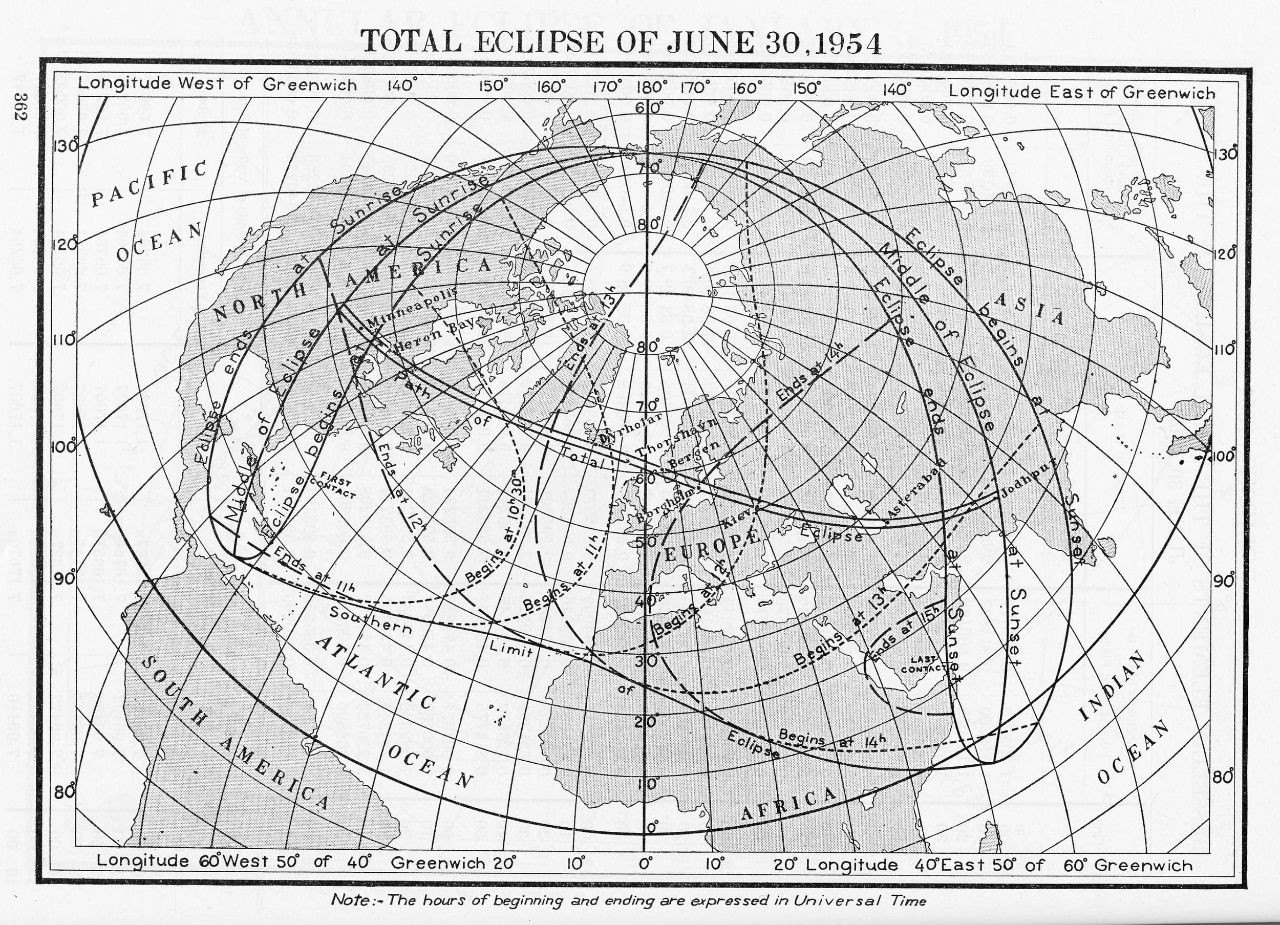
American Ephemeris and Nautical Almanac Total Eclipse of June 30, 1954 Scanned at Federal Depository Library
Stockholms Observatoriums Annaler The Total Eclipse of the Sun on June 30, 1954 NASA Astrophysics Data System, https://ui.adsabs.harvard.edu

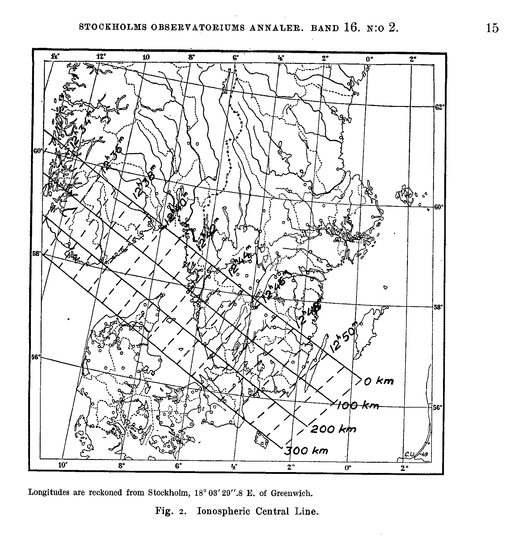
Stockholms Observatoriums Annaler The Total Eclipse of the Sun on June 30, 1954 Ionospheric Central Line NASA Astrophysics Data System, https://ui.adsabs.harvard.edu
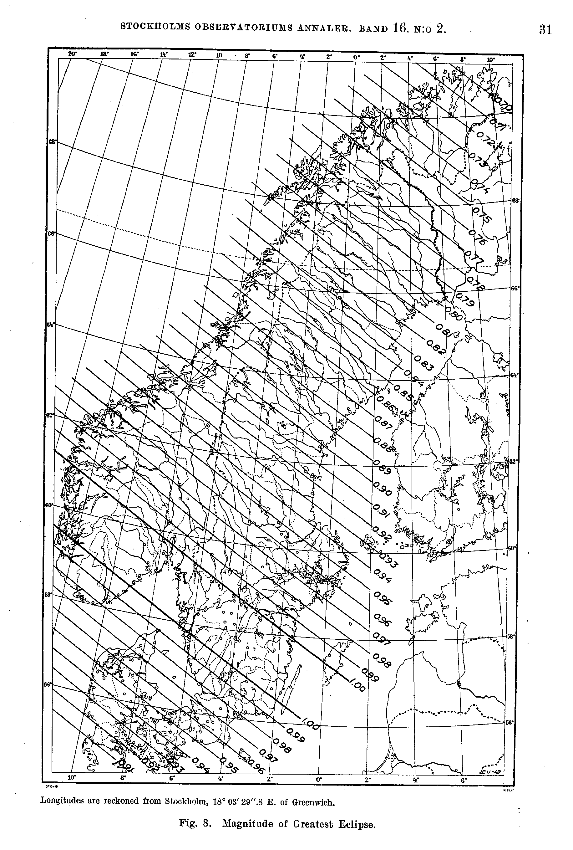
Stockholms Observatoriums Annaler The Total Eclipse of the Sun on June 30, 1954 Magnitude of Greatest Eclipse NASA Astrophysics Data System, https://ui.adsabs.harvard.edu
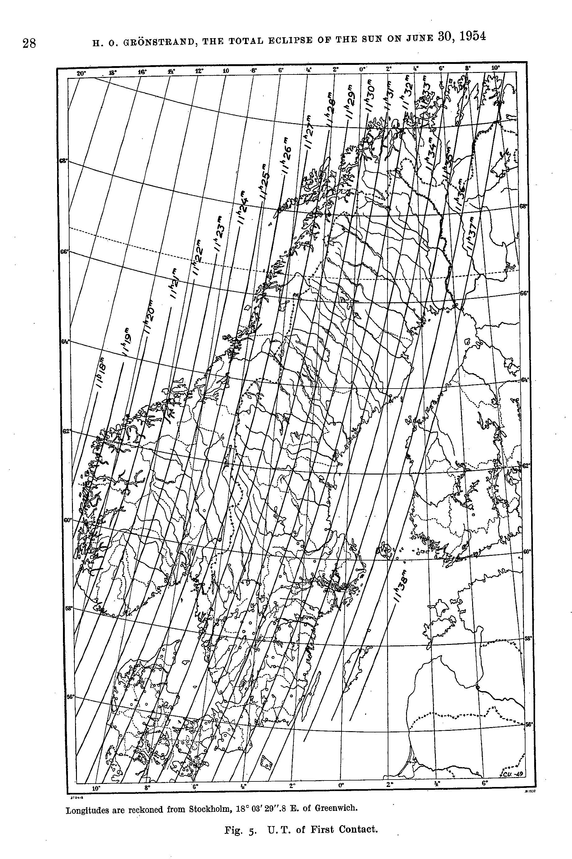
Stockholms Observatoriums Annaler The Total Eclipse of the Sun on June 30, 1954 U.T. of First Contact NASA Astrophysics Data System, https://ui.adsabs.harvard.edu
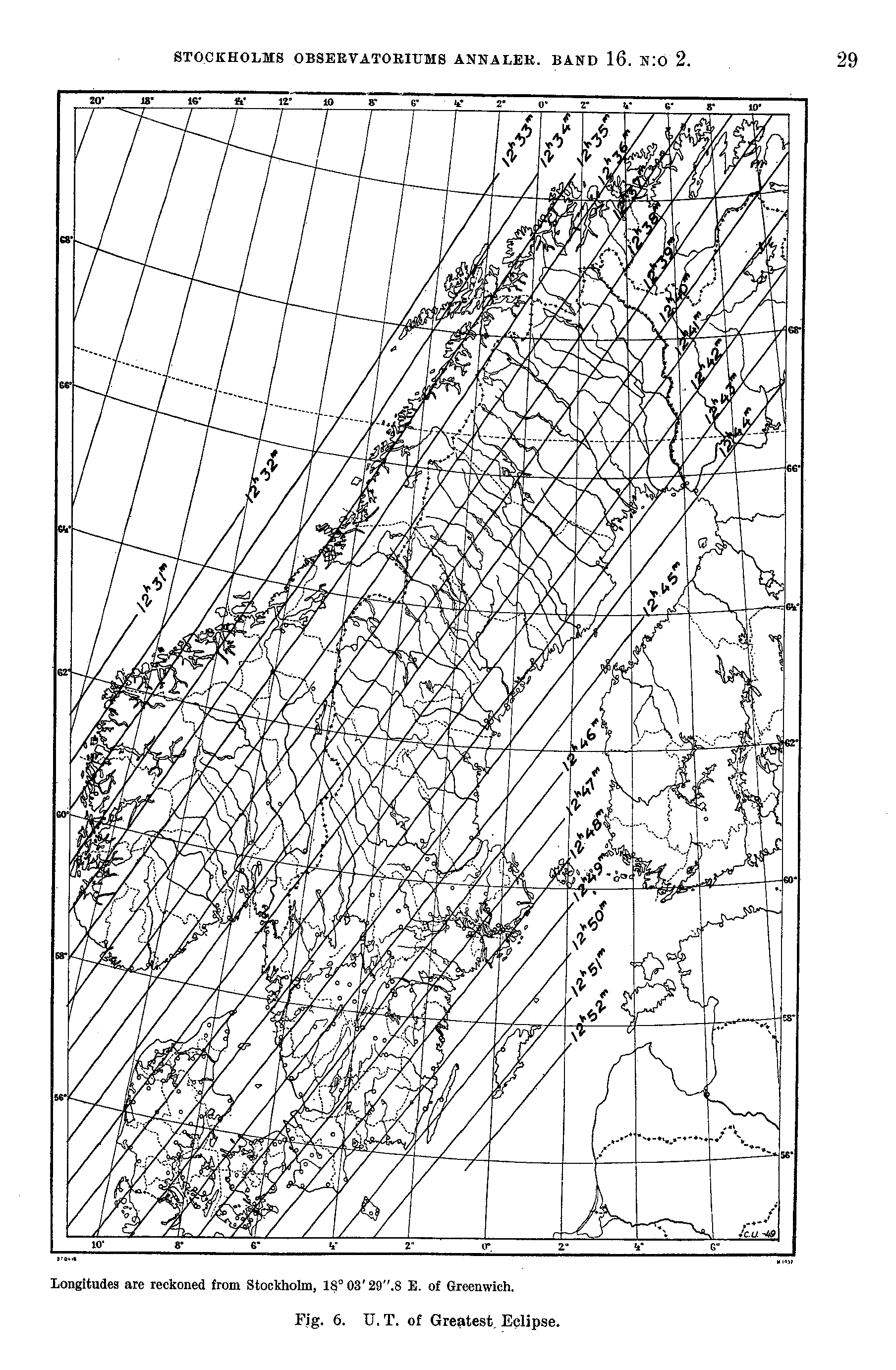
Stockholms Observatoriums Annaler The Total Eclipse of the Sun on June 30, 1954 U.T. of Greatest Eclipse NASA Astrophysics Data System, https://ui.adsabs.harvard.edu
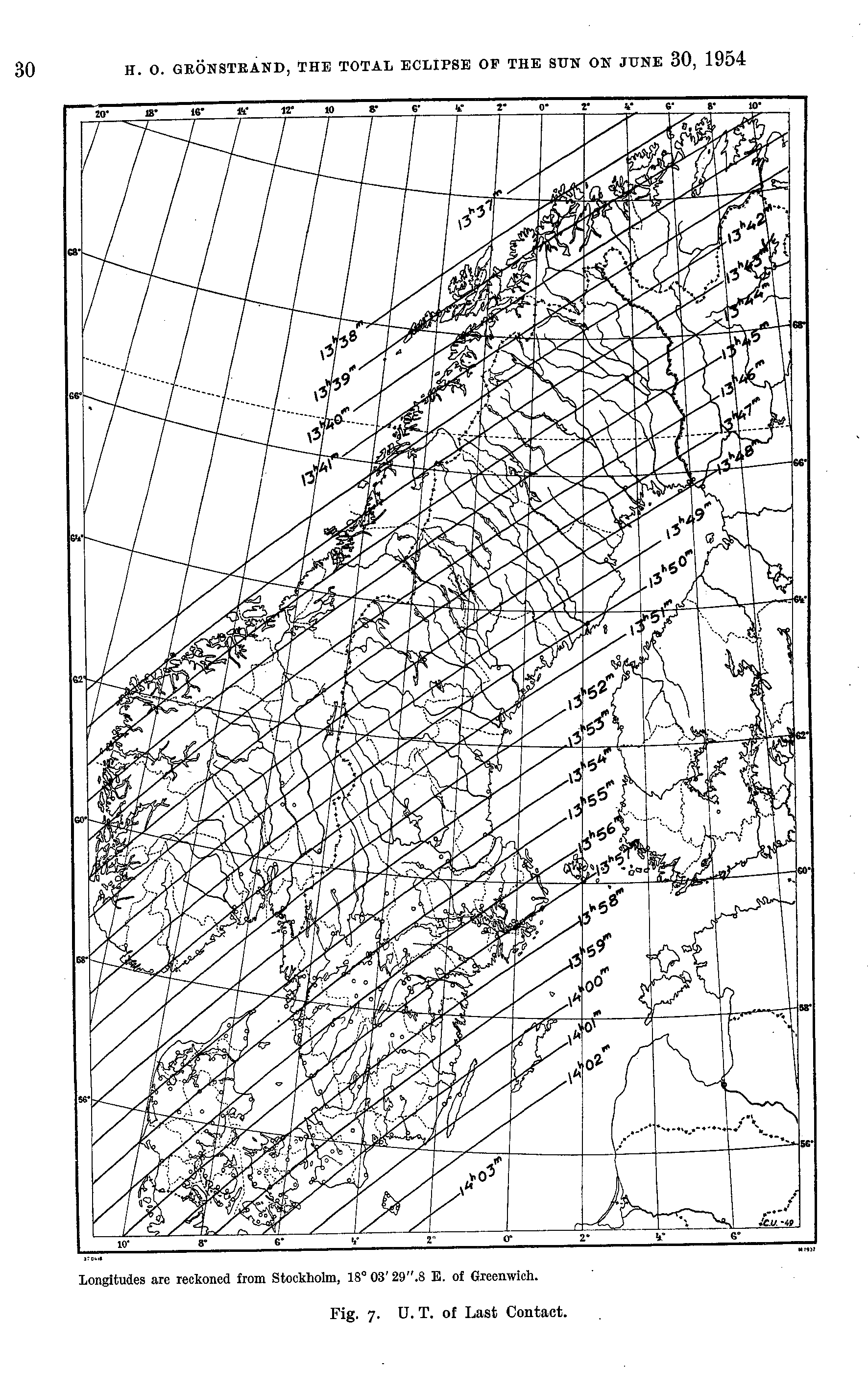
Stockholms Observatoriums Annaler The Total Eclipse of the Sun on June 30, 1954 U.T. of Last Contact NASA Astrophysics Data System, https://ui.adsabs.harvard.edu
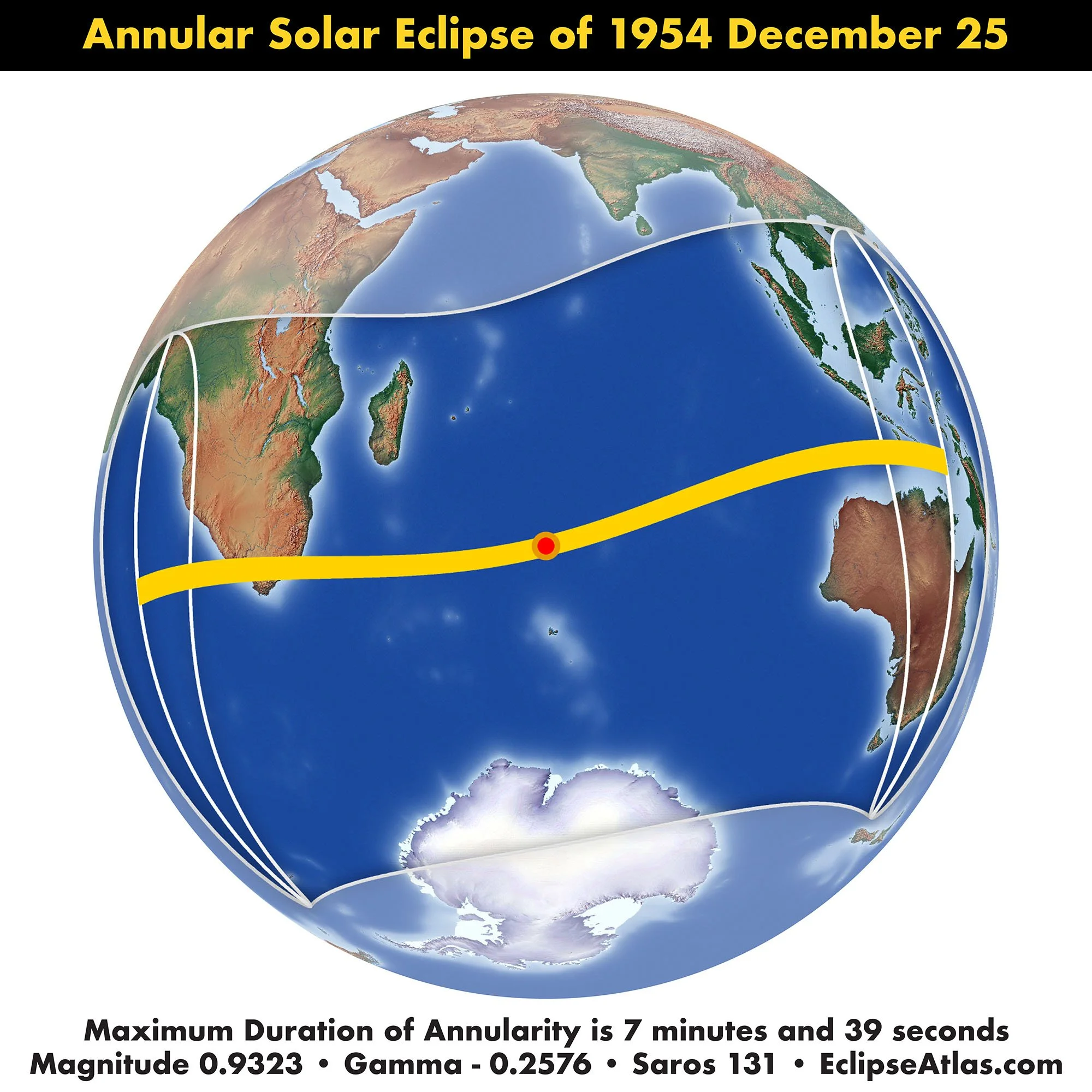
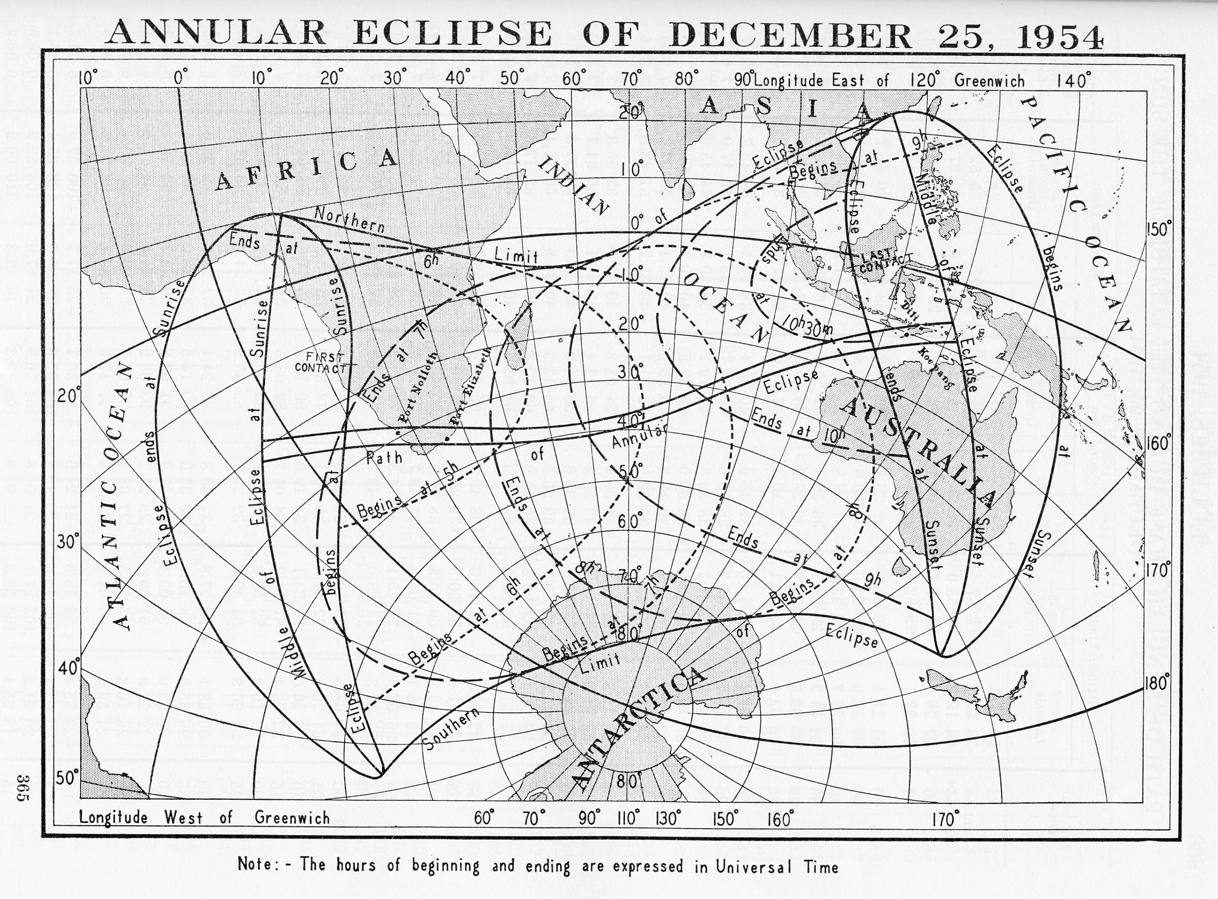
American Ephemeris and Nautical Almanac Annular Eclipse of December 25, 1954 Scanned at Federal Repository Library