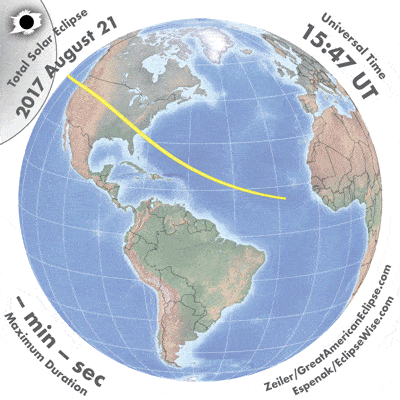
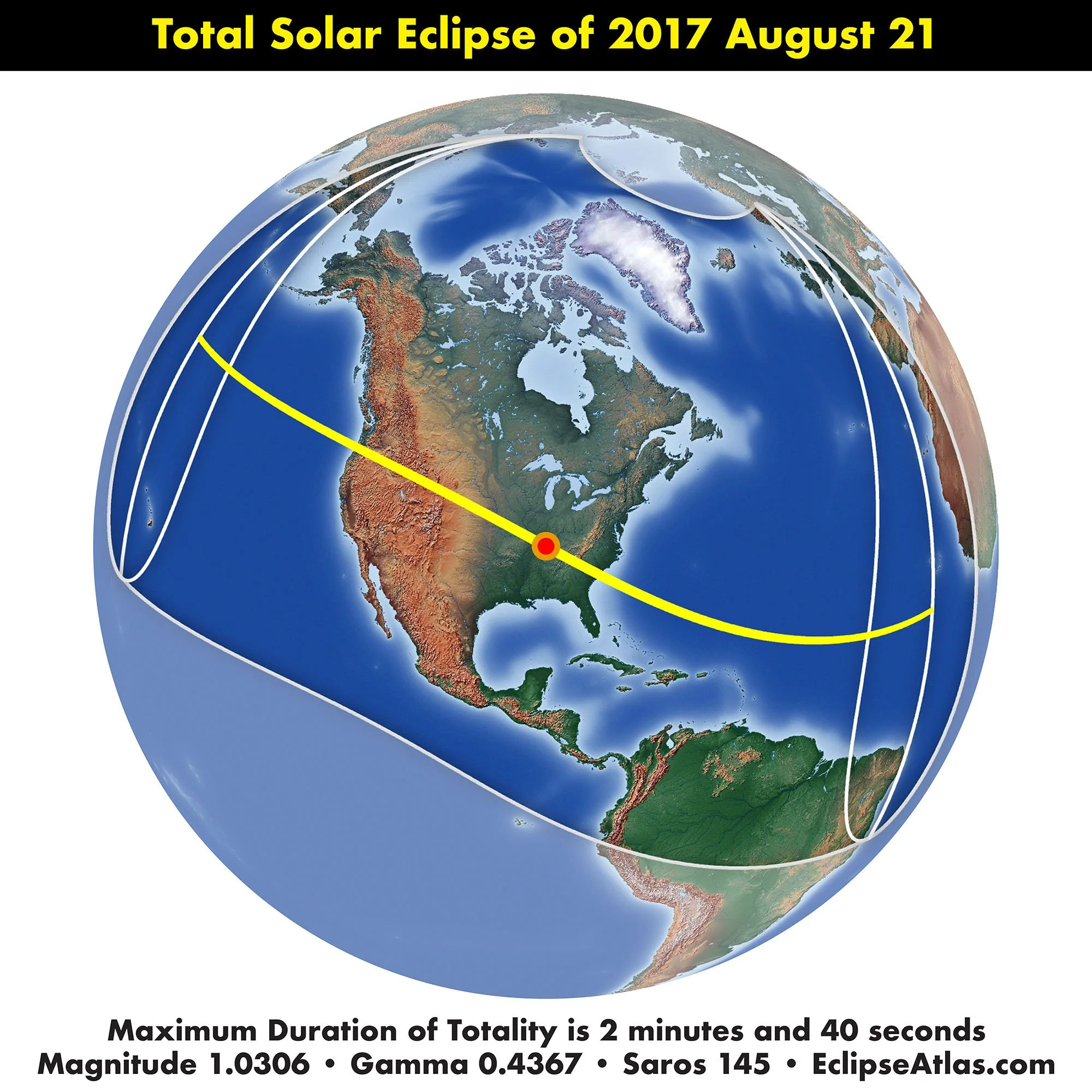
Total Solar Eclipse of August 17, 2017
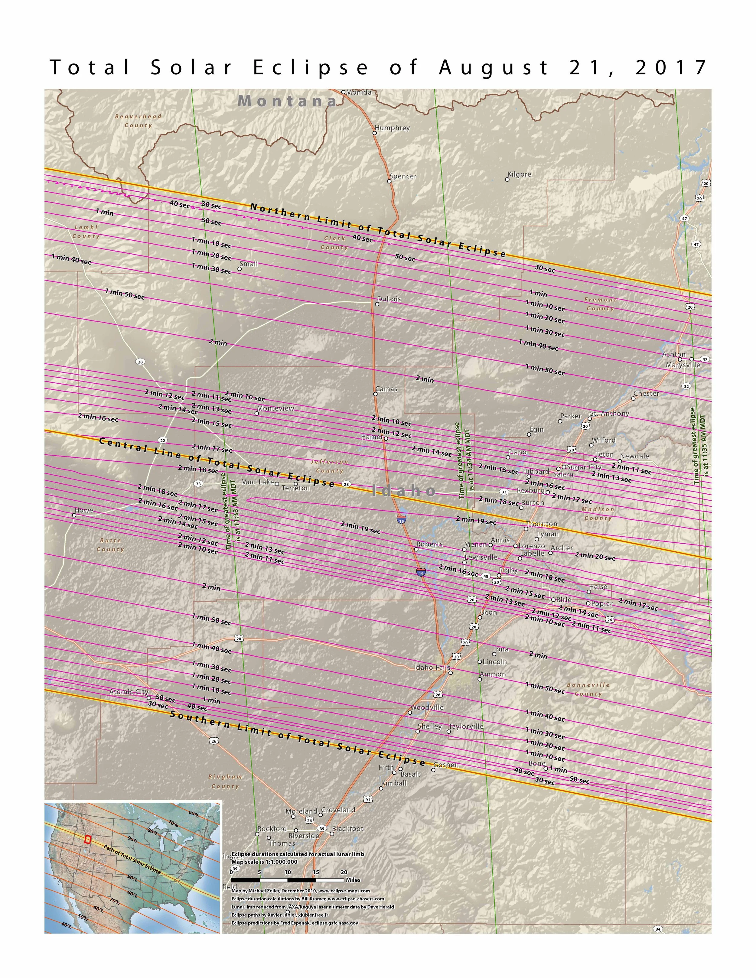
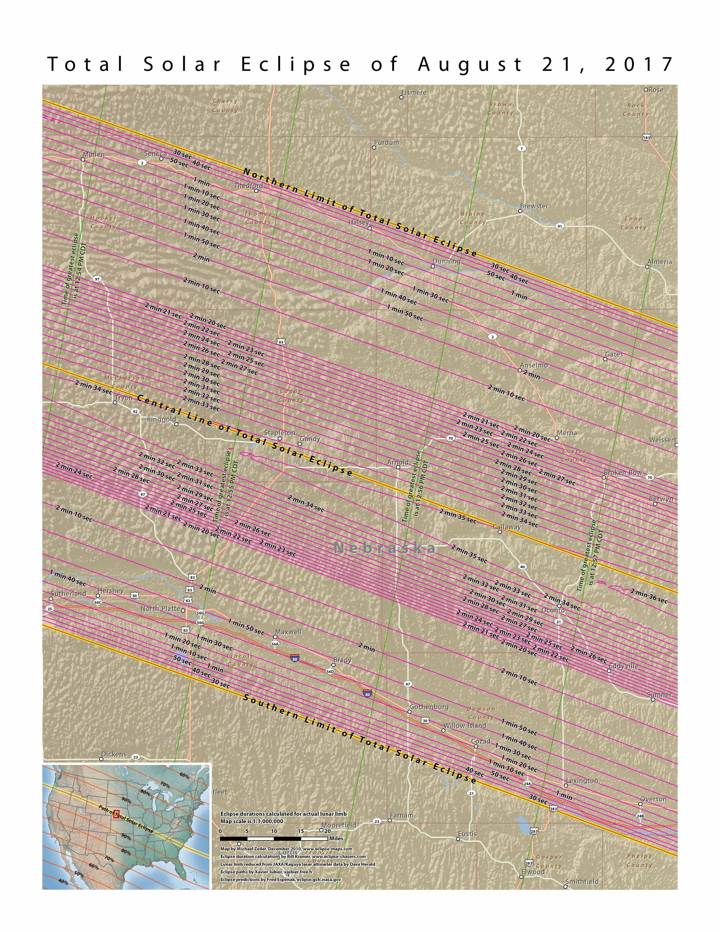
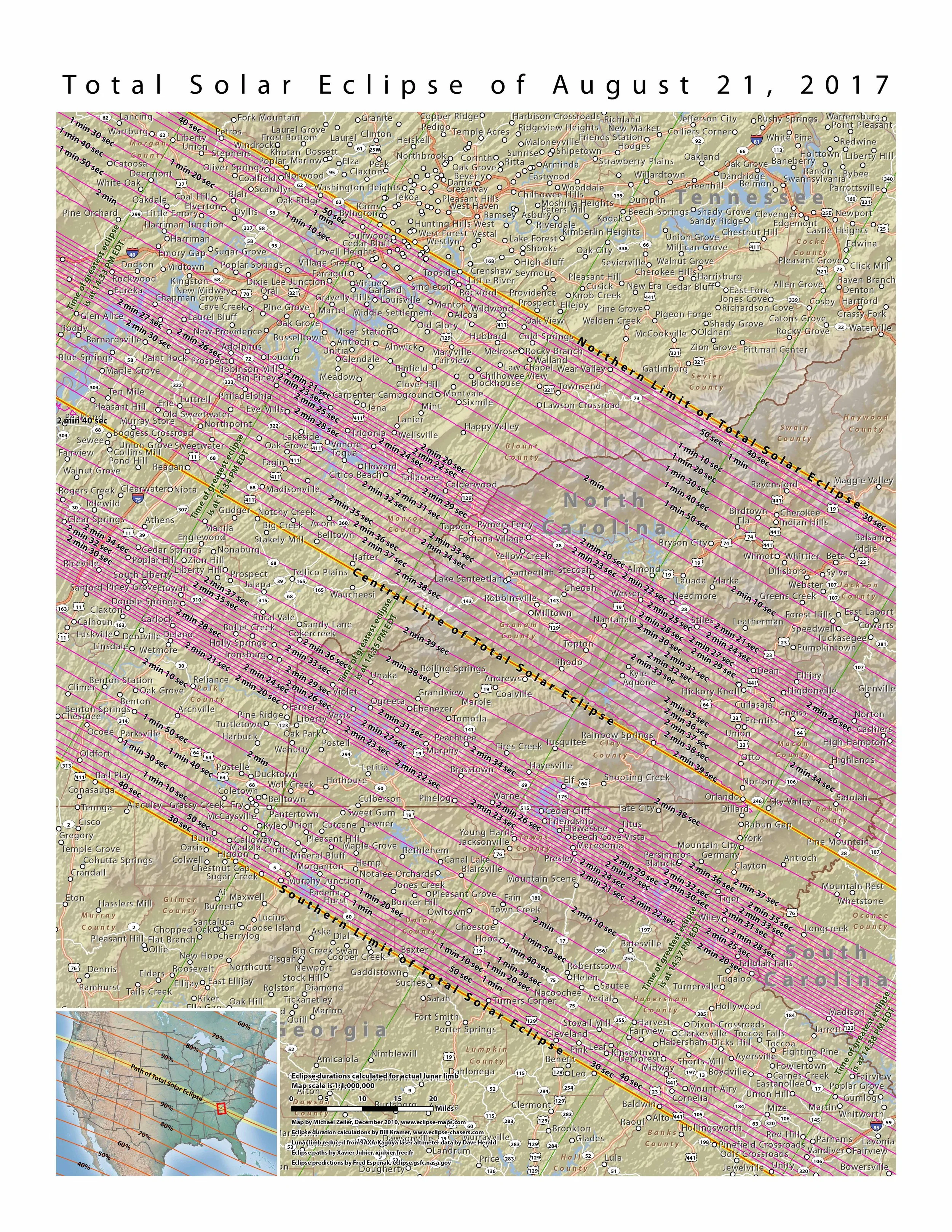
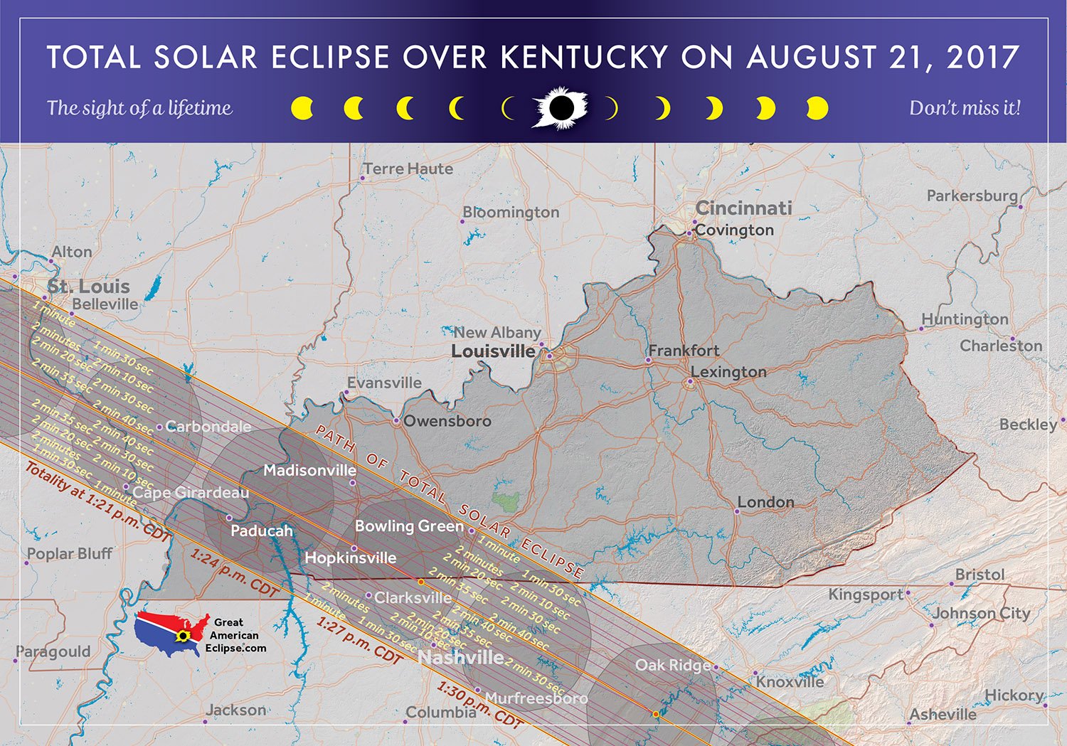
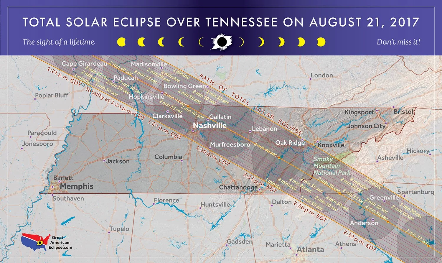
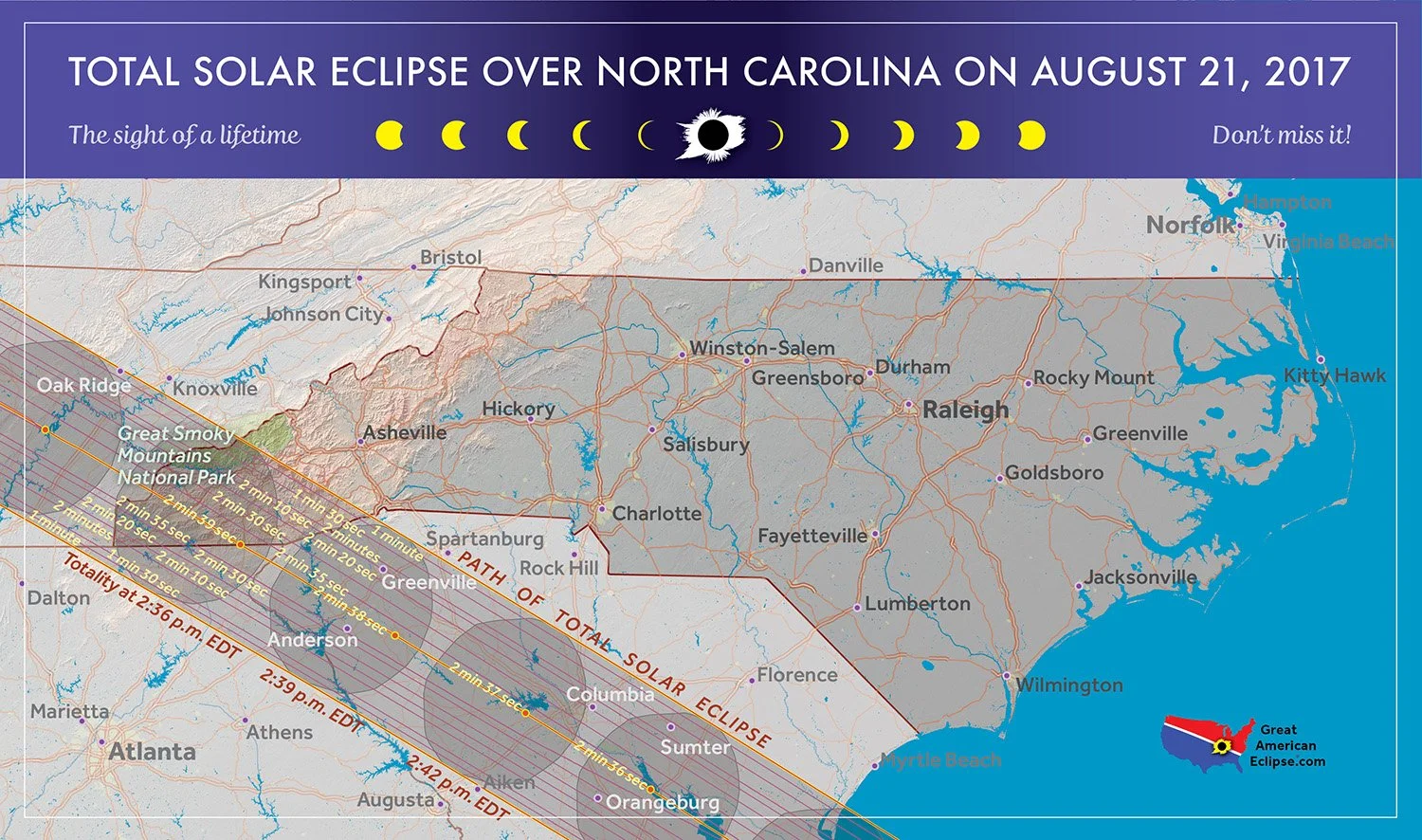
The total solar eclipse begins in the North Pacific Ocean between the Aleutian and Hawaiian Islands. The first landfall is at Lincoln Beach, Oregon. The path of totality crosses Oregon, Idaho, Wyoming, Nebraska, Kansas, Missouri, Illinois, Kentucky, Tennessee, Georgia, North Carolina, and South Carolina. An interesting fact is that no country experienced totality.
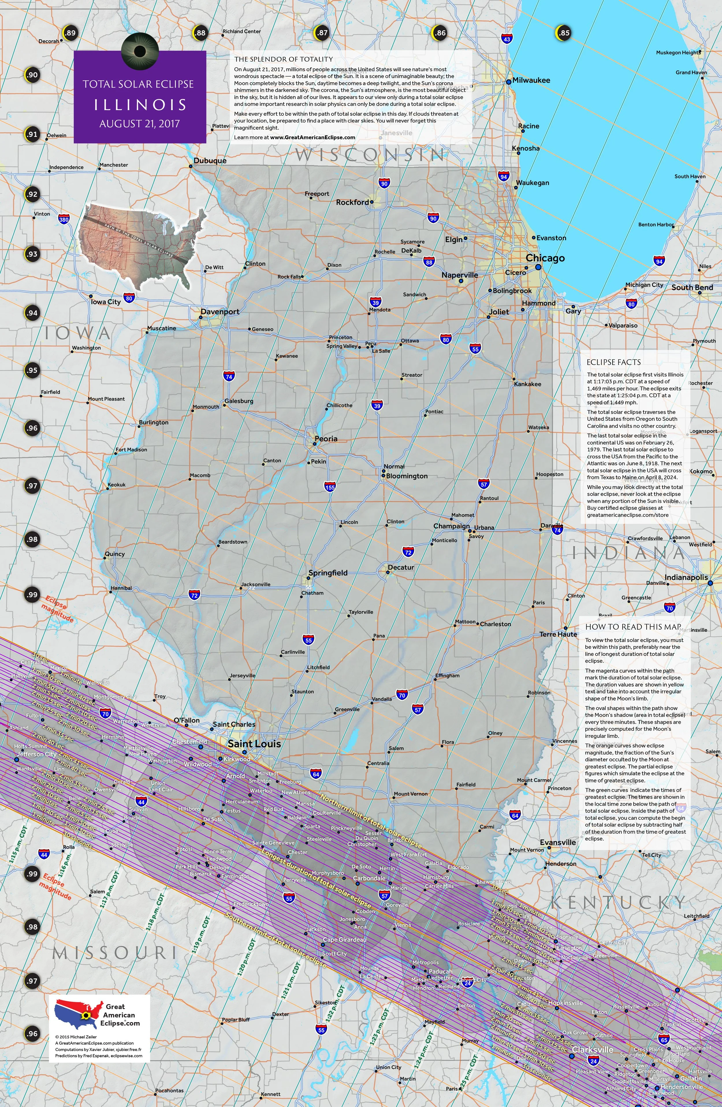
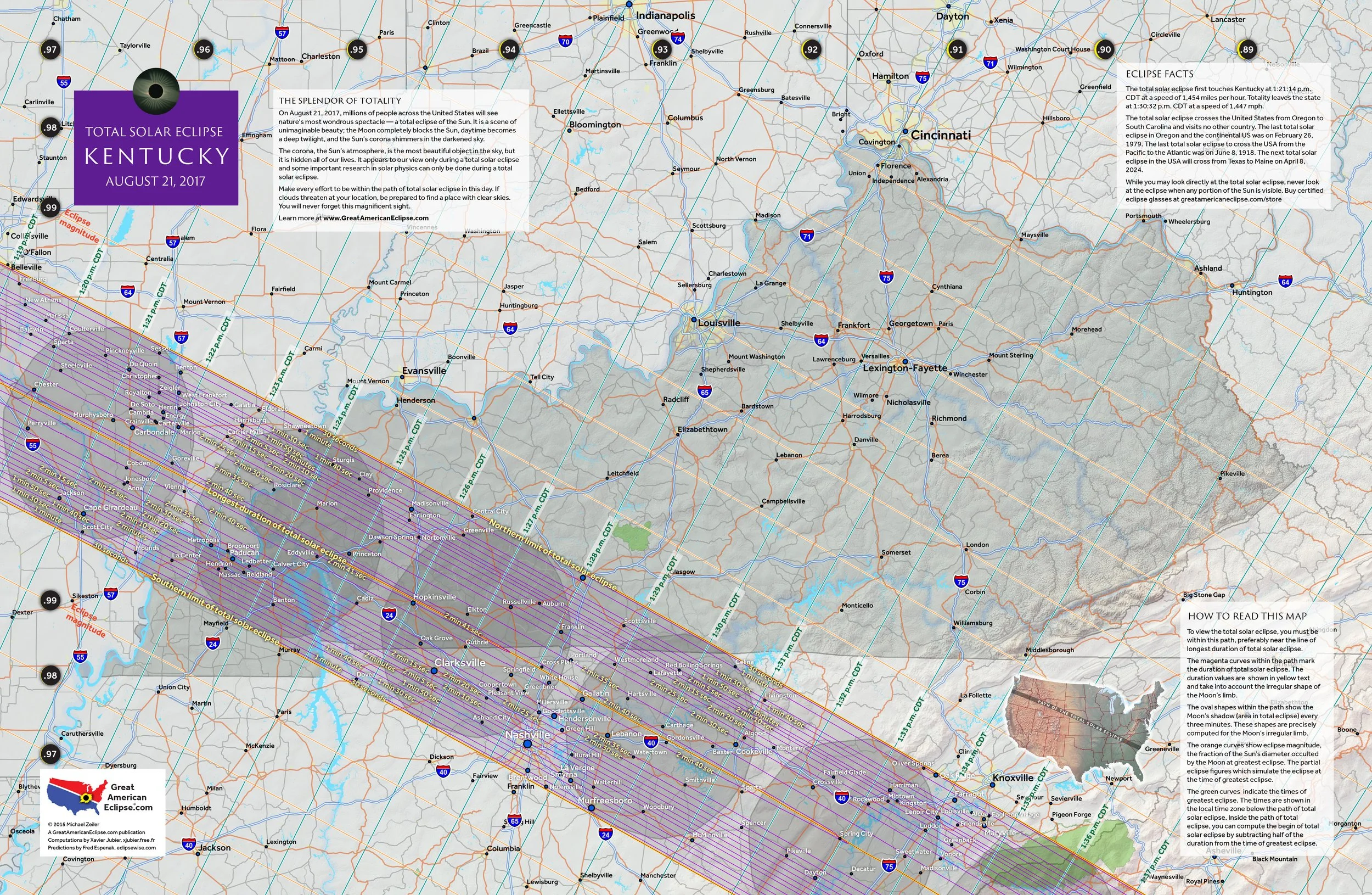
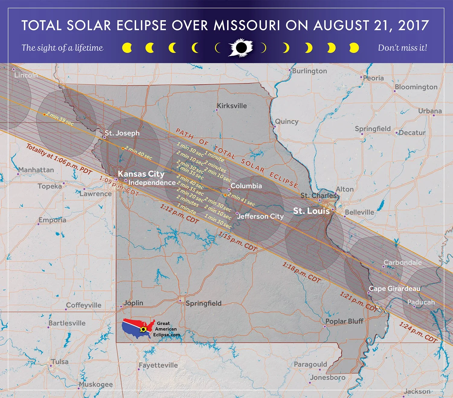
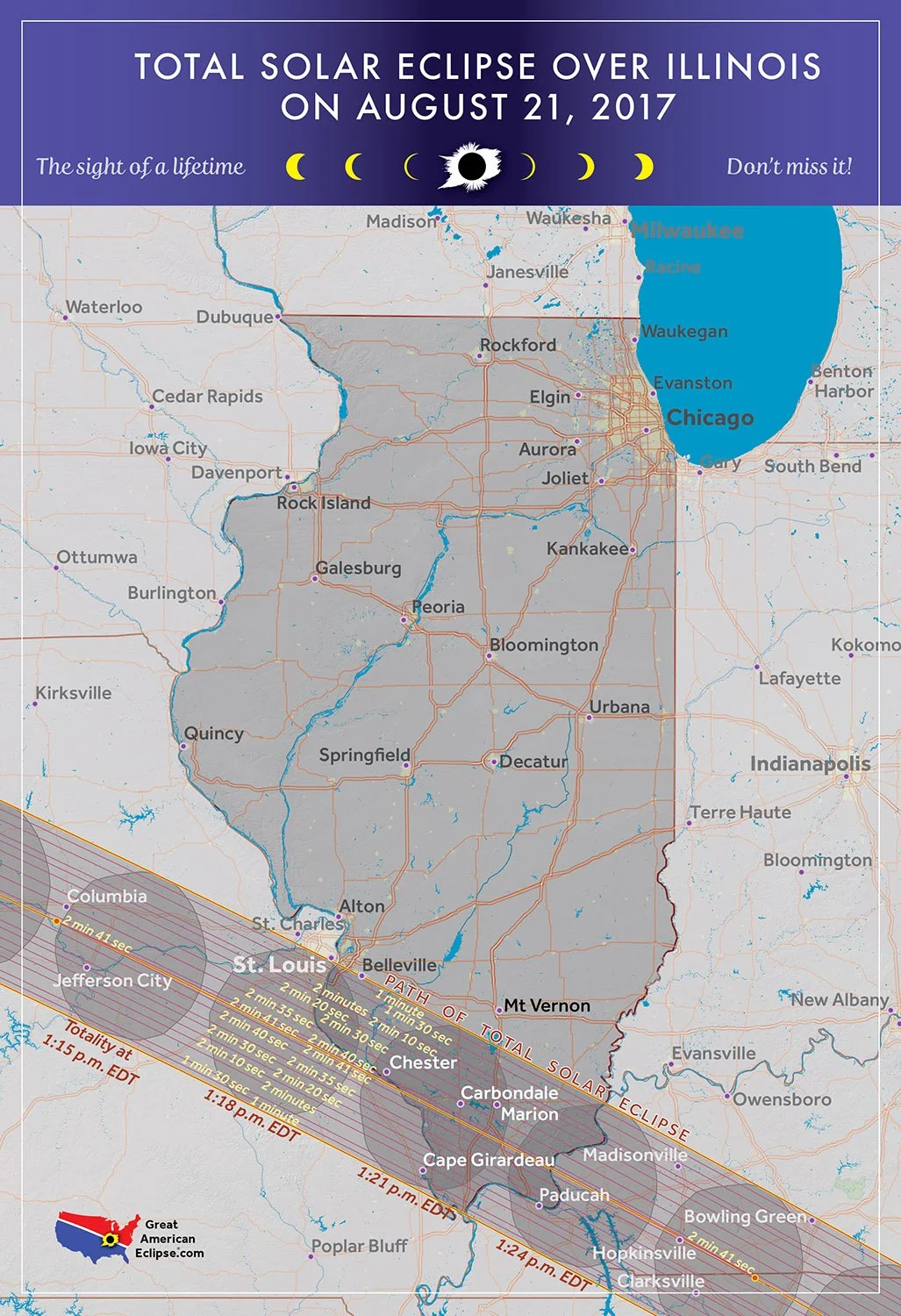
The point of greatest eclipse was near Hopkinsville Kentucky which enjoyed 2 minutes and 40 seconds of totality. The longest duration was in southern Illinois near Carbondale with a duration of 2 minutes and 41 seconds. Carbondale also fortuitously witnessed the 2024 total solar eclipse less than 7 years later.
The maps on this page were first published on GreatAmericanEclipse.com

Flyover the United States with the Moon’s shadow
This animation follows the Moon’s shadow from Oregon to South Carolina. The shape of the umbra (inner shadow of totality) was precisely calculated to account for the irregularities of the Moon’s profile as well as the Earth’s terrain.
Watch the shadow in the Rocky Mountains, especially in Wyoming. The rippling edges are evidence of the terrain’s influence on the shape of the shadow.
Moving map animation of the eclipse
This animation stays centered on the umbra, the inner shadow of the eclipse from where you can see totality. The shadow is first elongated because it is morning and the angle of incidence creates this shape. As the shadow crosses over the United States, it assumes more of an oval, then circular shape.
The eclipse as seen from the Moon
This animation shows how the moon’s inner shadow (umbra) and outer shadow (penumbra) crosses the Earth from the perspective of the Moon.
The eclipse in motion
The animation shows the inner shadow (umbra) and outer shadow (penumbra) of the eclipse from the perspective of the Moon. The umbra is where the total solar eclipse will be seen. The penumbra is where a partial solar eclipse will be observed from North America, South America, and western parts of Europe and Africa.
A careful look at this animation shows how the Earth’s axial tilt, the Moon’s orbital inclination, and the offset from Earth’s center (called gamma) combine to create this curved eclipse path of totality on Earth.
The eclipse in summary
The maximum duration of totality occurs within the red dot on the yellow path of totality near Iceland.
Eclipse magnitude is the fraction of the Moon’s apparent disk size compared to the Sun.
Eclipse gamma is the fraction of the how close the center of the Moon’s shadow passes to the center of Earth.
Learn about Saros 145 at www.eclipsewise.com/solar/SEsaros/SEsaros145.html
Overview maps of the eclipse
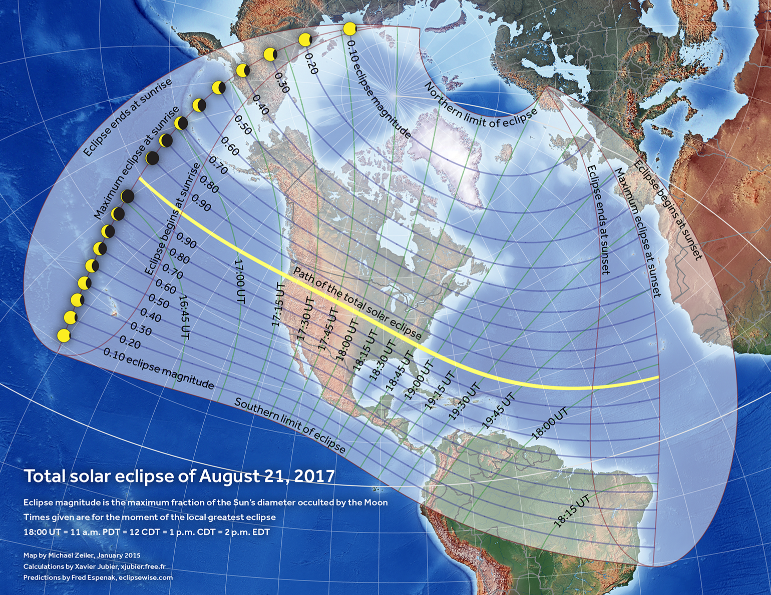
Stereographic map of the penumbral extent
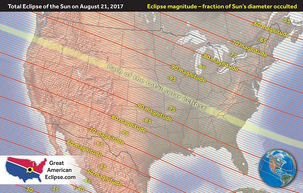
Eclipse magnitude - fraction of the Sun's diameter occulted
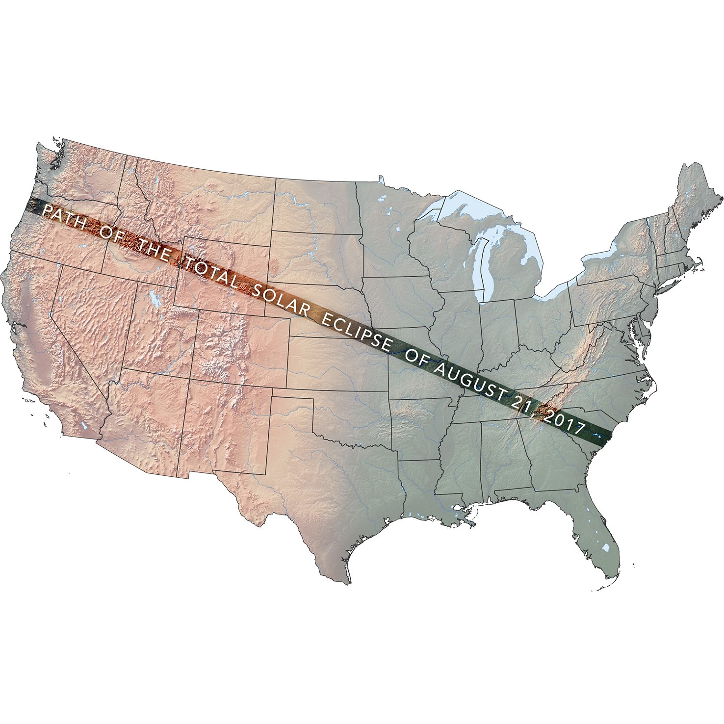
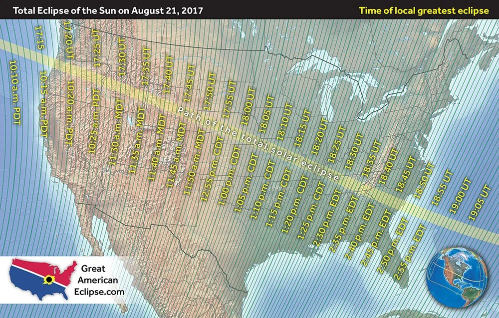
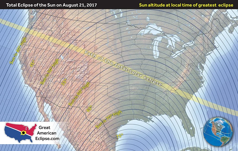
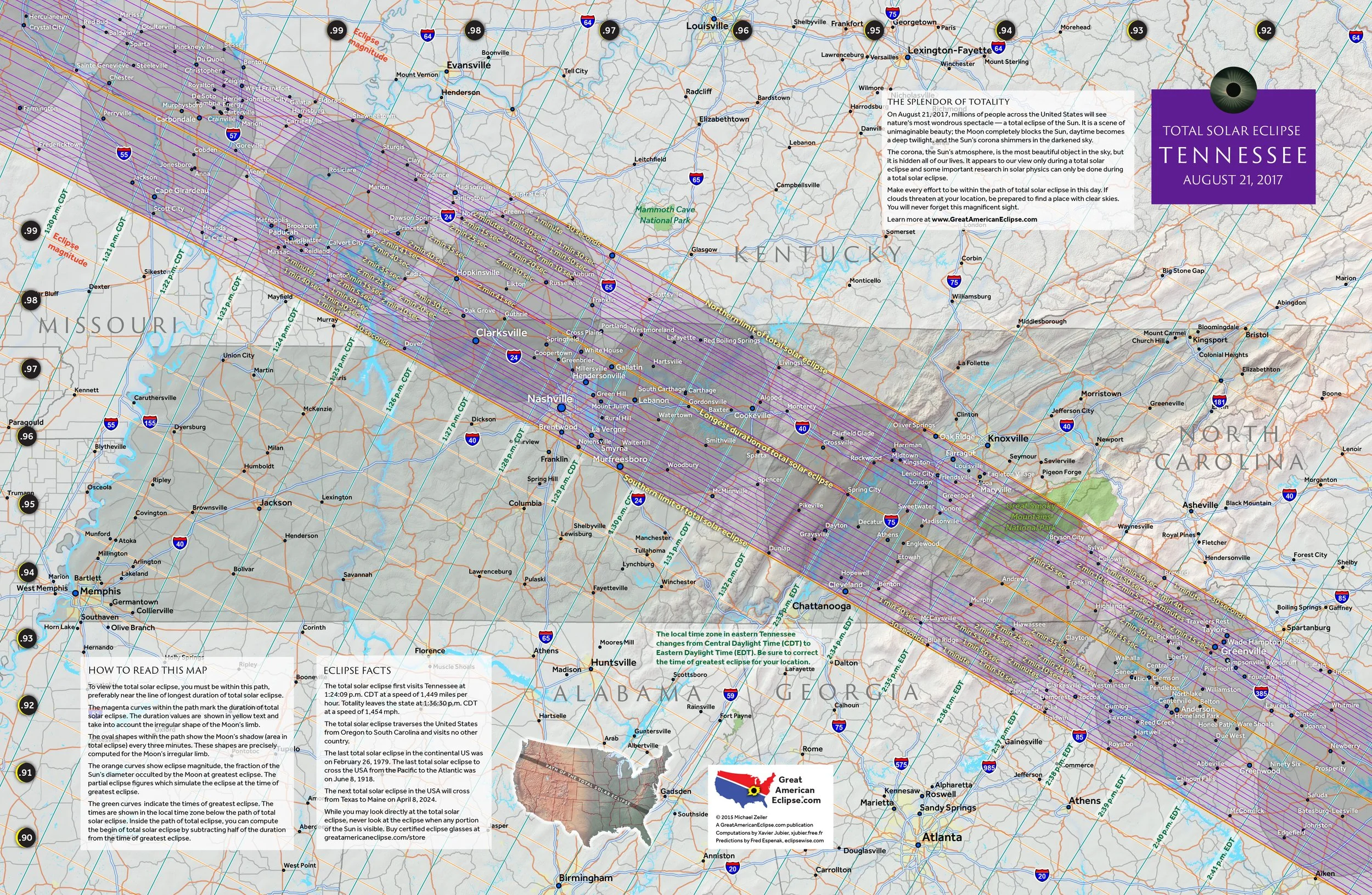
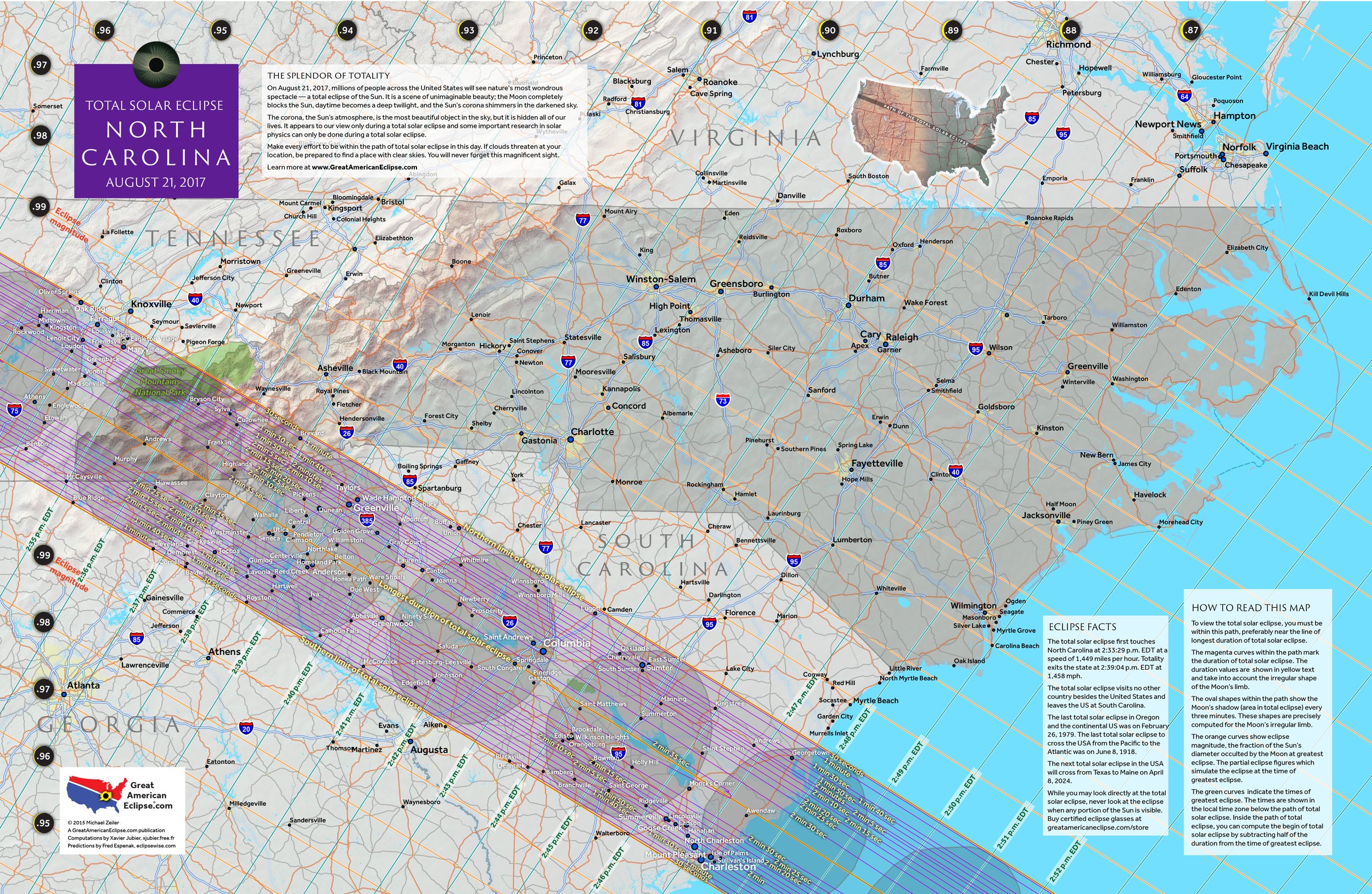
Path of the total solar eclipse of August 21, 2017

All the total solar eclipses across the United States of America from 1776 to 2017
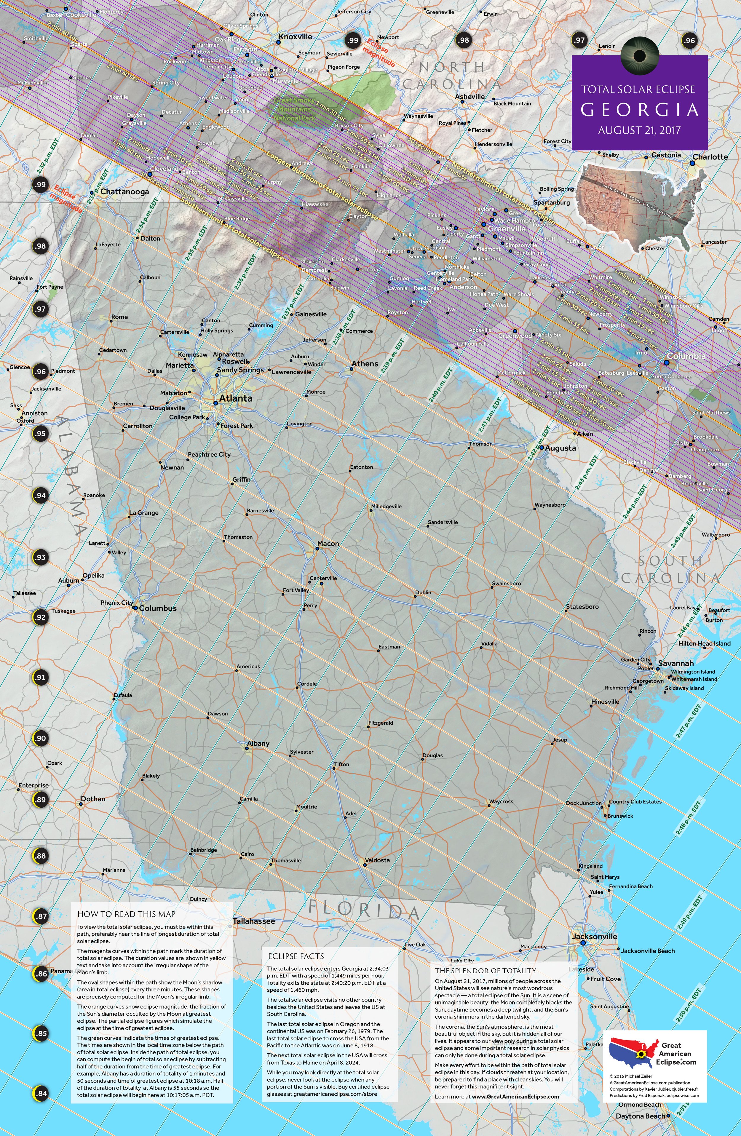
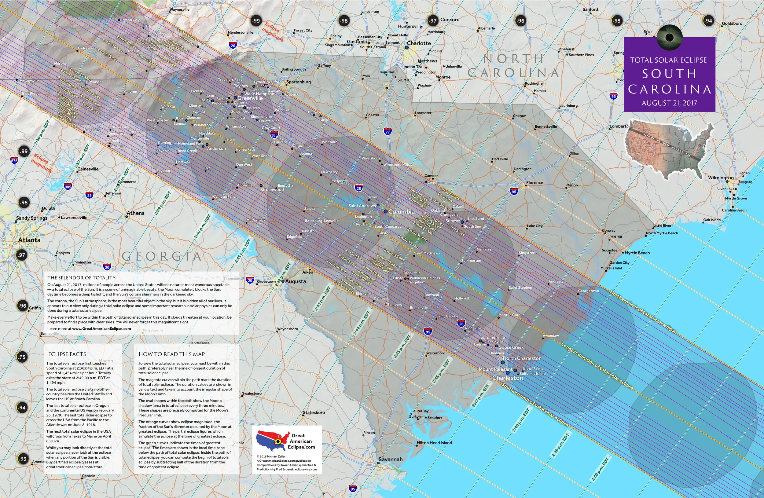
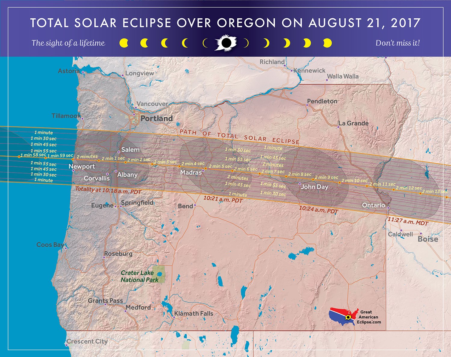
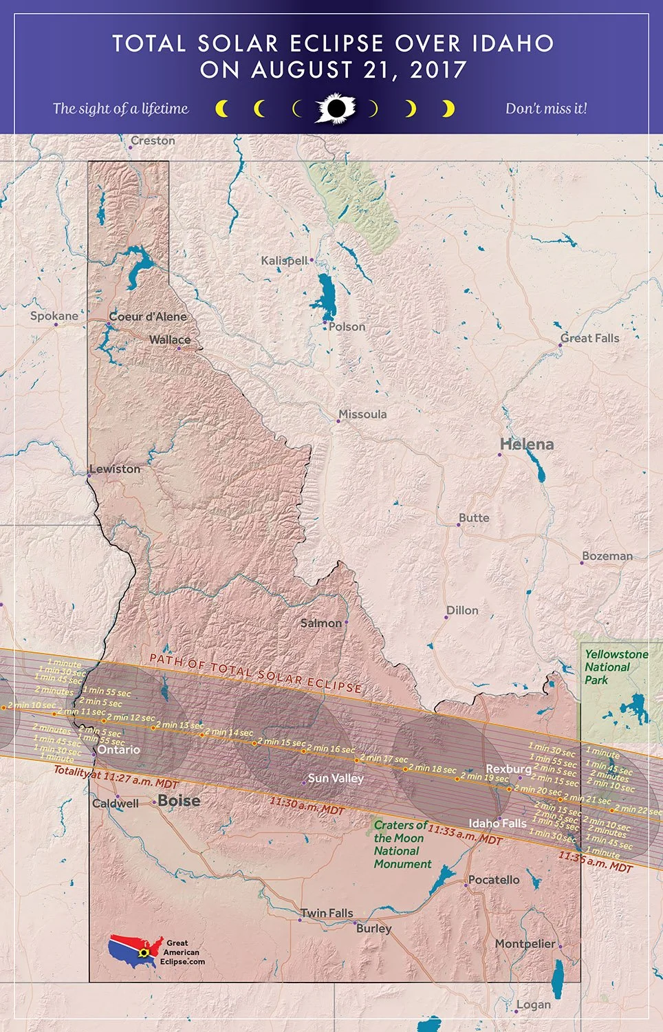
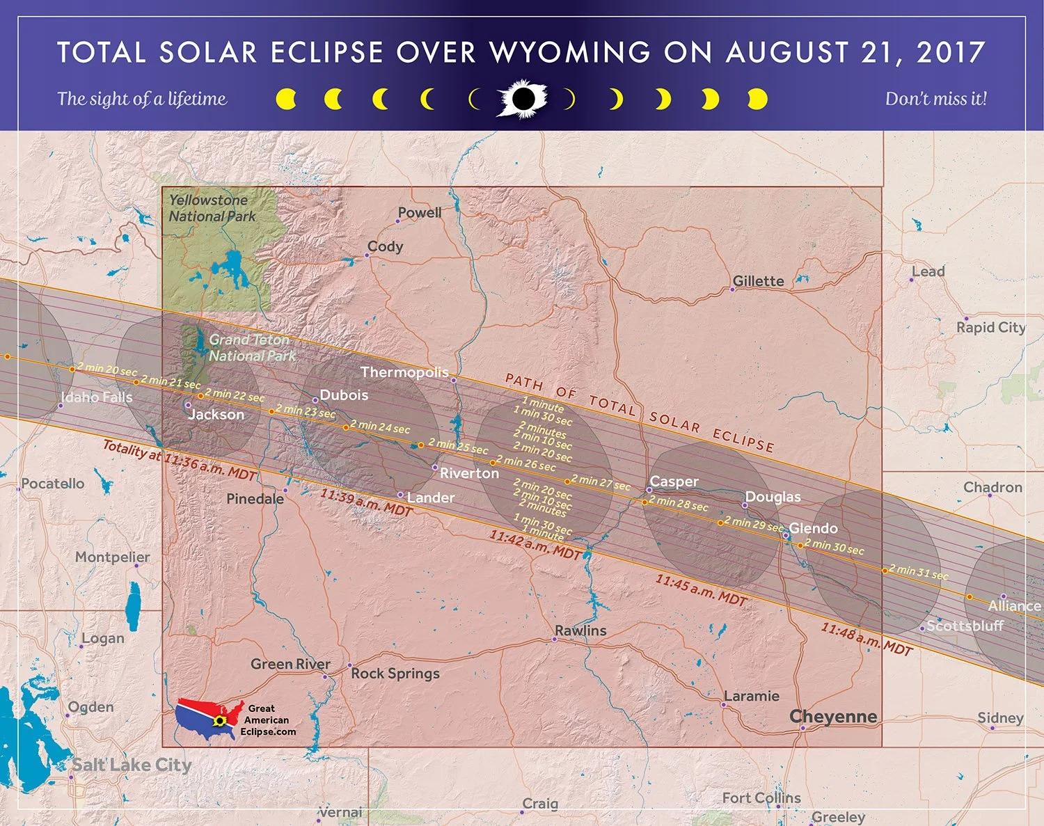
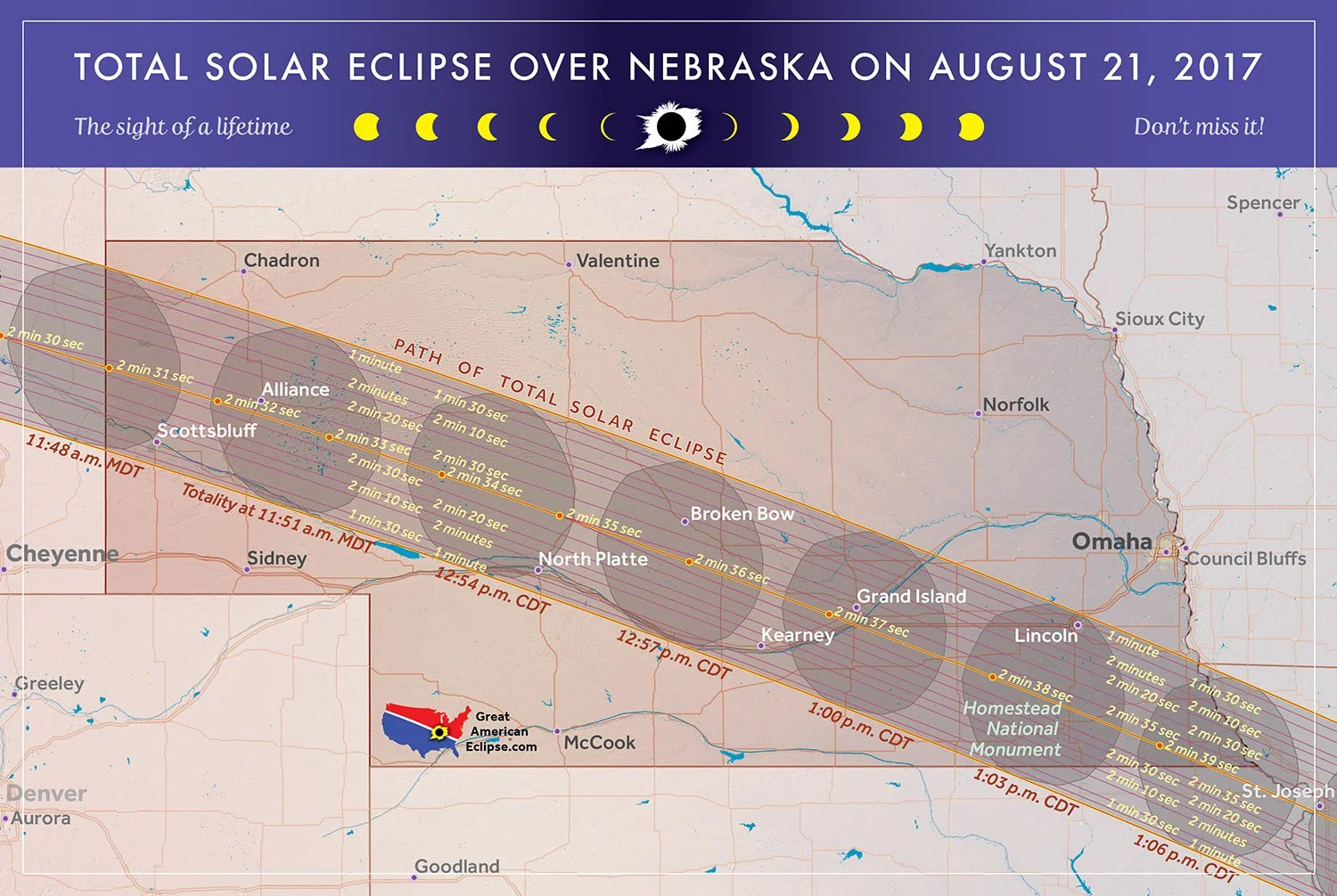
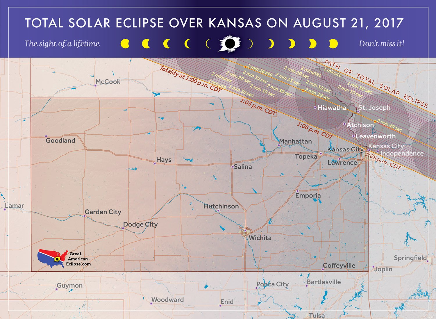
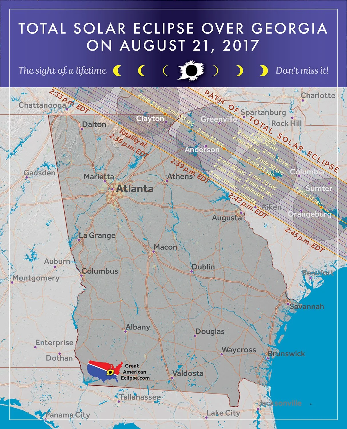
Total solar eclipse over states
These are print maps which we published and sold on greatamericaneclipse.com
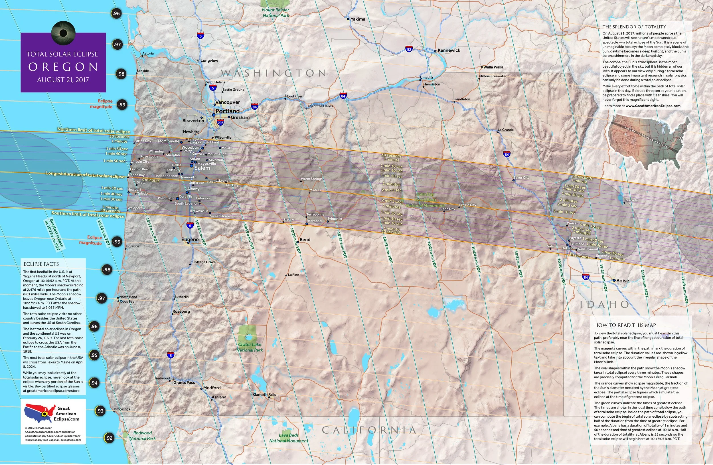

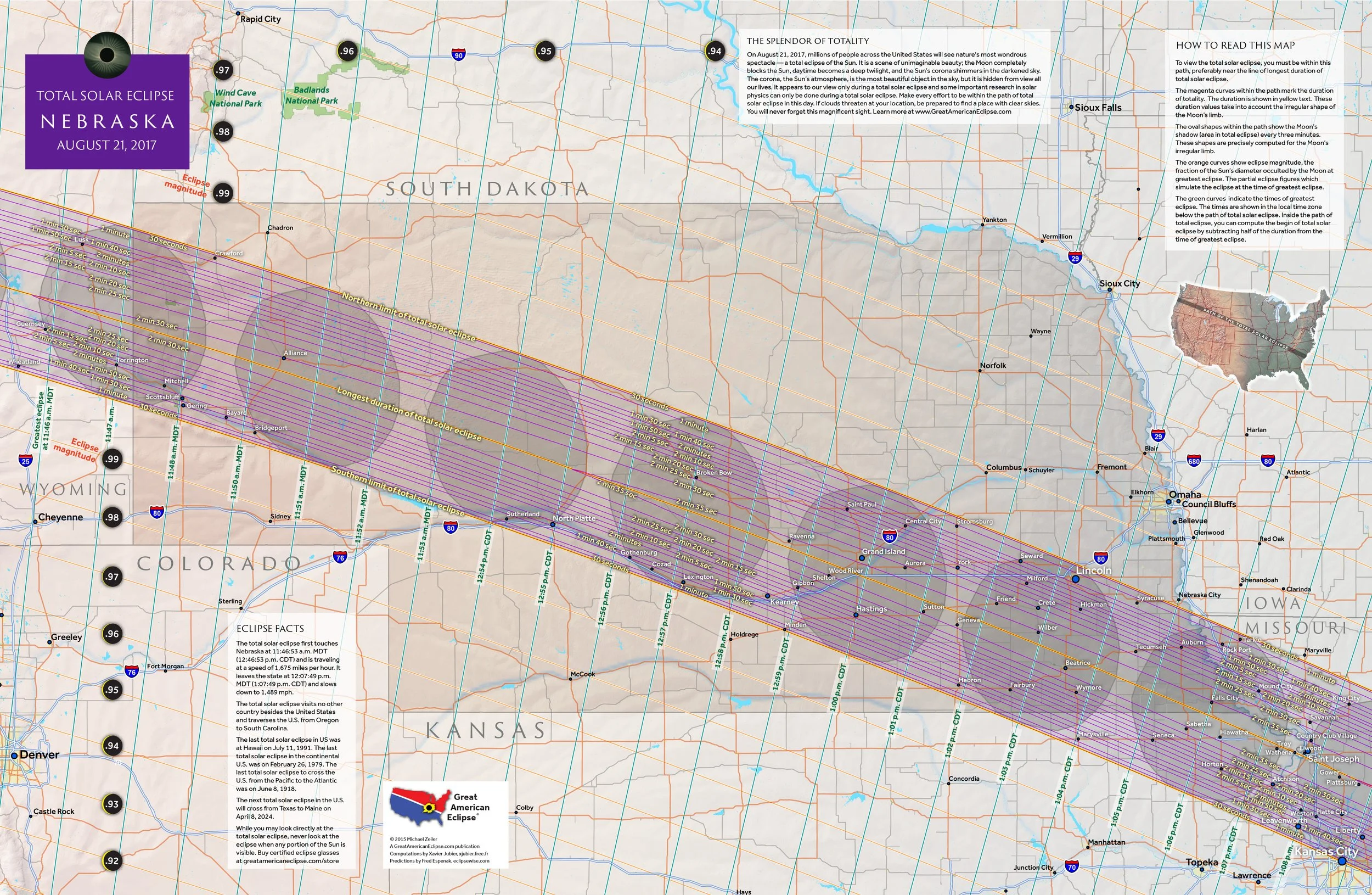
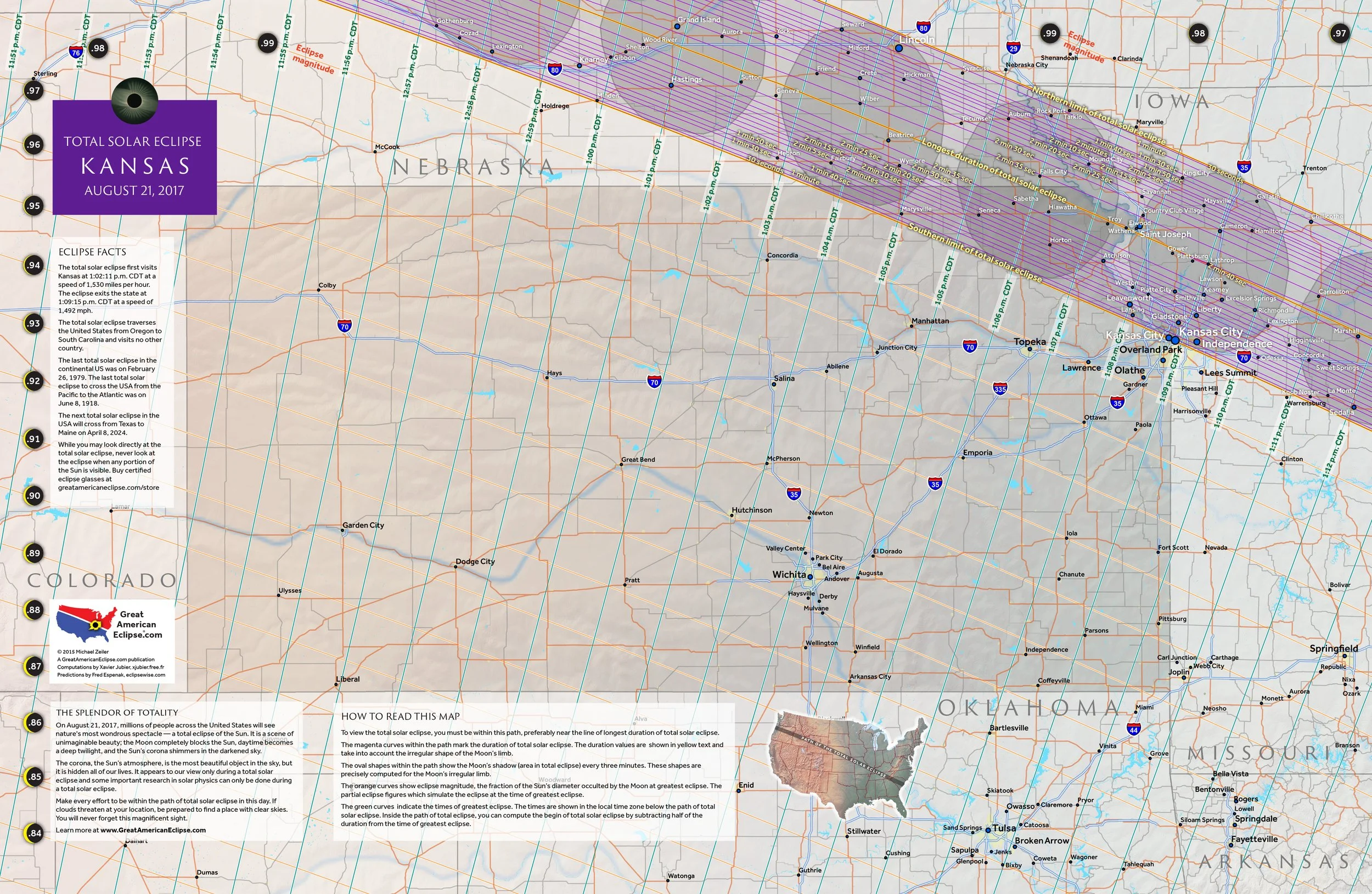

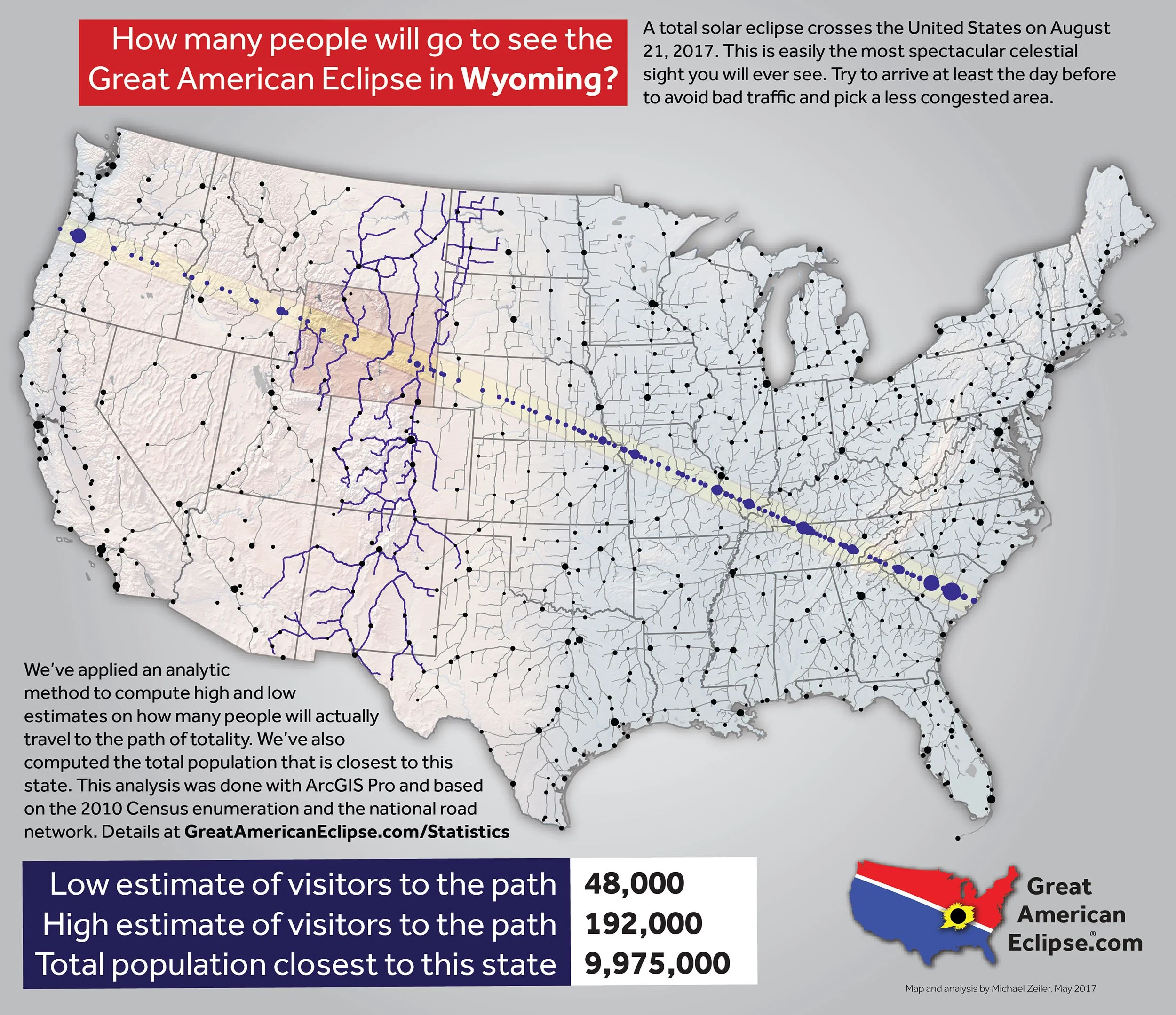
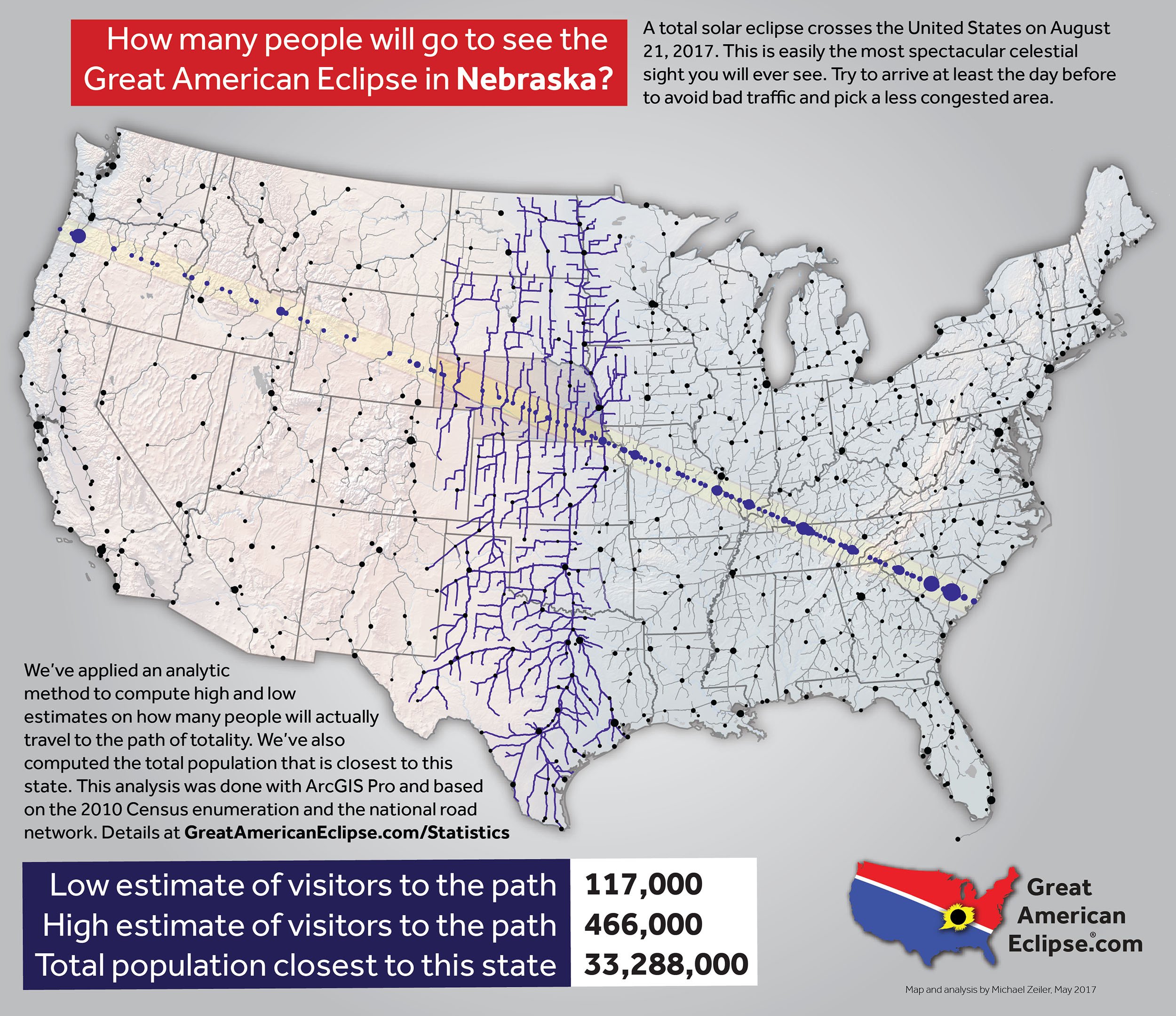
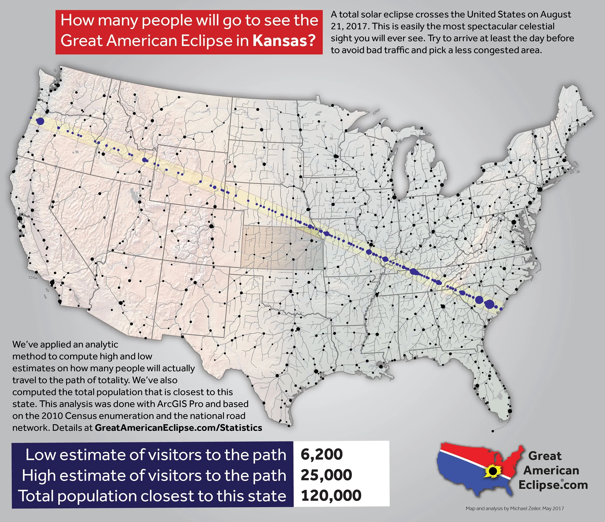
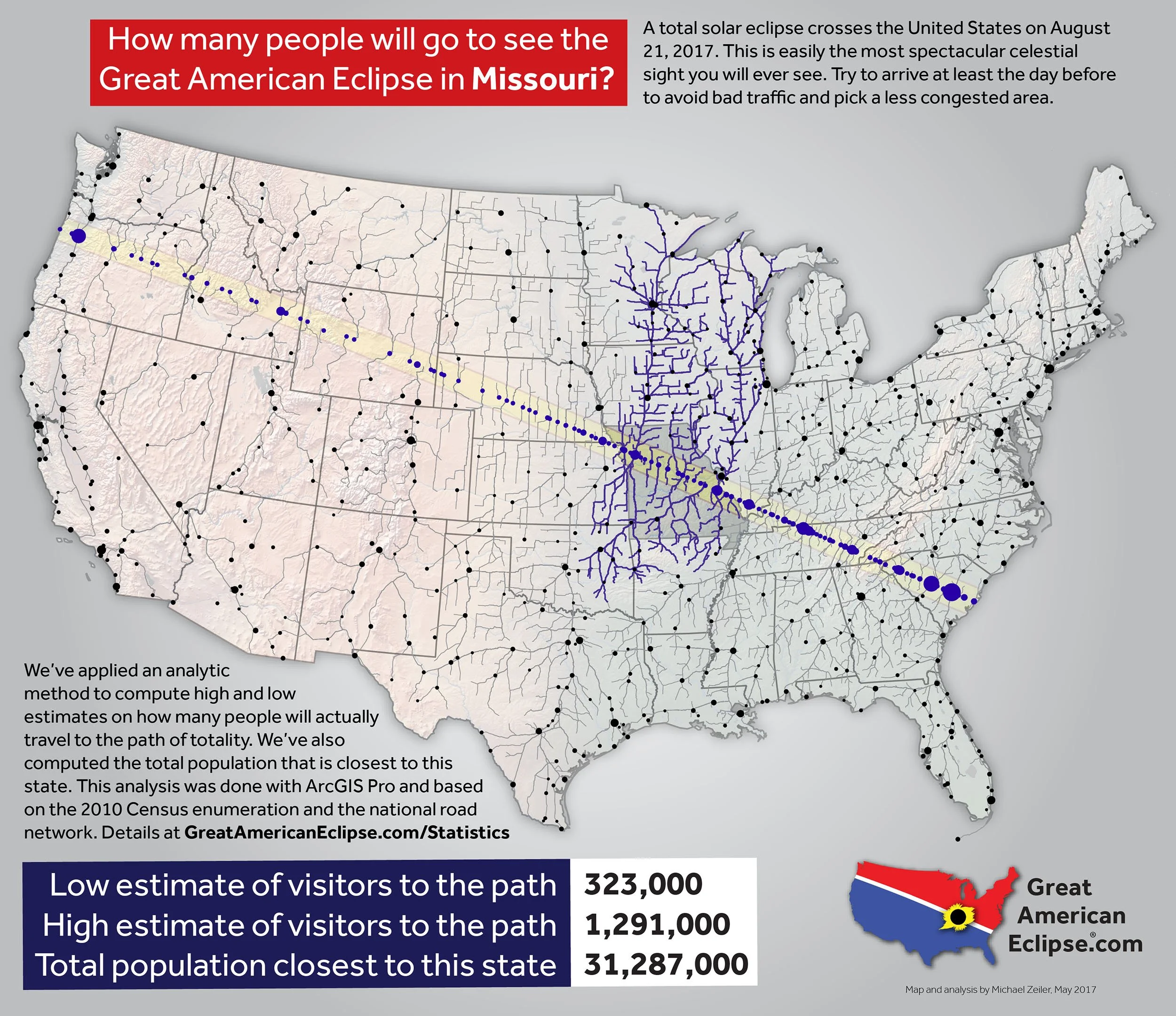
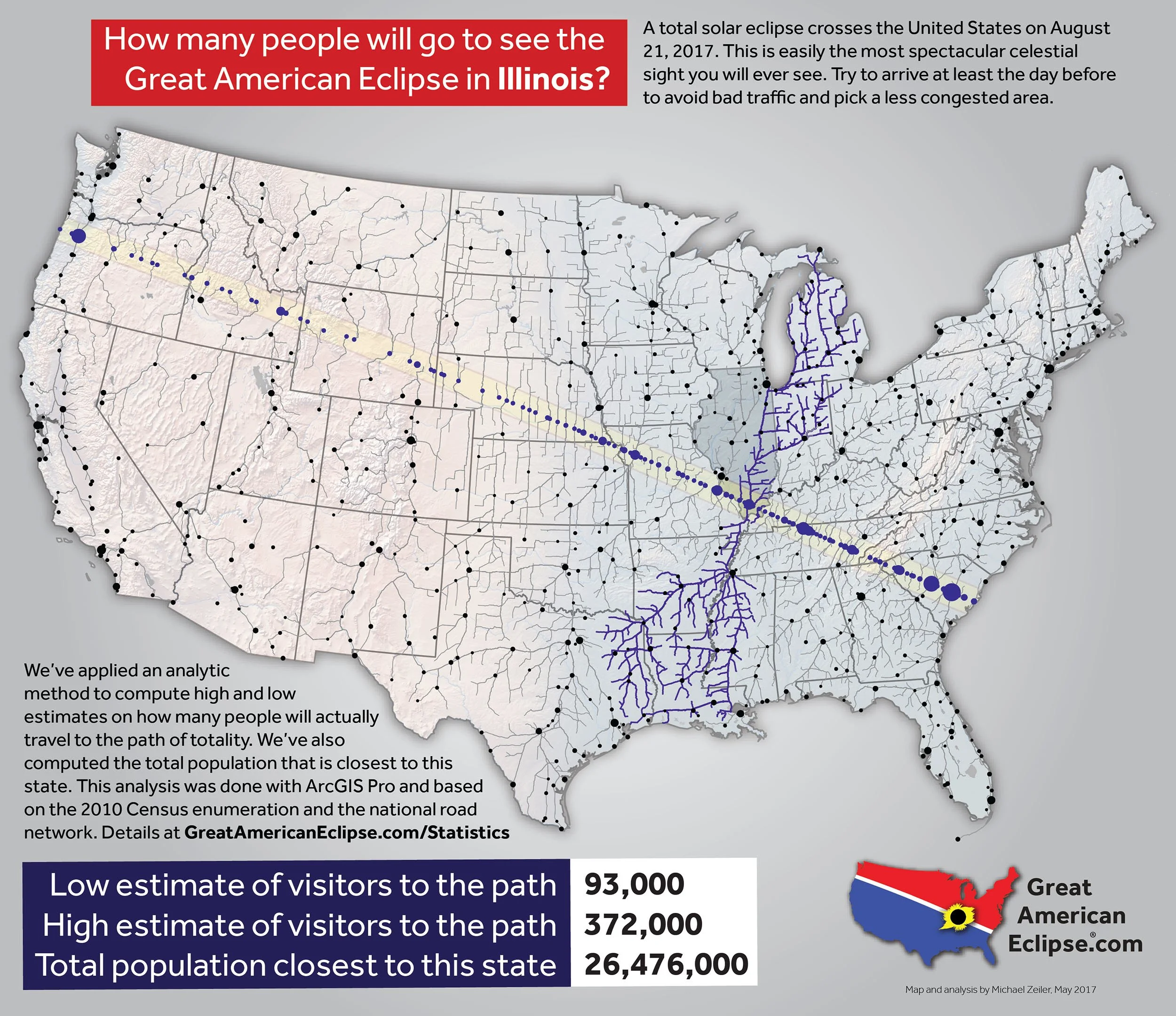
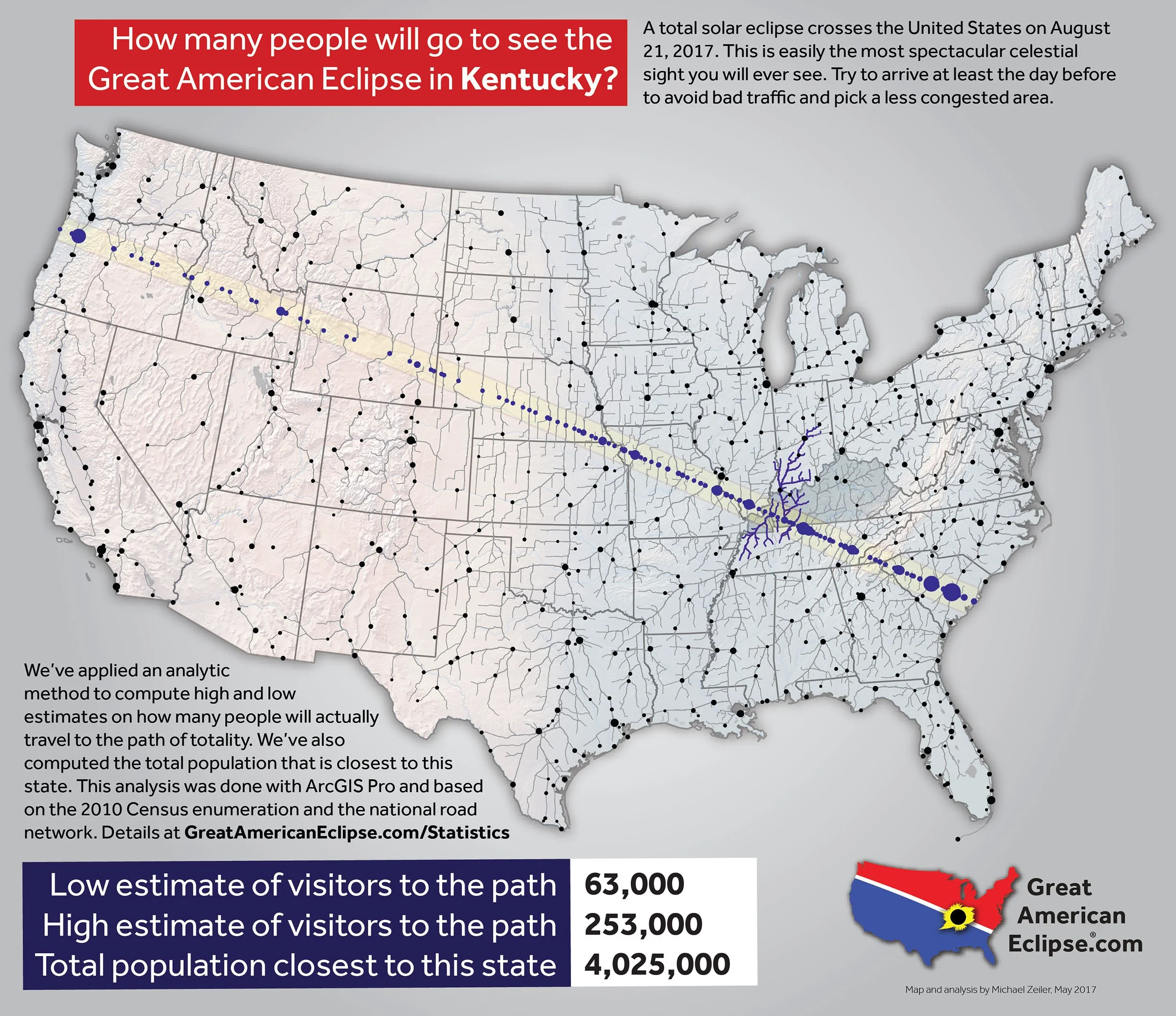
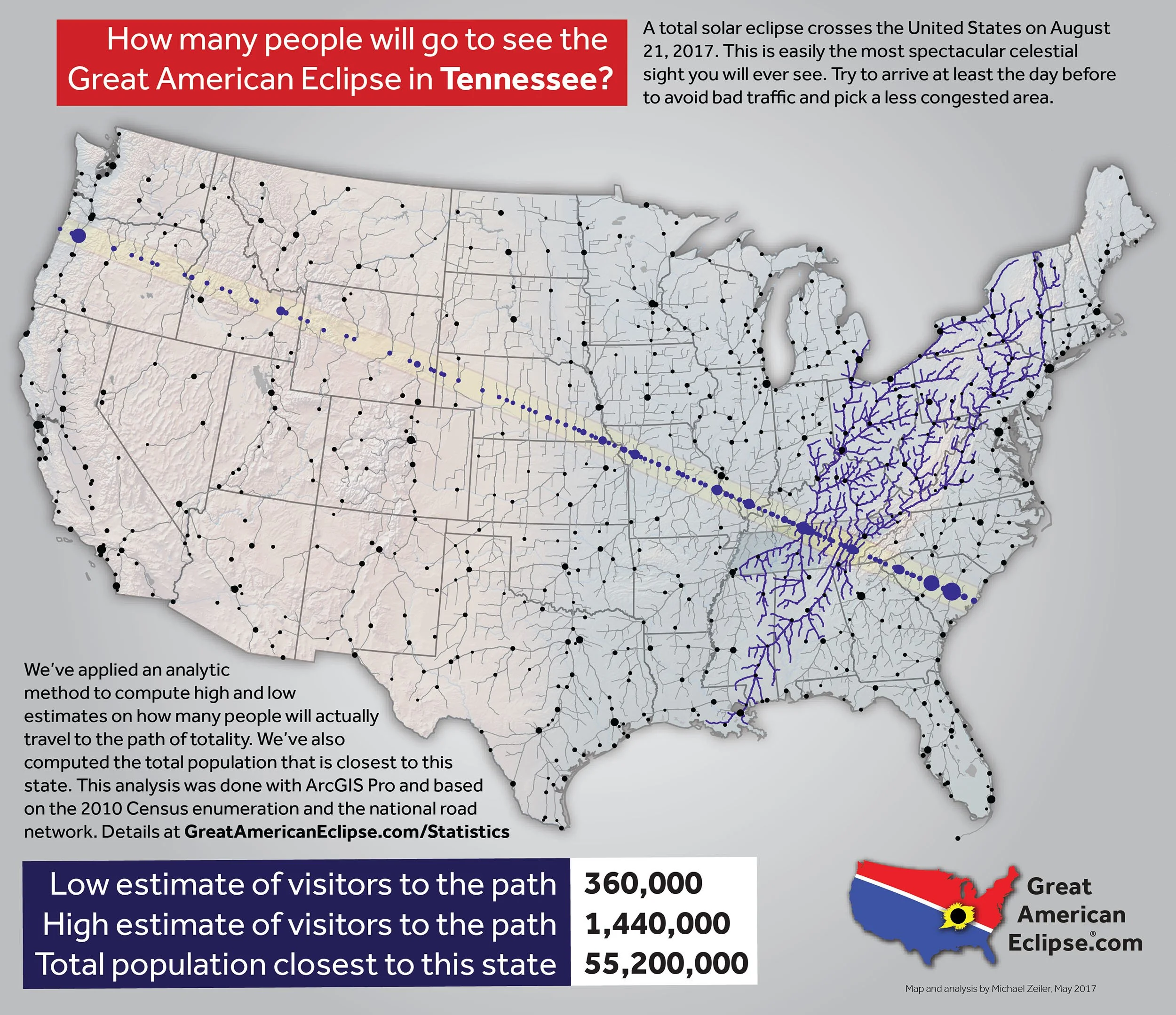
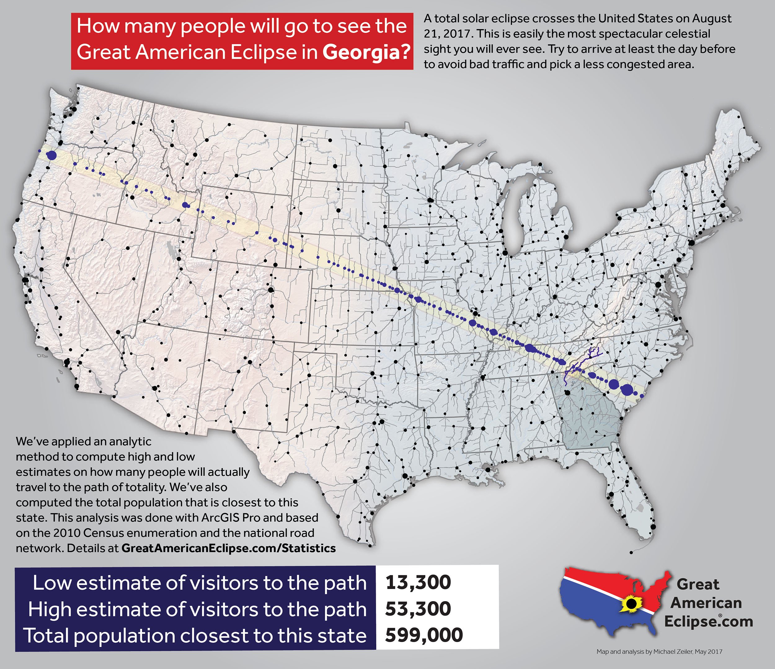
Summary maps of the eclipse by state

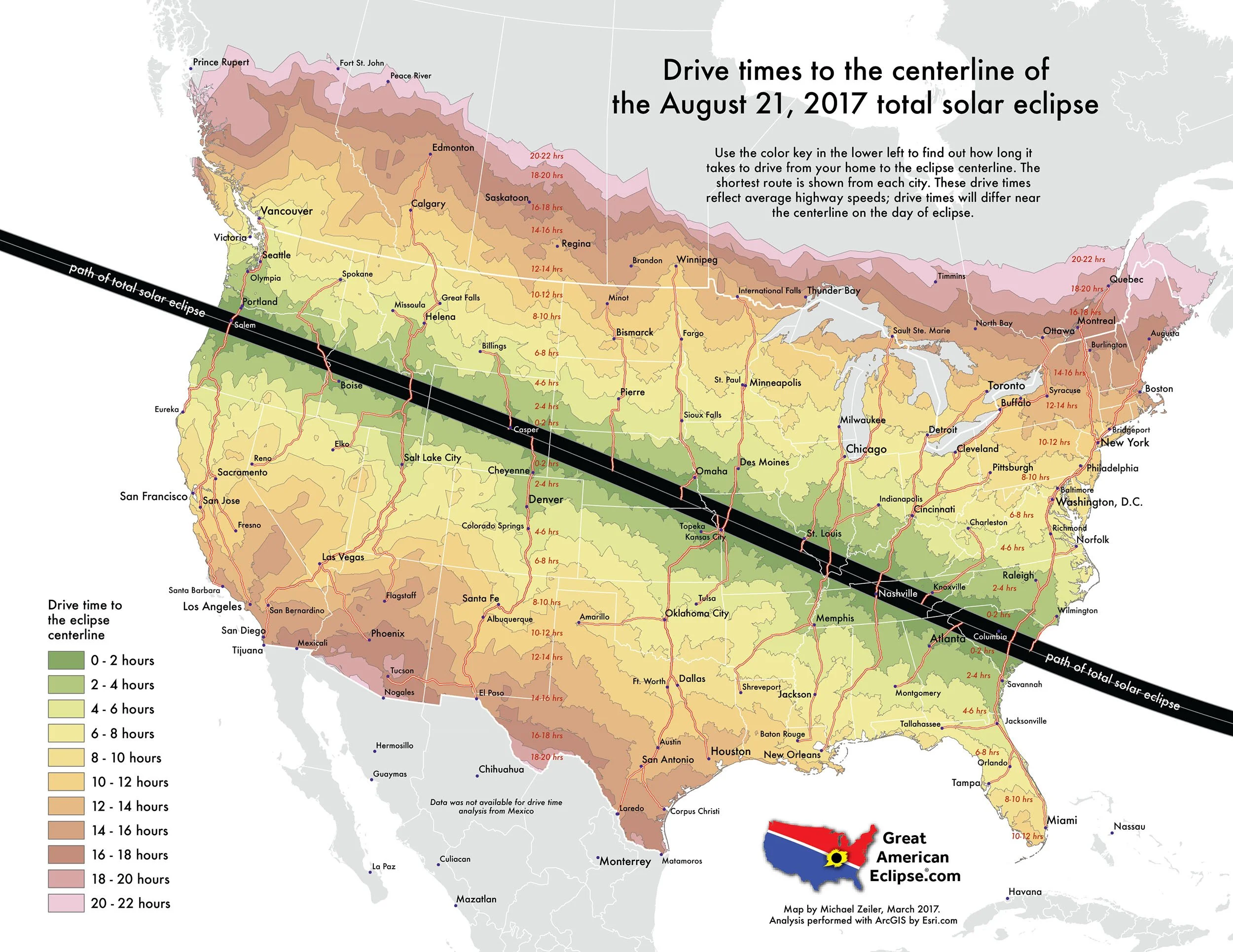
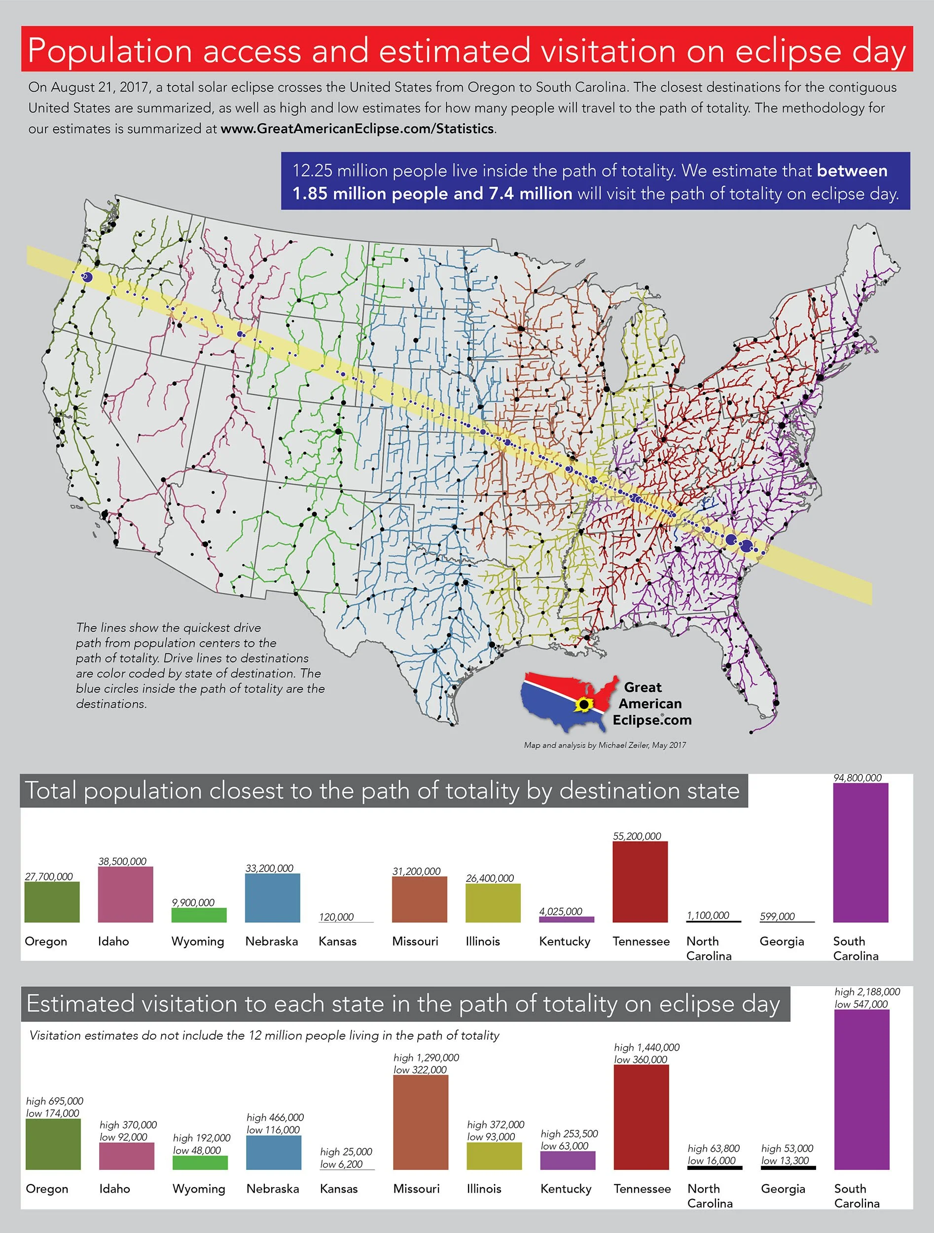
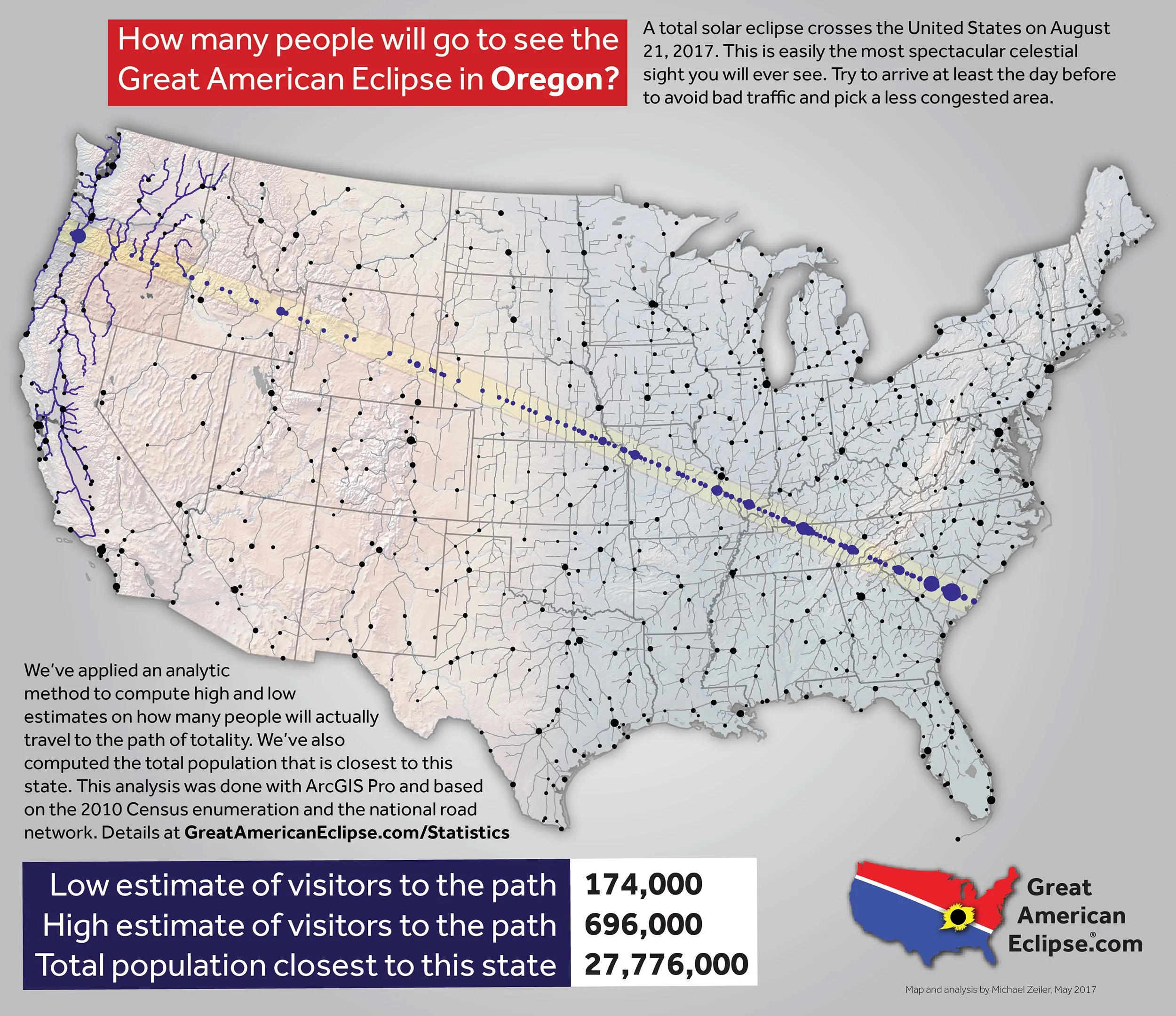
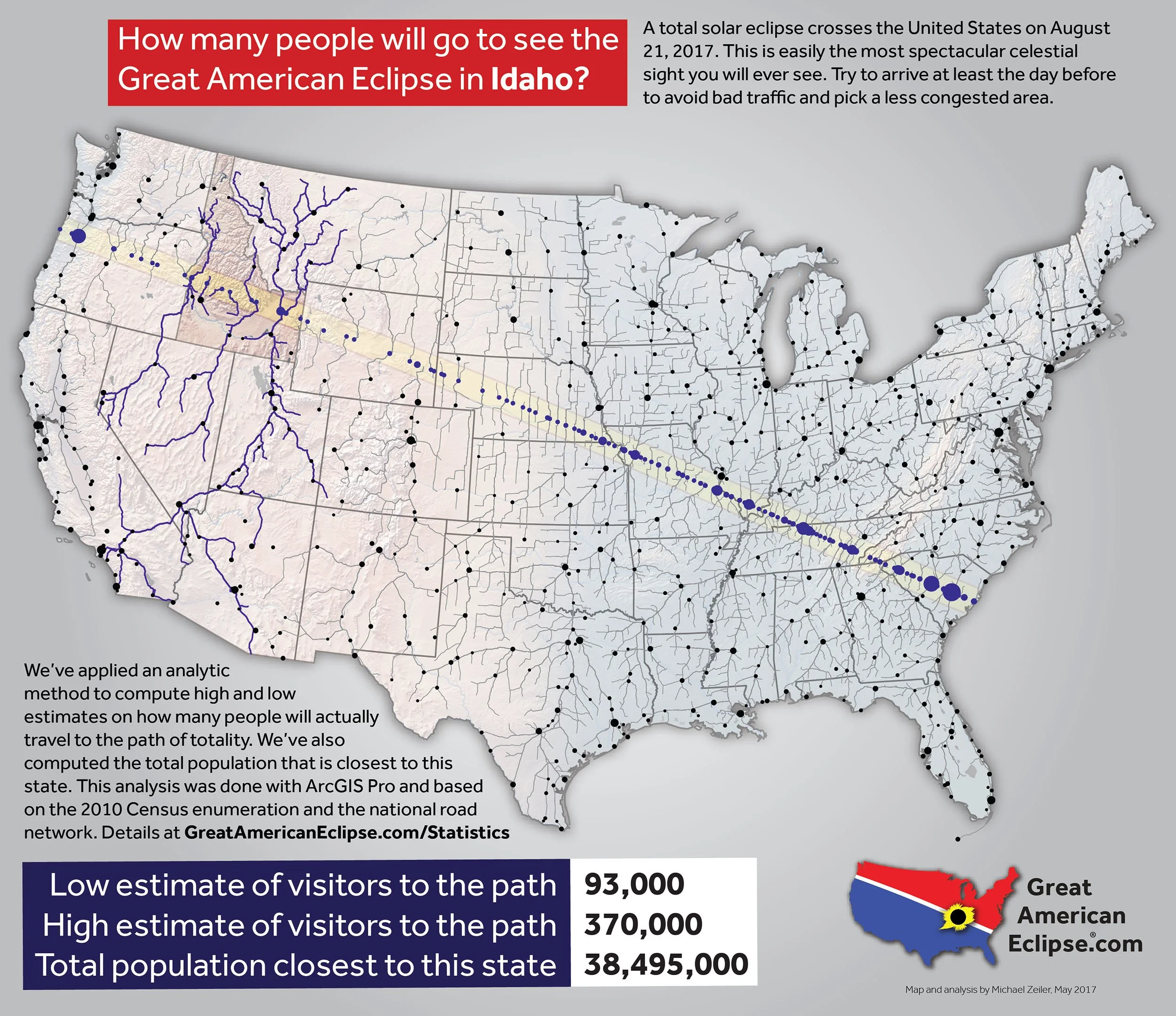
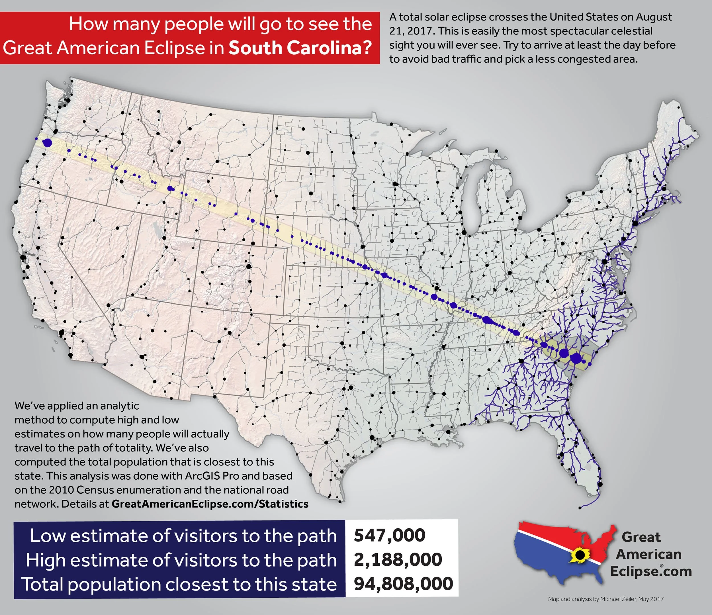
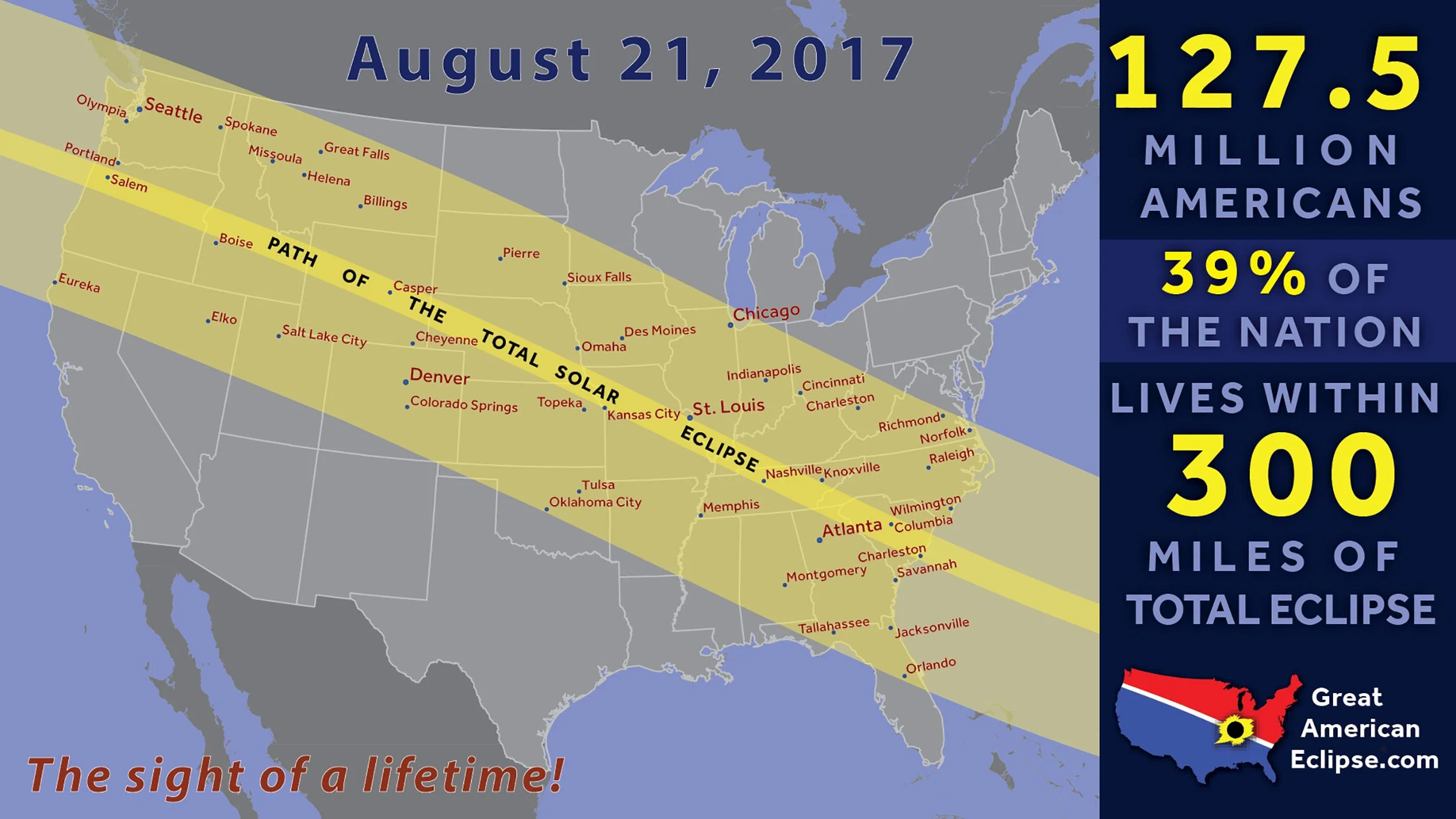
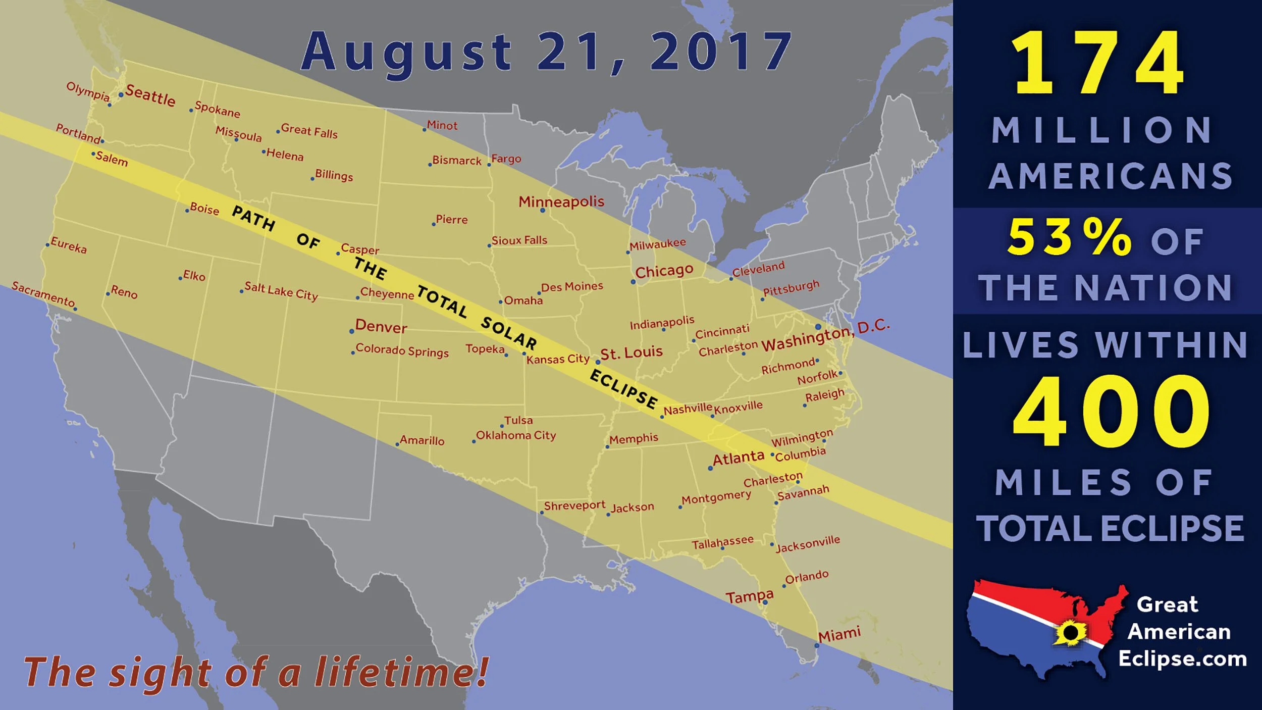
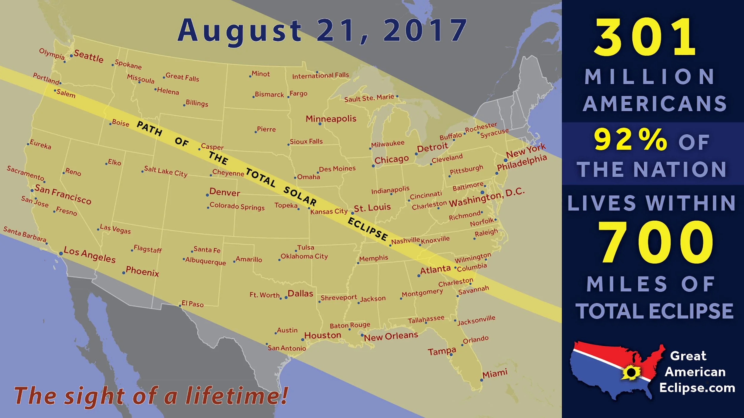
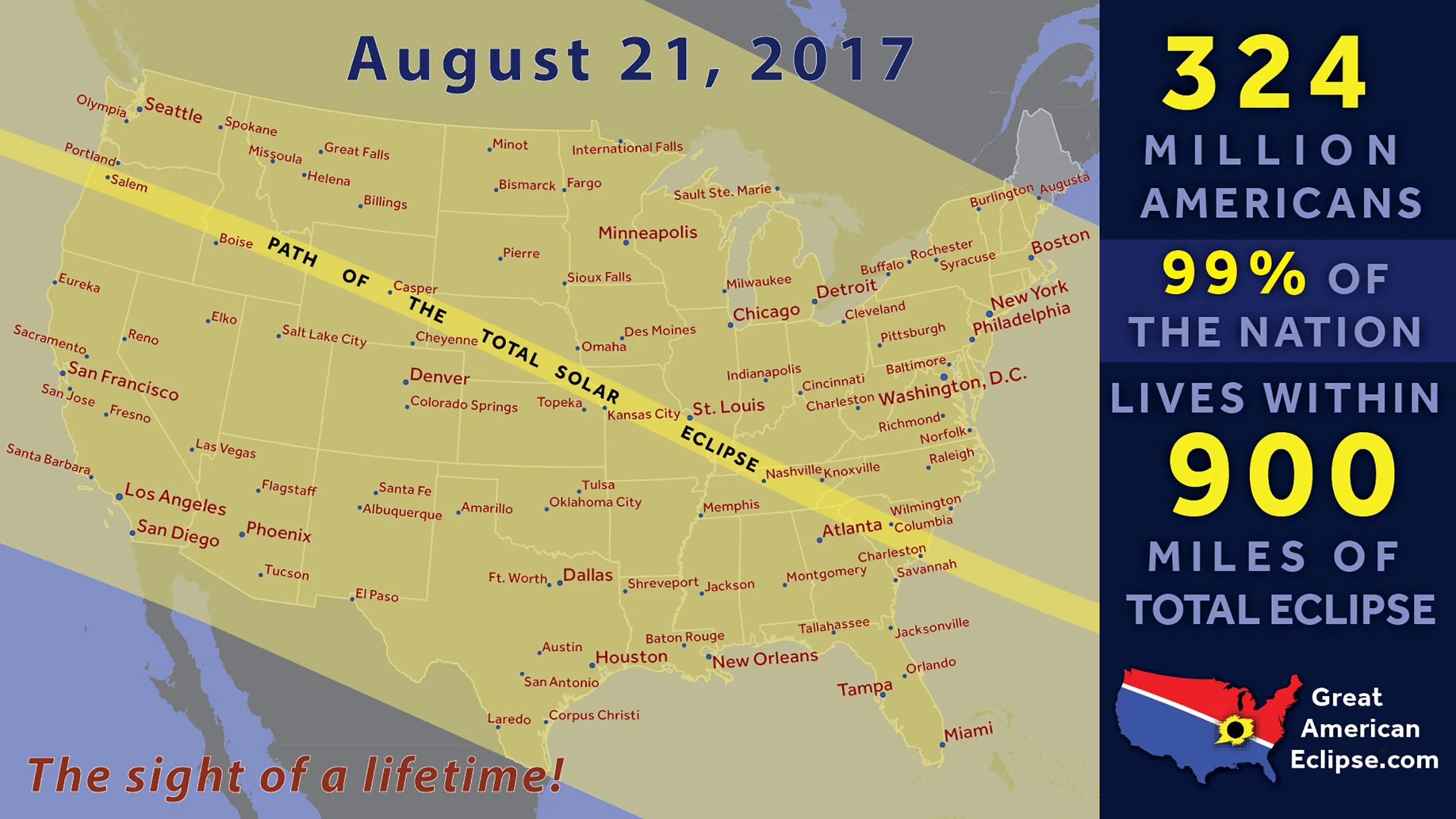
Drive times and population within distances of the path of totality
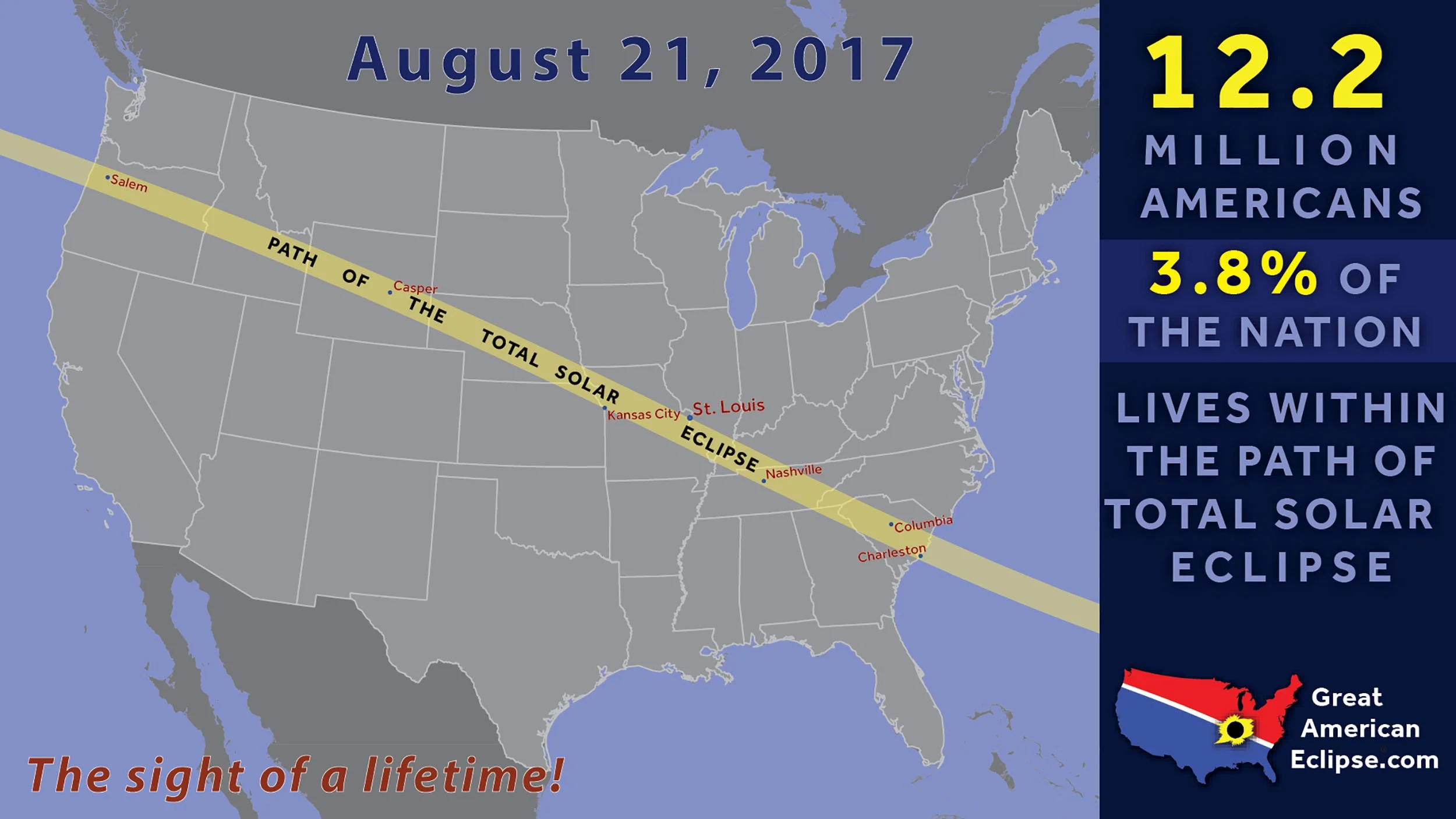
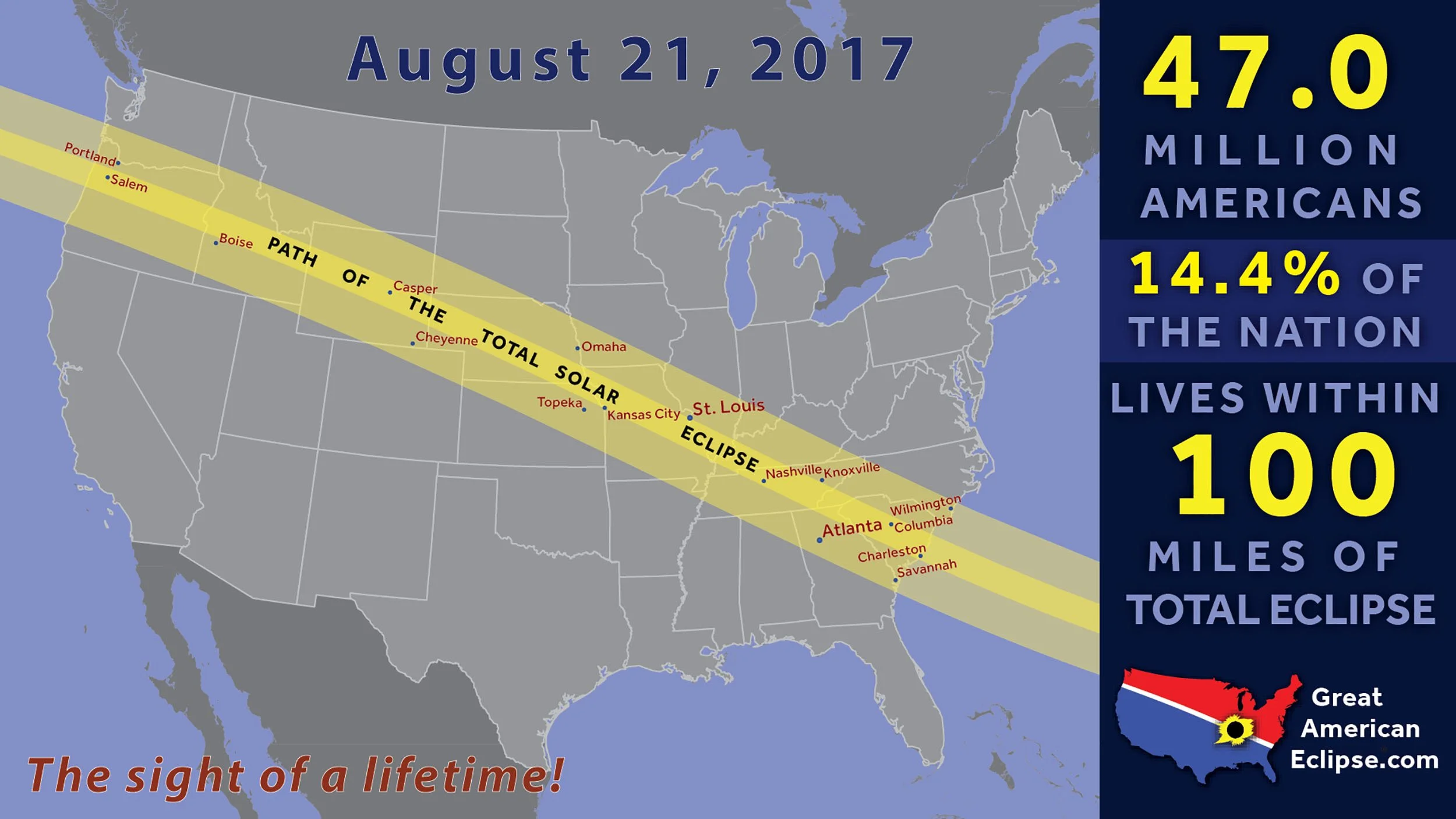


Shortest drive path and visitation estimates


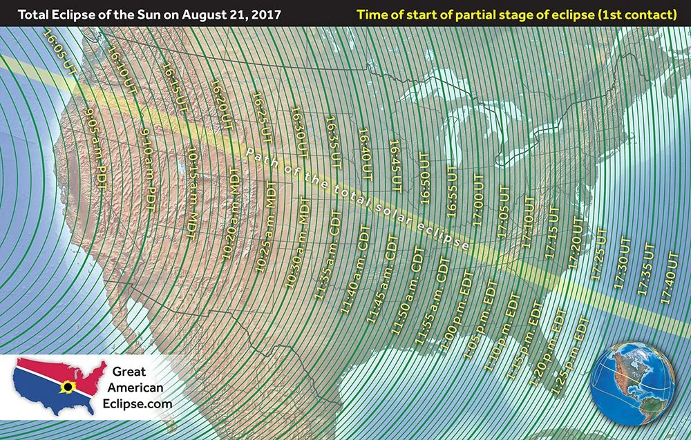
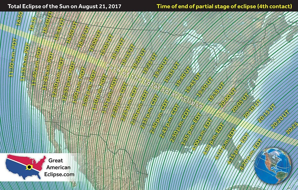
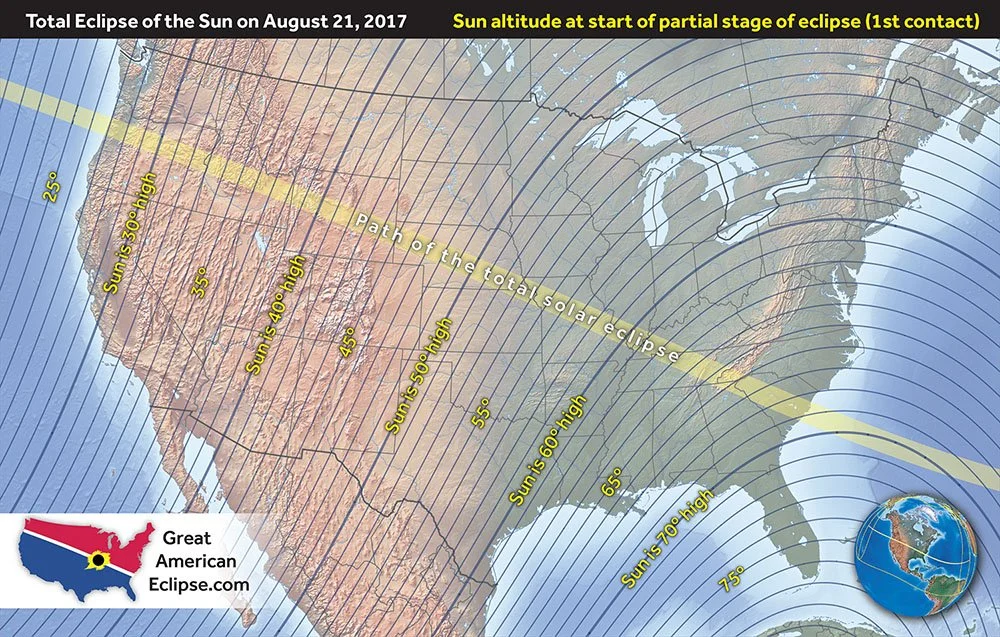
Maps of eclipse circumstances