
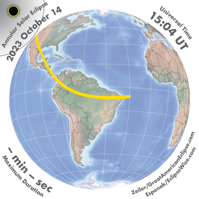
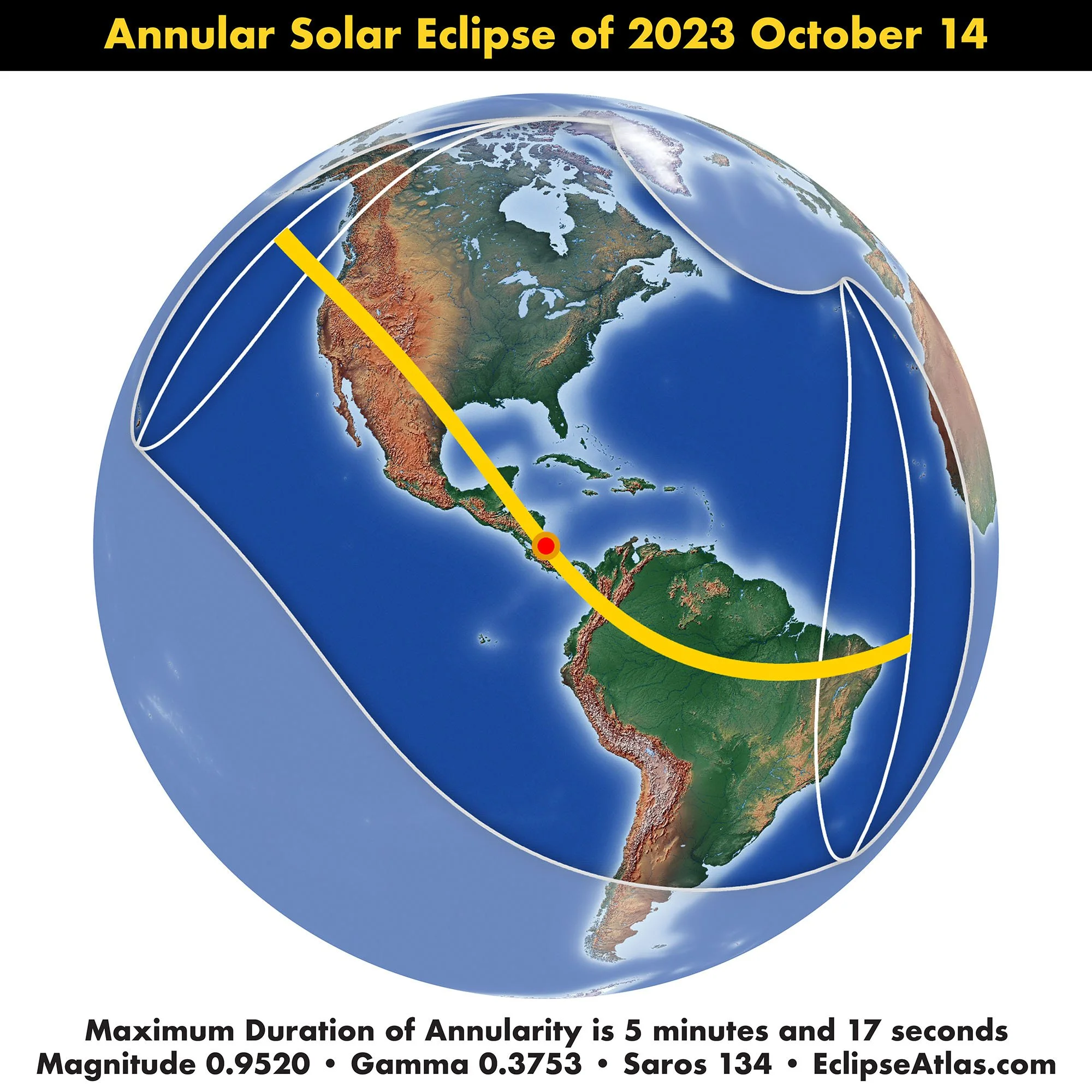
Annular Solar Eclipse of October 14, 2023
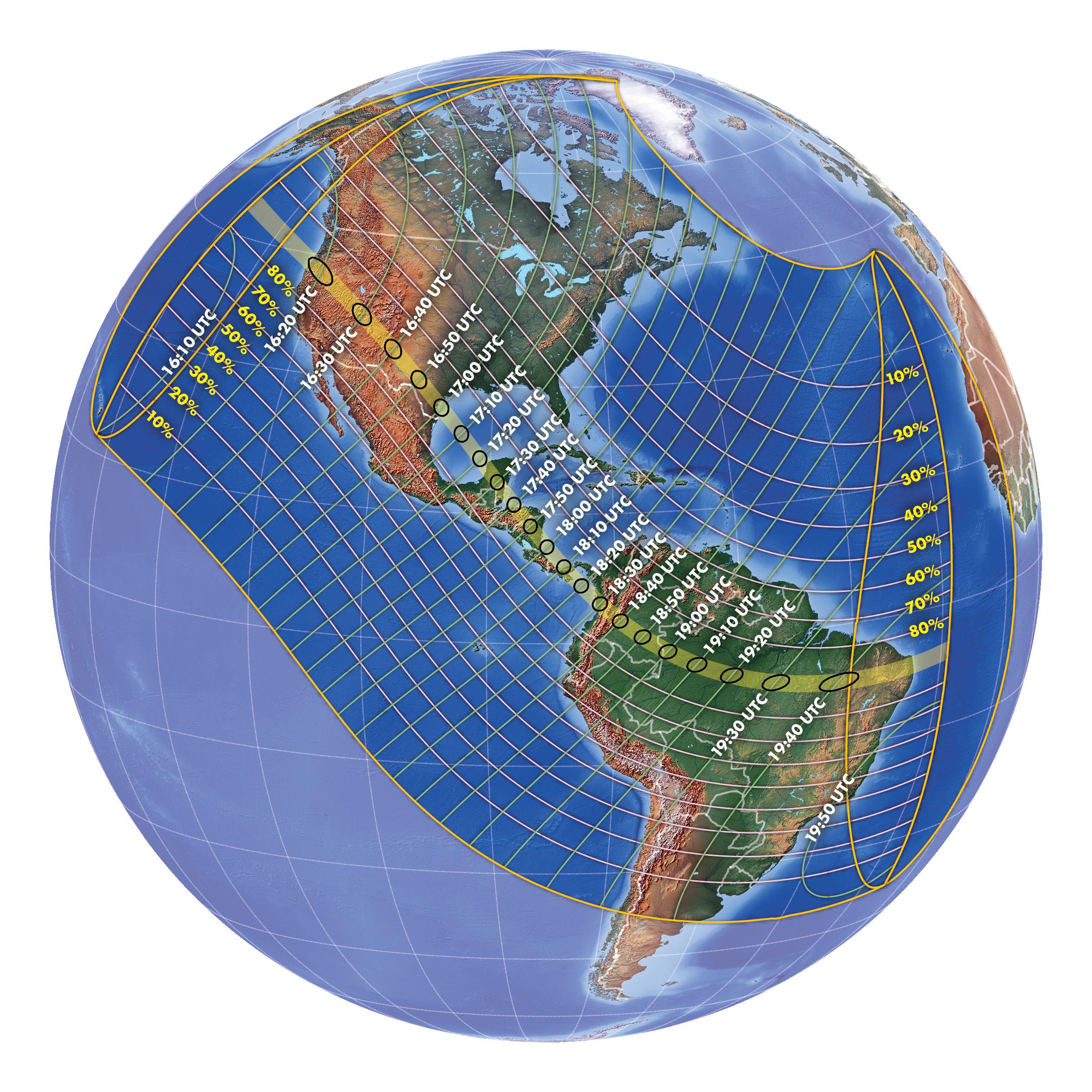
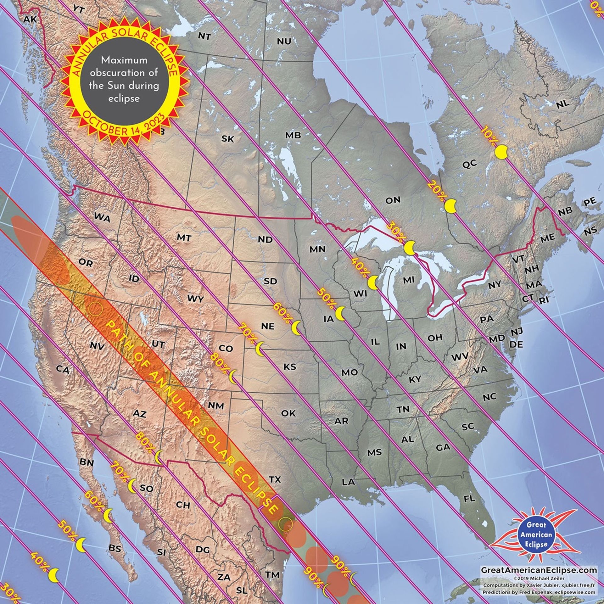
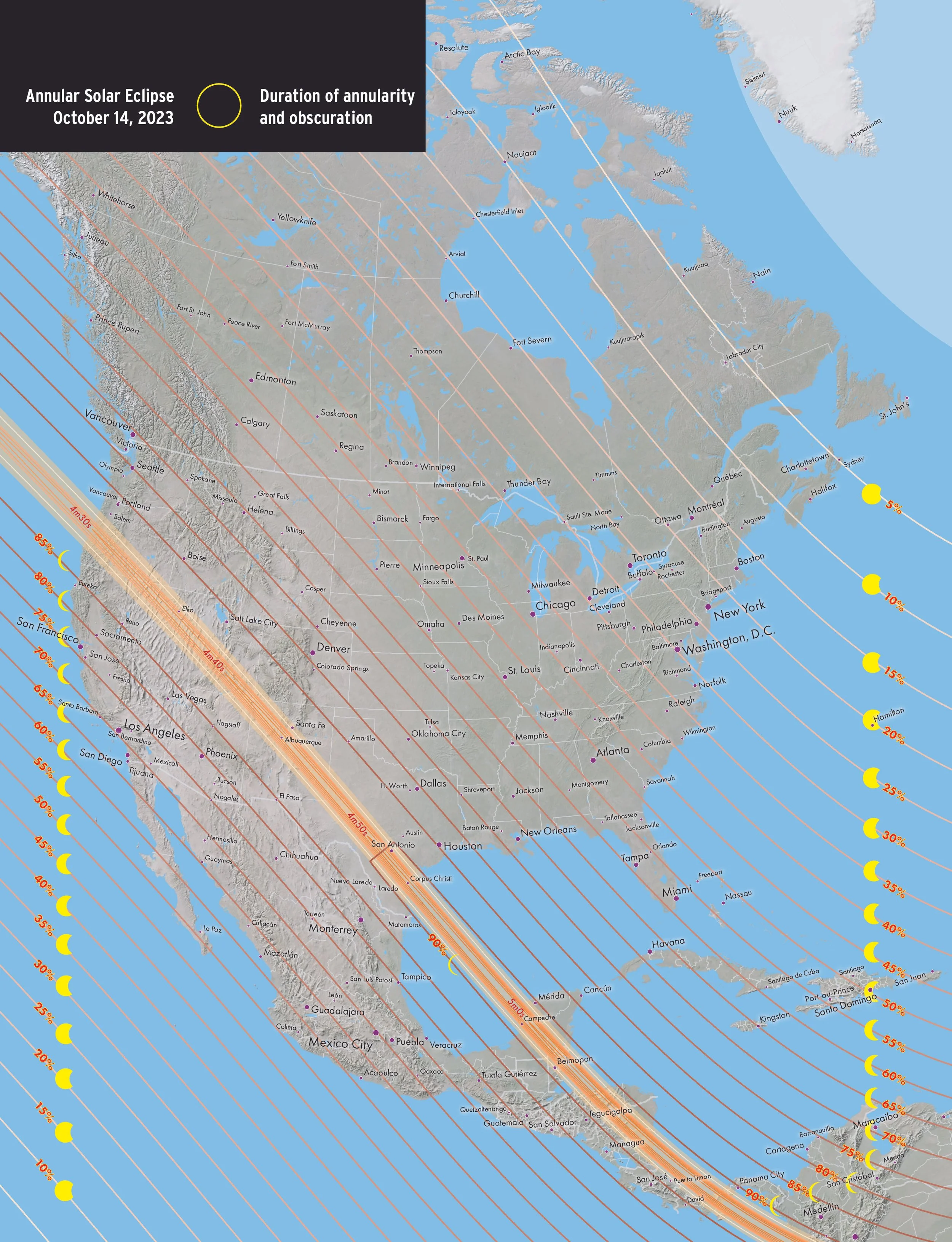
The annular solar eclipse begins at sunrise off the coast of Oregon. The ring of fire then blazed over Oregon, California, a corner of Idaho, Nevada, Utah, Arizona, Colorado, New Mexico, and Texas. The path of annularity crossed over the scenic American southwest and many national parks. The largest cities in the path in the United States was Albuquerque with 4 minutes and 43 seconds of annular eclipse and San Antonio with 4 minutes and 6 seconds. The Ring of Fire eclipse left Texas at Corpus Christi. Next, the path of annularity swept over the Yucatan peninsula, the Central American countries of Honduras, Nicaragua, and Costa Rica. Finally, the eclipse path went over Panama, Columbia, and Brazil. The eclipse ended at sunset near the eastern coast of Brazil.
The eclipse maps on this page were first published on GreatAmericanEclipse.com
Fly over the annular solar eclipse
Watch the Moon's shadow race from Oregon to Texas on October 14, 2023! This flyover video animation chases the 'Ring of Fire' eclipse from 125 miles high at speeds from 7,000 mph to 1,700 mph. Anyone with eclipse glasses inside the dark oval will see the blazing sight of the Sun appearing as a slender brilliant ring.
If you could design an eclipse path that maximizes the number of national parks in its path, this is it! See the eclipse fly over Crater Lake National Park, Great Basin National Park, and others in the Four Corners region. The archeo-astronomical site at Chaco Canyon is ideally situated for a dramatic eclipse. In Texas, the path of this eclipse intersects the path of the April 8, 2024 total solar eclipse in the San Antonio region.
The dark oval represents where the thin ring of the Sun, the 'Ring of Fire', will be seen at that moment. The time of eclipse is given in the local time zone. The duration is the maximum at the center of the Moon's shadow. Places near the centerline receive the longest duration.
The passage of the Moon’s shadow
This animation shows the passage of the Moon's shadow over the United States on October 14, 2023. During an annular solar eclipse, the Moon's apparent disk is slightly smaller than the Sun and inside the path of annular solar eclipse, you will see the dramatic sight of the Sun as a thin ring.
The Moon’s shadow is highly elongated at first because the eclipse begins in the morning off the Oregon coast. As the eclipse approaches local noon, the shape becomes more circular.
The eclipse in motion
The animation shows the inner shadow (umbra) and outer shadow (penumbra) of the eclipse from the perspective of the Moon. The umbra is where the total solar eclipse will be seen. The penumbra is where a partial solar eclipse will be observed from North America, northeast Russia, northwest Africa, and much of Europe.
A careful look at this animation shows how the Earth’s axial tilt, the Moon’s orbital inclination, and the offset from Earth’s center (called gamma) combine to create this curved eclipse path of totality on Earth.
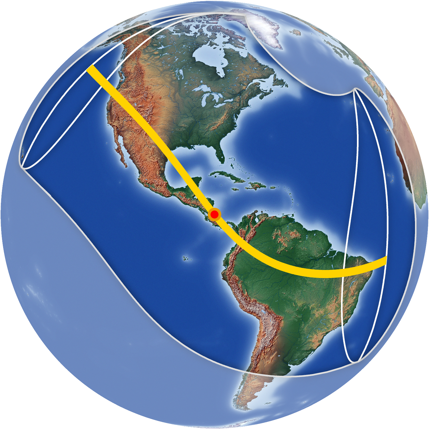
The eclipse in summary
The maximum duration of totality occurs within the red dot on the yellow path of totality near Iceland.
Eclipse magnitude is the fraction of the Moon’s apparent disk size compared to the Sun.
Eclipse gamma is the fraction of the how close the center of the Moon’s shadow passes to the center of Earth.
Learn about Saros 134 at www.eclipsewise.com/solar/SEsaros/SEsaros134.html
Print maps for the eclipse
These are the print maps which we published and sold on GreatAmericanEclipse.com
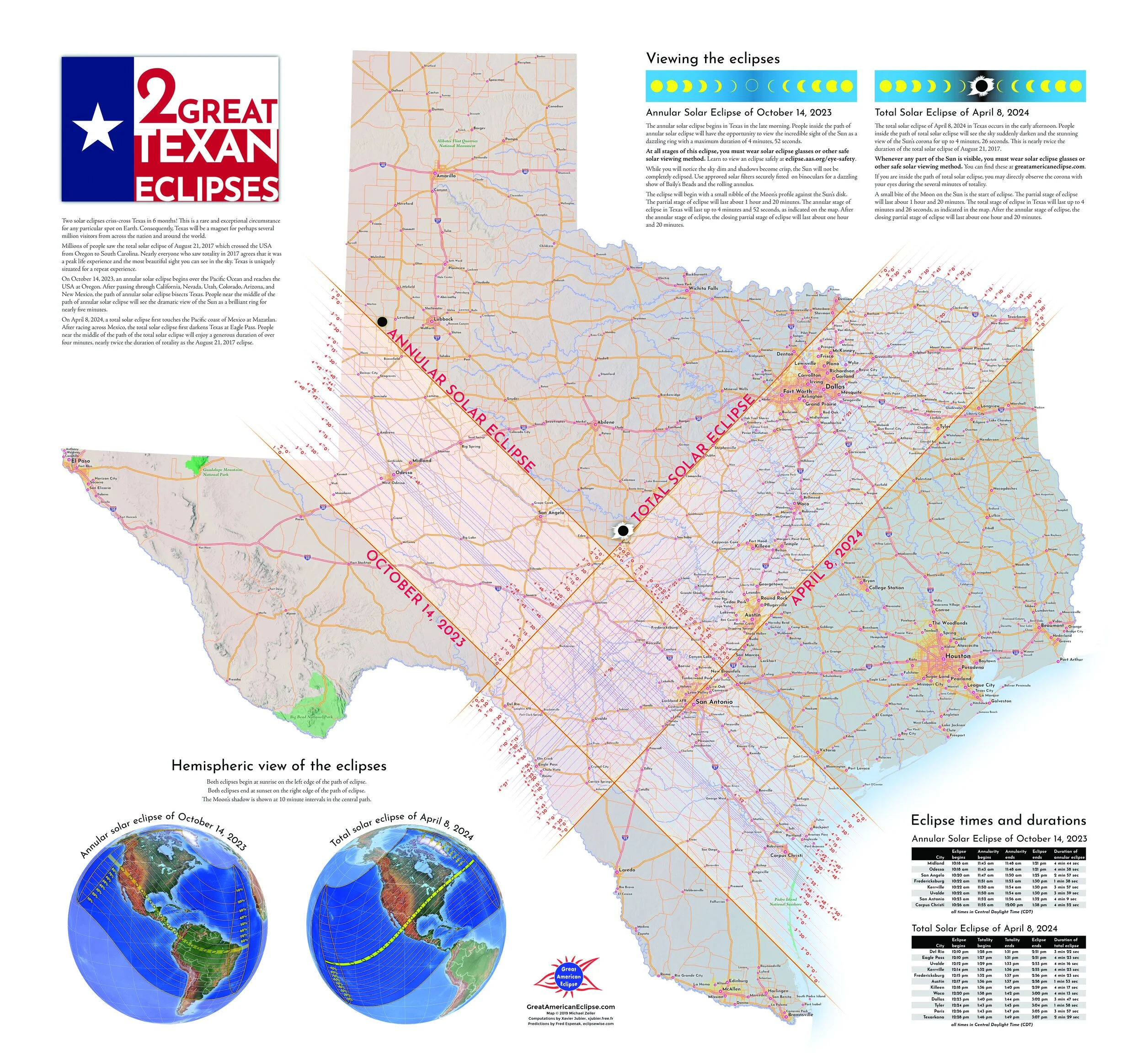
2 Great Texas Eclipses
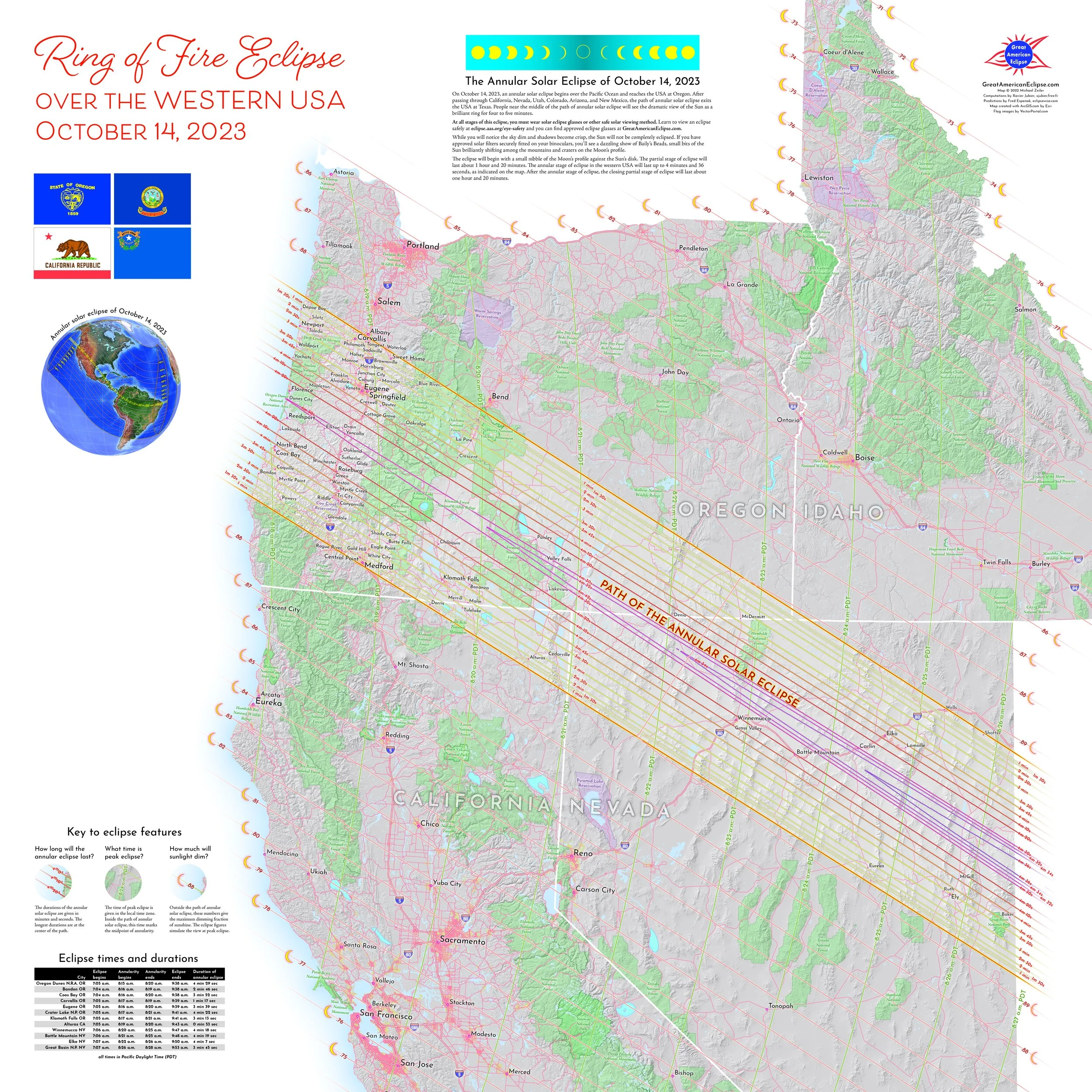
Ring of Fire Eclipse over the Western USA
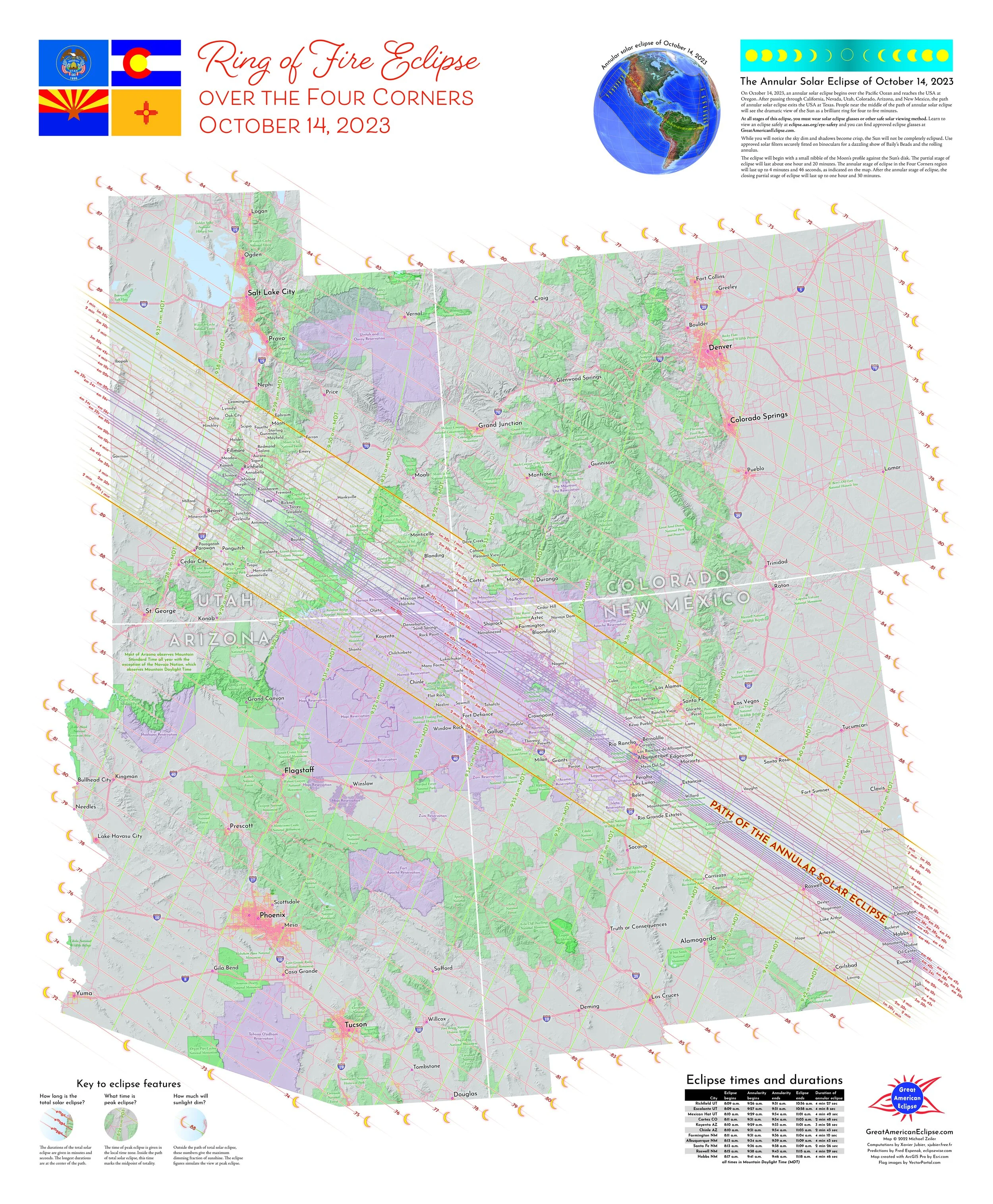
Ring of Fire Eclipse over the Four Corners
Overview maps of the annular eclipse
These maps are from our Atlas of Solar Eclipses - 2020 to 2045 by Michael Zeiler and Michael Bakich
Orthographic view of the annular eclipse
Overview and eclipse circumstances of the annular eclipse
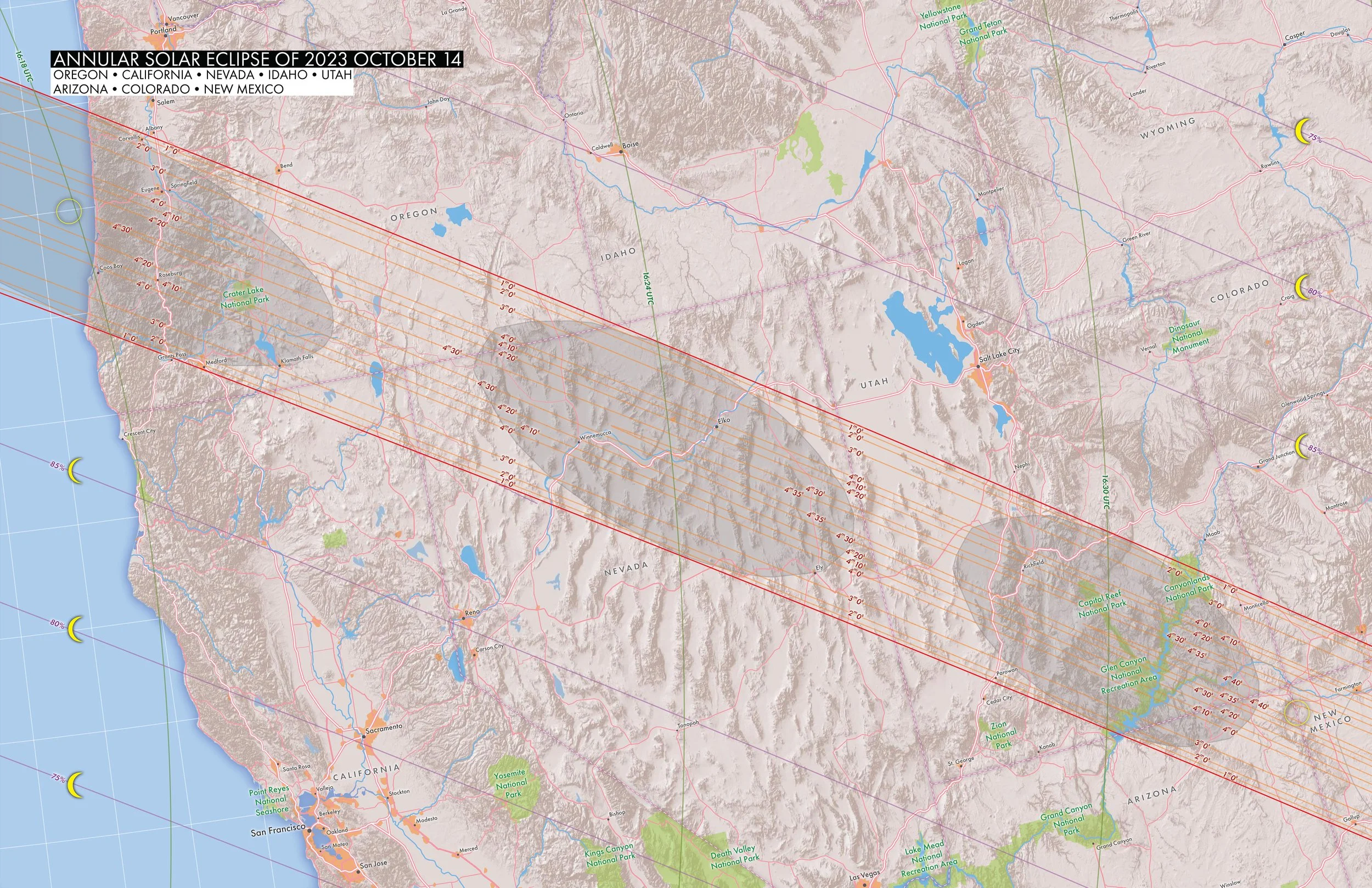
Regional map over the western US Oregon, California, Nevada, Utah, Arizona, Colorado, and New Mexico
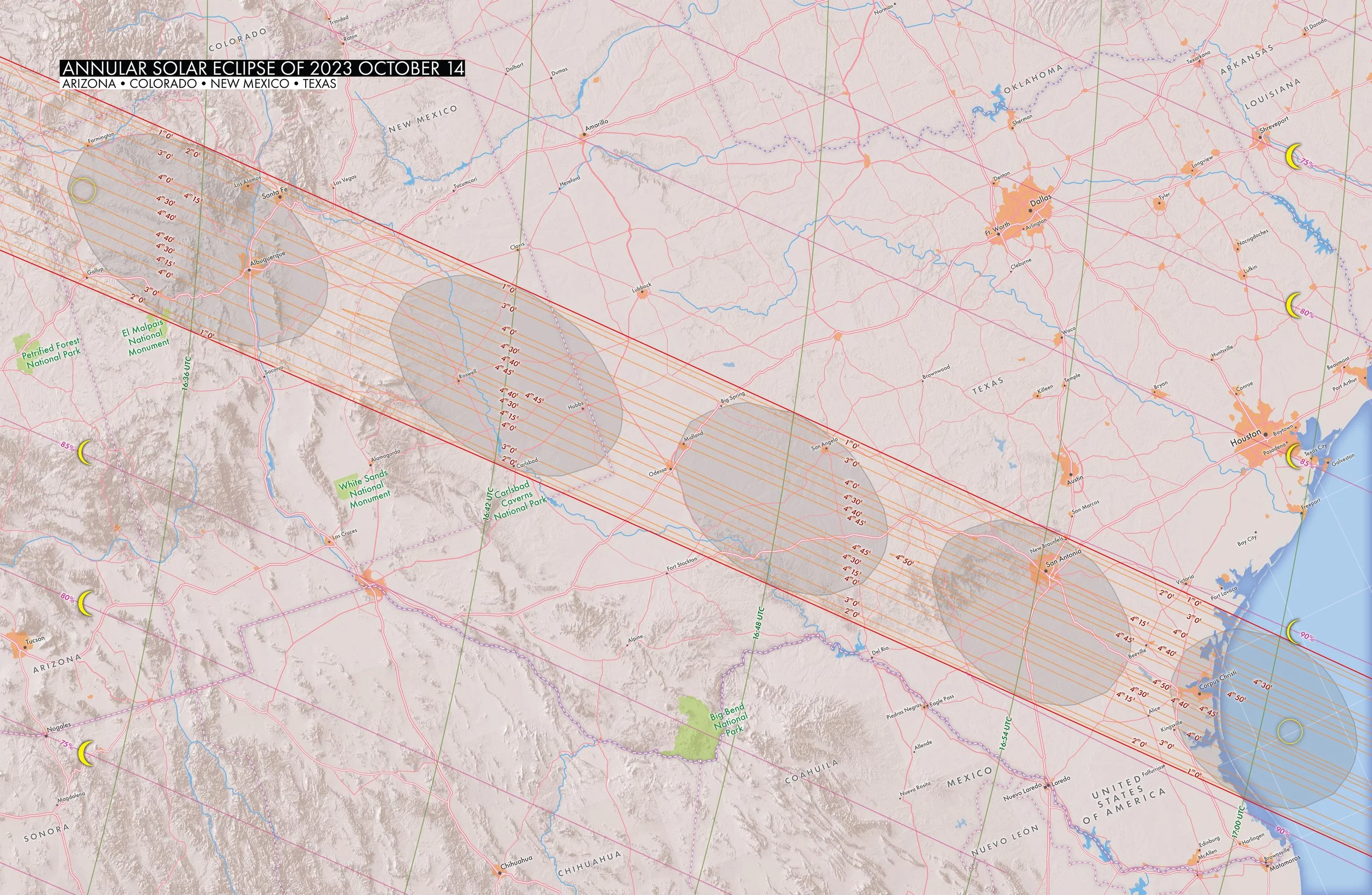
Regional map over New Mexico and Texas
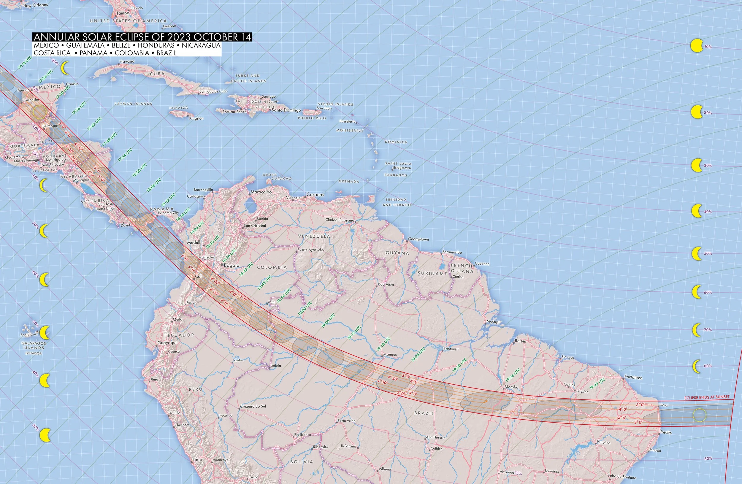
Regional map over Central America and South America
Continental maps of the annular solar eclipse
North America
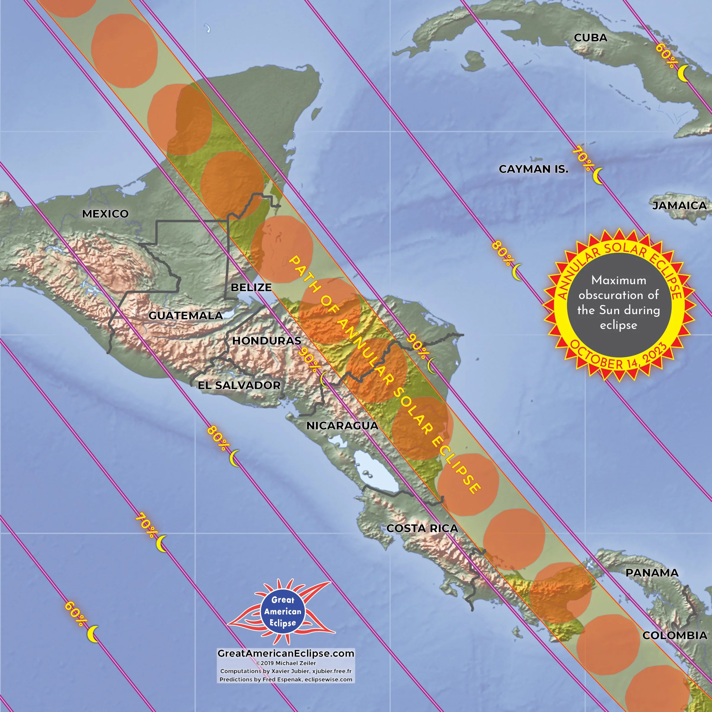
Central America

South America
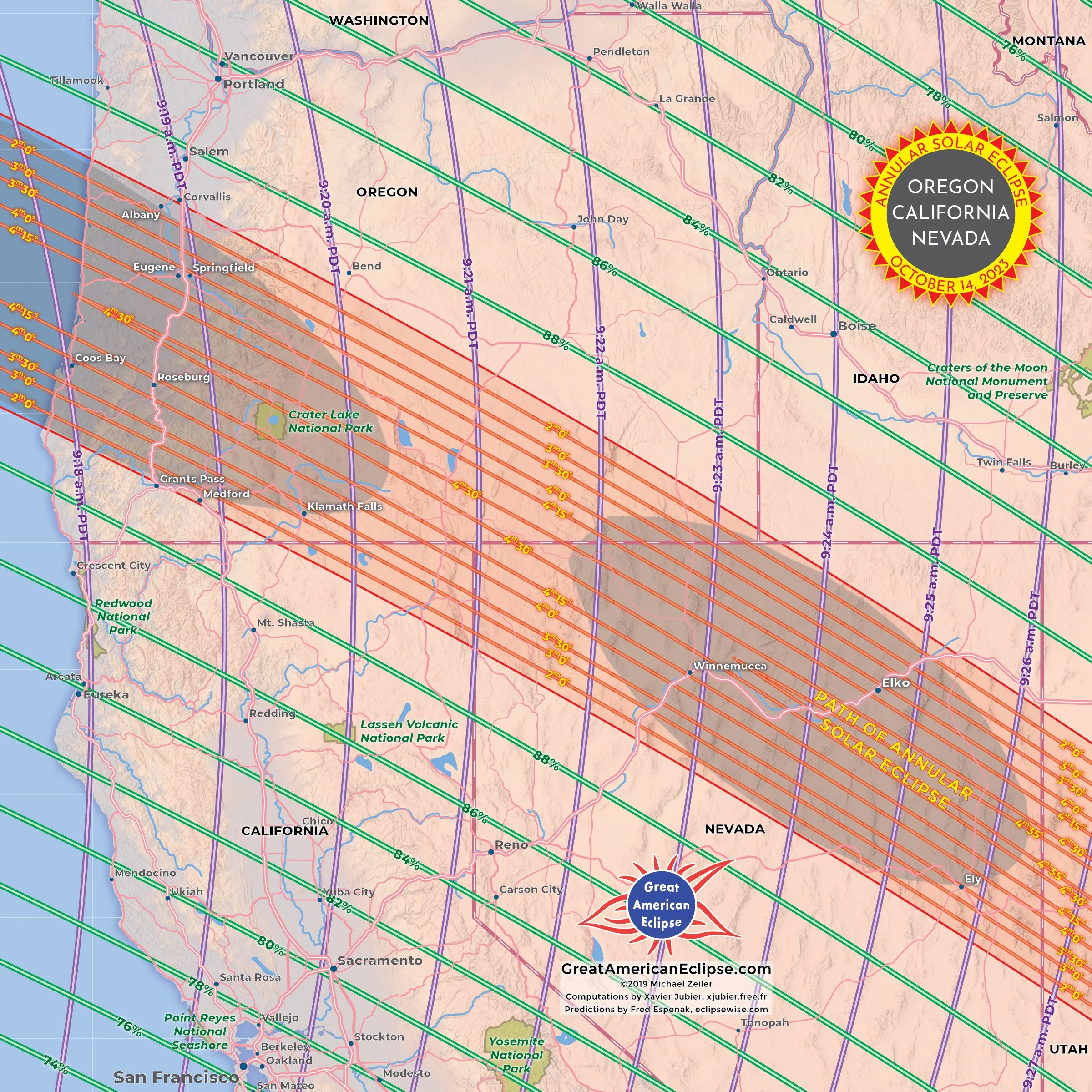
Oregon, California, Nevada
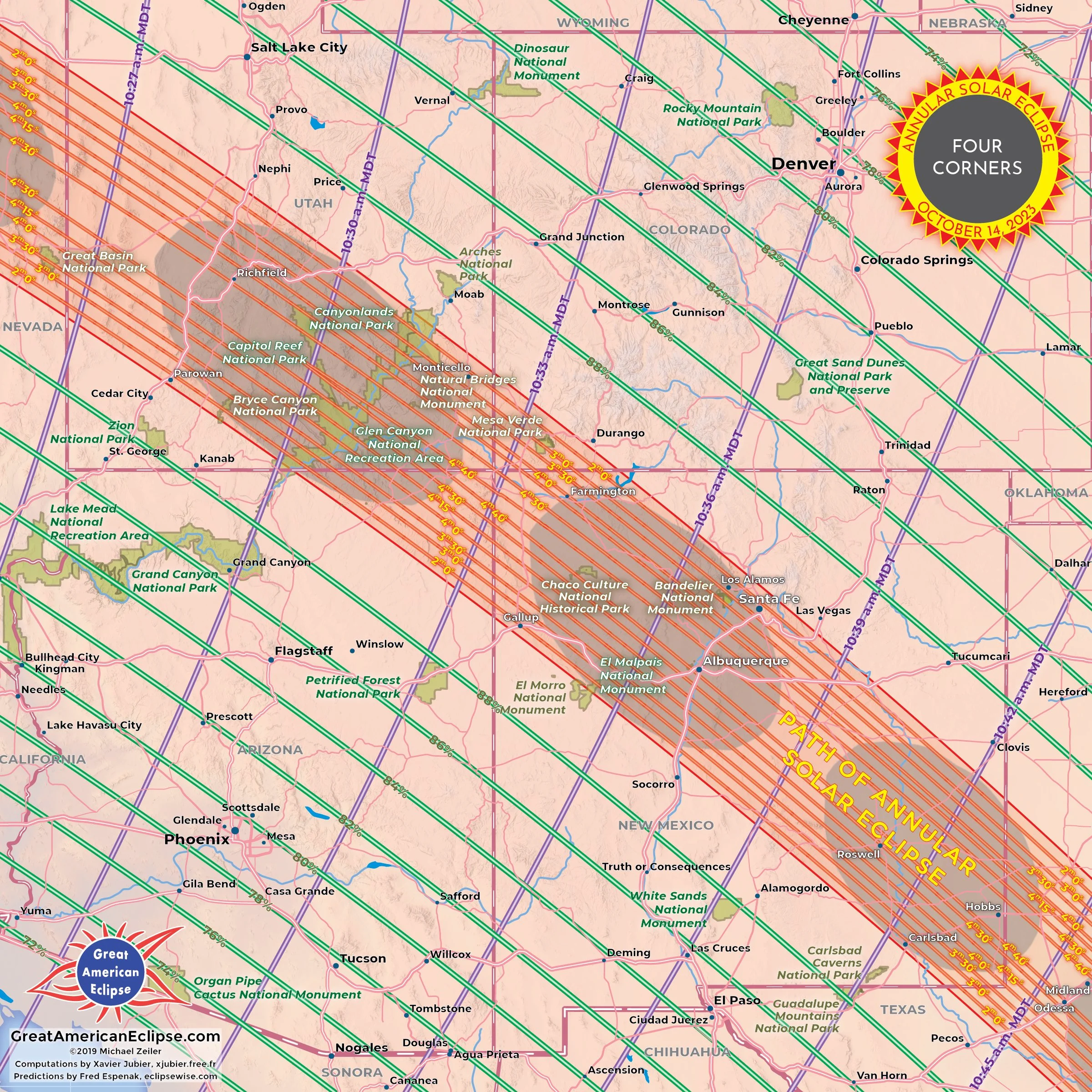
Utah, Arizona, Colorado, New Mexico
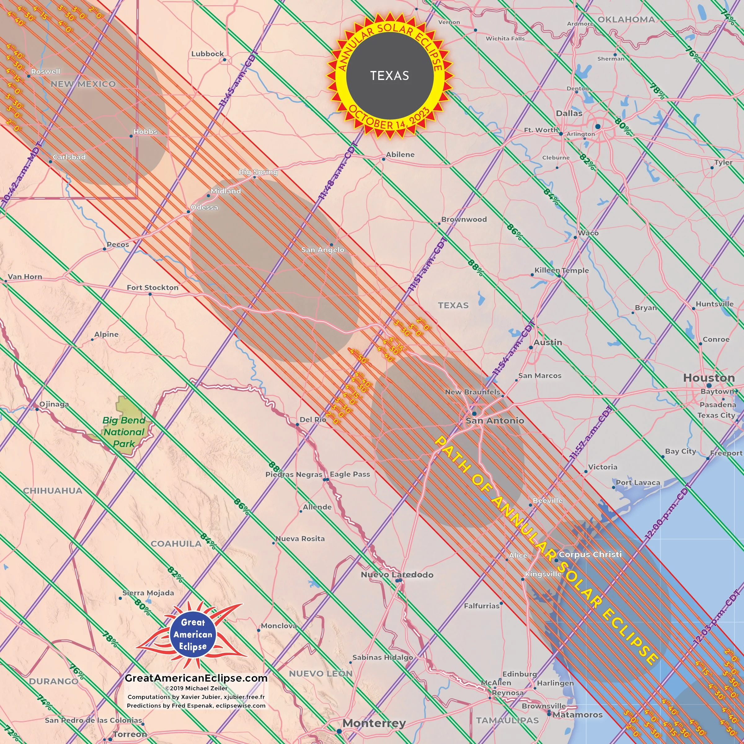
Texas
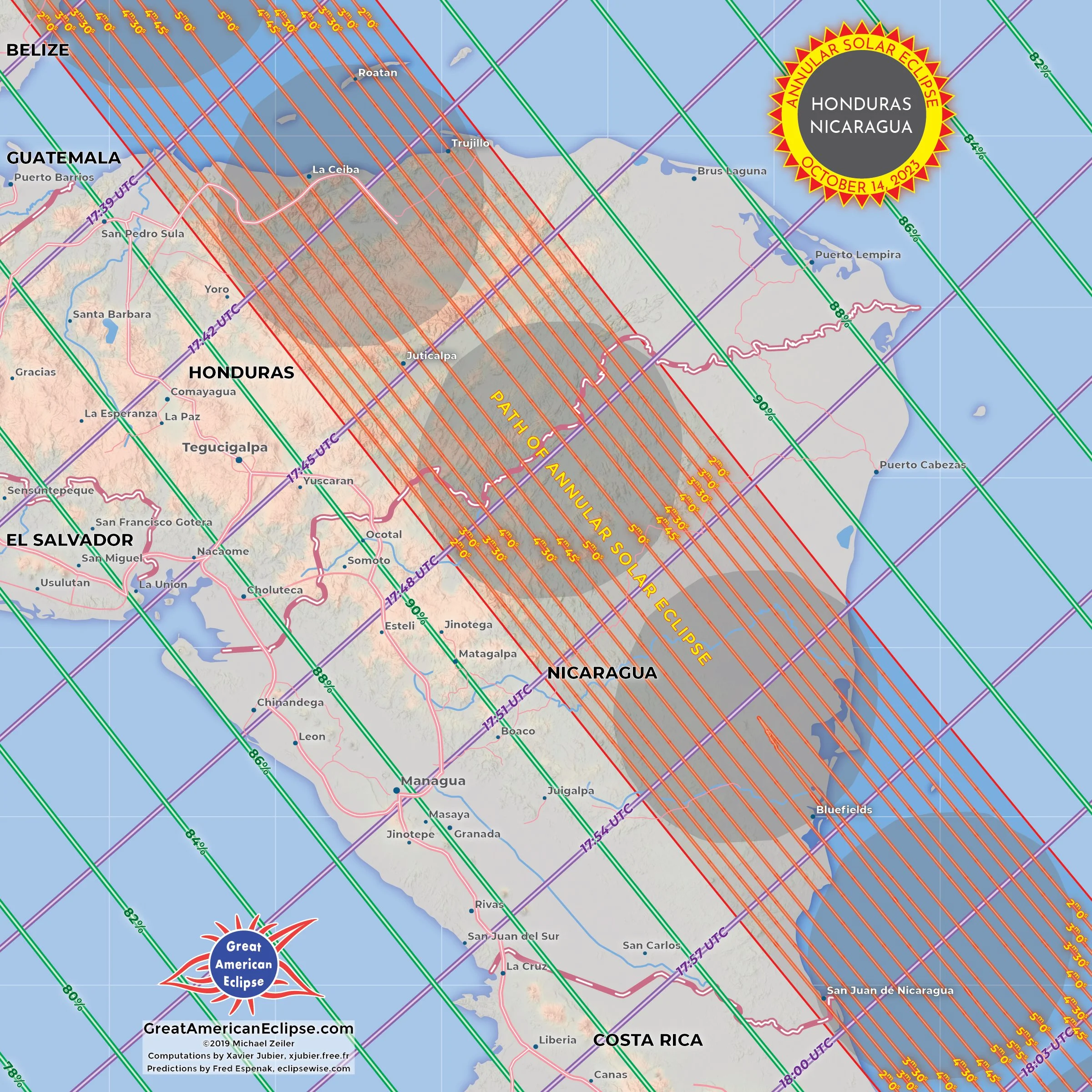
Honduras, Nicaragua
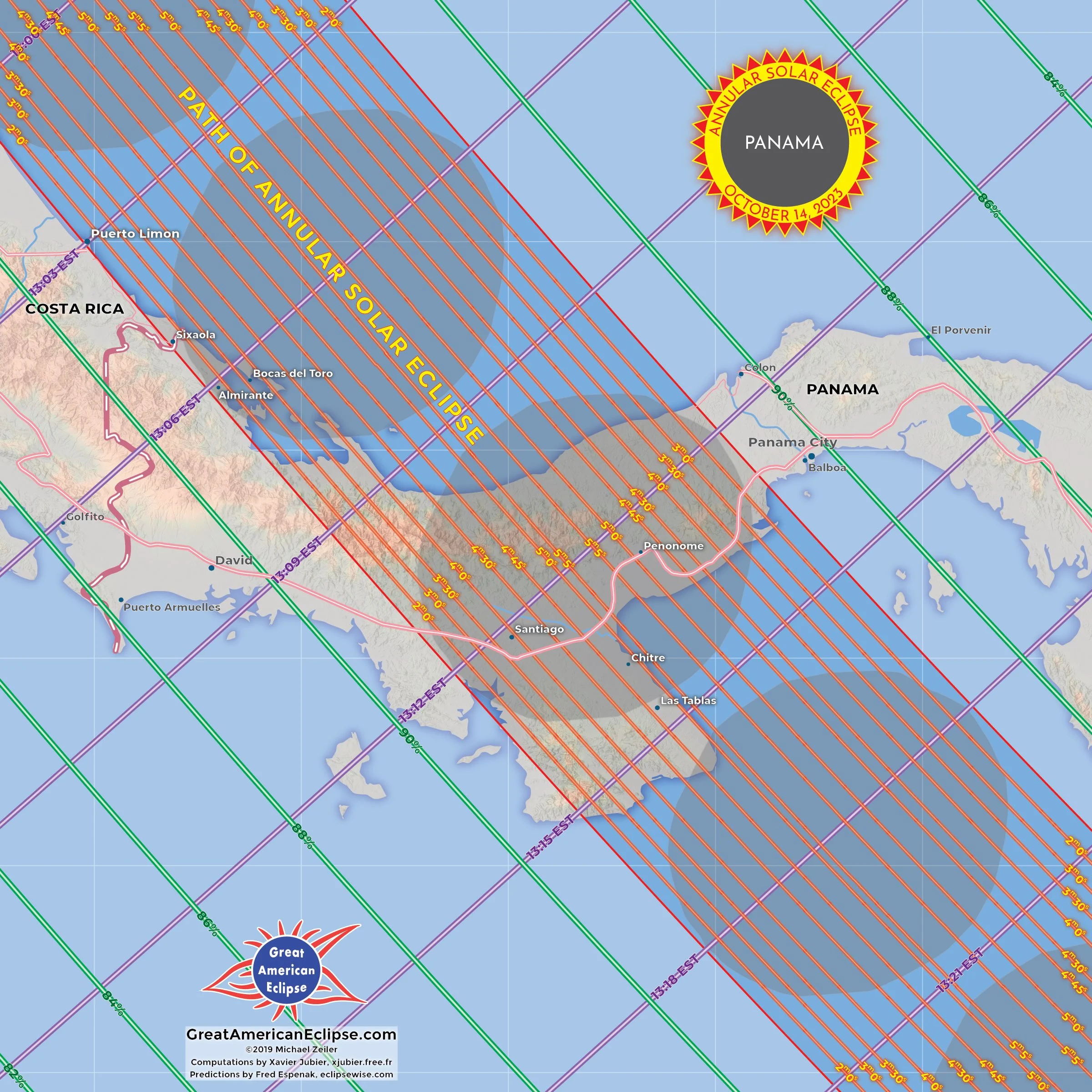
Panama
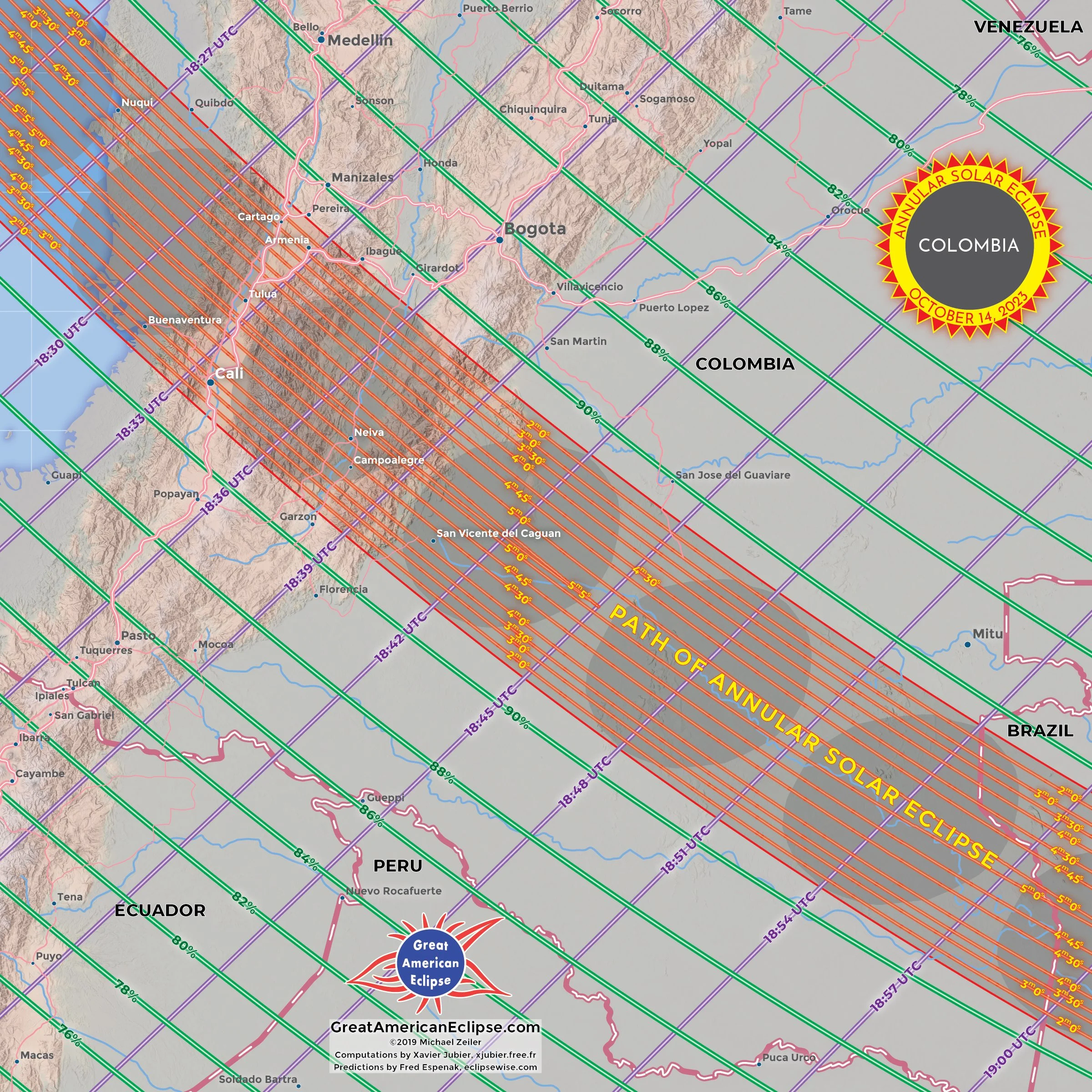
Colombia
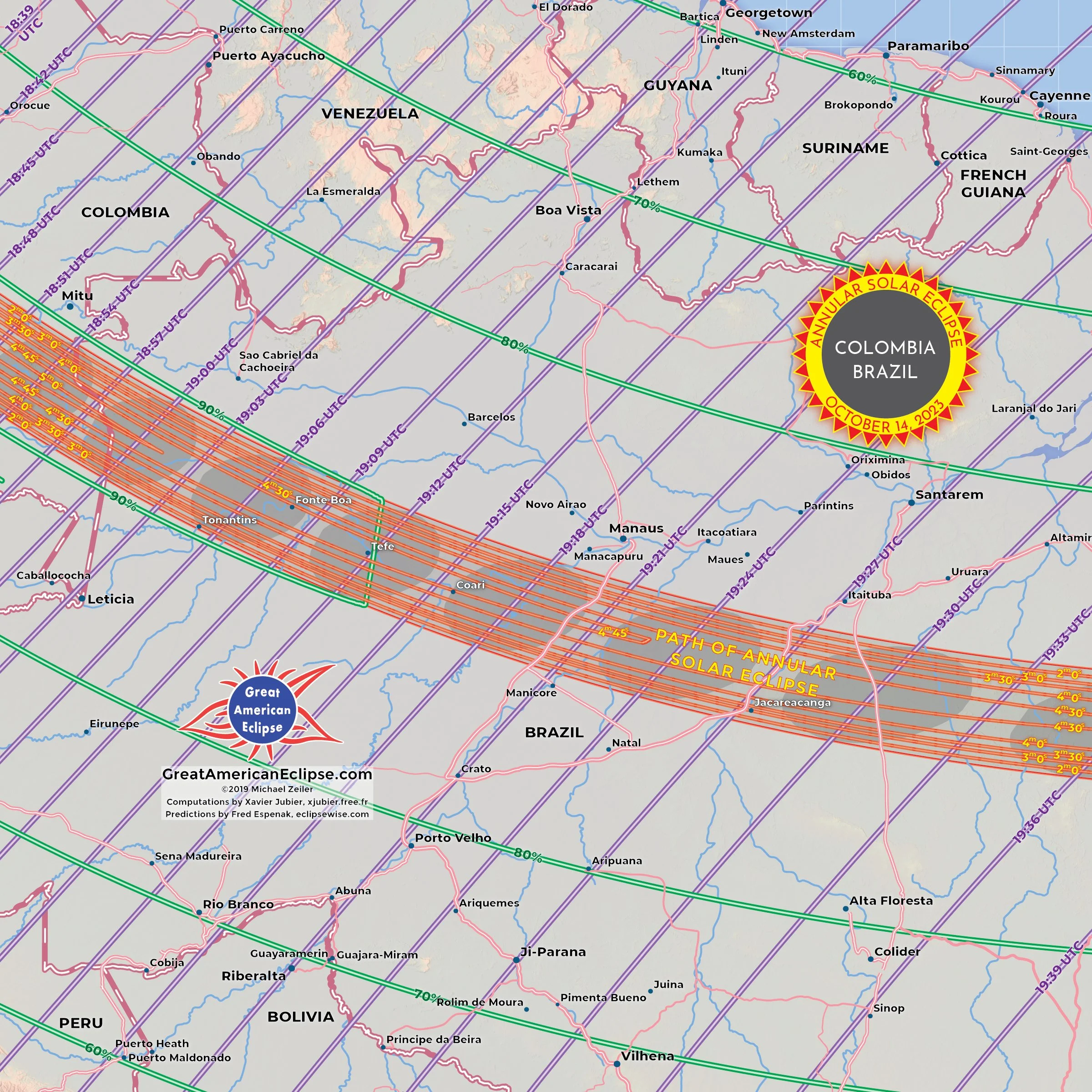
Western Brazil
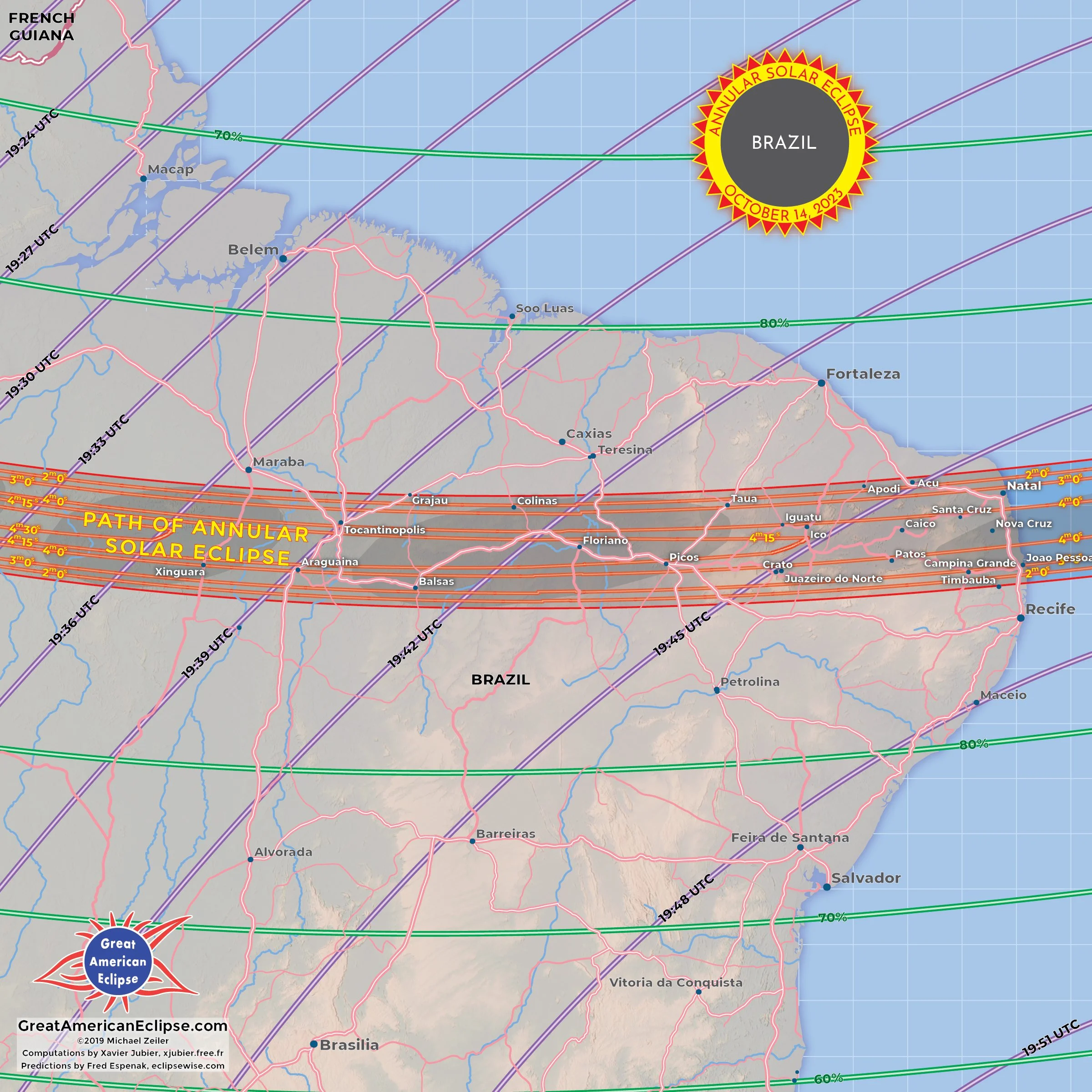
Eastern Brazil
Population and visitors to the annular solar eclipse
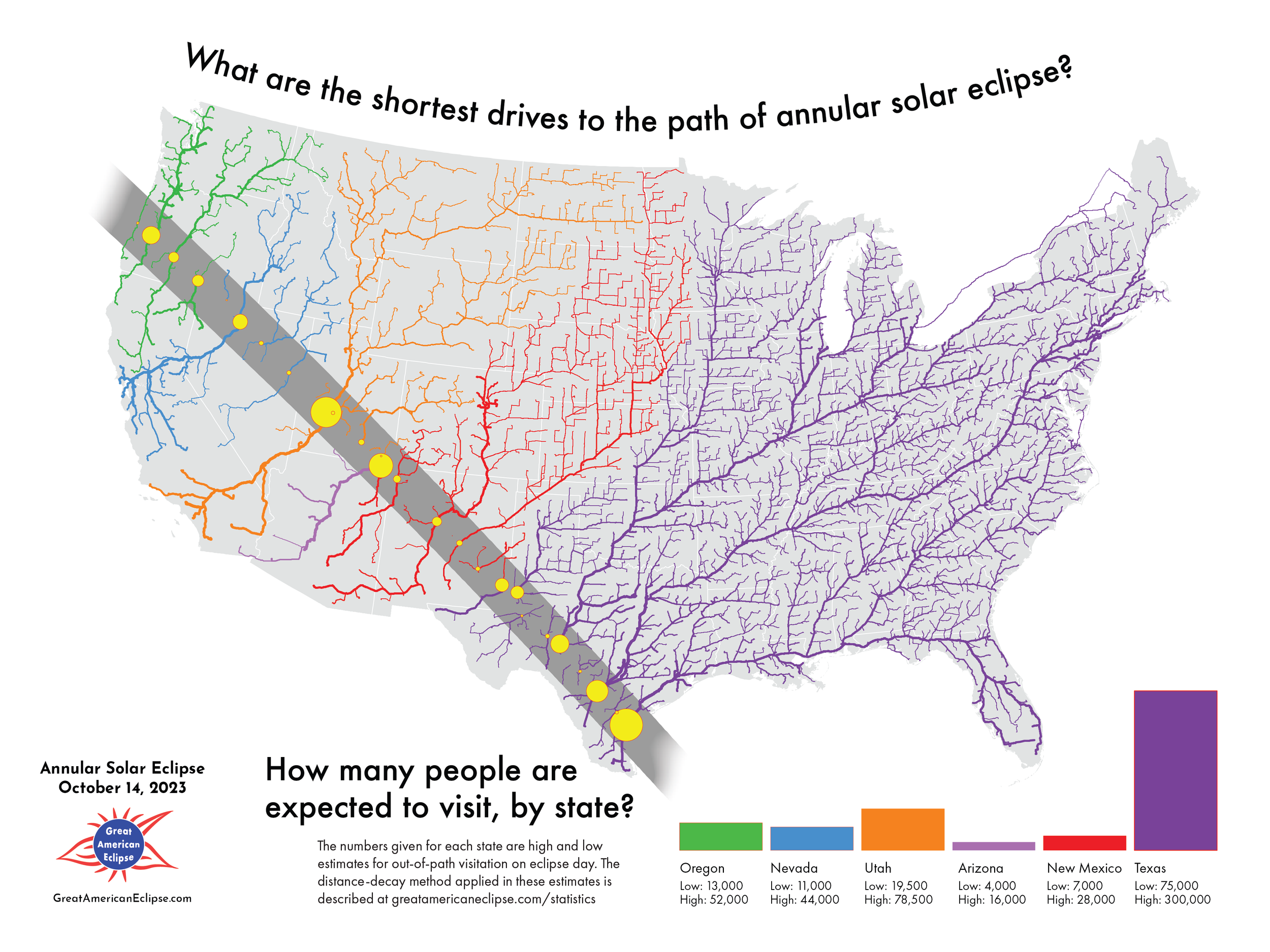
How many people are expected to visit, by state?
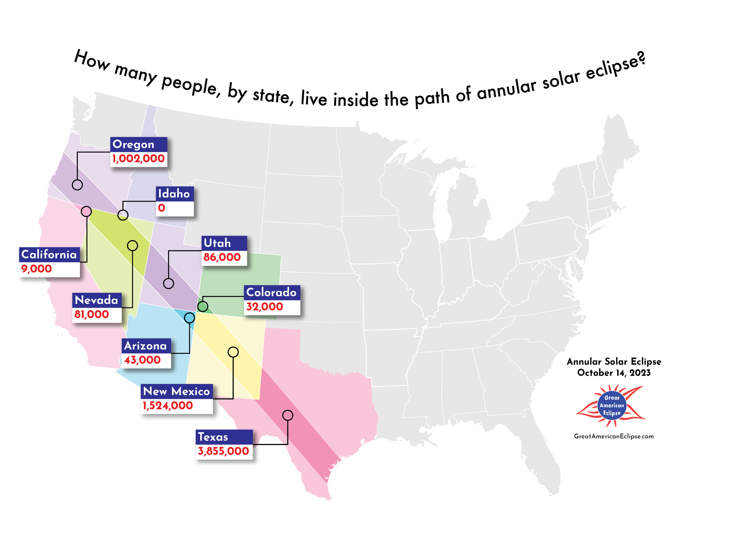
How many people, by state, live inside the path of annular solar eclipse?
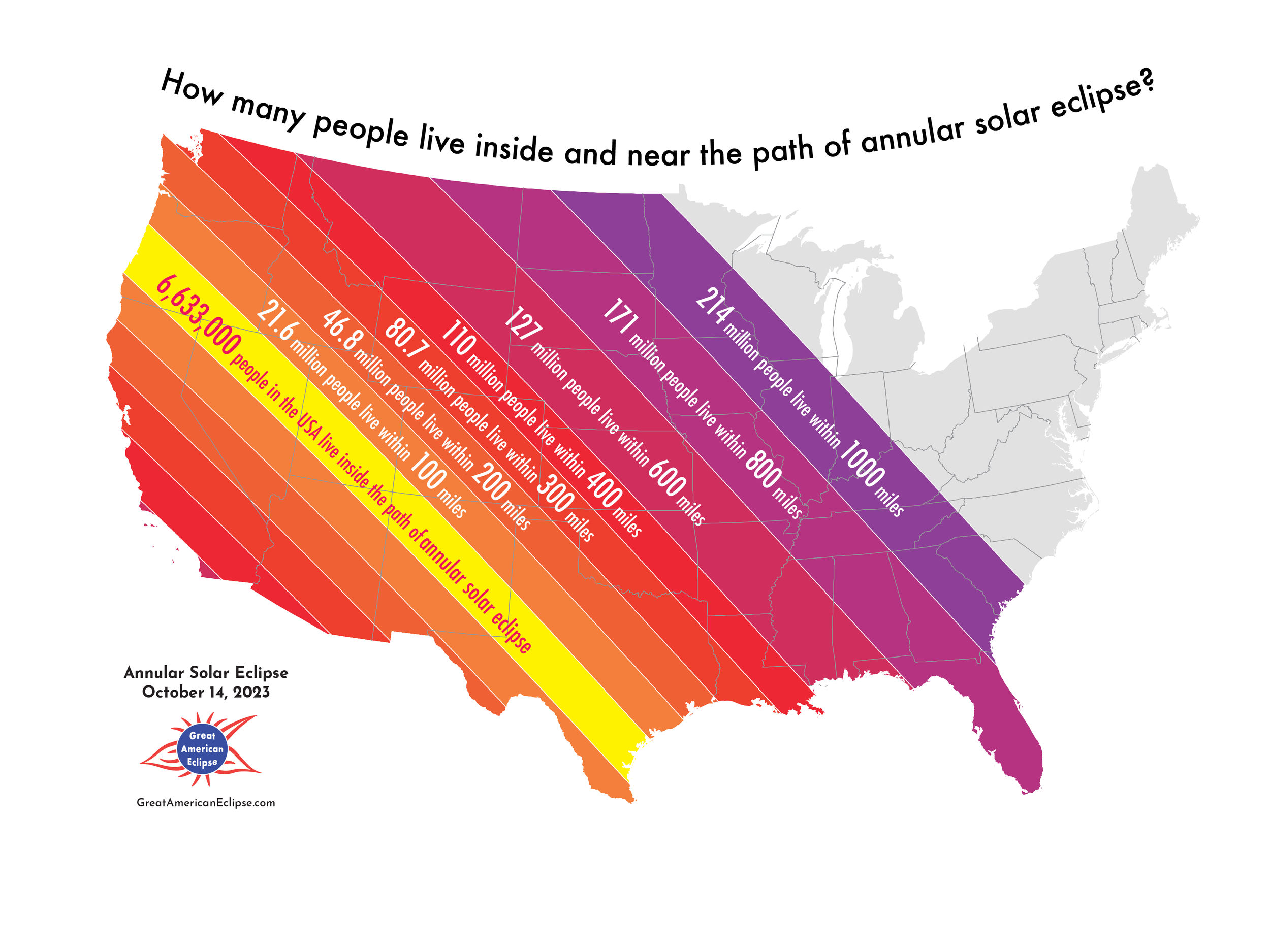
How many people live inside and near the path of annular solar eclipse?
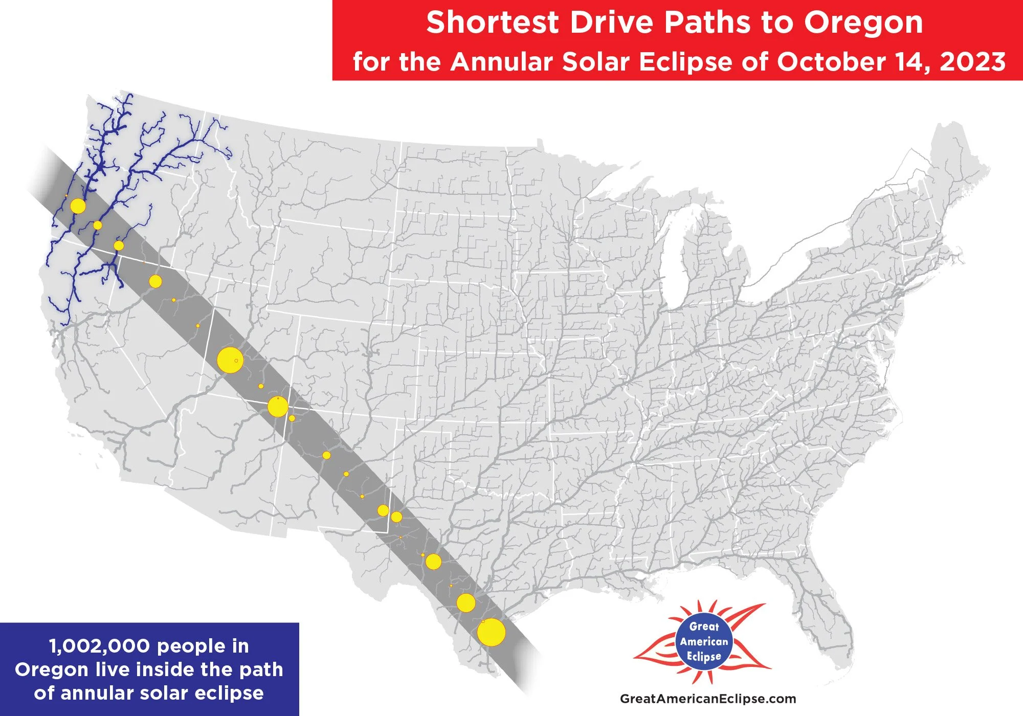
Shortest drive paths to Oregon
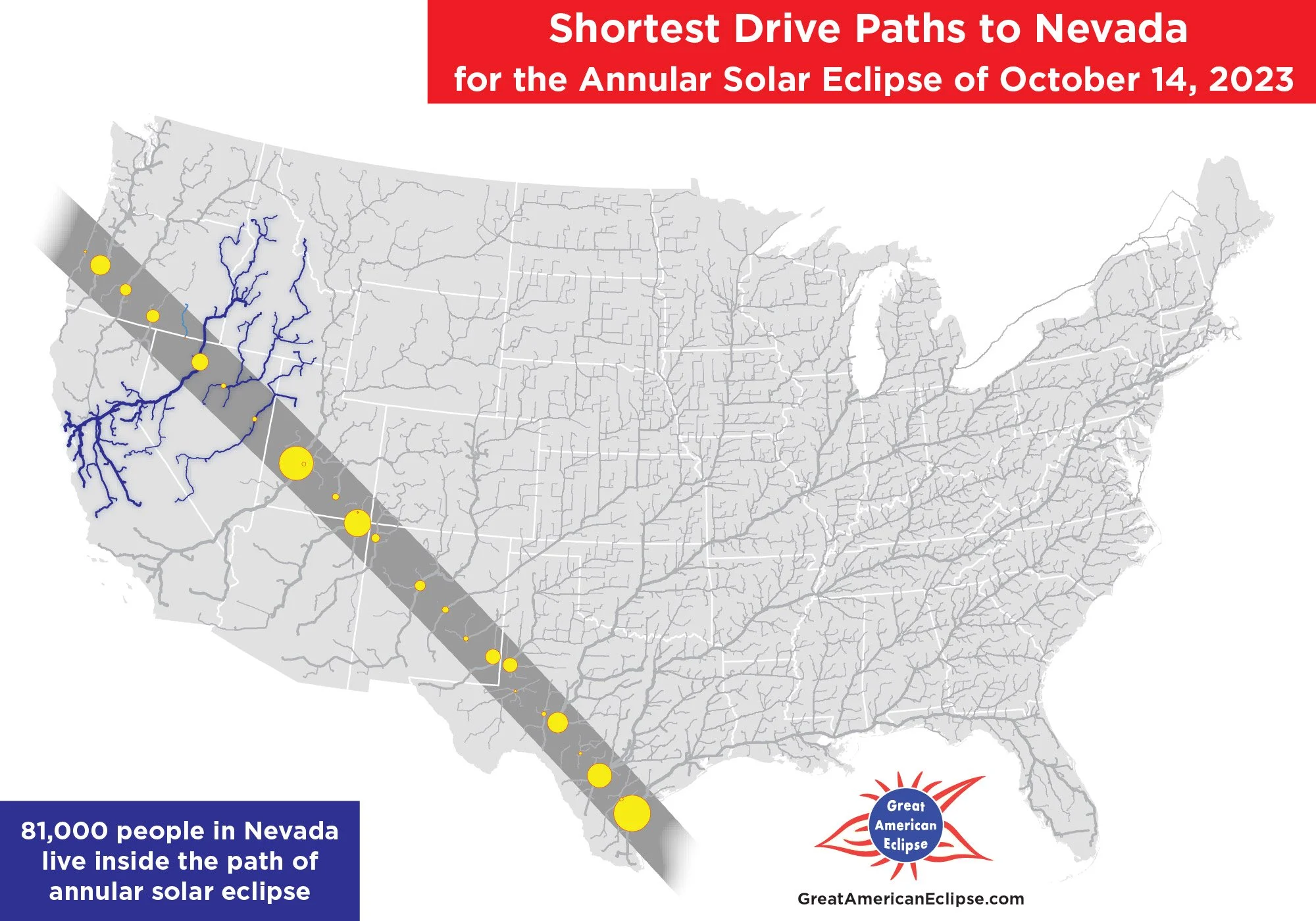
Shortest drive paths to Nevada
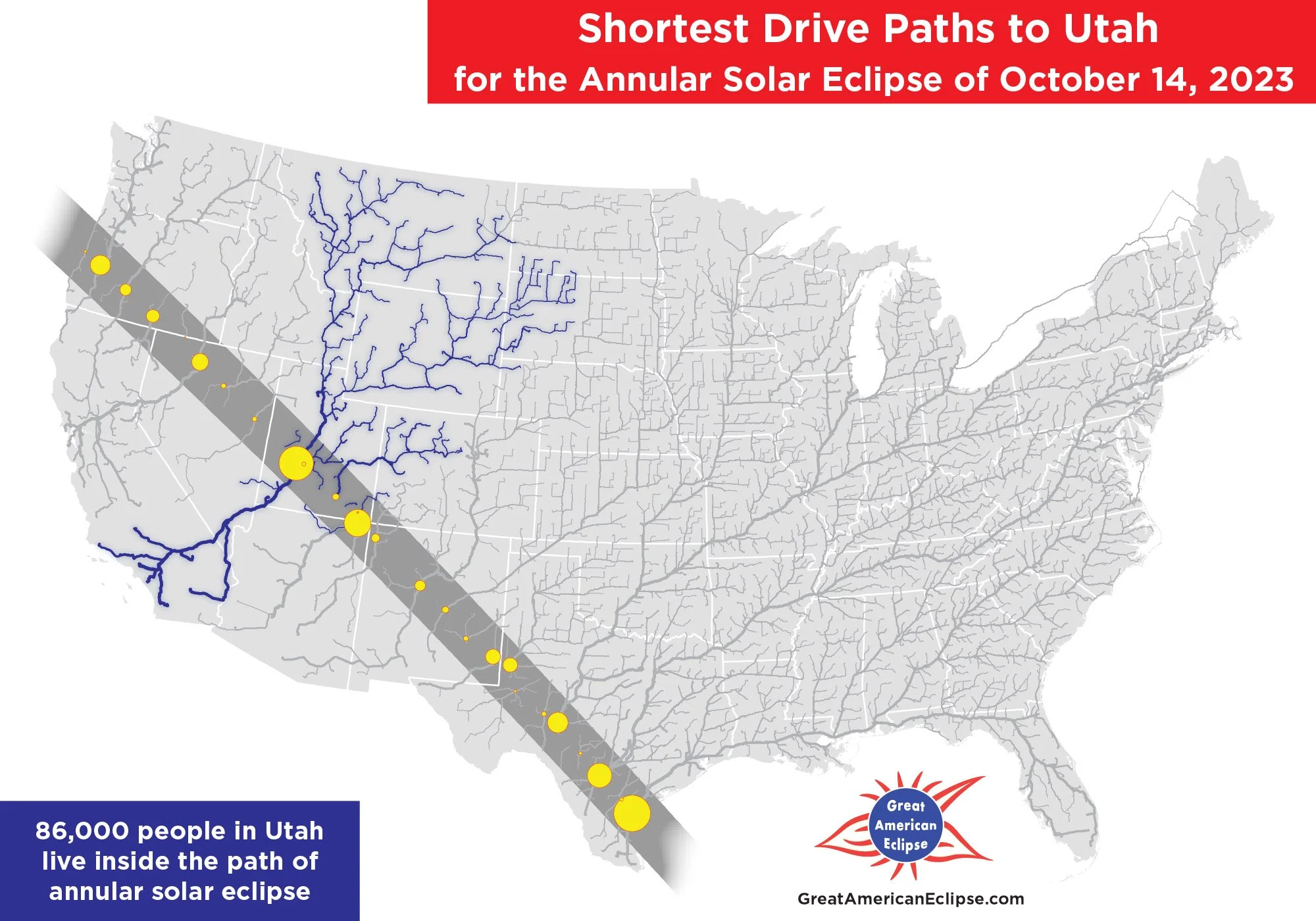
Shortest drive paths to Utah
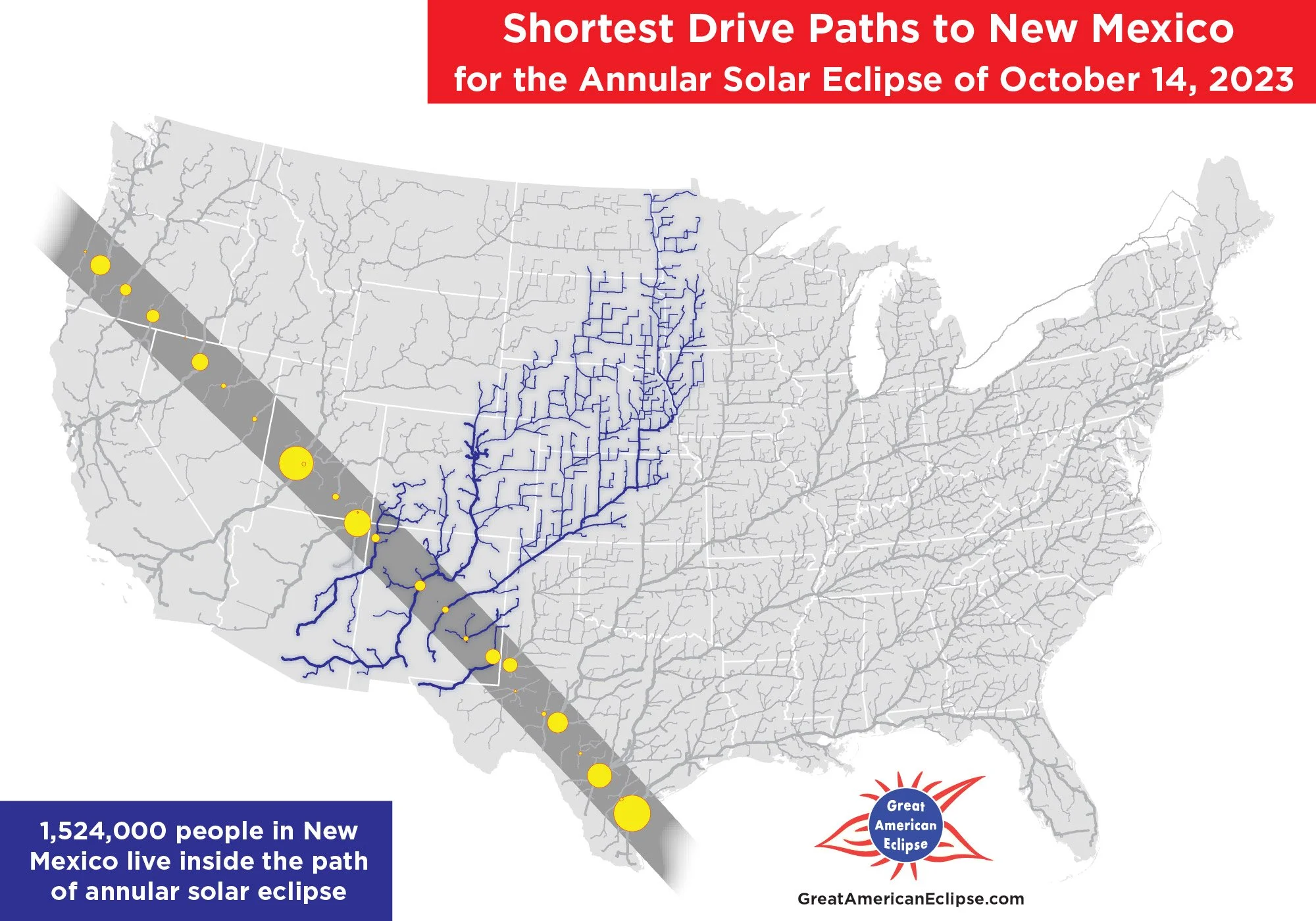
Shortest drive paths to New Mexico
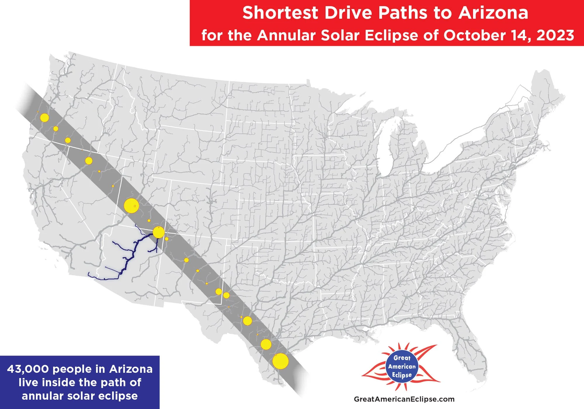
Shortest drive paths to Arizona
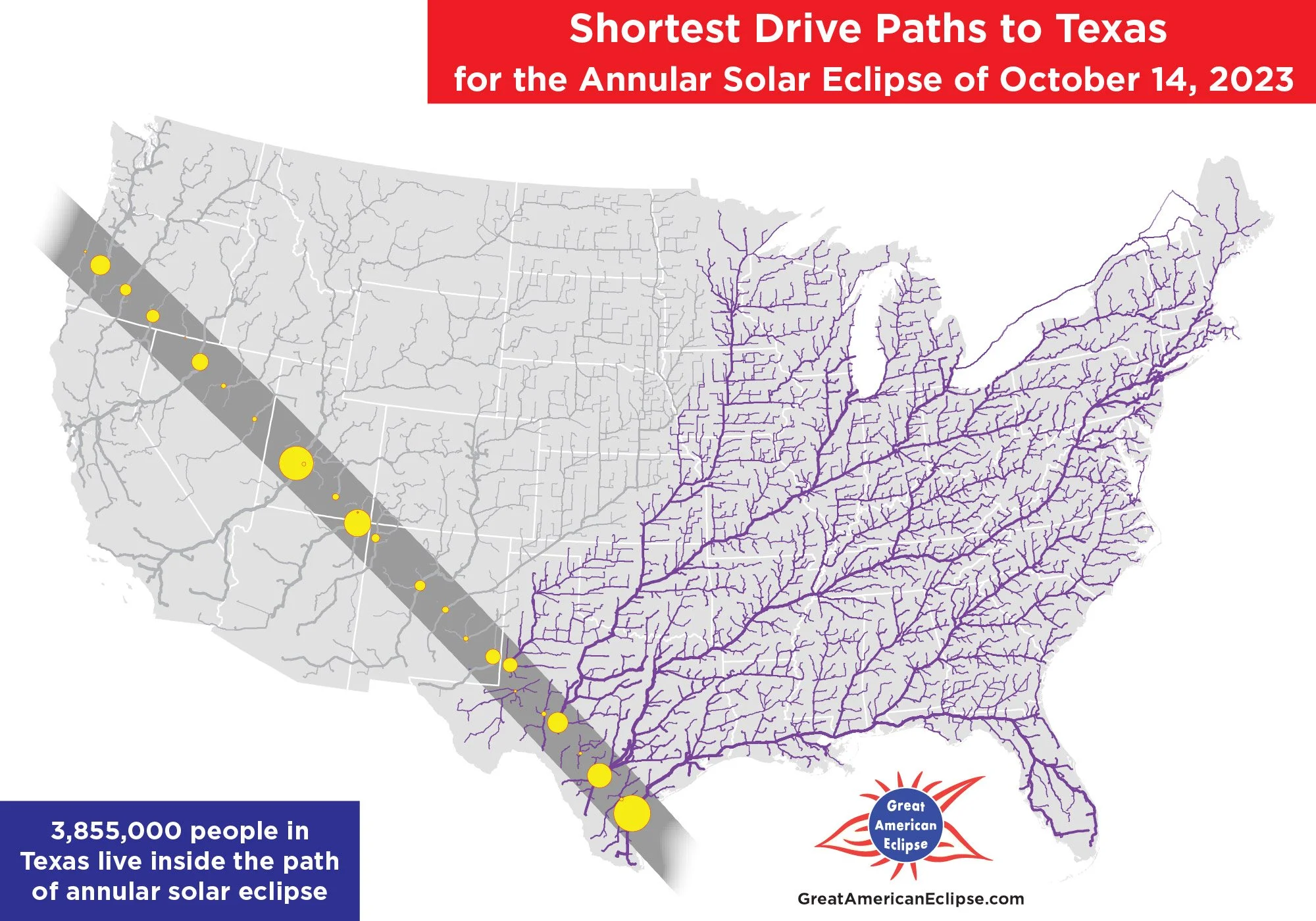
Shortest drive paths to Texas
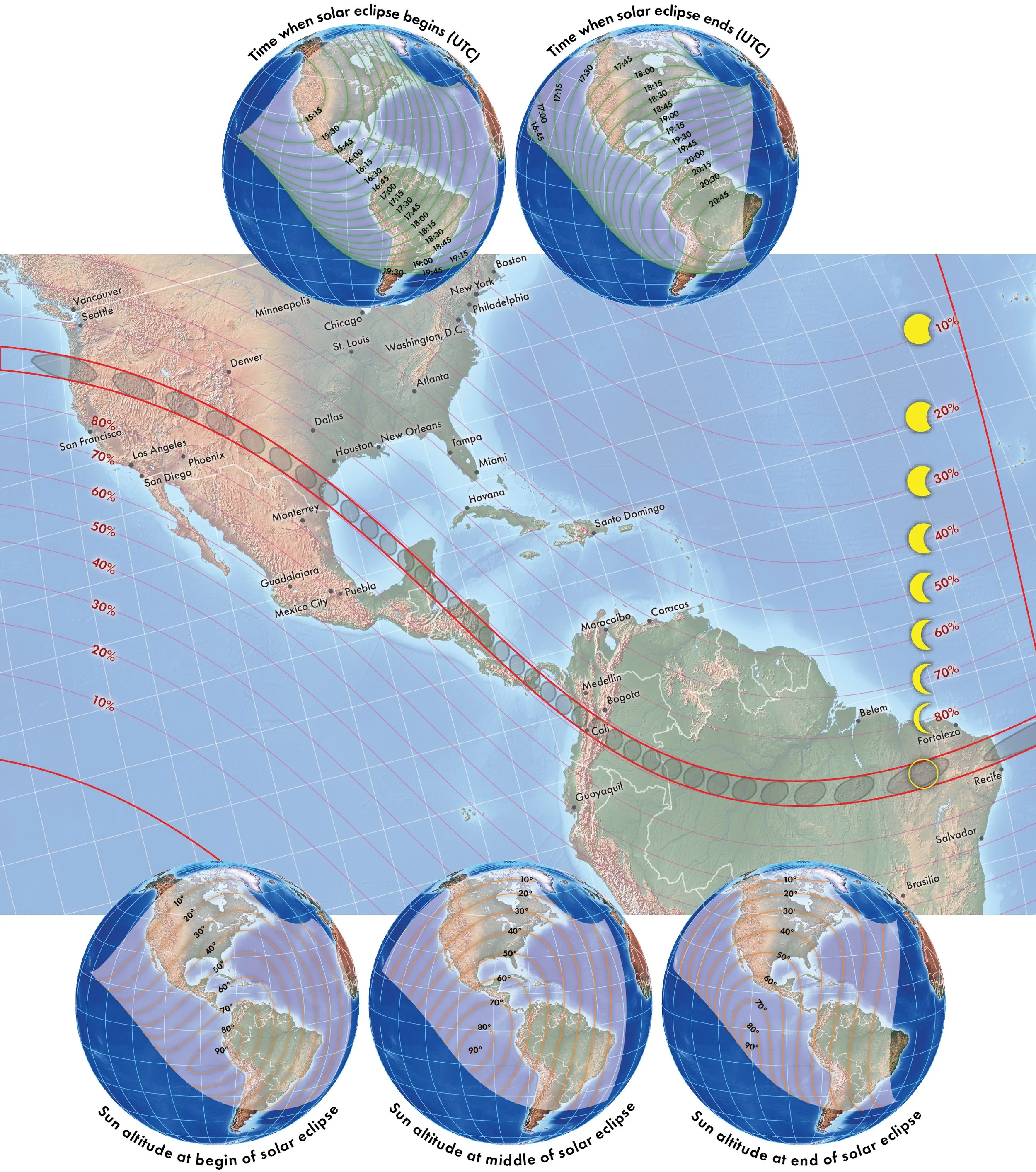
Eclipse circumstances of the annular solar eclipse
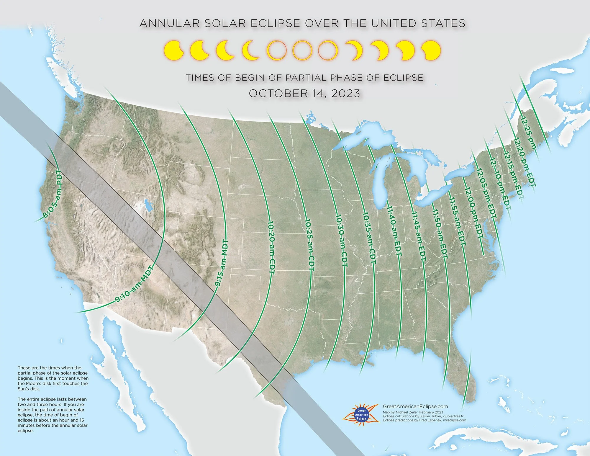
Times of begin of partial phase of eclipse
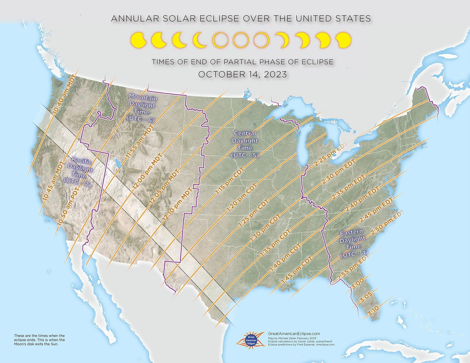
Times of end of partial phase of eclipse
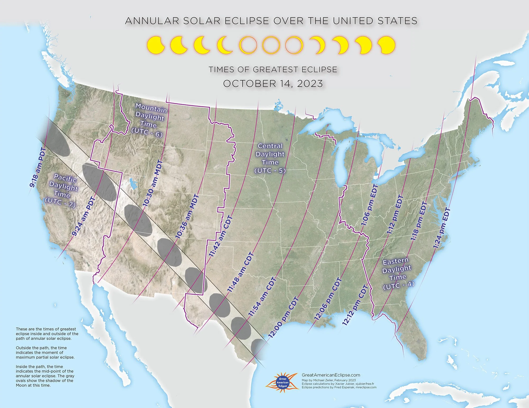
Times of greatest eclipse
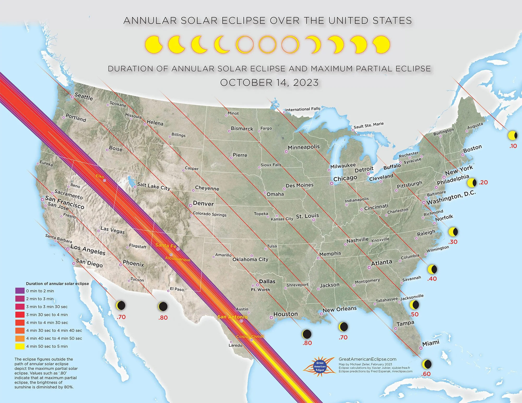
Duration of annular solar eclipse and maximum partial eclipse
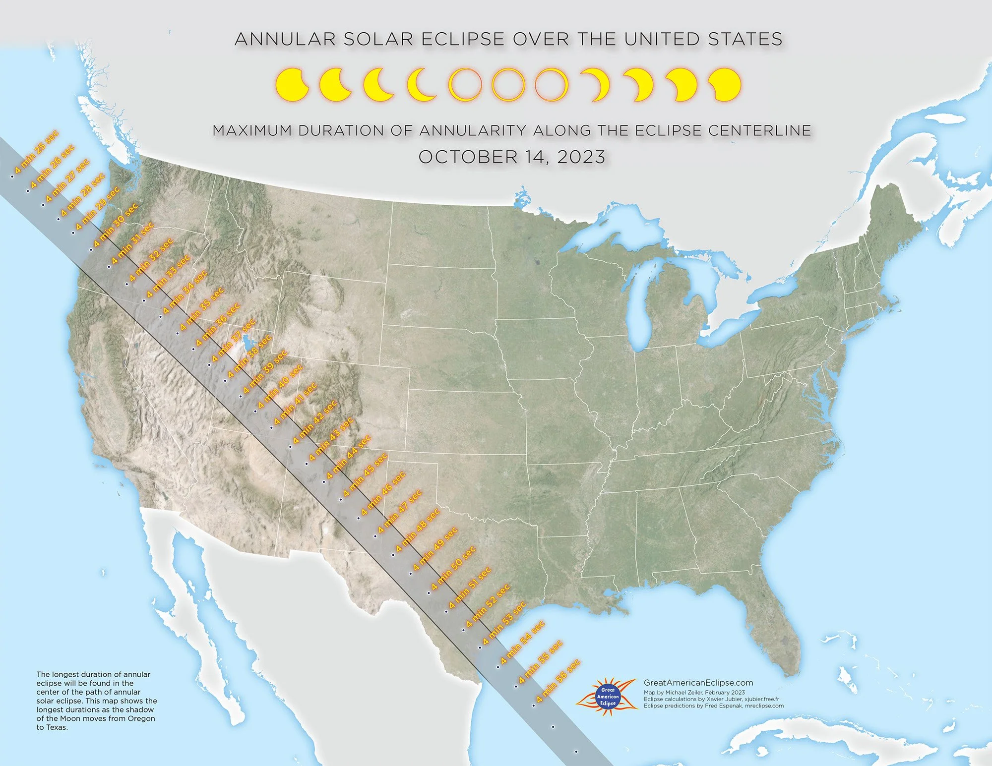
Maximum duration of angularity along the eclipse centerline
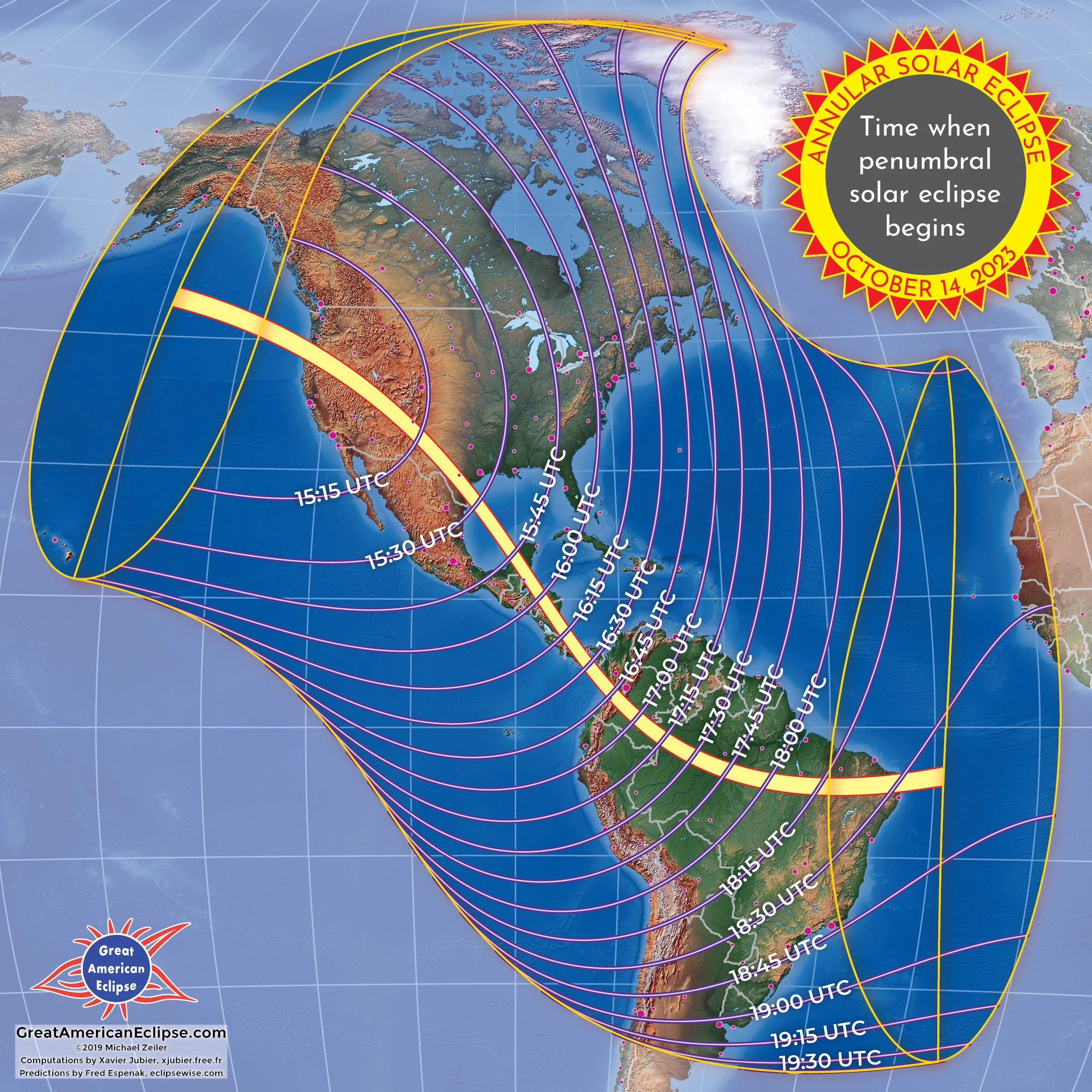
Time when penumbral solar eclipse begins
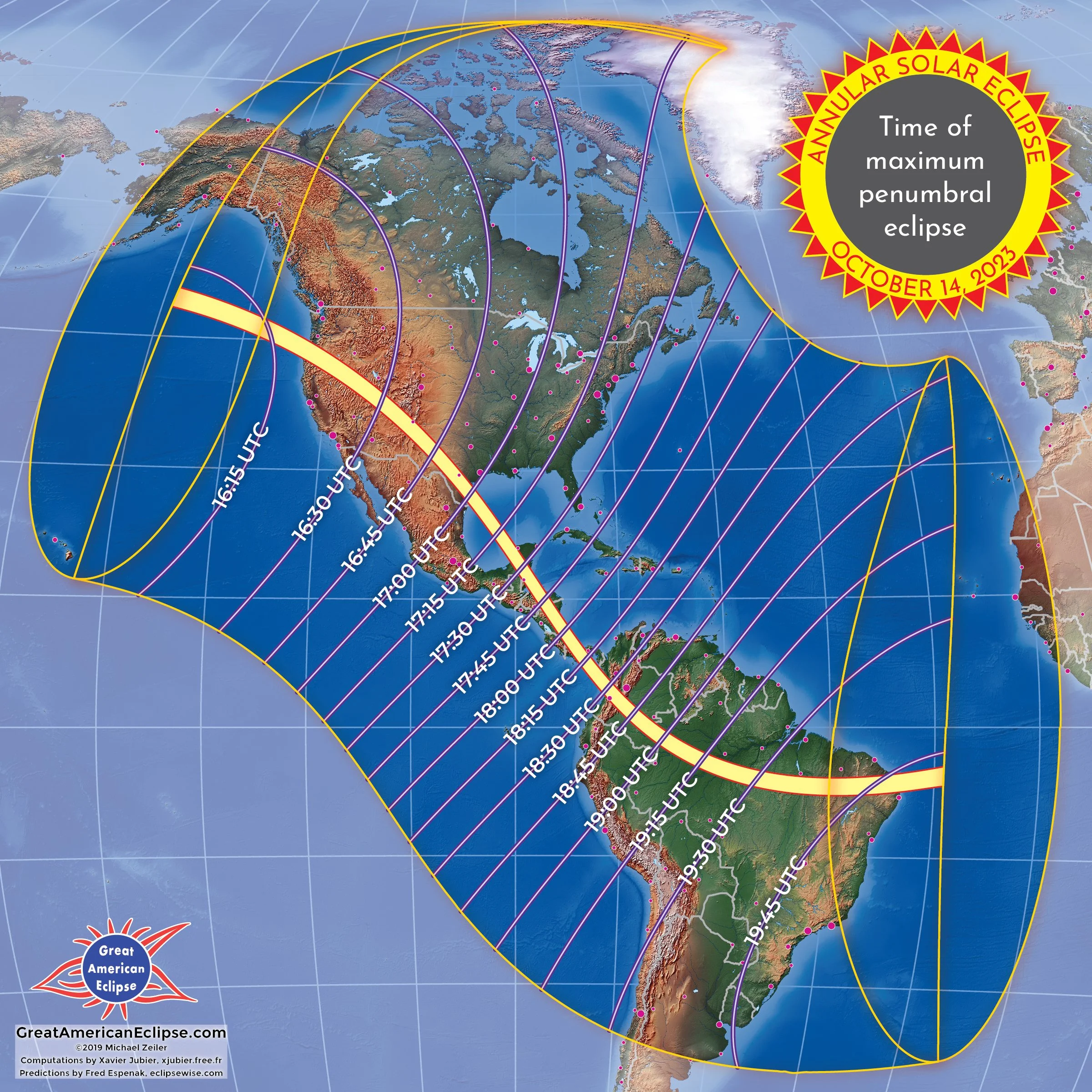
Time of maximum penumbral eclipse
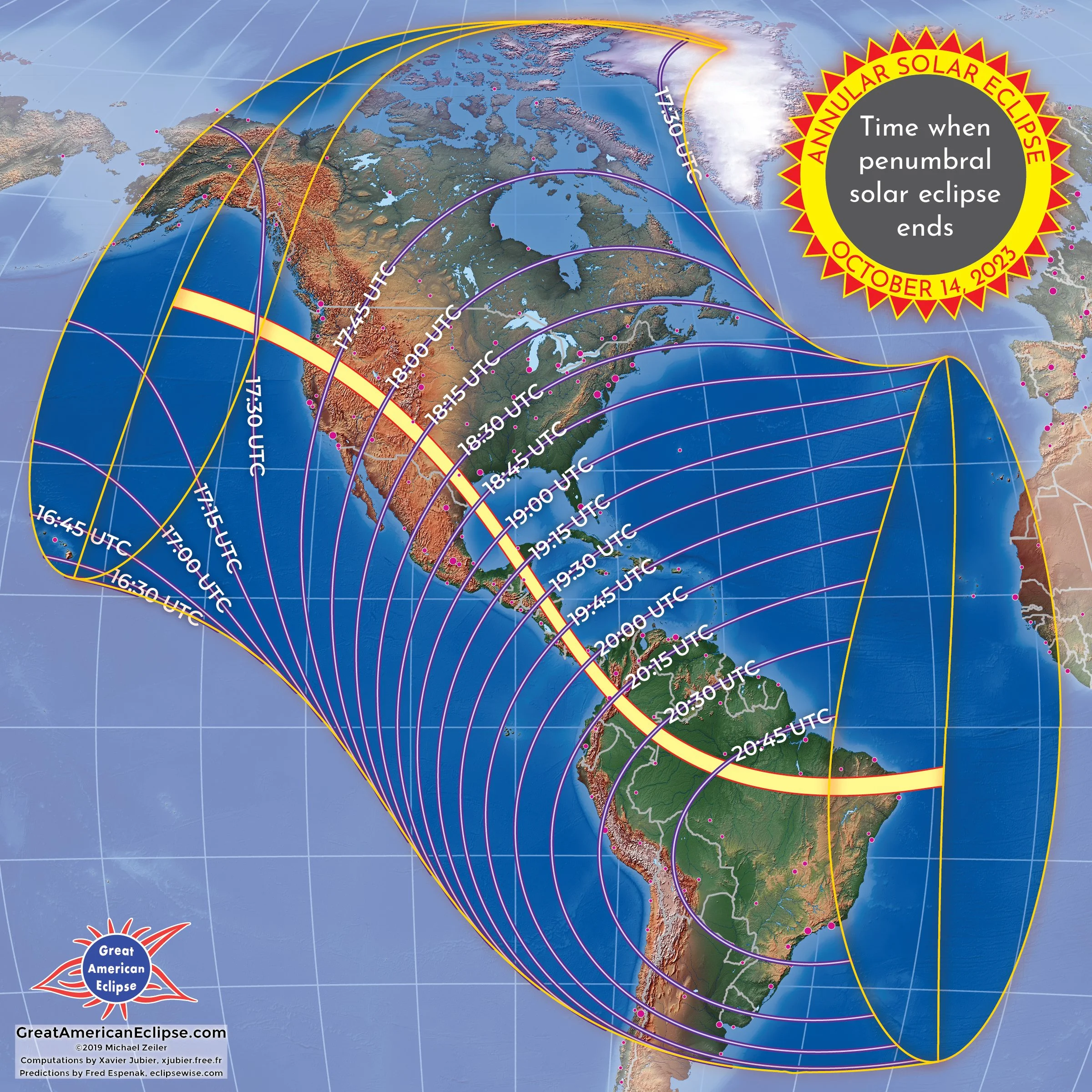
Time when penumbral solar eclipse ends
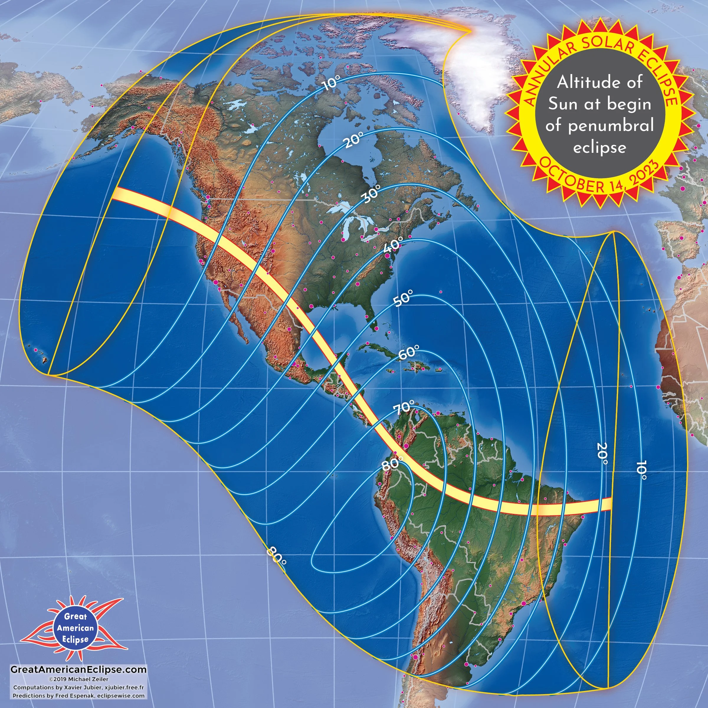
Altitude of Sun at begin of penumbral eclipse

Altitude of Sun at maximum penumbral eclipse

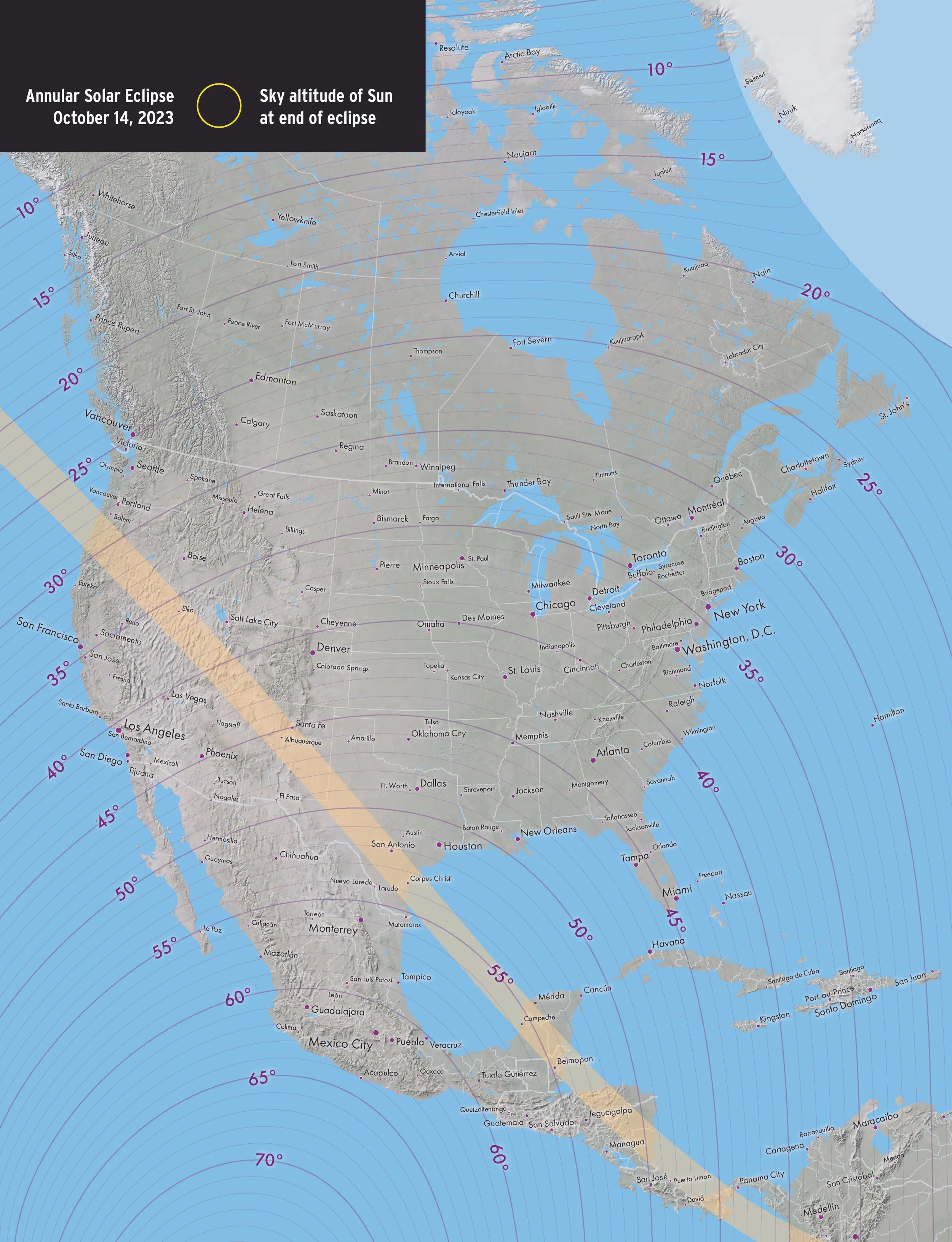
Altitude of Sun at end of penumbral eclipse
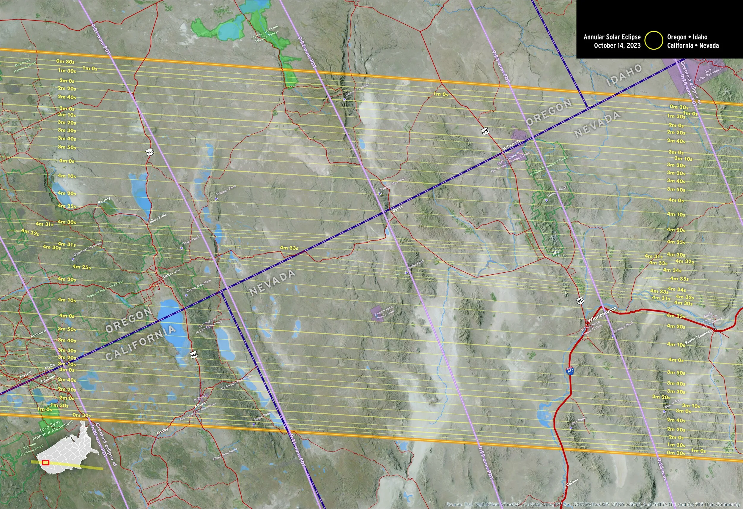
Detail maps of the annular solar eclipse
These maps were published in our Field Guide to the 2023 and 2024 Solar Eclipses by Michael Zeiler and Michael Bakich
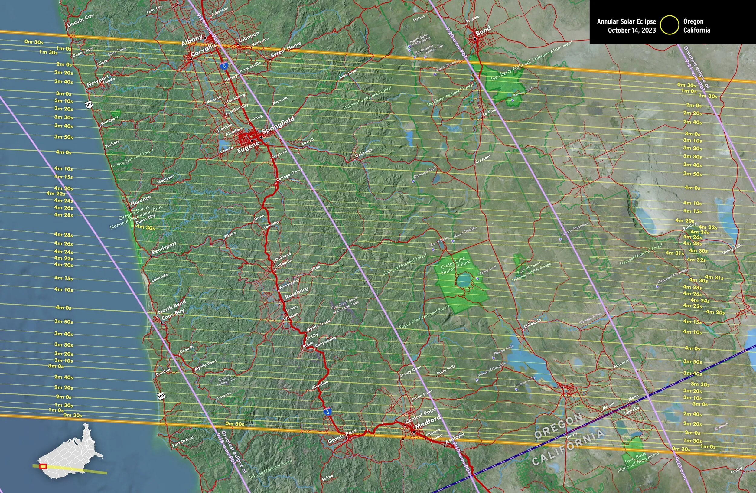
Oregon, California
Nevada, Utah, California, Nevada
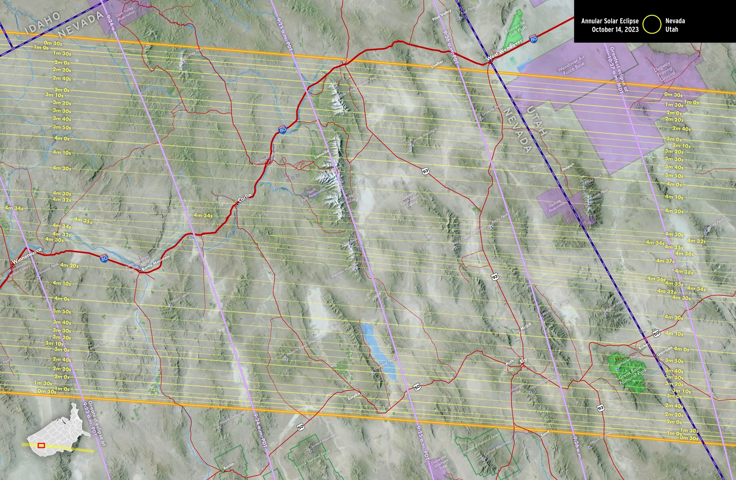
Nevada, Utah
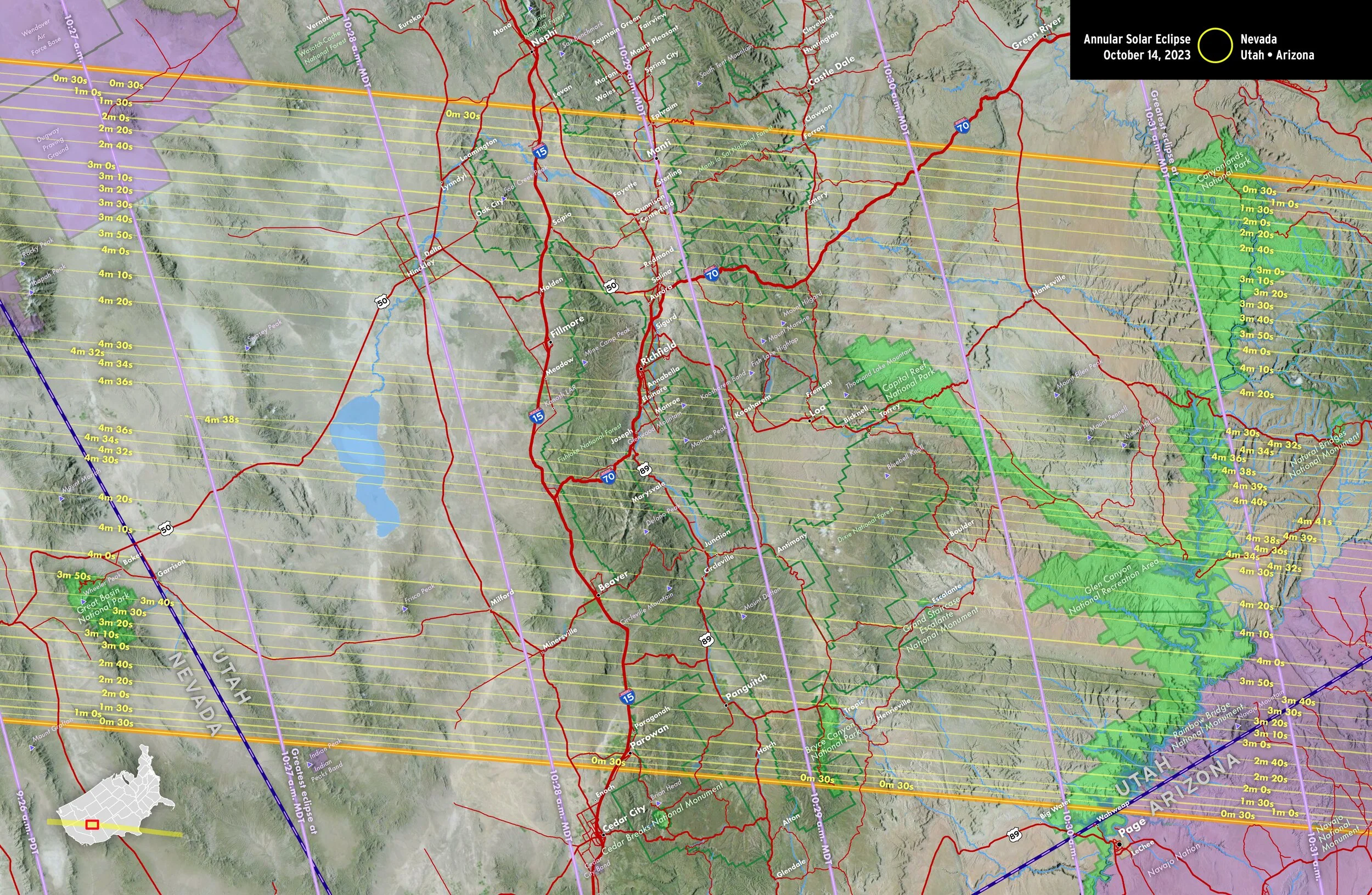
Nevada, Utah, Arizona
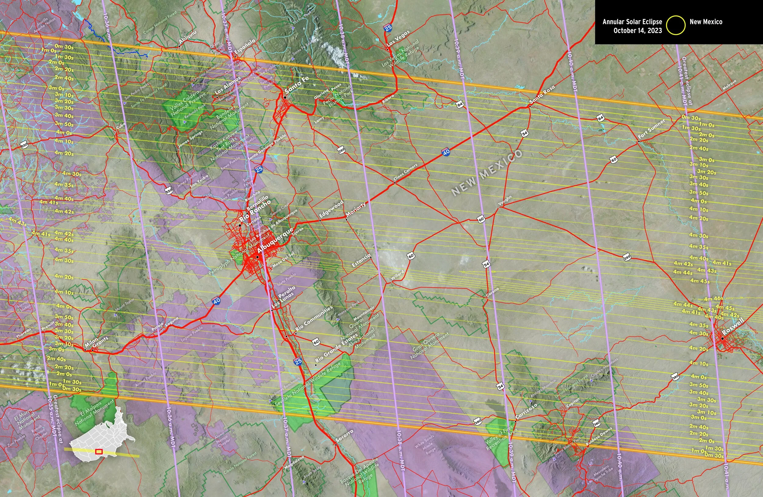
New Mexico
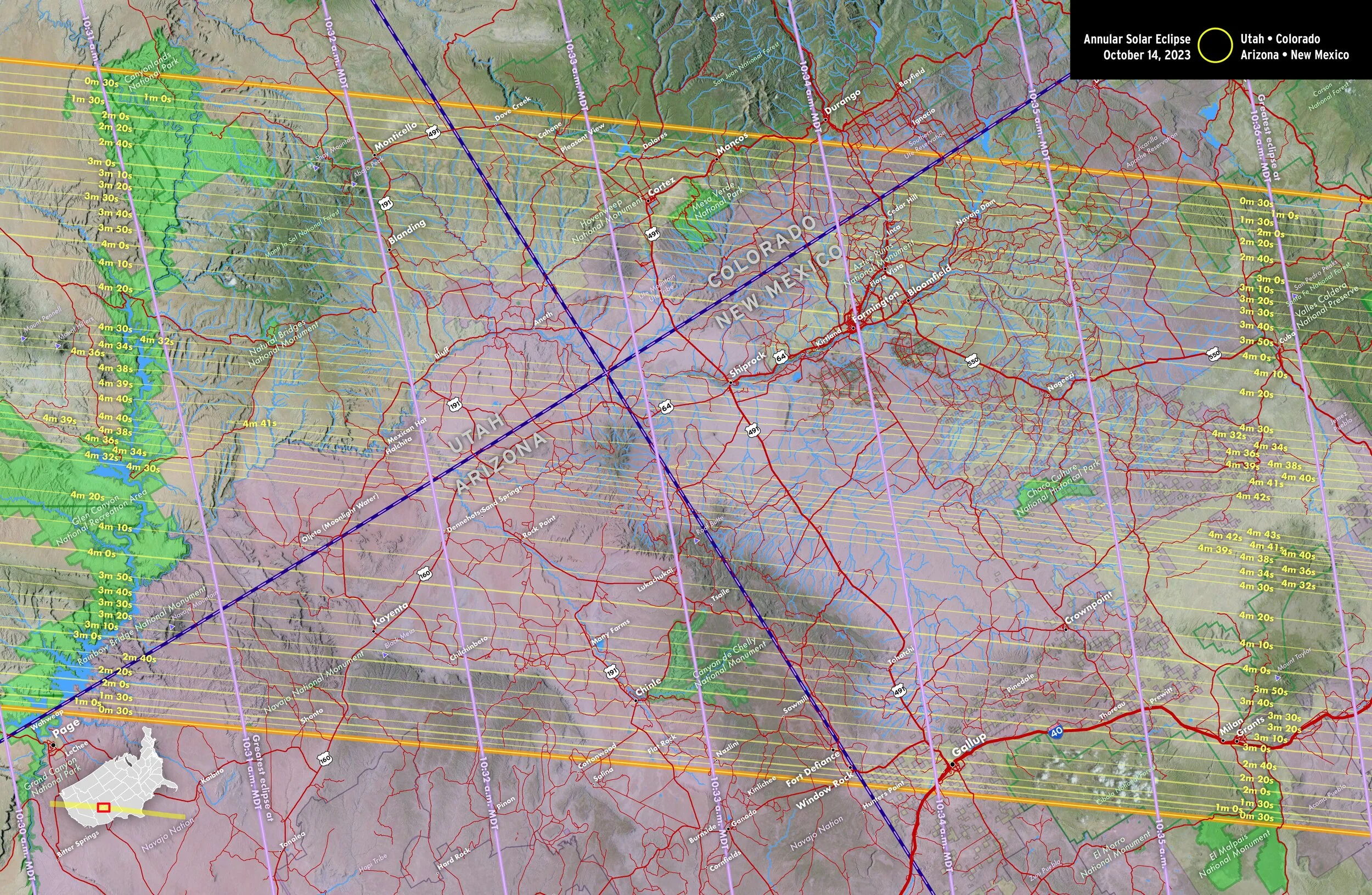
Utah, Colorado, Arizona, New Mexico
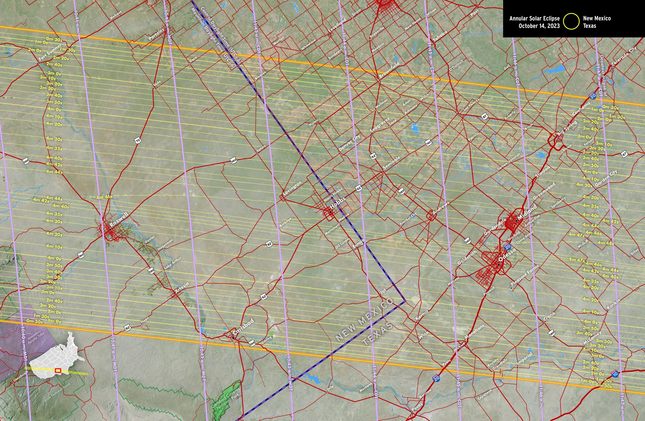
New Mexico, Texas

New Mexico, Texas
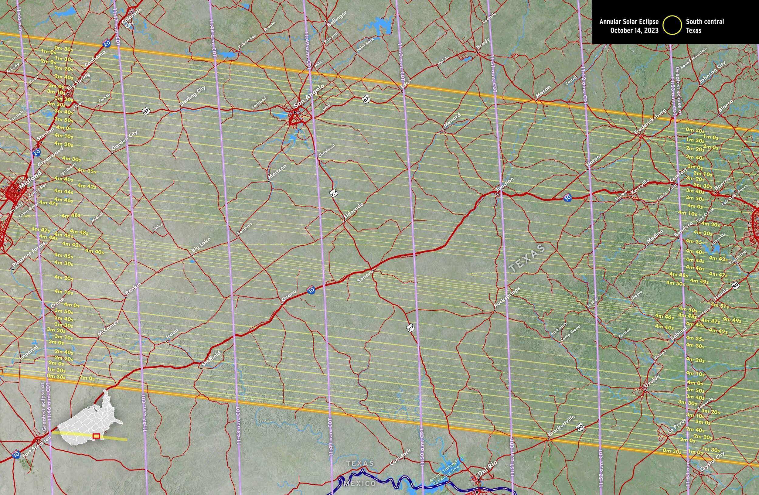
South central Texas
Duration, obscuration, times, and sky altitudes of eclipse
Duration of annularity and obscuration
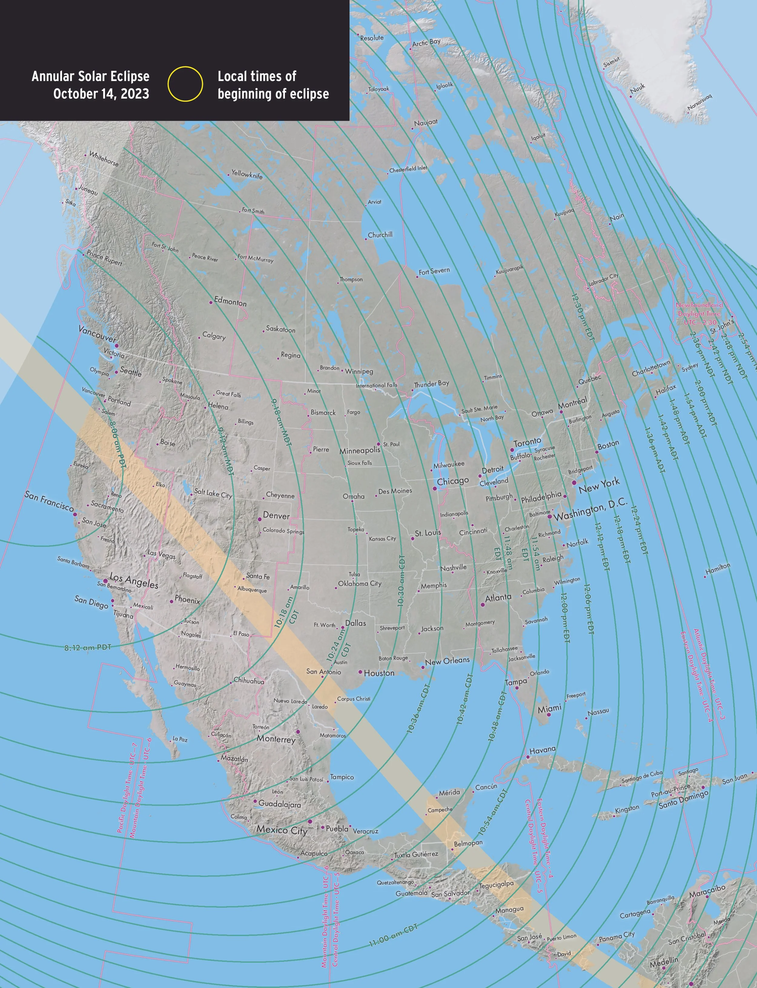
Local times of beginning of eclipse
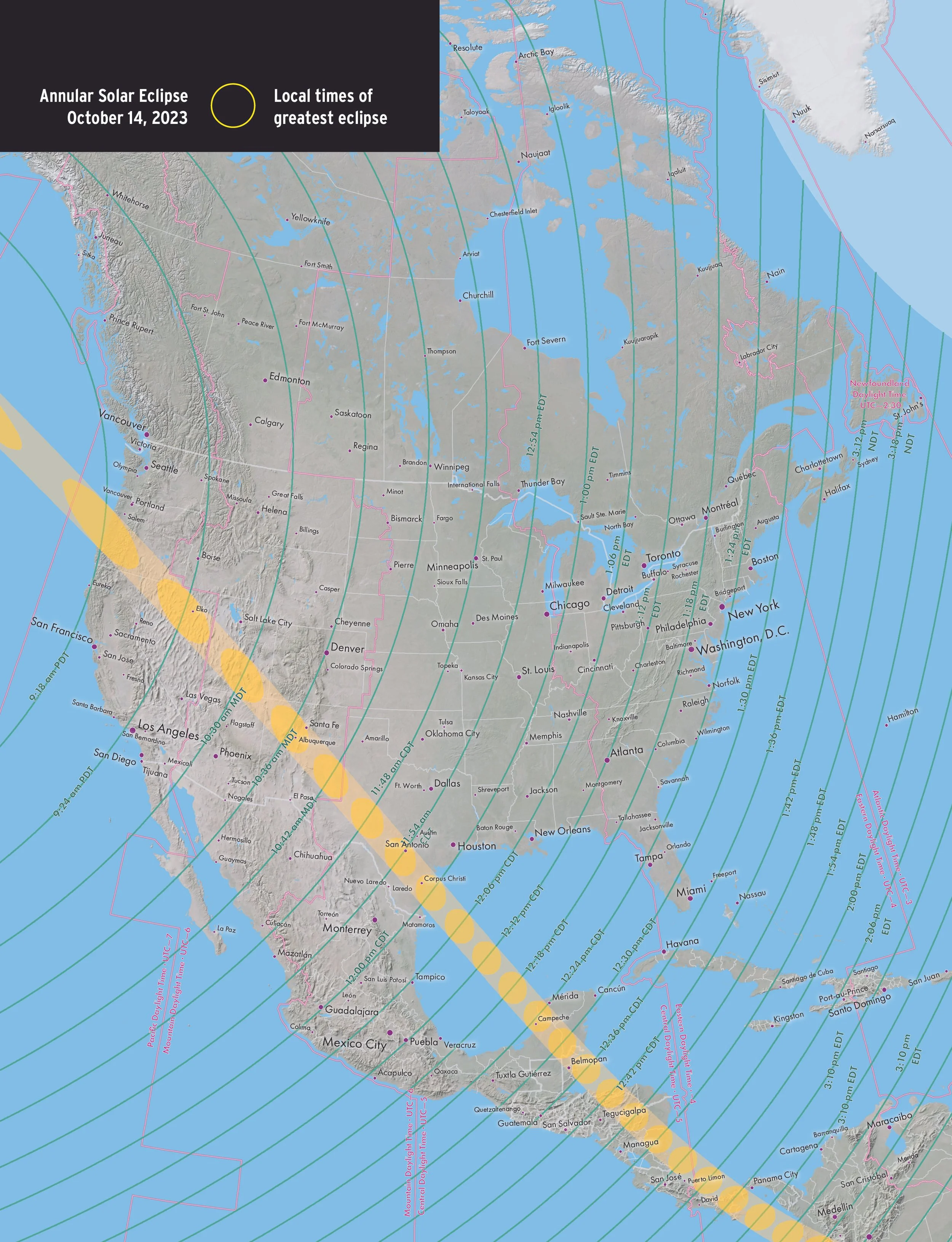
Local times of greatest eclipse
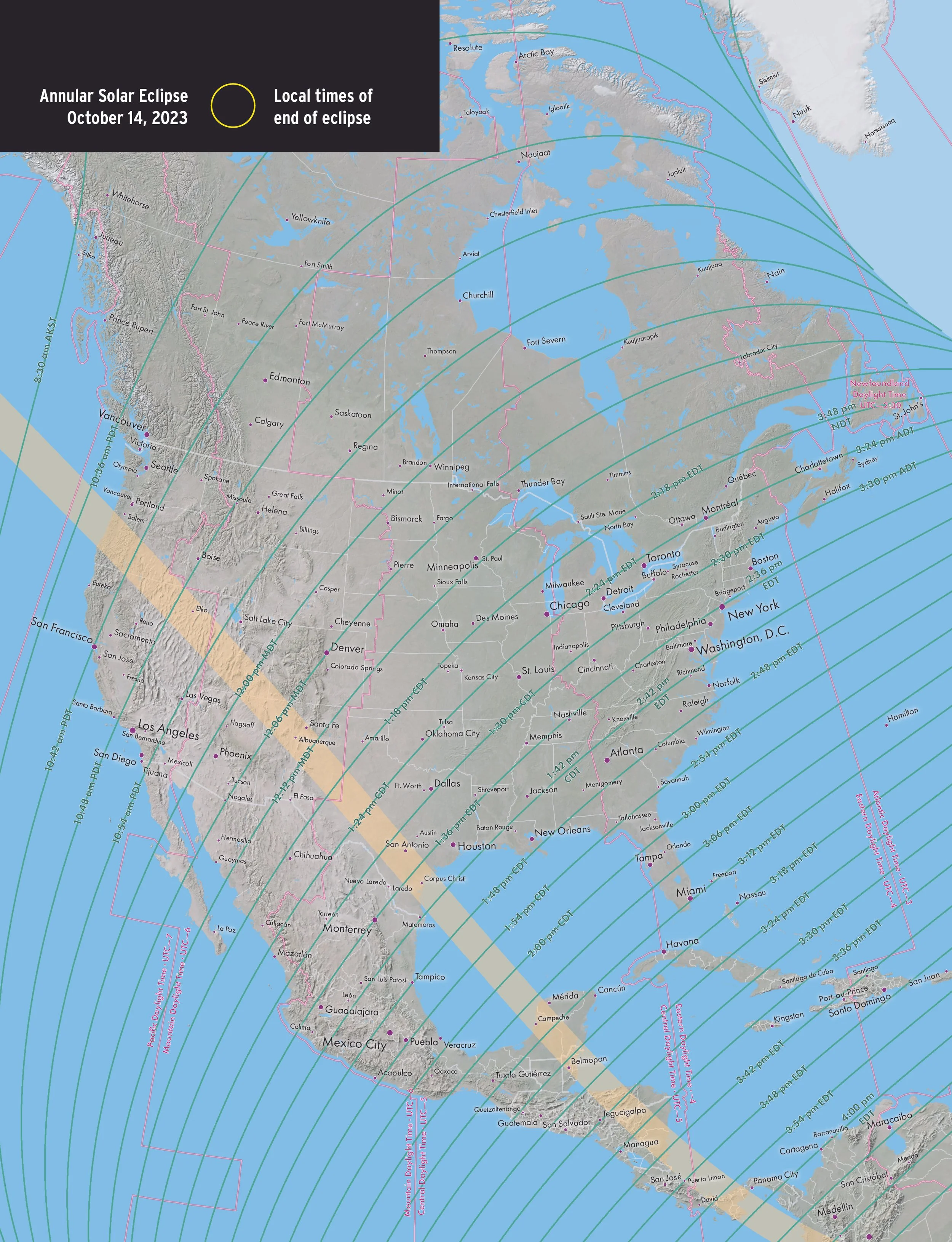
Local time of end of eclipse
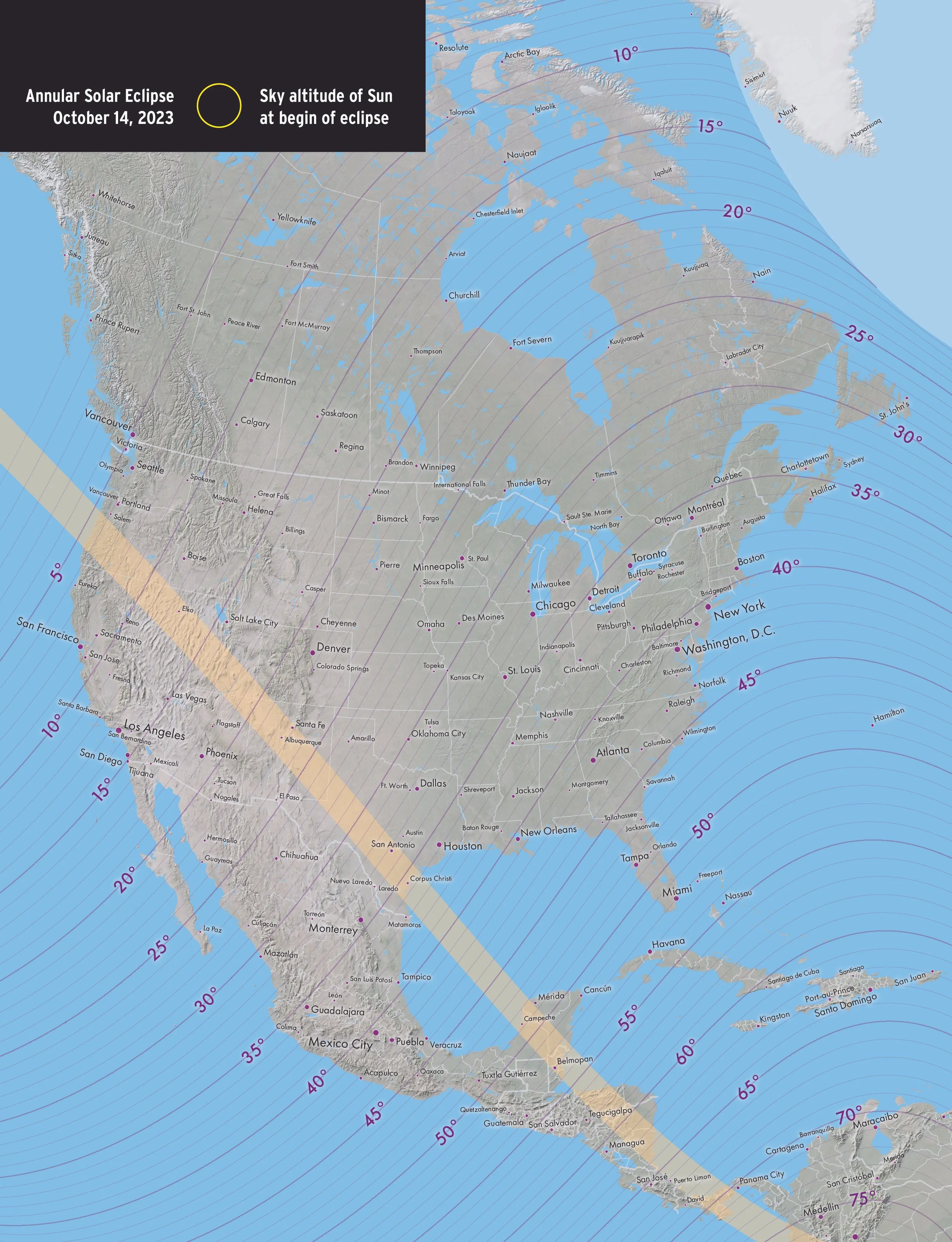
Sky altitude of Sun at begin of eclipse

Sky altitude of Sun at greatest eclipse
Sky altitude of Sun at end of eclipse