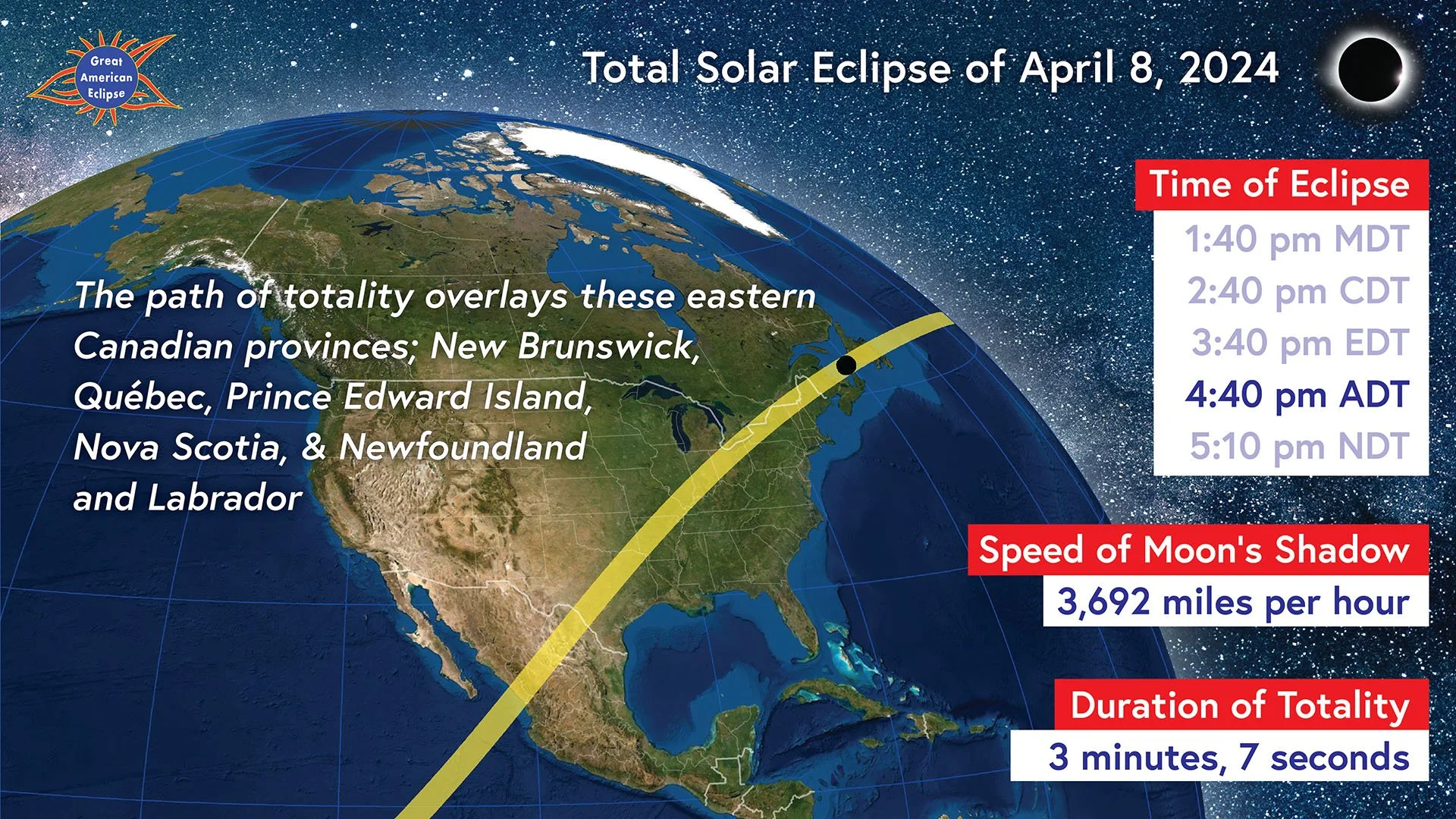
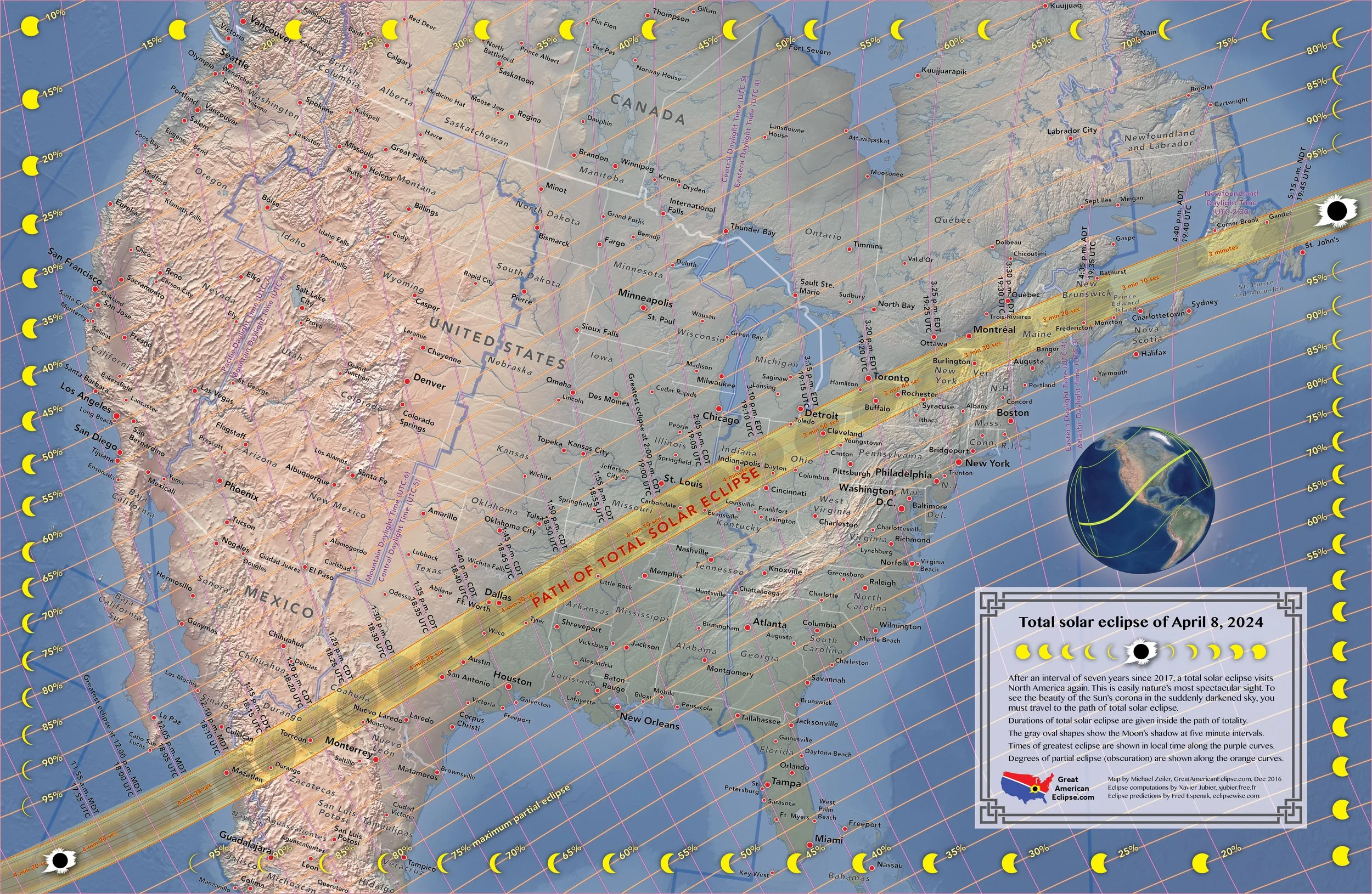
Maps of the Total Solar Eclipse of April 8, 2024
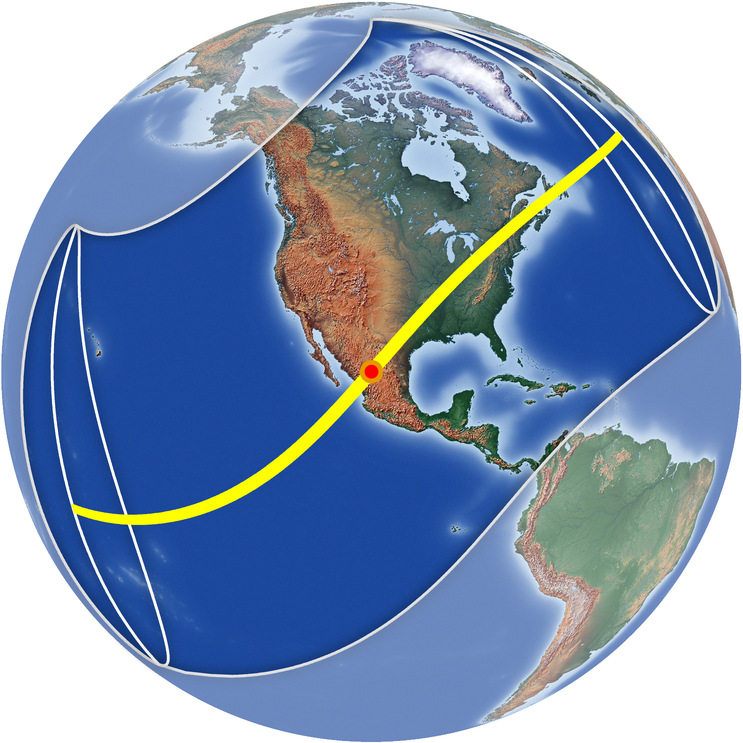
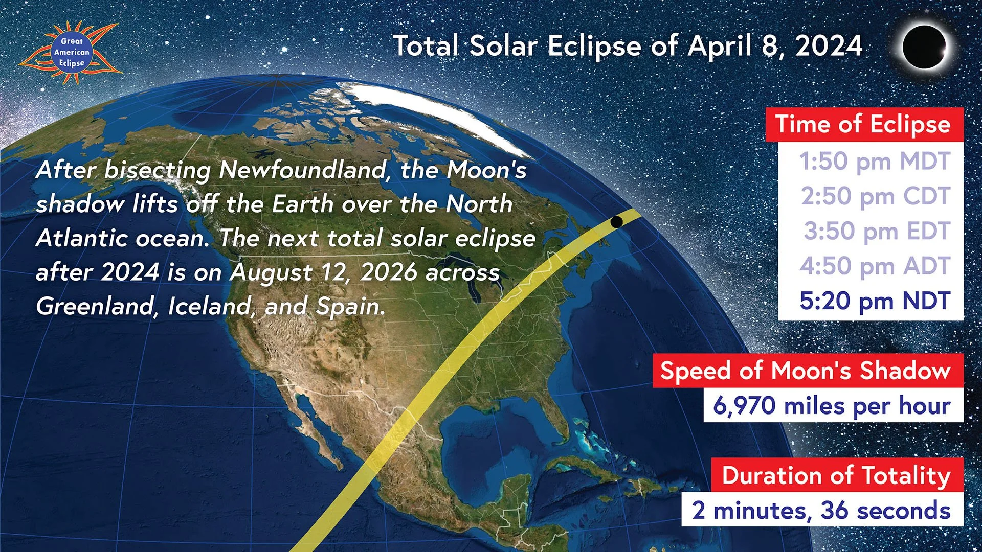
Totality begins in the South Pacific near French Polynesia. After crossing a vast expanse of the Pacific without any landfalls, totality reaches Mexico just before the point of greatest eclipse. At this point, totality is 4 minutes and 28 seconds. When the shadow reaches Texas, totality is still 4 minutes and 26 seconds. The path of totality in the US spans the states of Texas, Oklahoma, Arkansas, Missouri, Illinois, Indiana, Kentucky, Ohio, Pennsylvania, New York, Vermont, New Hampshire, and Maine. Canadian provinces in the path are Ontario, Québec, New Brunswick, and Labrador and Newfoundland. After departing the island of Newfoundland, totality ends in the North Atlantic Ocean.
These maps were first published on GreatAmericanEclipse.com.
Fly over the 2024 total solar eclipse
This animation of the Moon’s shadow across North America simulates the view from a spacecraft 125 miles high chasing the shadow! On April 8, 2024, everyone inside the shadow will experience the breathtaking sight of the Sun’s corona during the total solar eclipse. Totality races from Mazatlan to Newfoundland.
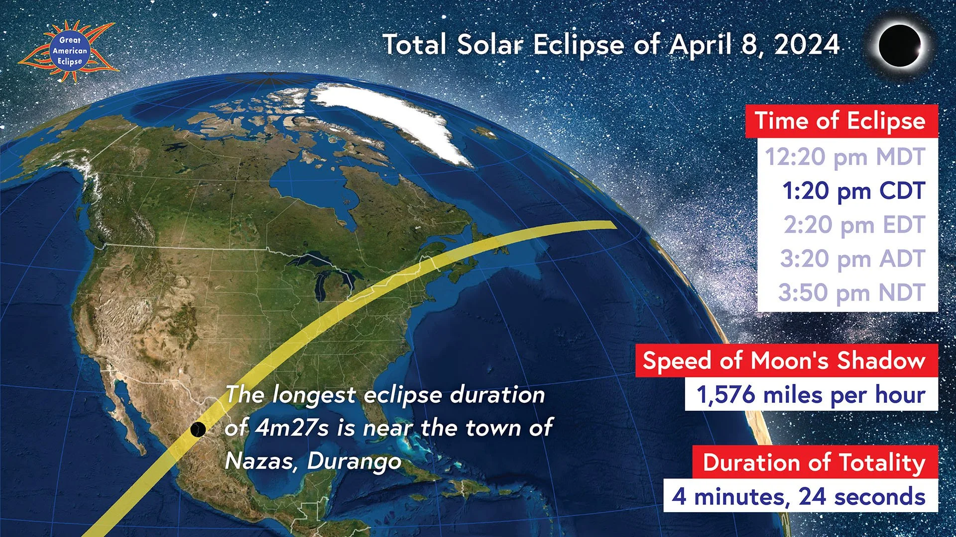
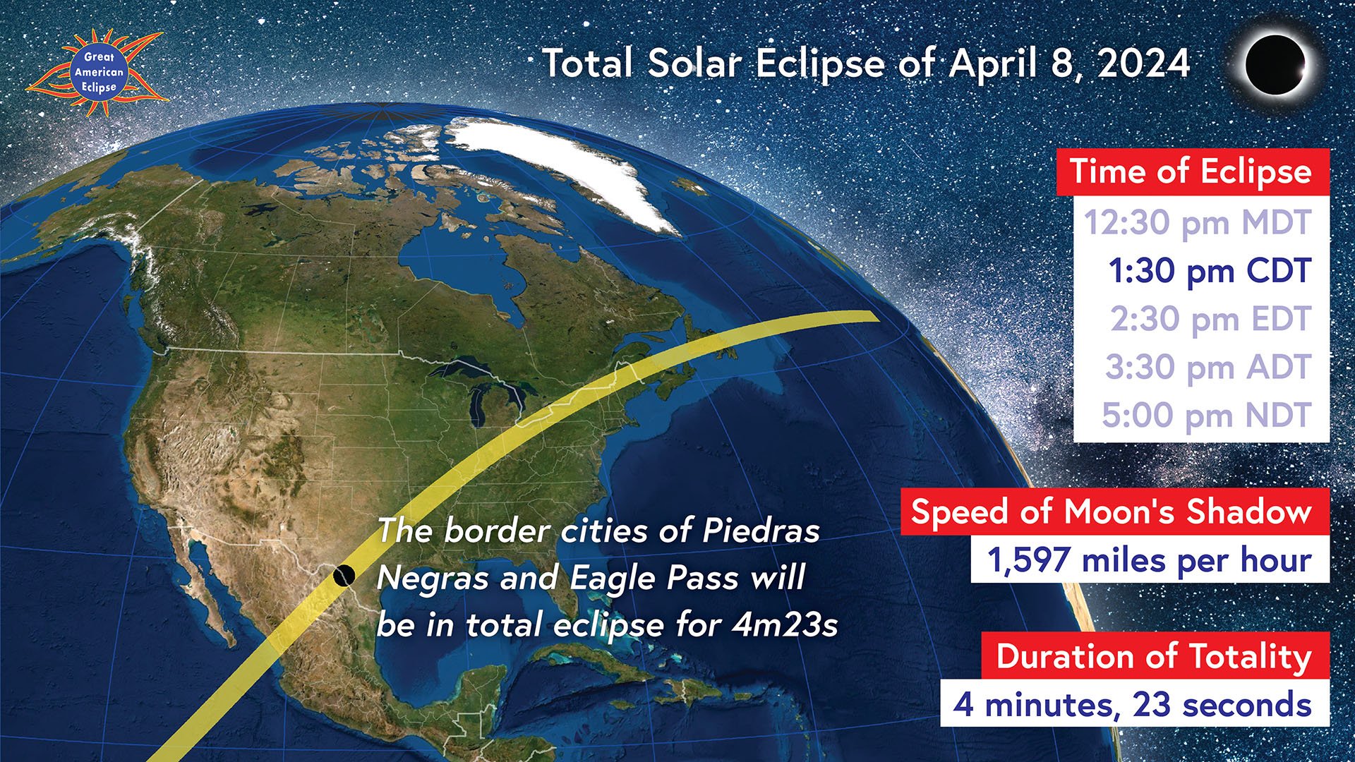
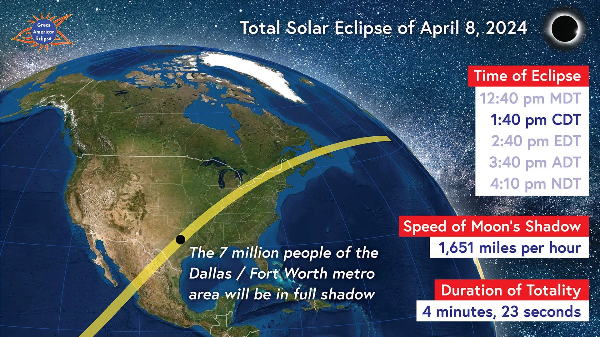
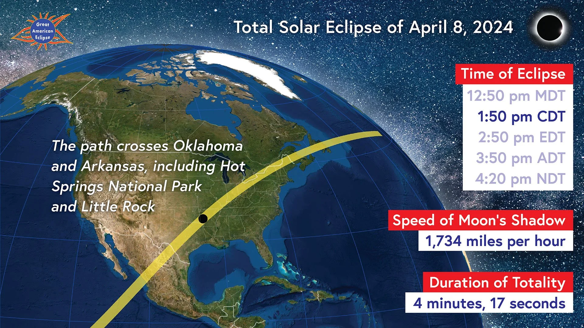
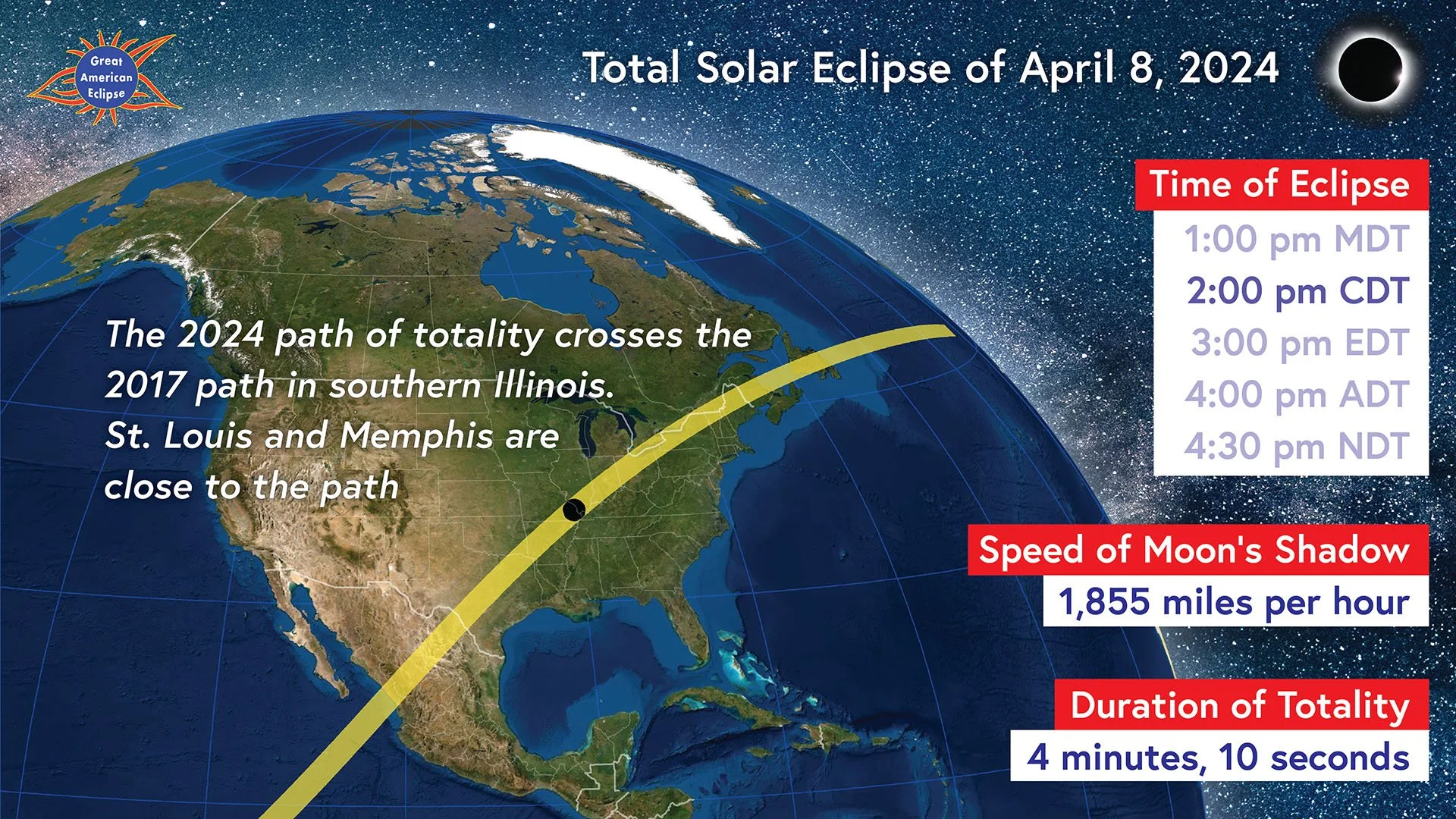
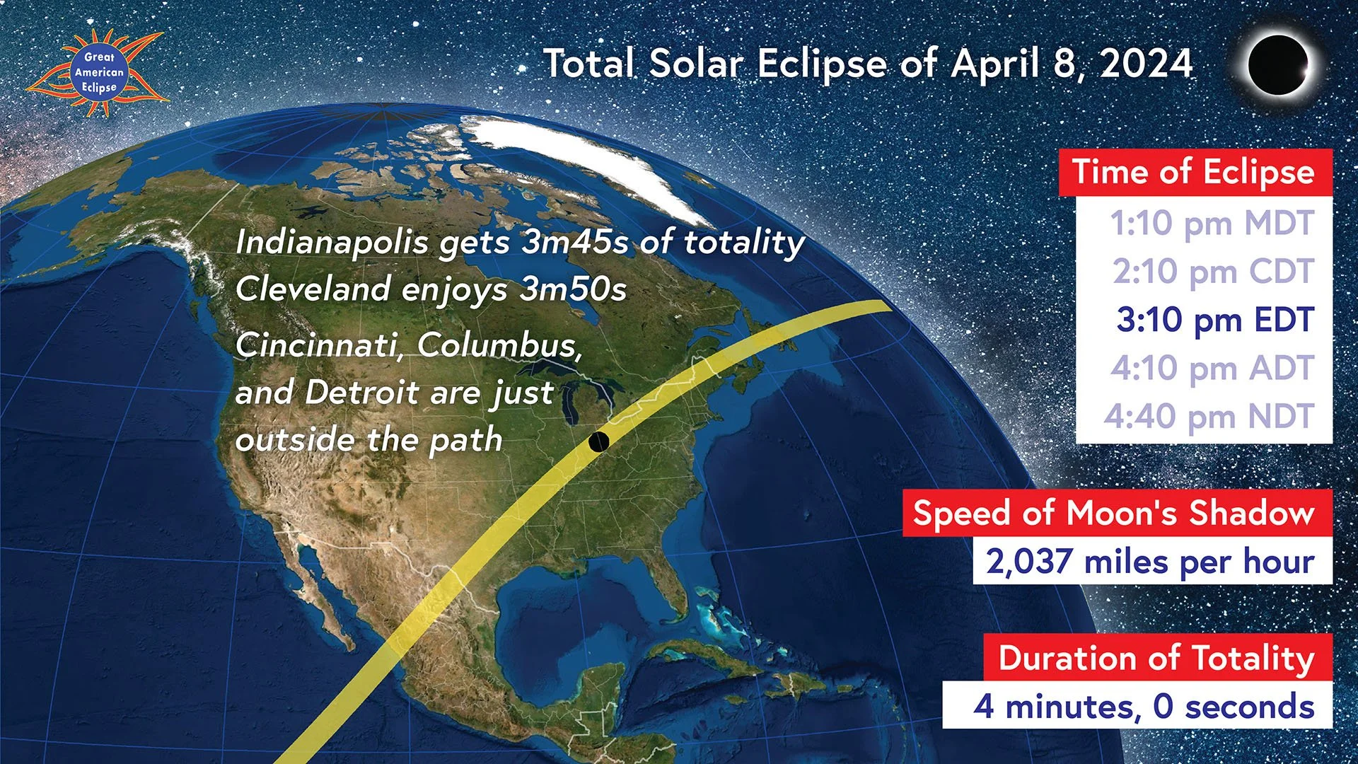
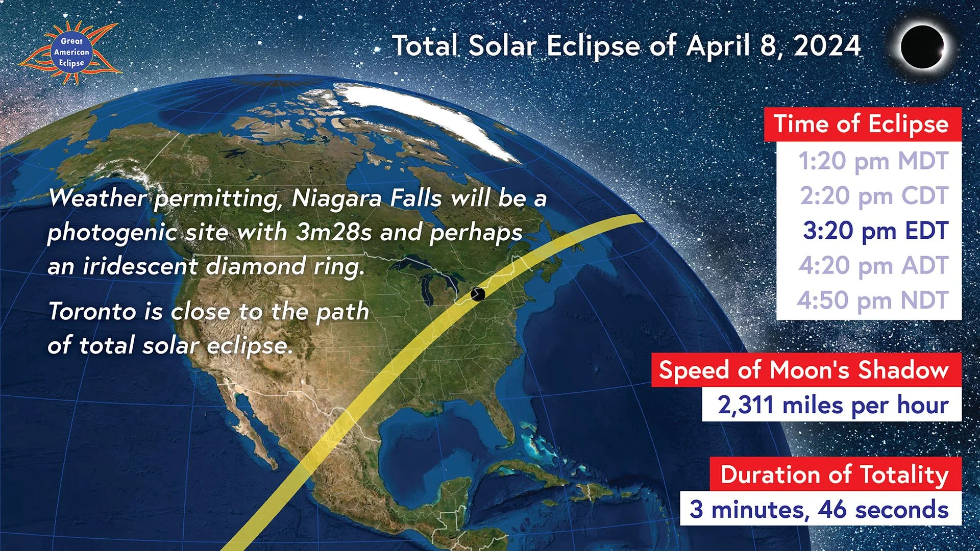
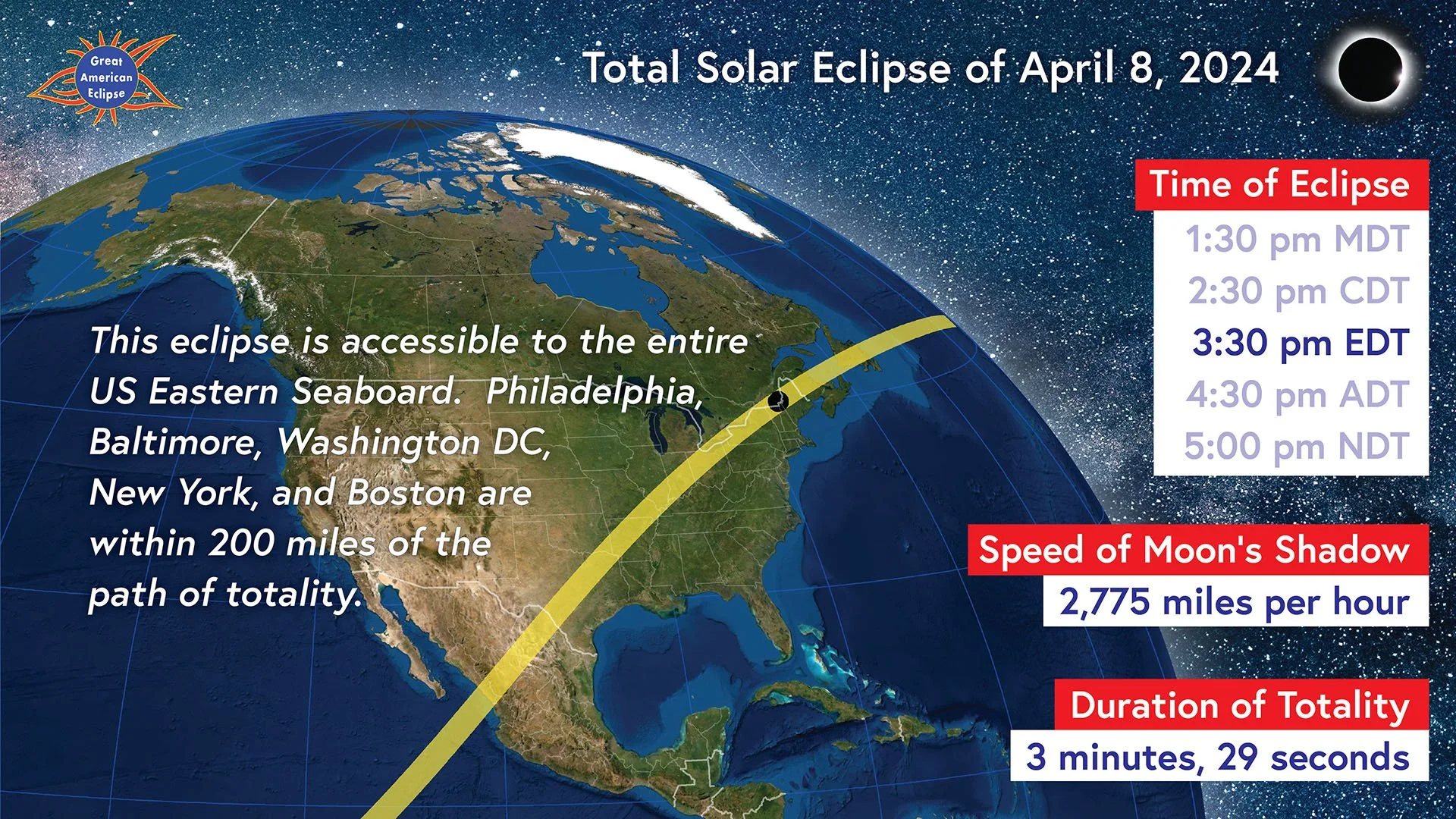
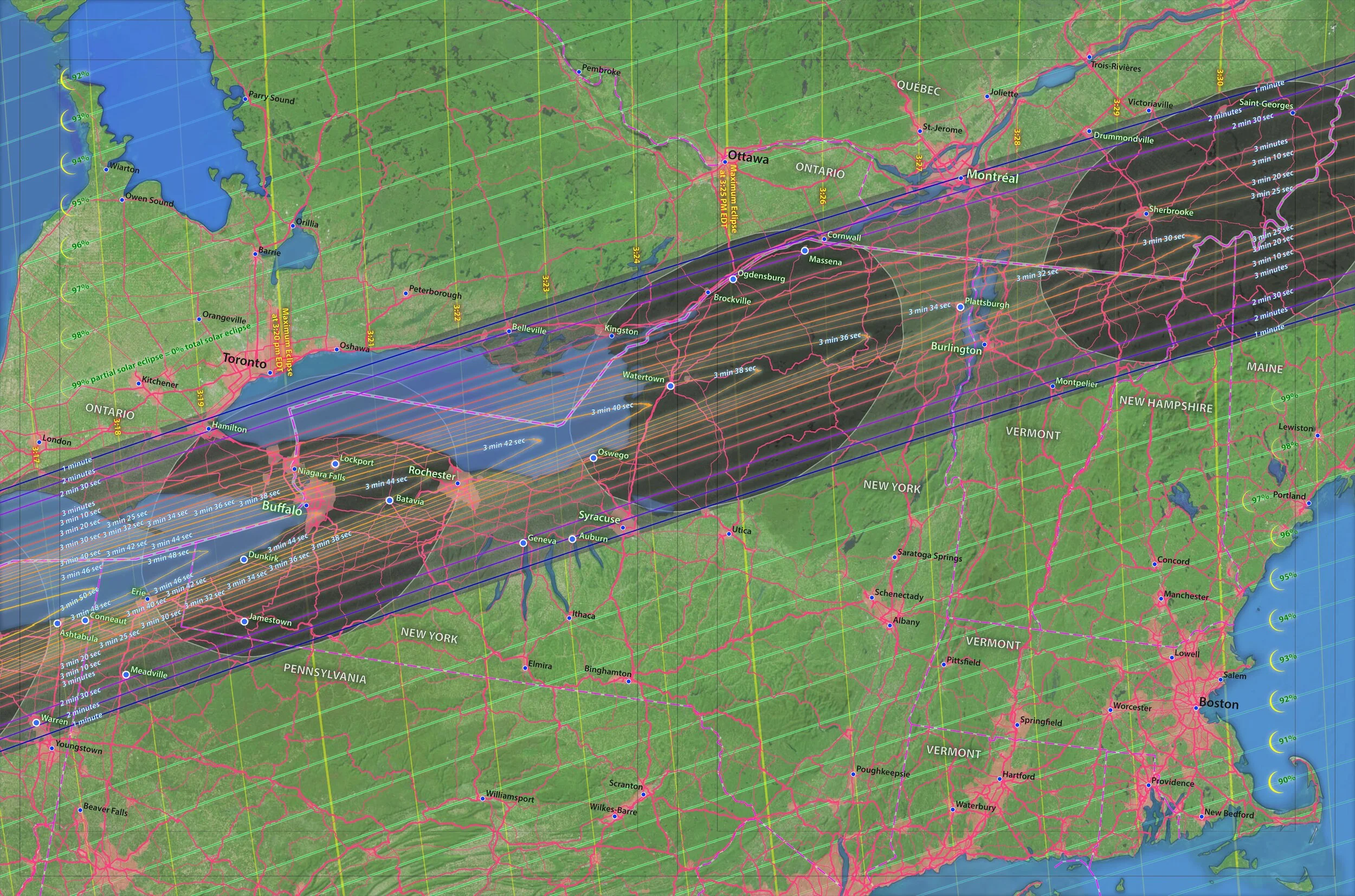
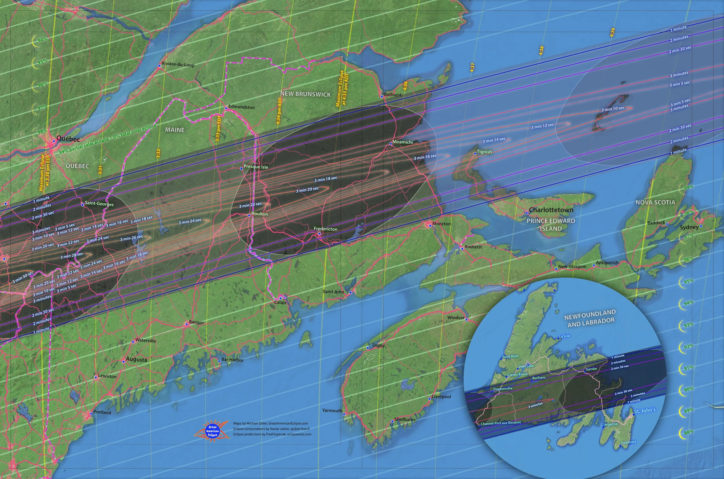
The dark oval represents where totality will be seen at that moment. The time of eclipse is given in the local time zone. The duration is the maximum at the center of the Moon's shadow. Places near the centerline receive the longest duration.
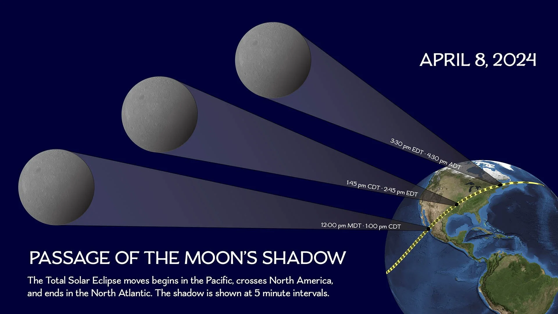
The path narrows throughout North America because after the Moon's shadow meets the point of greatest eclipse near Nazas, Mexico, the distance from the Moon to the Earth becomes slightly longer. While the path is narrowing, the shadow is also intercepting the Earth's surface at an increasingly oblique angle. This oblique angle lengthens the shadow along the direction of the path. So this results in the shadow becoming narrower as the eclipse moves from Texas to Newfoundland while also elongating the shape of the shadow.
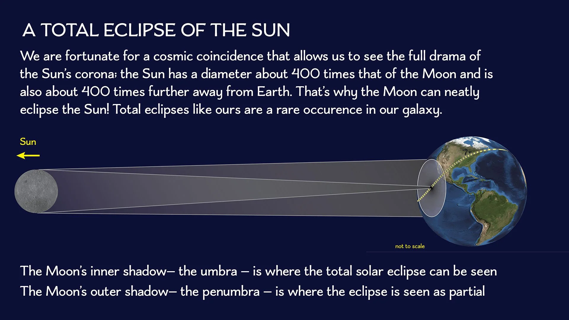
To see the full glory of a total solar eclipse, when daylight suddenly darkens and the beautiful corona of the Sun becomes visible, people must be inside the inner shadow of the Moon (called the umbra). Even if people are in the zone of 99% partial solar eclipse, they will experience 0% total solar eclipse. Being inside the path is essential to view totality.
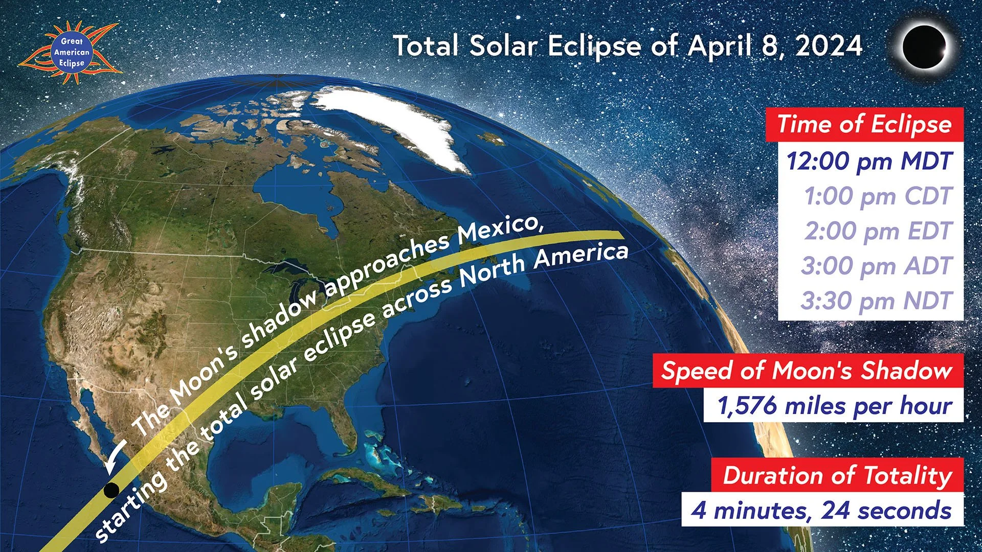
The shadow moves across the United States
Watch the shadow of totality slide from Texas to Maine. This animation displays the local time, the speed of the Moon’s shadow, and the maximum duration of totality.
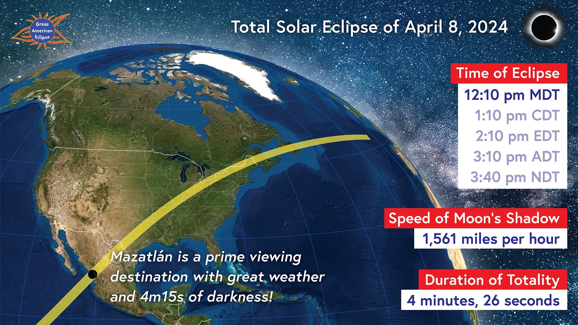
Totality moves across Mexico
Watch the shadow of totality slide from over Mexico from Sinaloa to Chihuahua. This animation displays the local time, the speed of the Moon’s shadow, and the maximum duration of totality.
Passage of the eclipse over Canada
Totality first touches Canada near Windsor, Ontario and cross the Atlantic provinces to Newfoundland. This animation displays the local time, the speed of the Moon’s shadow, and the maximum duration of totality.
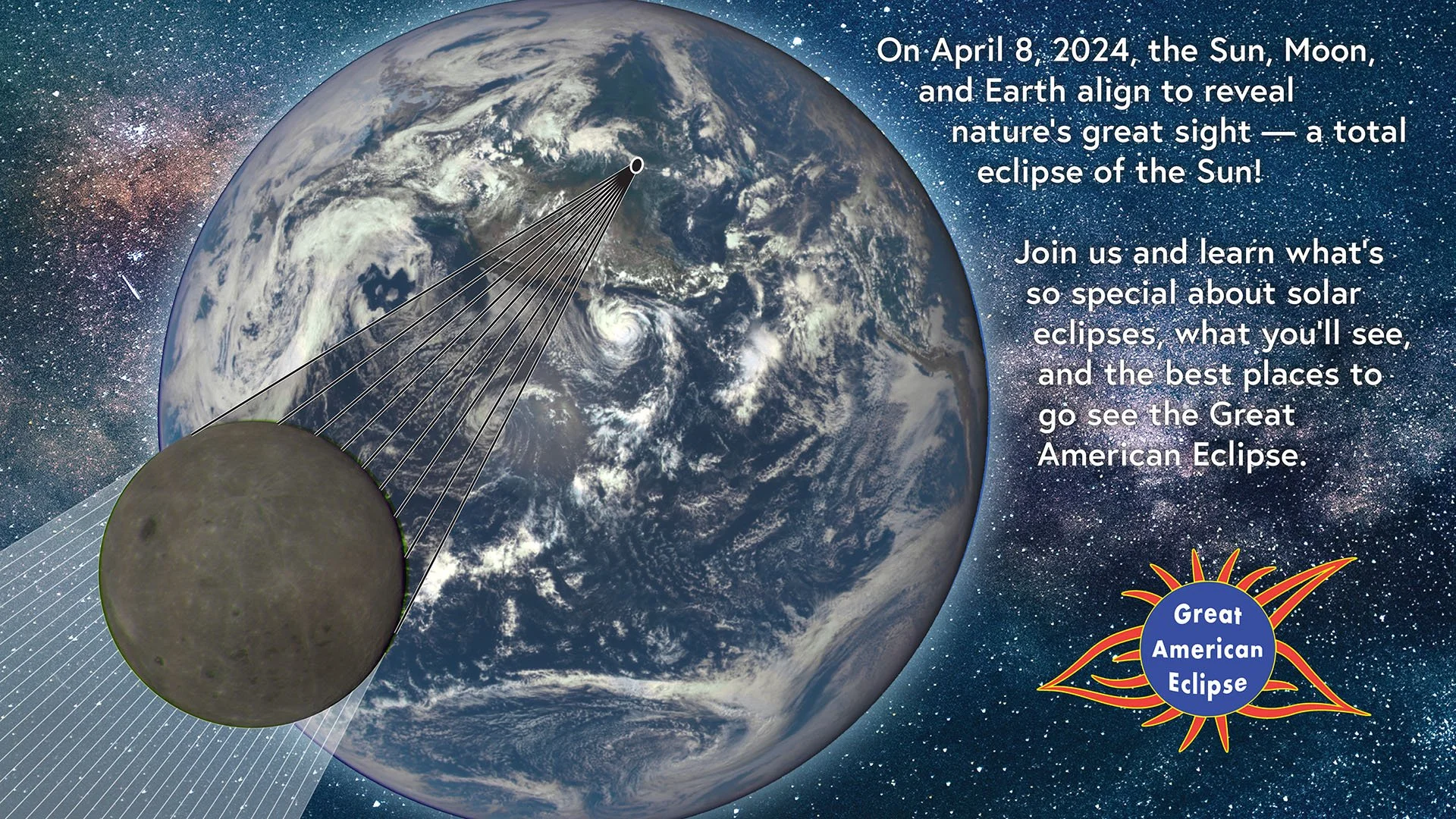
Introduction to the total solar eclipse
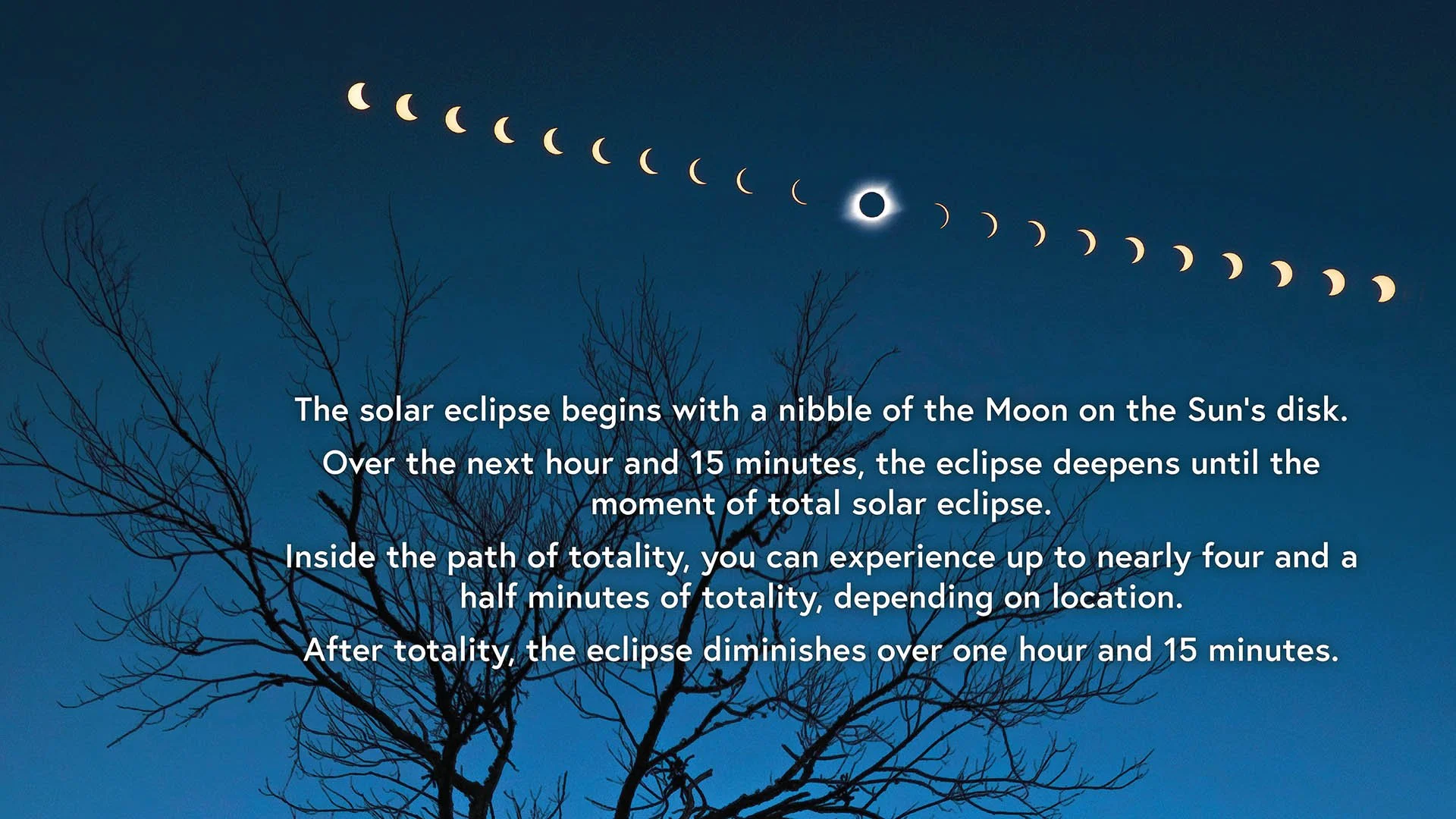
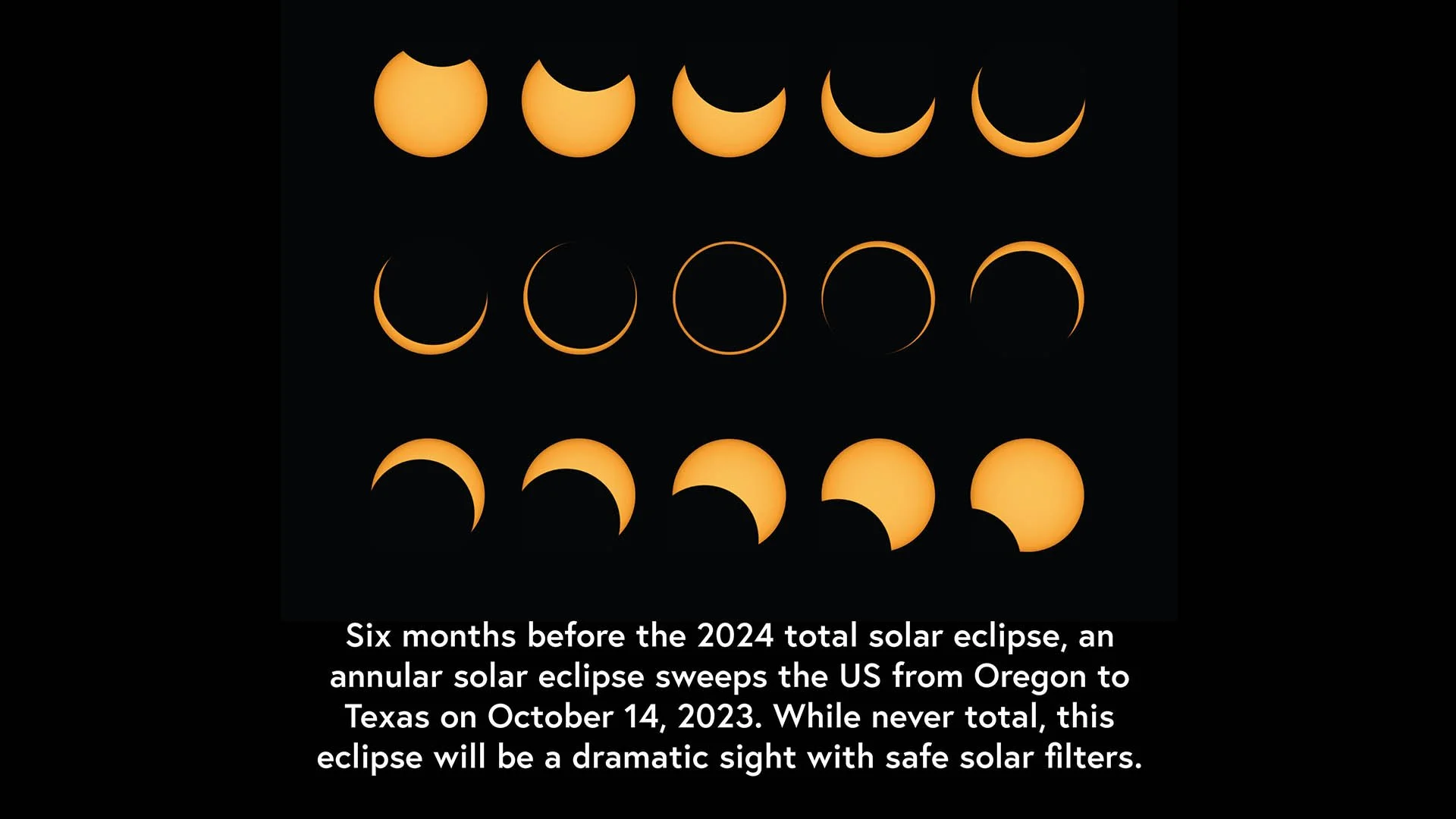
The eclipse every 10 minutes
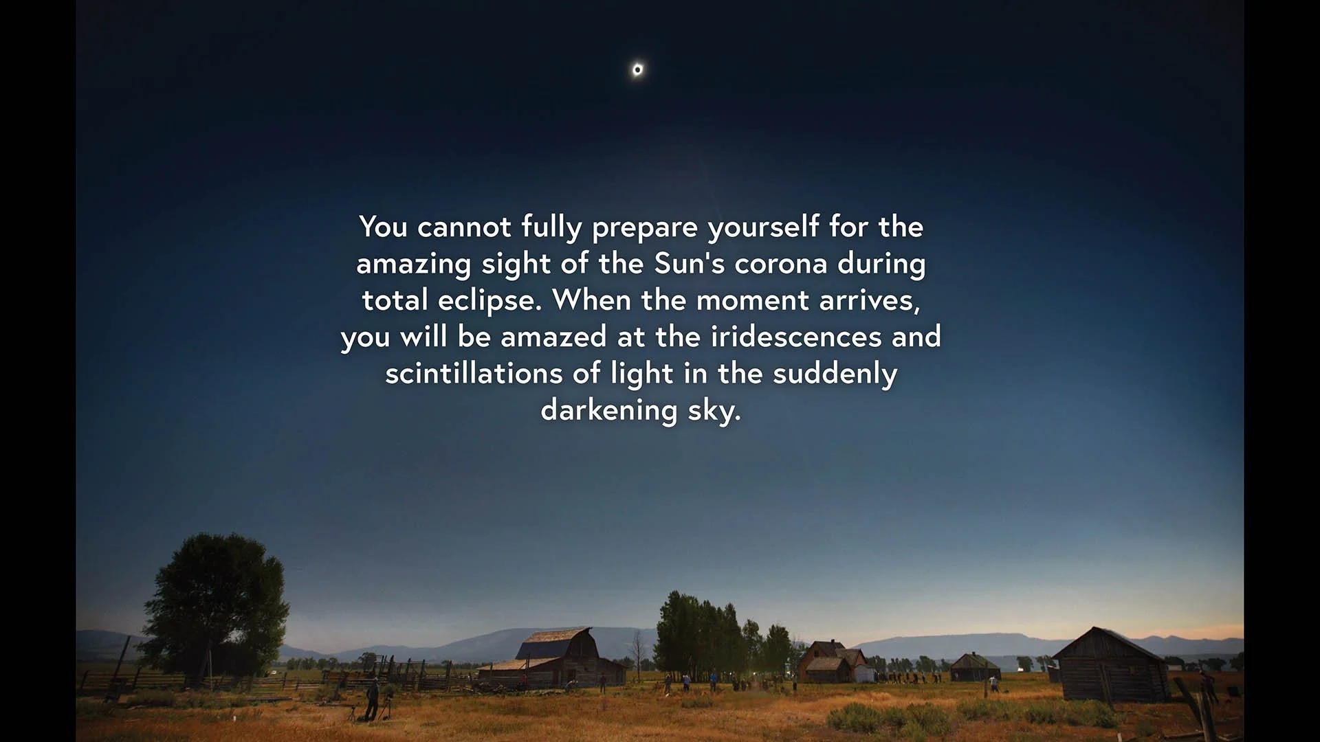
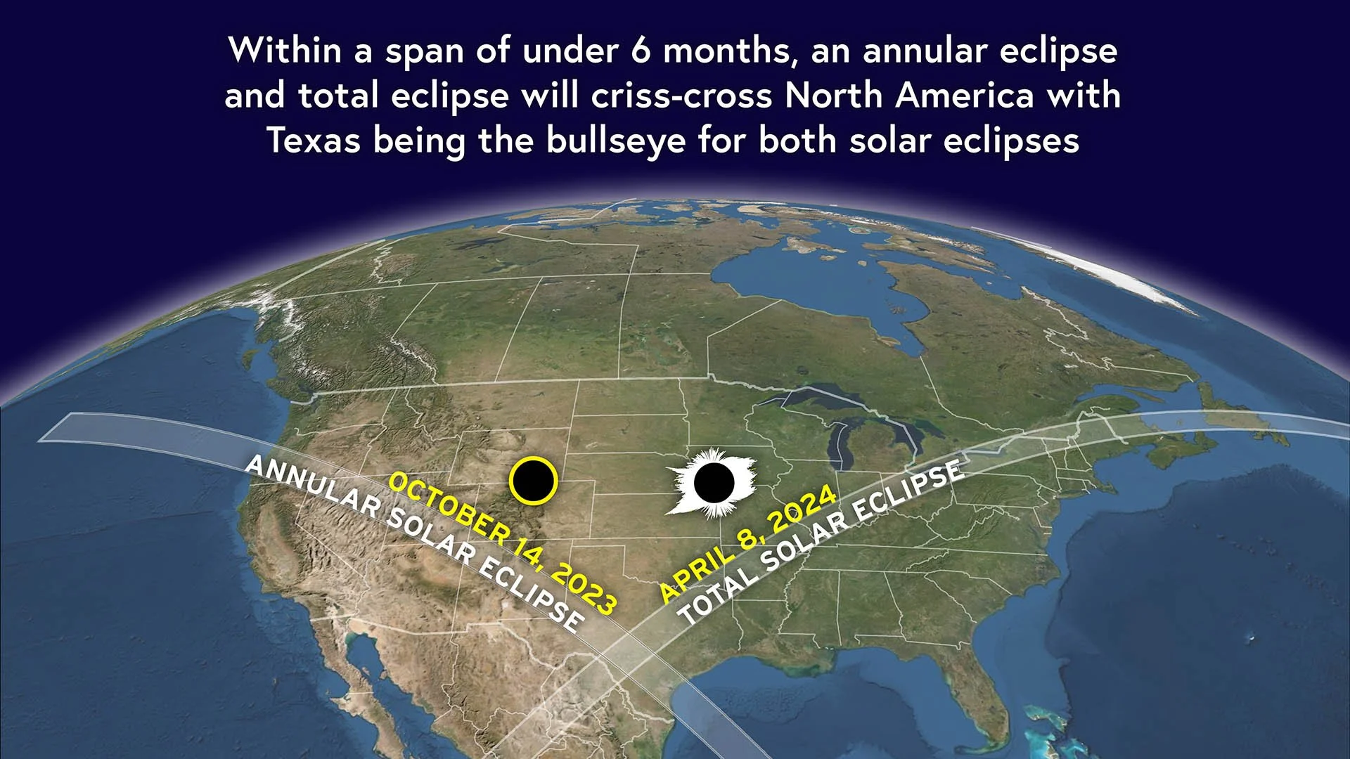
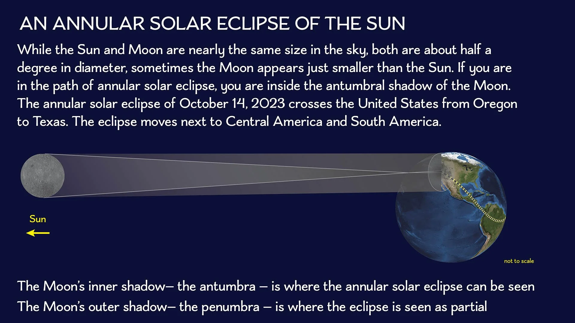
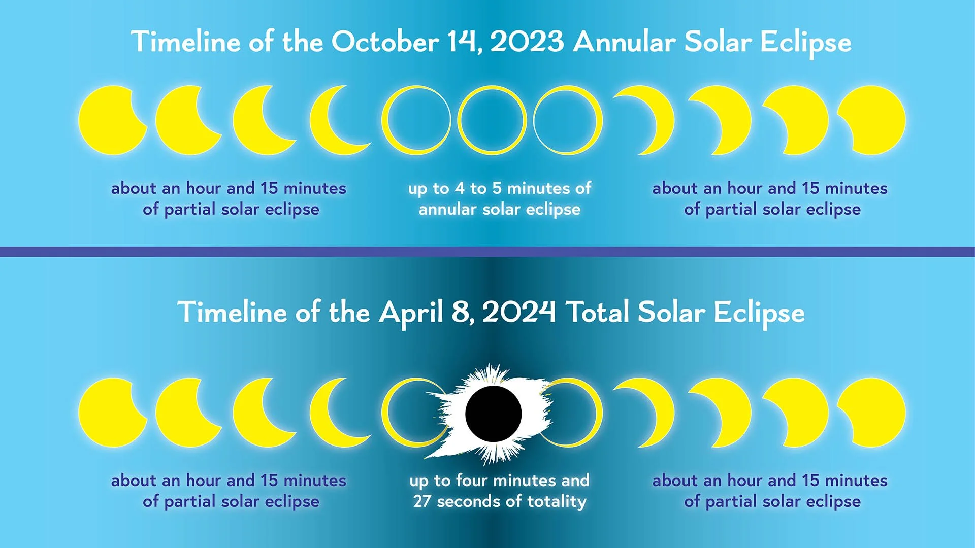
Eclipse basics
Detail maps of the eclipse
These maps are from our Field Guide to the 2023 and 2024 Solar Eclipses by Michael Zeiler and Michael Bakich
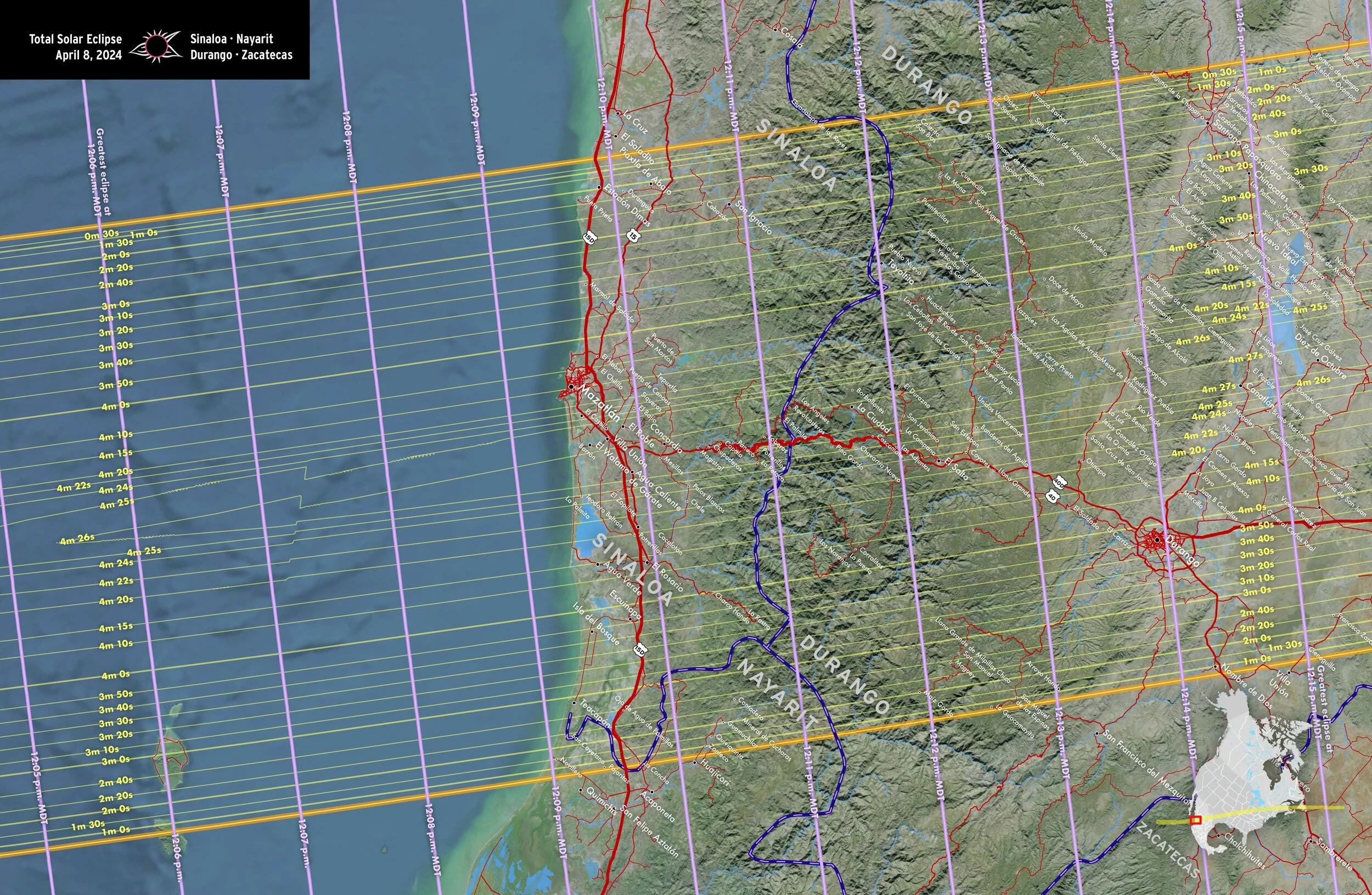
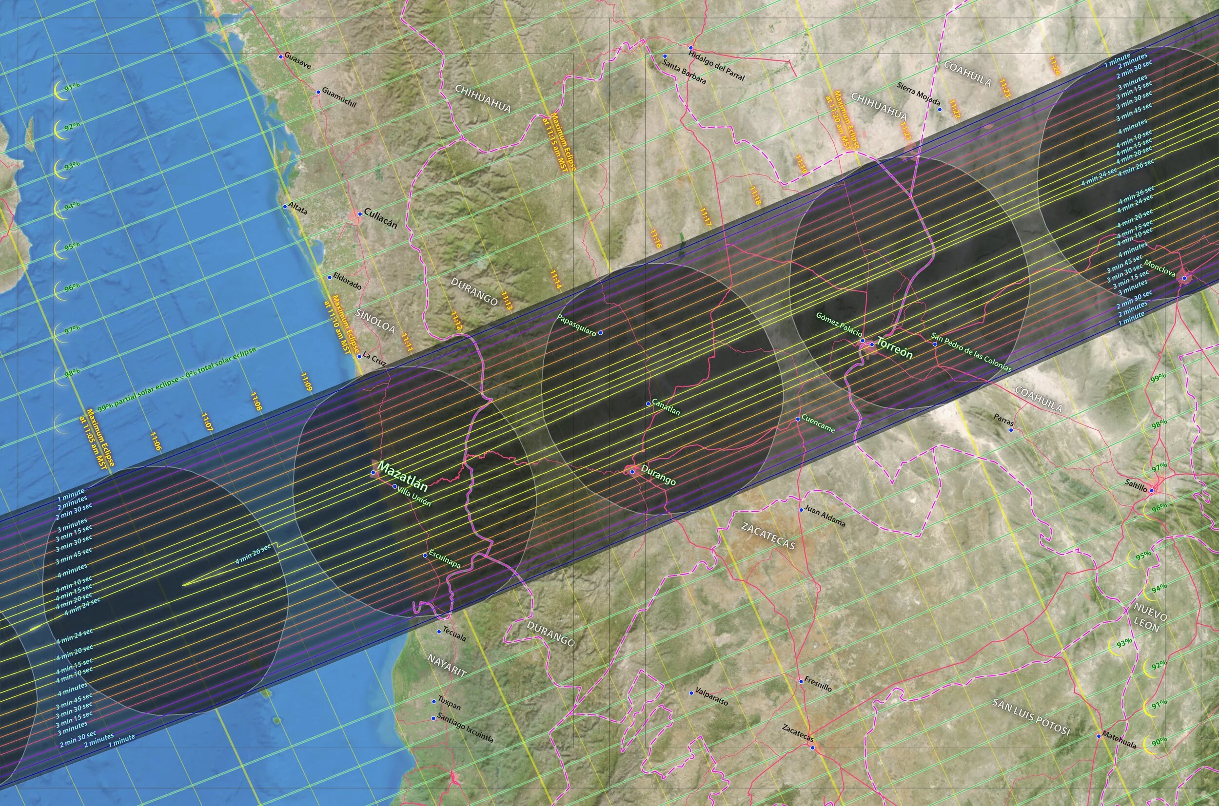
Sinaloa • Nayarit • Durango • Zacatecas
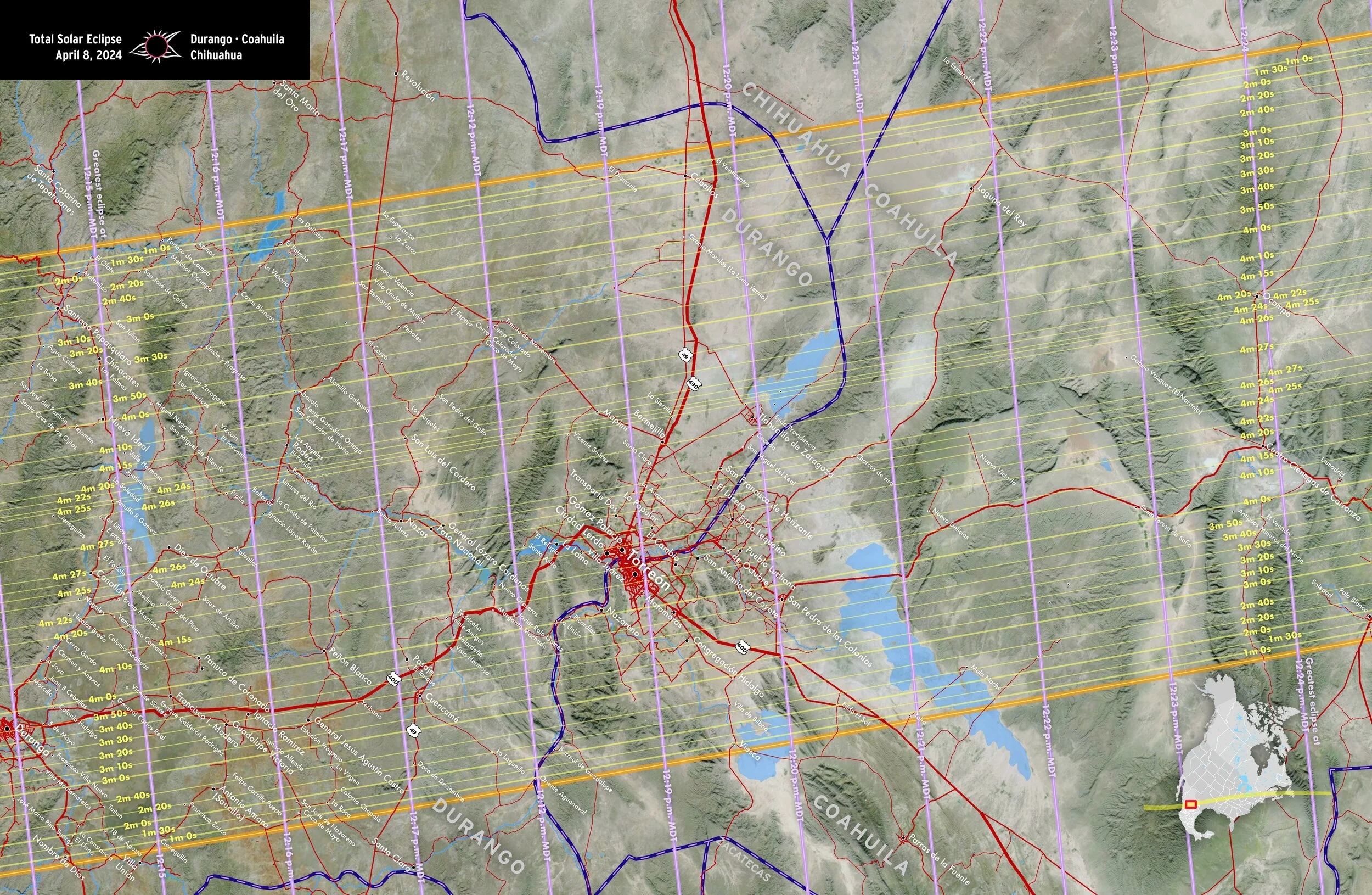
Durango • Coahuila • Chihuahua
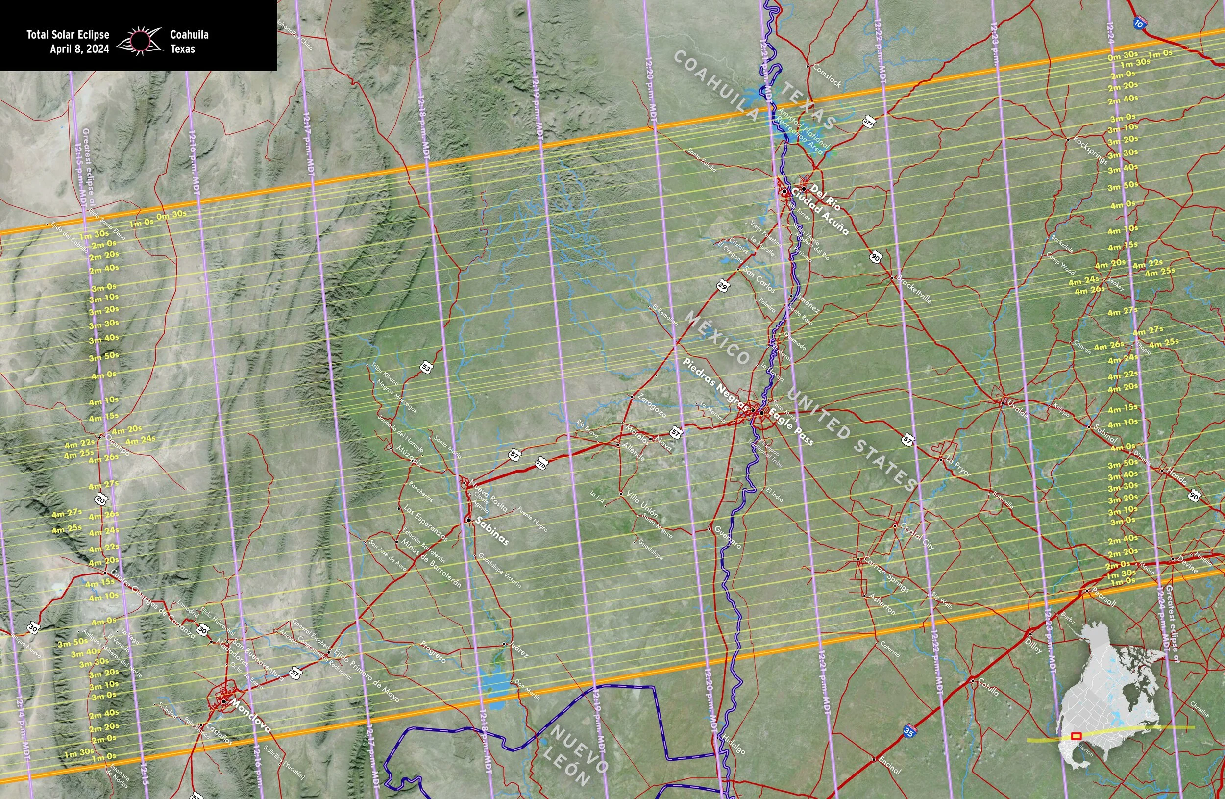
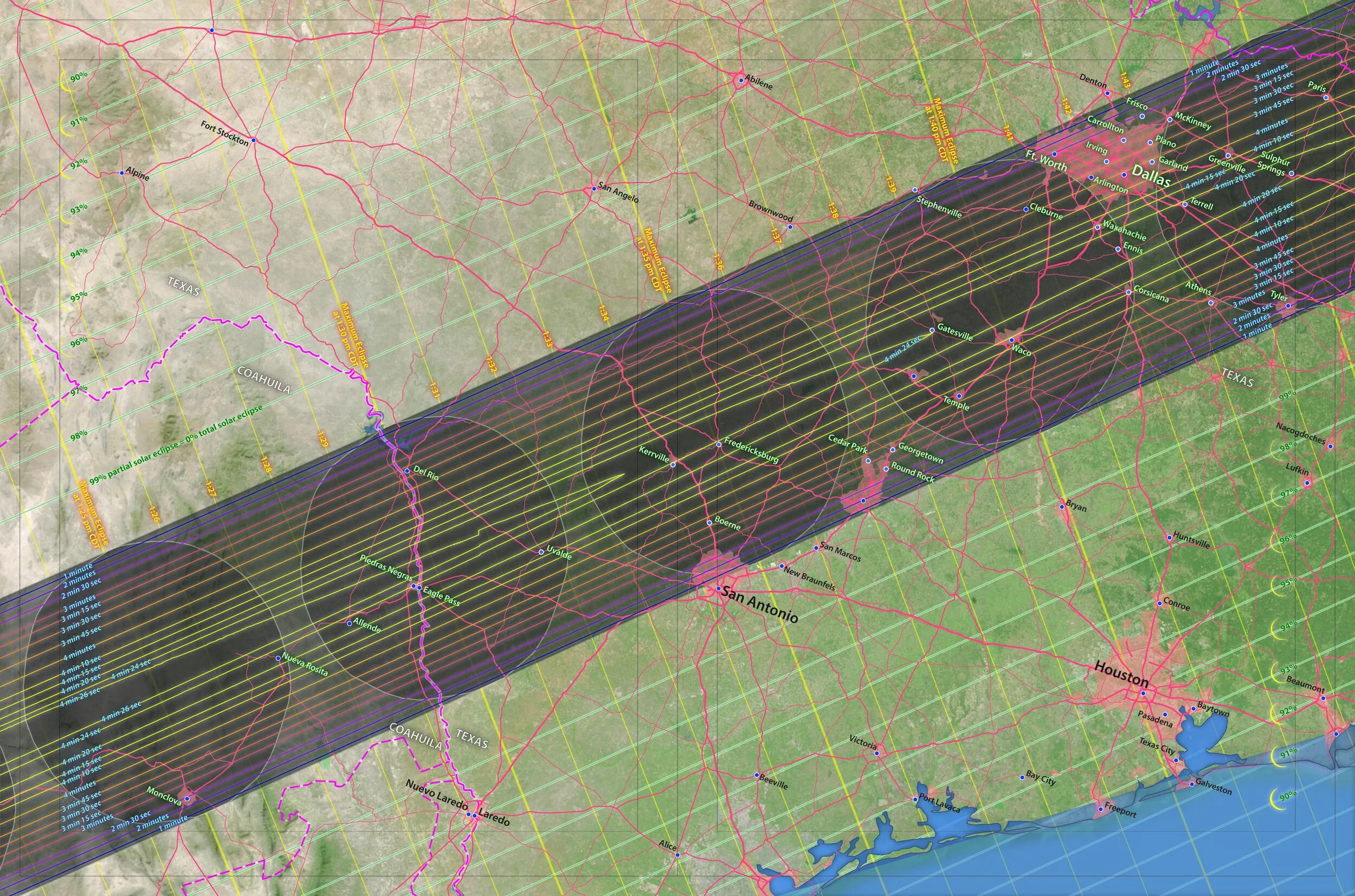
Coahuila • Texas
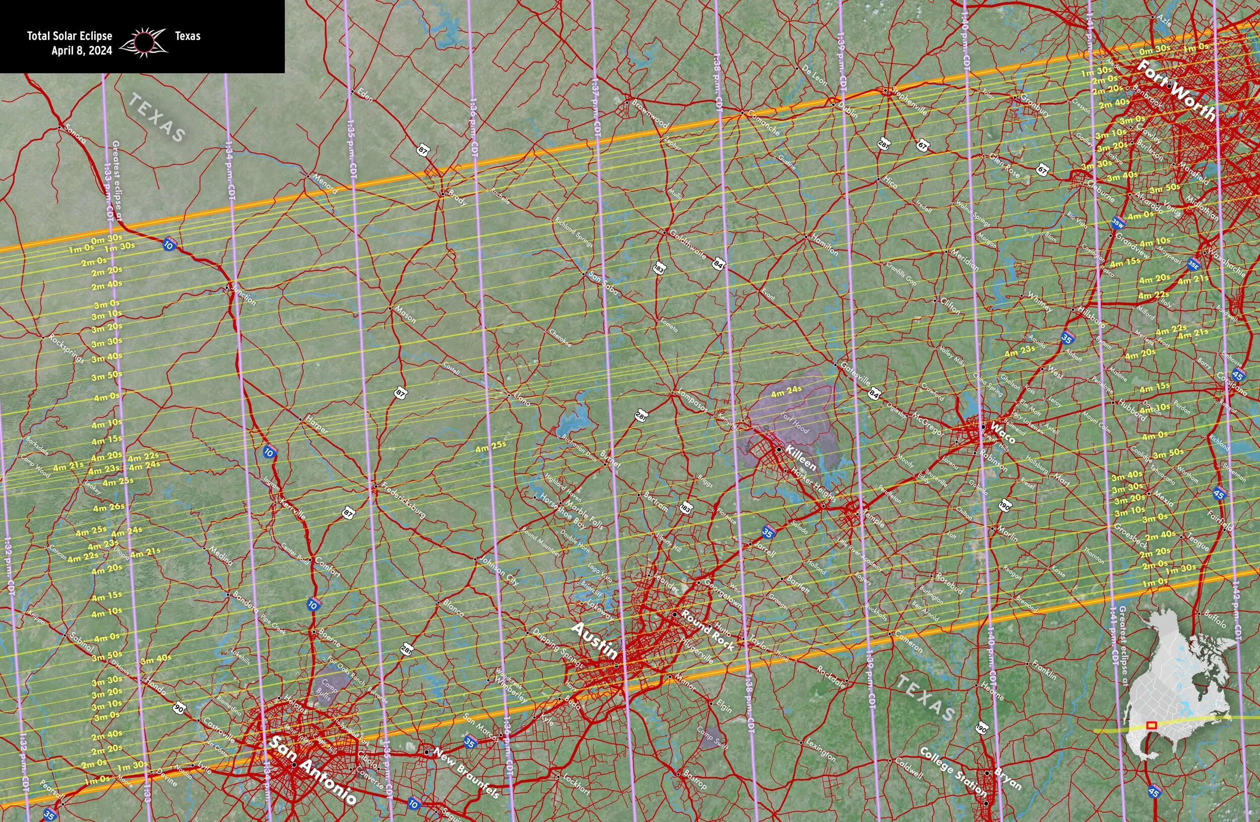
Texas
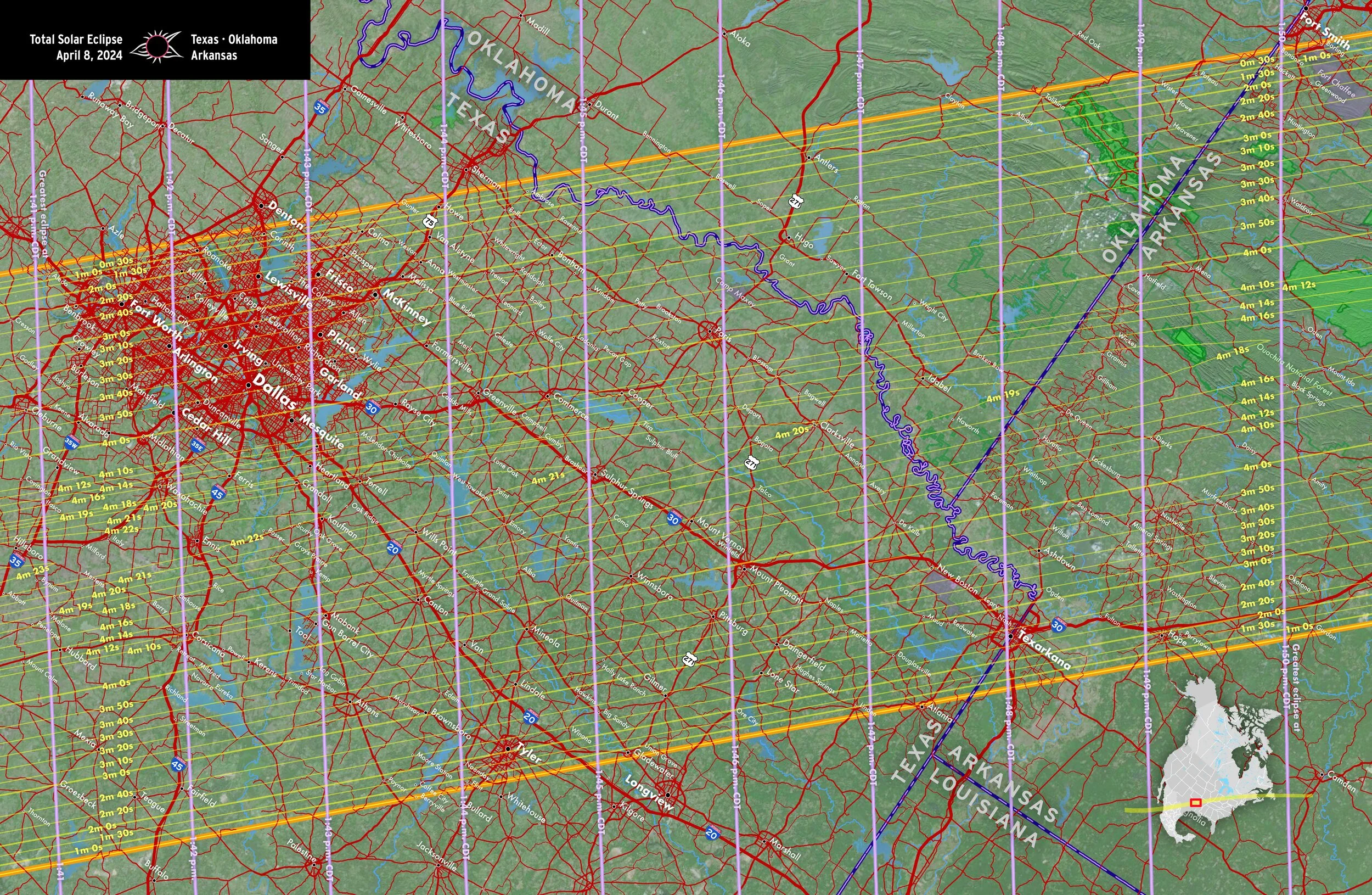
Texas • Oklahoma • Arkansas
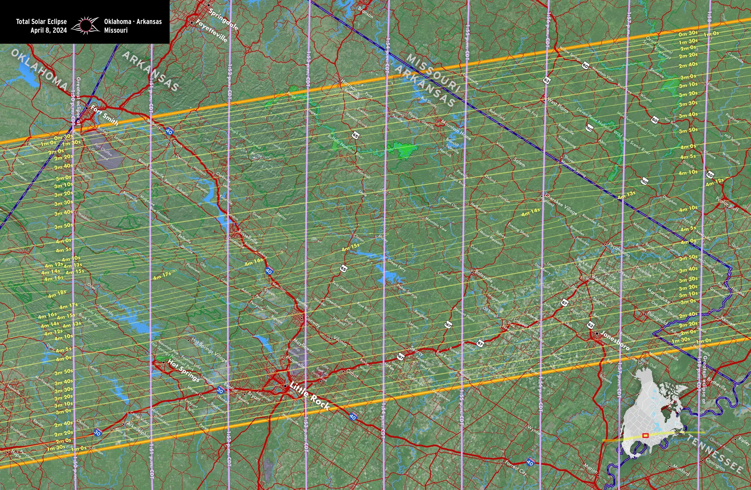
Oklahoma • Arkansas • Missouri
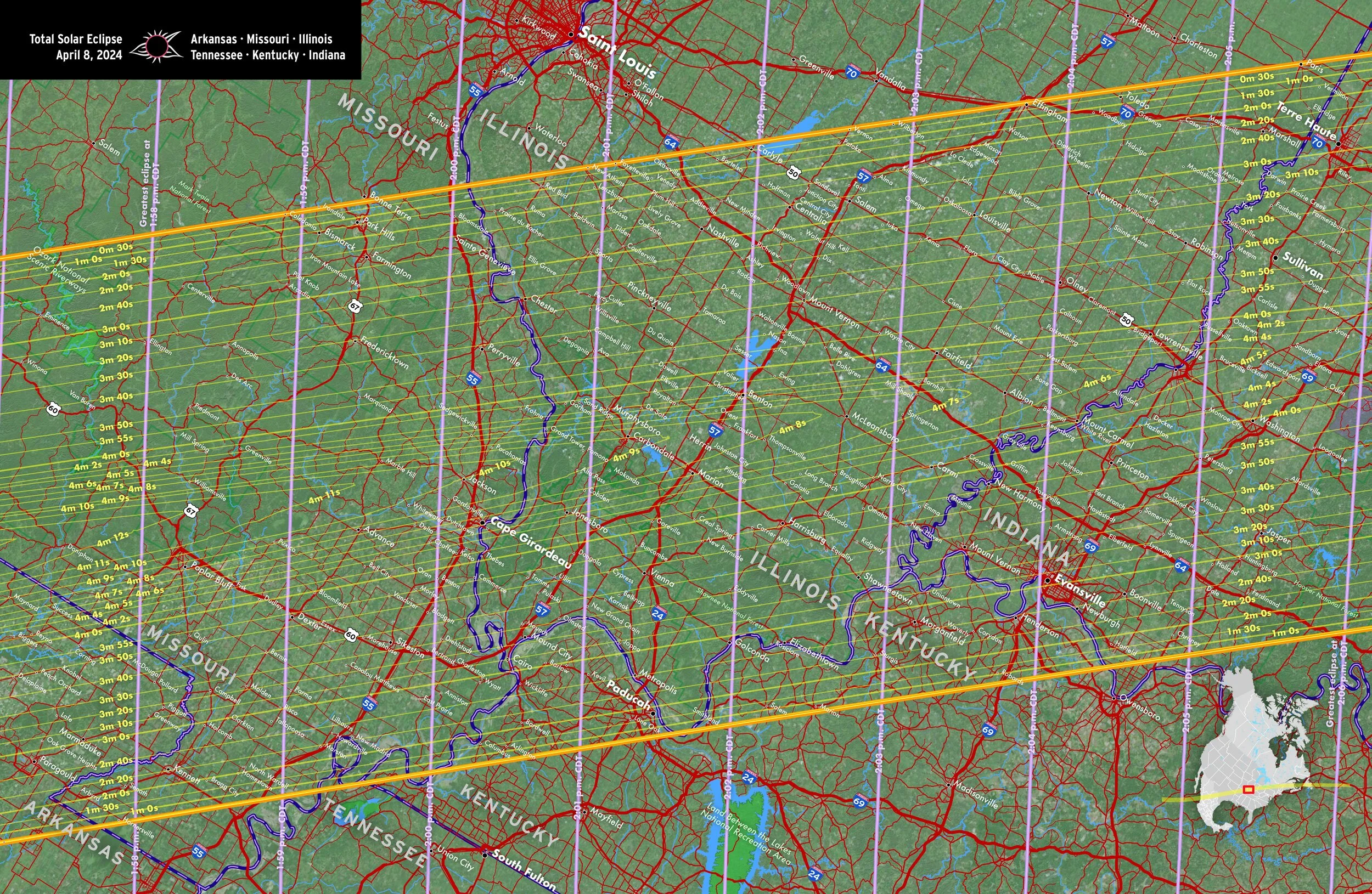
Arkansas • Missouri • Illinois • Tennessee • Kentucky • Indiana
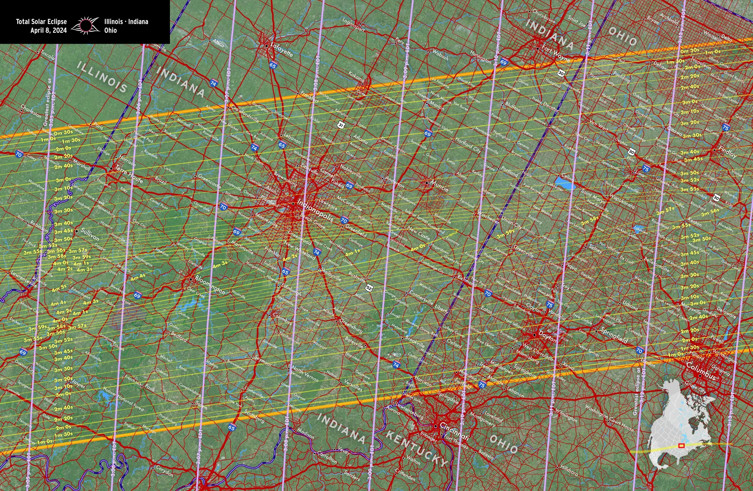
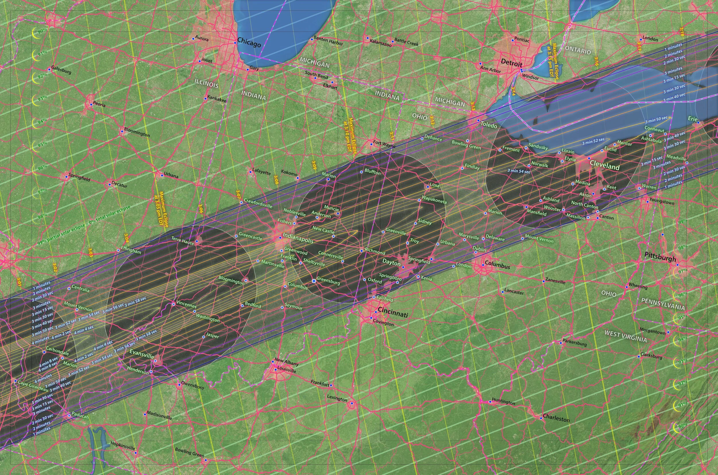
Illinois • Indiana • Ohio
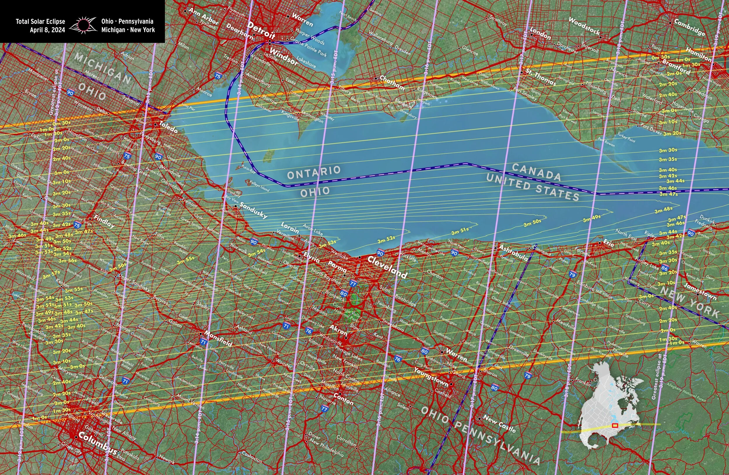
Ohio • Pennsylvania • Michigan • New York
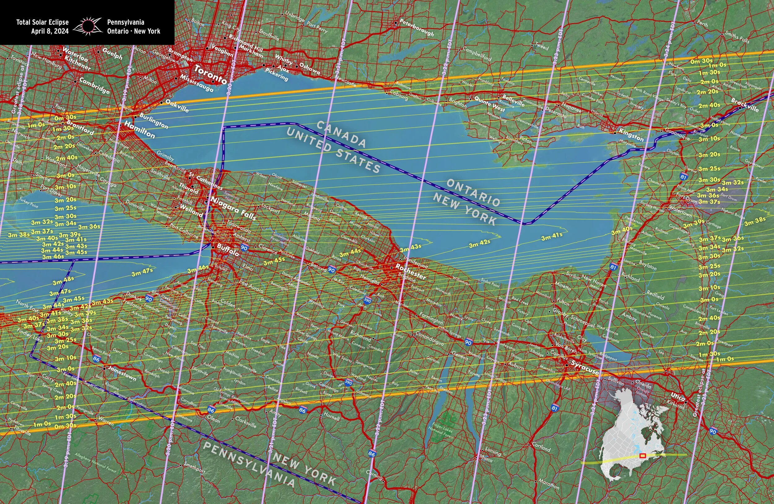
Pennsylvania • Ontario • New York
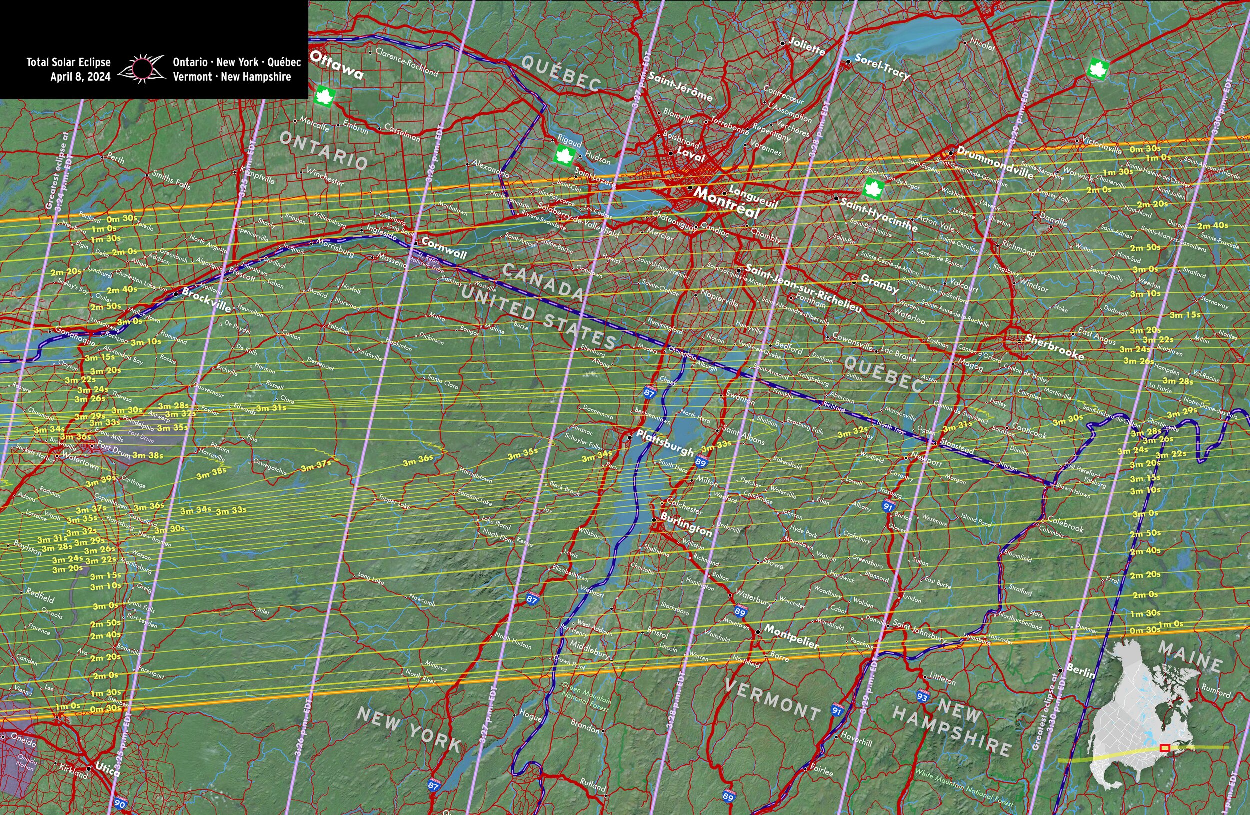
Ontario • New York • Québec • Vermont • New Hampshire
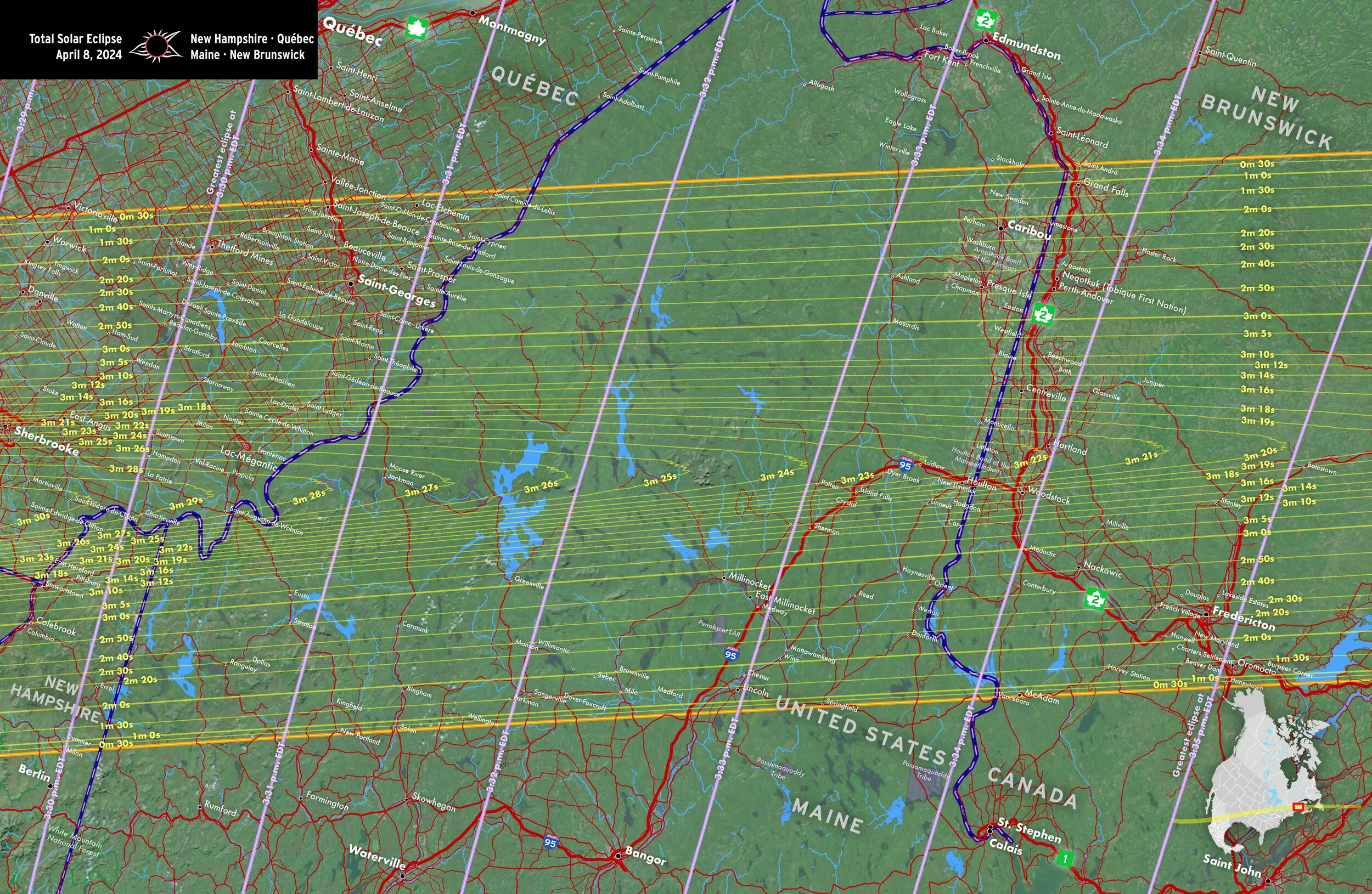
New Hampshire • Québec • Maine • New Brunswick
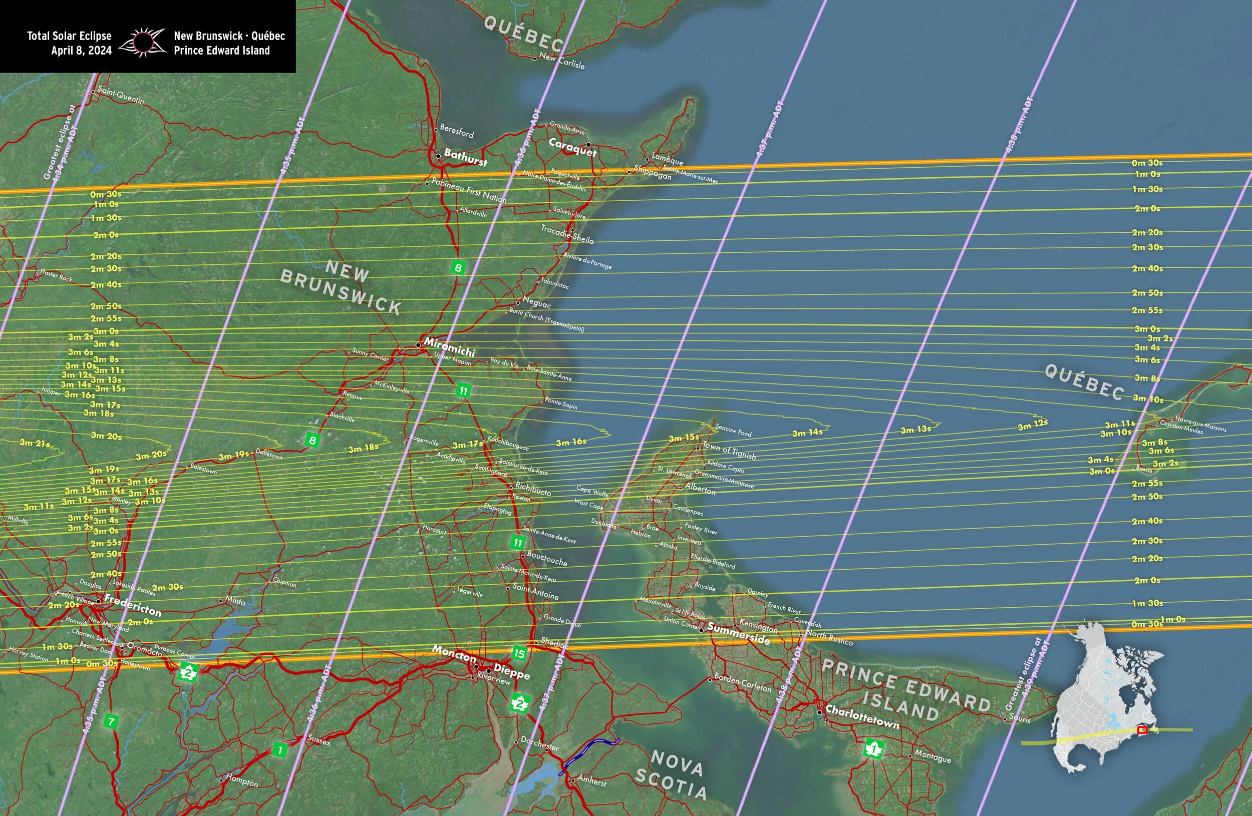
New Brunswick • Québec • Prince Edward Island
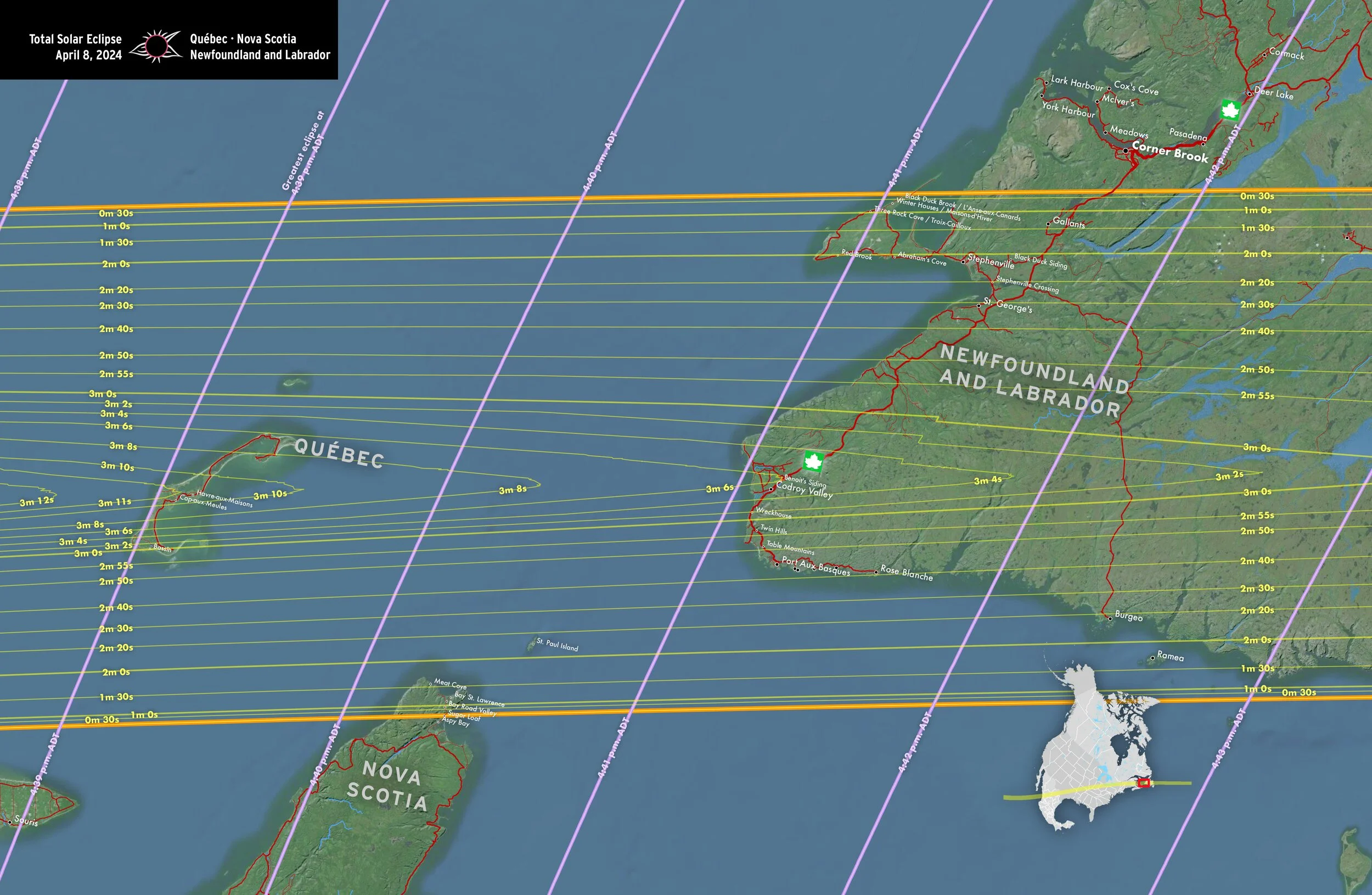
Québec • Nova Scotia • Newfoundland and Labrador
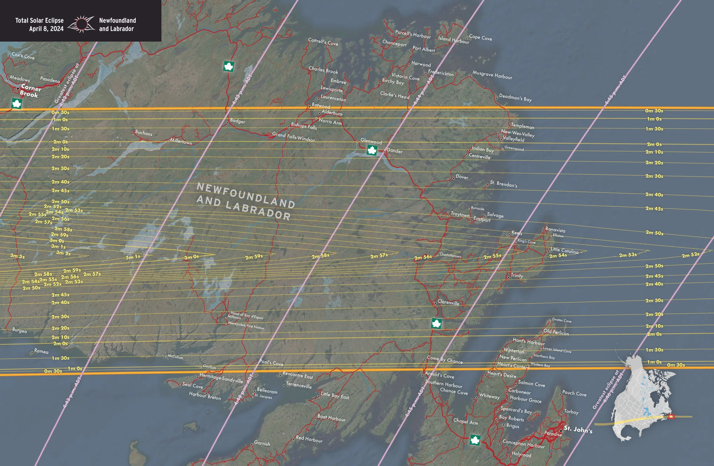
Newfoundland and Labrador
Circumstances of the eclipse
These maps show the obscuration, times, and sky position of the eclipse. They are from our Field Guide to the 2023 and 2024 Solar Eclipses by Michael Zeiler and Michael Bakich
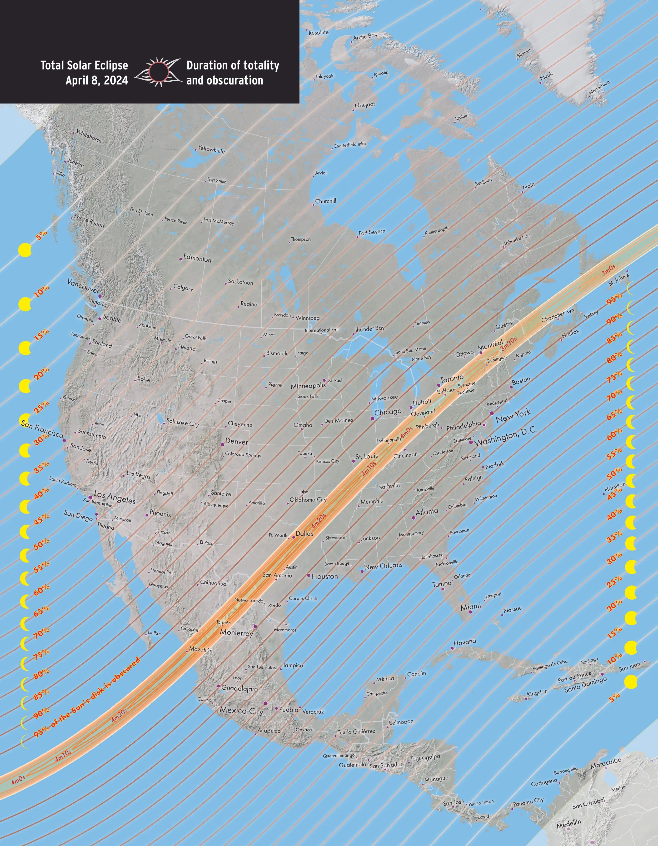
Duration of totality and obscuration

Local times of beginning of eclipse
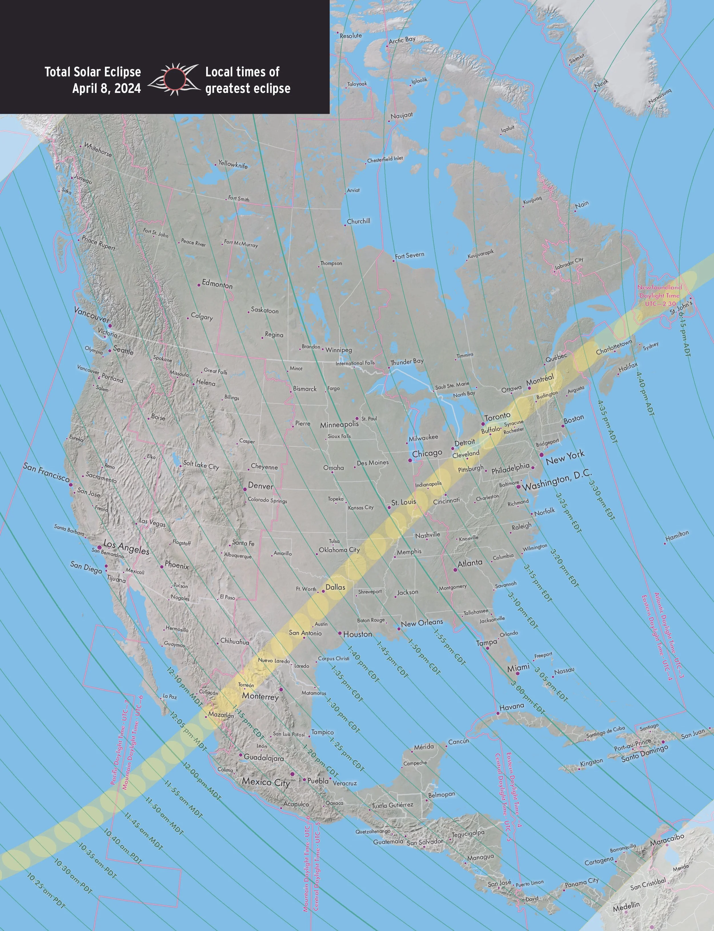
Local times of greatest eclipse

Local times of end of eclipse

Sky altitude of Sun at begin of eclipse
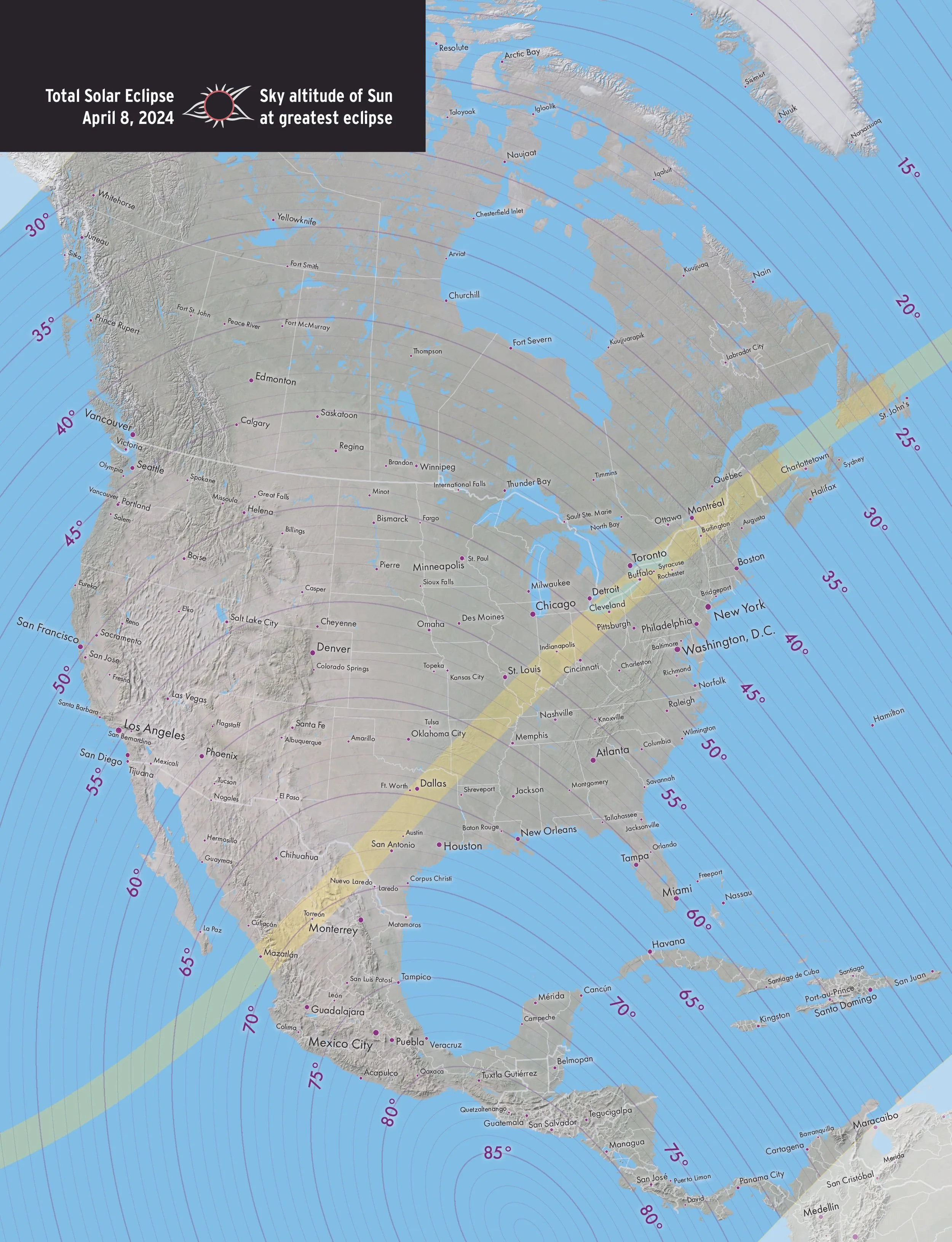
Sky altitude of Sun at greatest eclipse
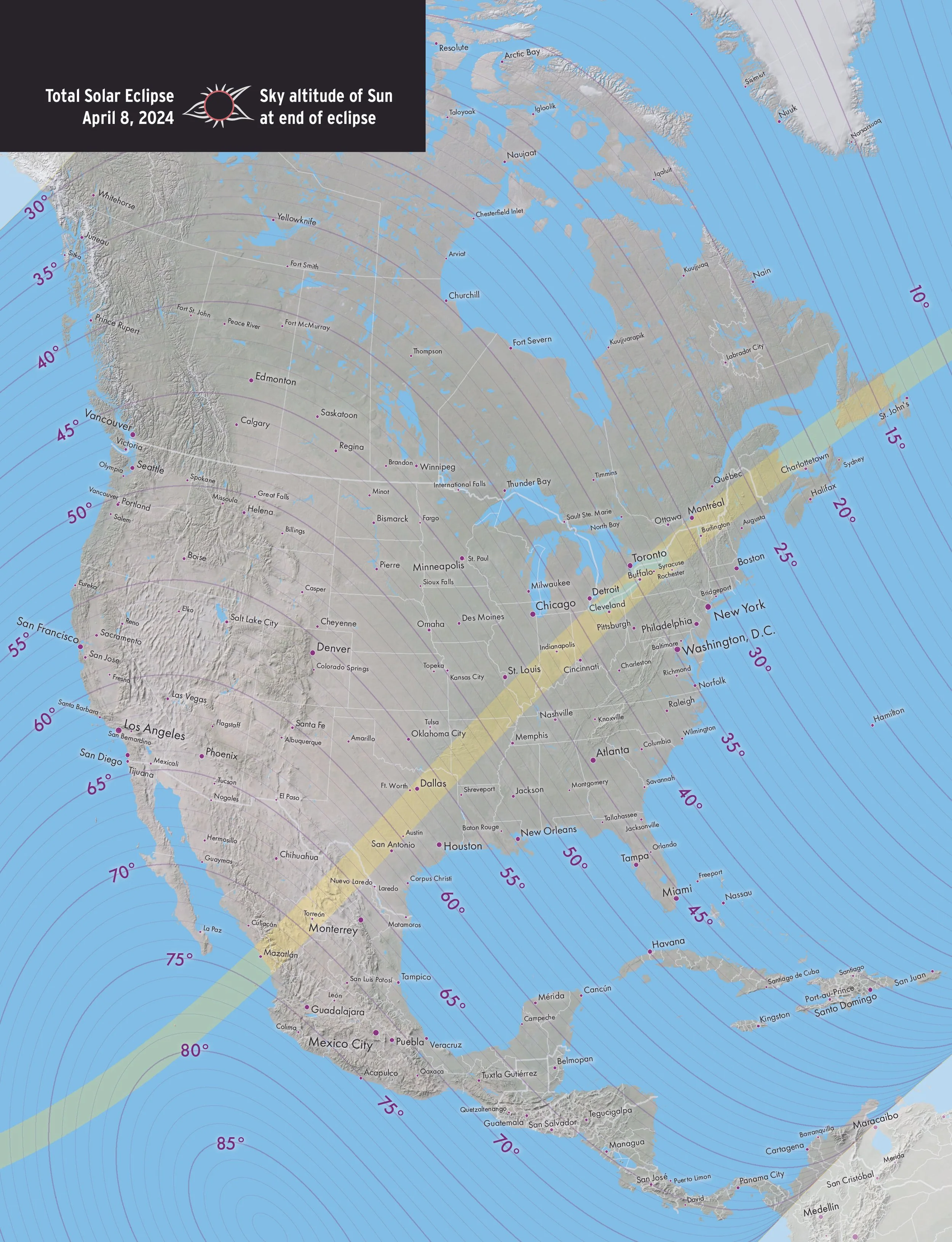
Sky altitude of Sun at end of eclipse
Six-panel maps of the eclipse
We created this maps for a special edition of Astronomy magazine focused on the 2024 total solar eclipse.
Mexico
Mexico to Texas

Texas to Illinois
Illinois to Pennsylvania
Pennsylvania to New Hampshire
Maine to Newfoundland
Print maps of the eclipse
We published and sold these maps on GreatAmericanEclipse.com
Total solar eclipse of April 8, 2024
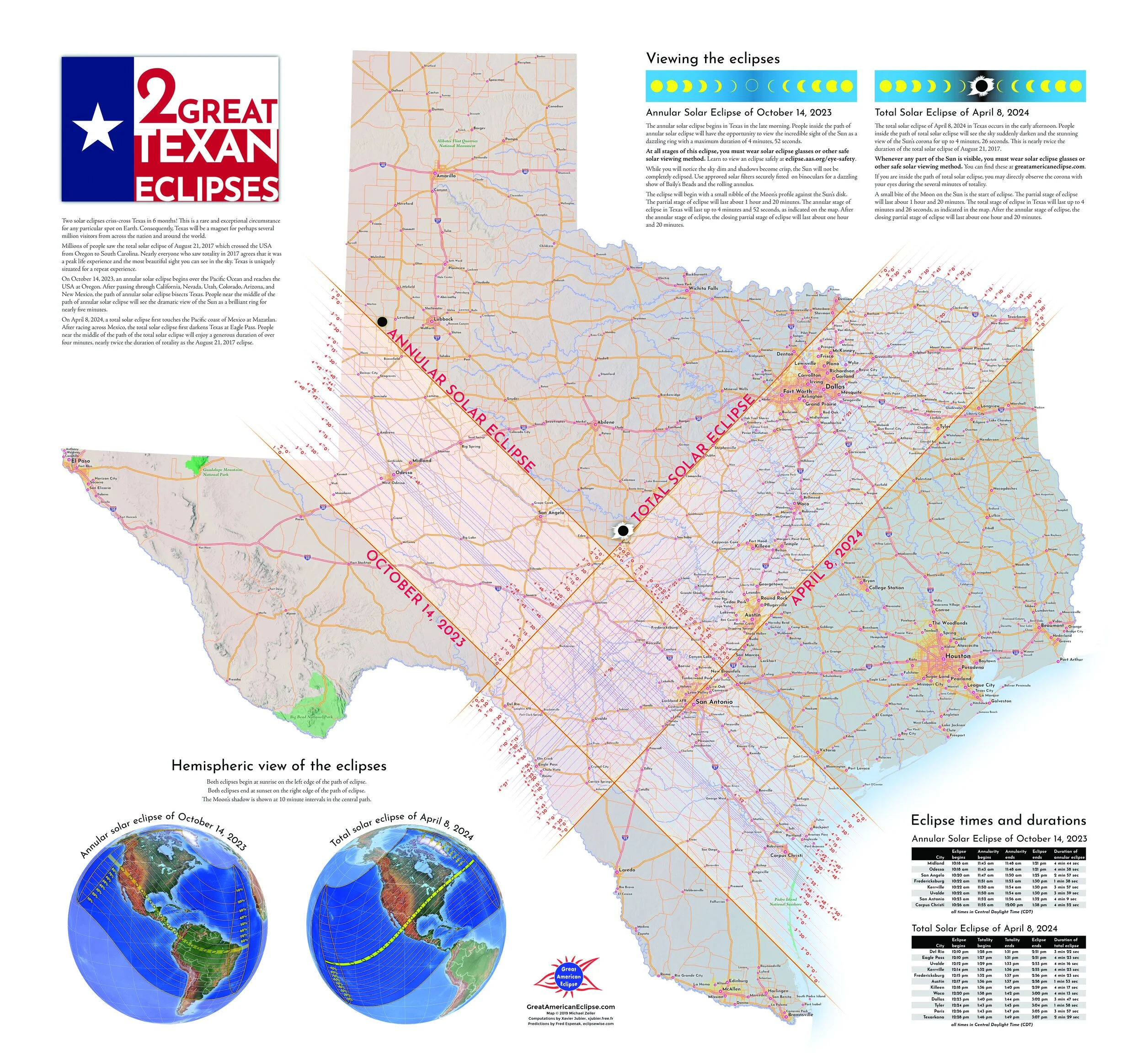
2 Great Texas Eclipses
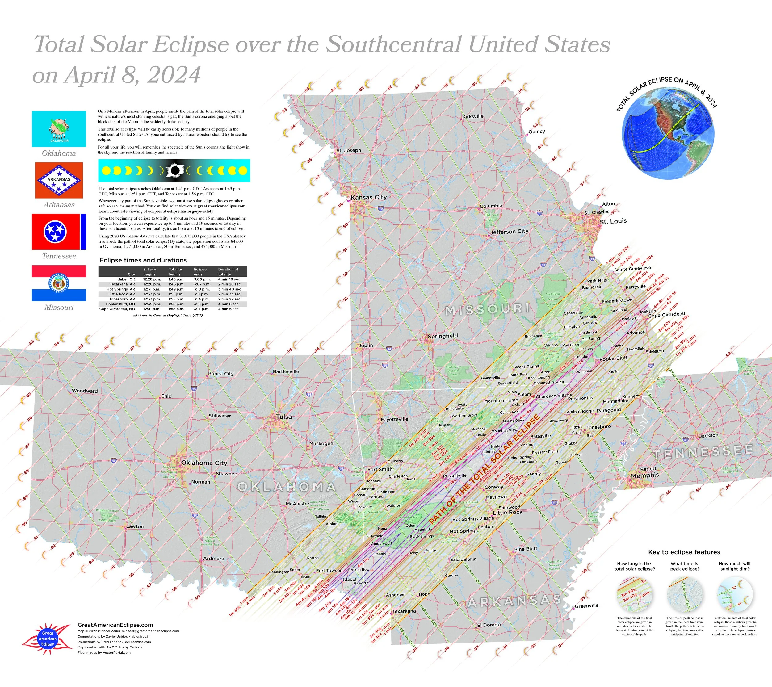
Total Solar Eclipse over the Southcentral United States on April 8, 2024
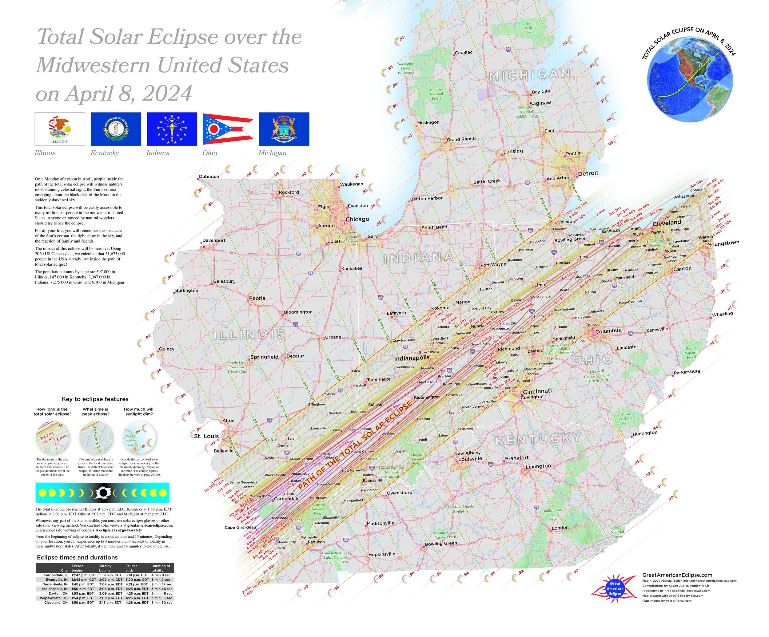
Total Solar Eclipse over the Midwestern United States on April 8, 2024
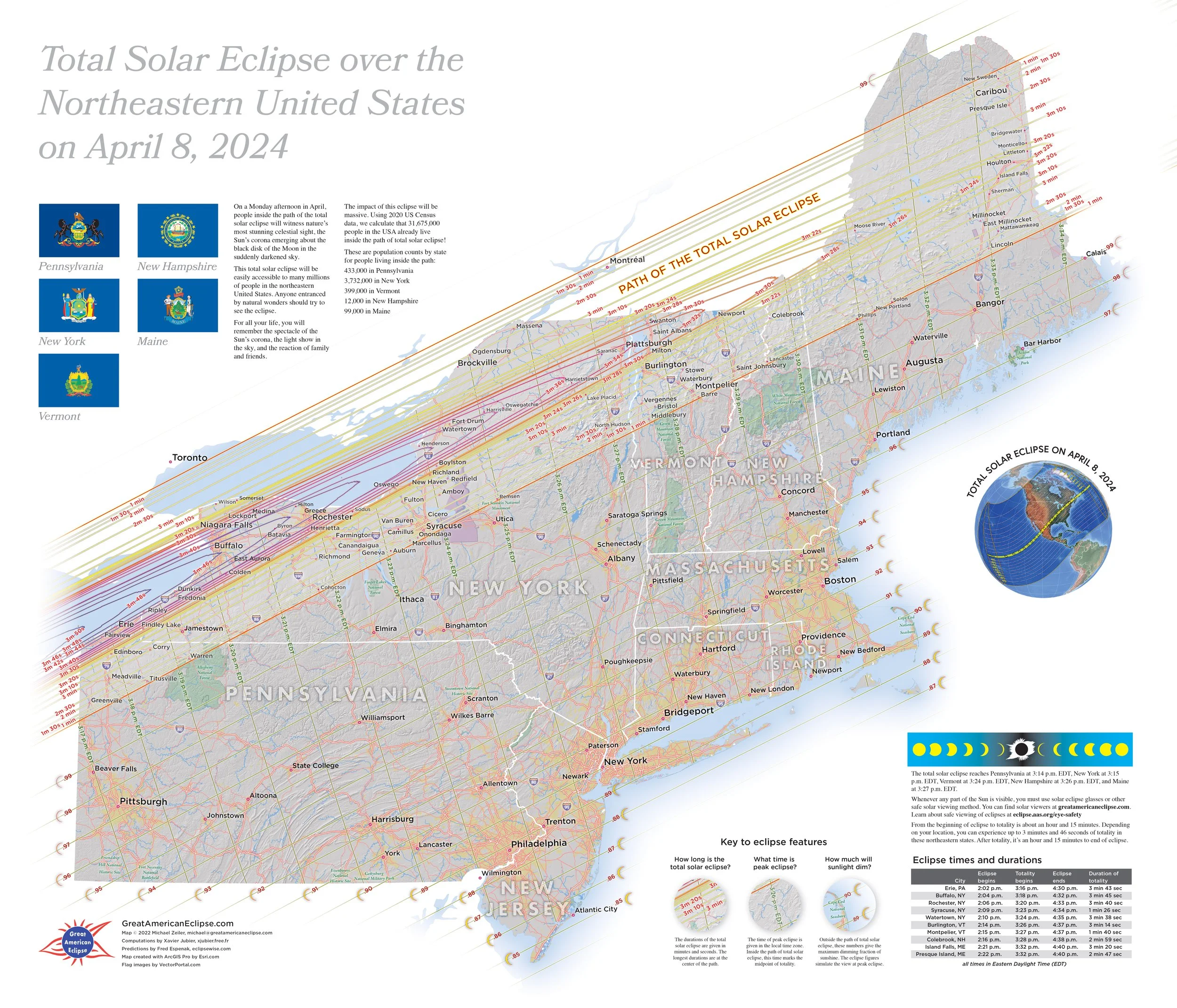
Total Solar Eclipse over the Northeastern United States on April 8, 2024
Thematic maps of the eclipse
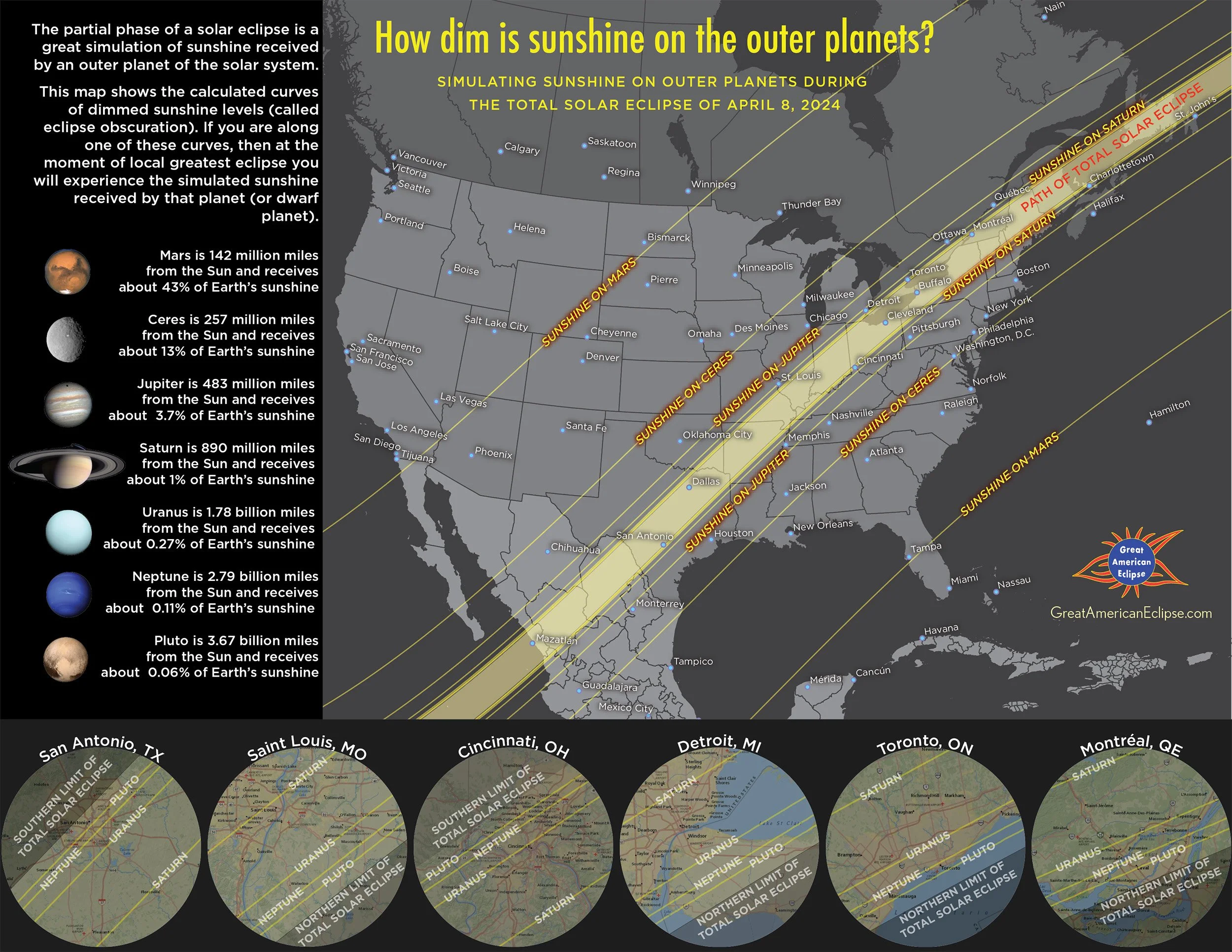
How dim is sunshine on the outer planets?
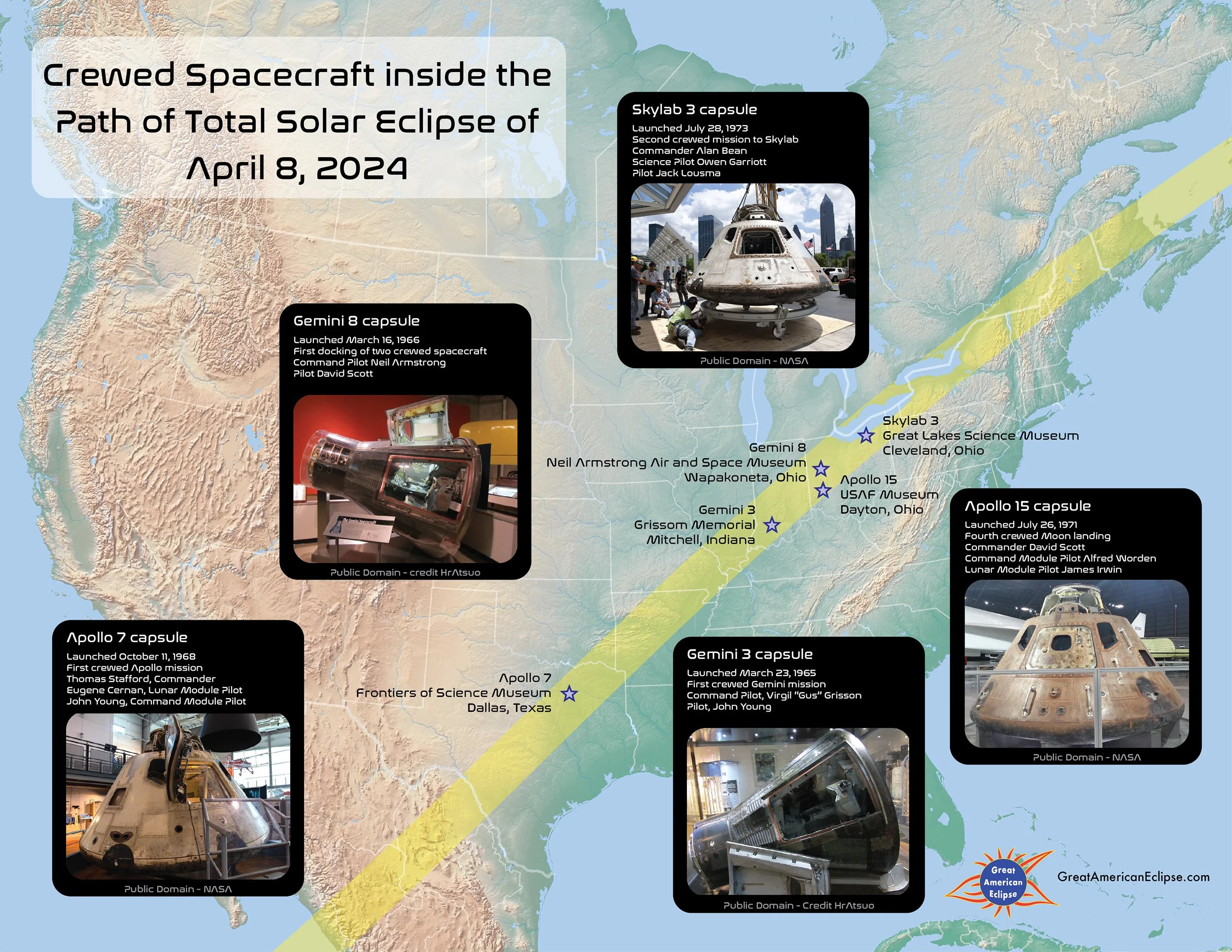
Crewed Spacecraft inside the Path of Total Solar Eclipse of April 8, 2024
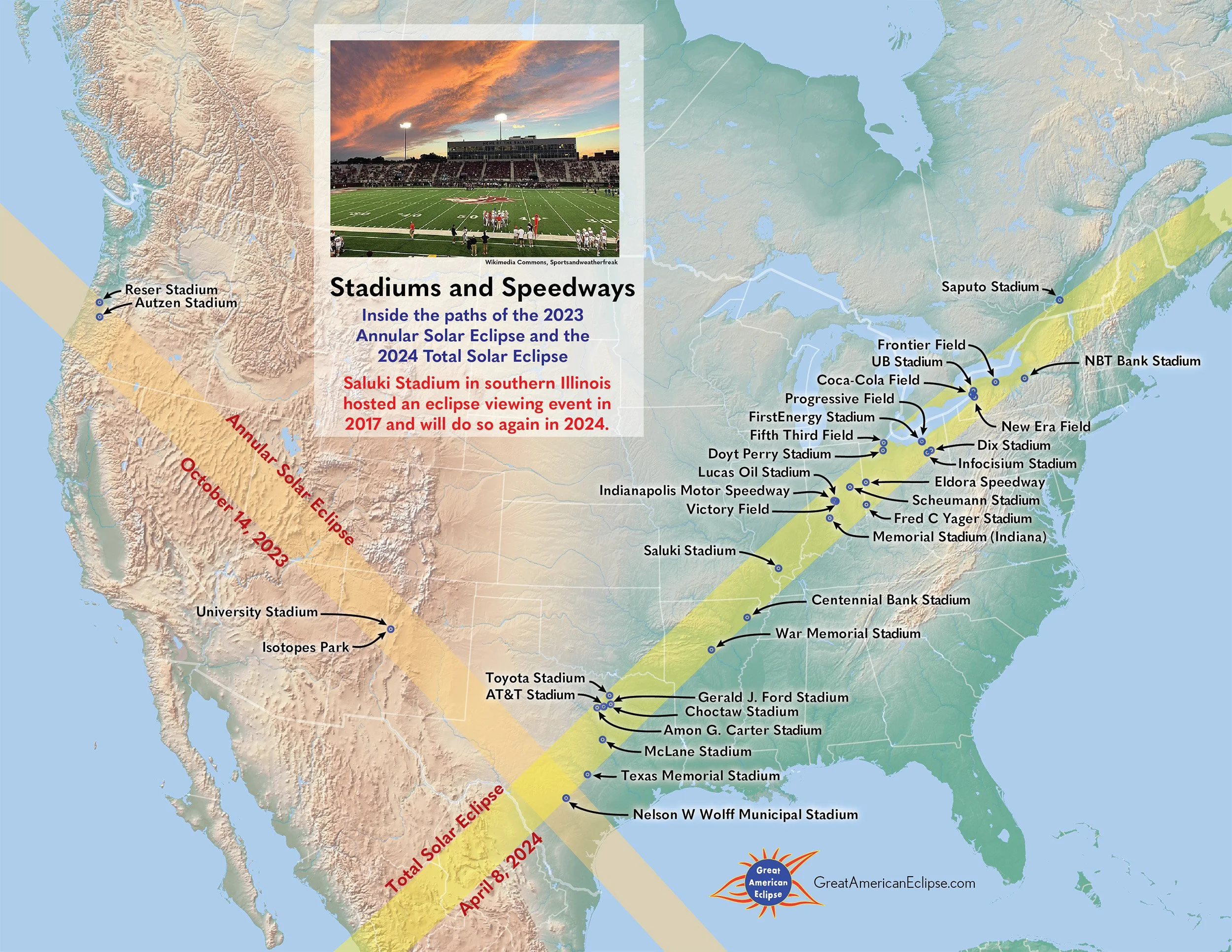
Stadiums and Speedways
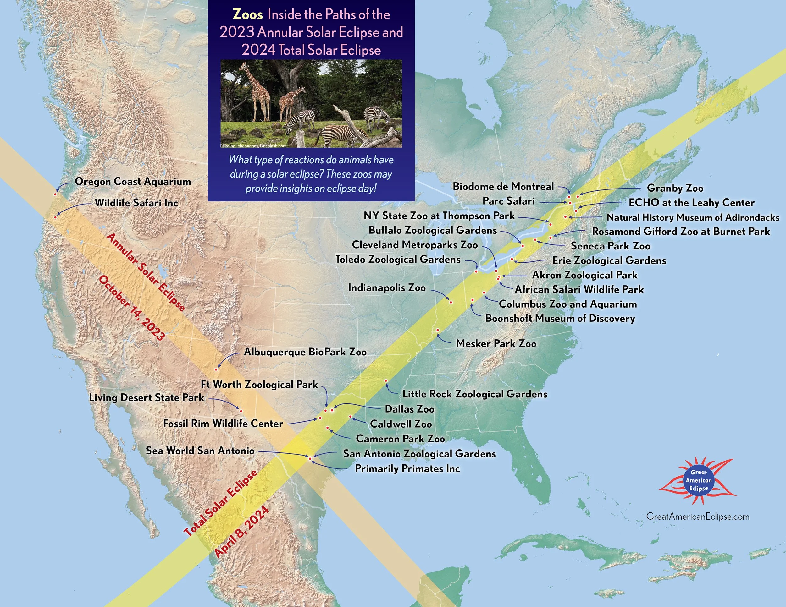
Zoos
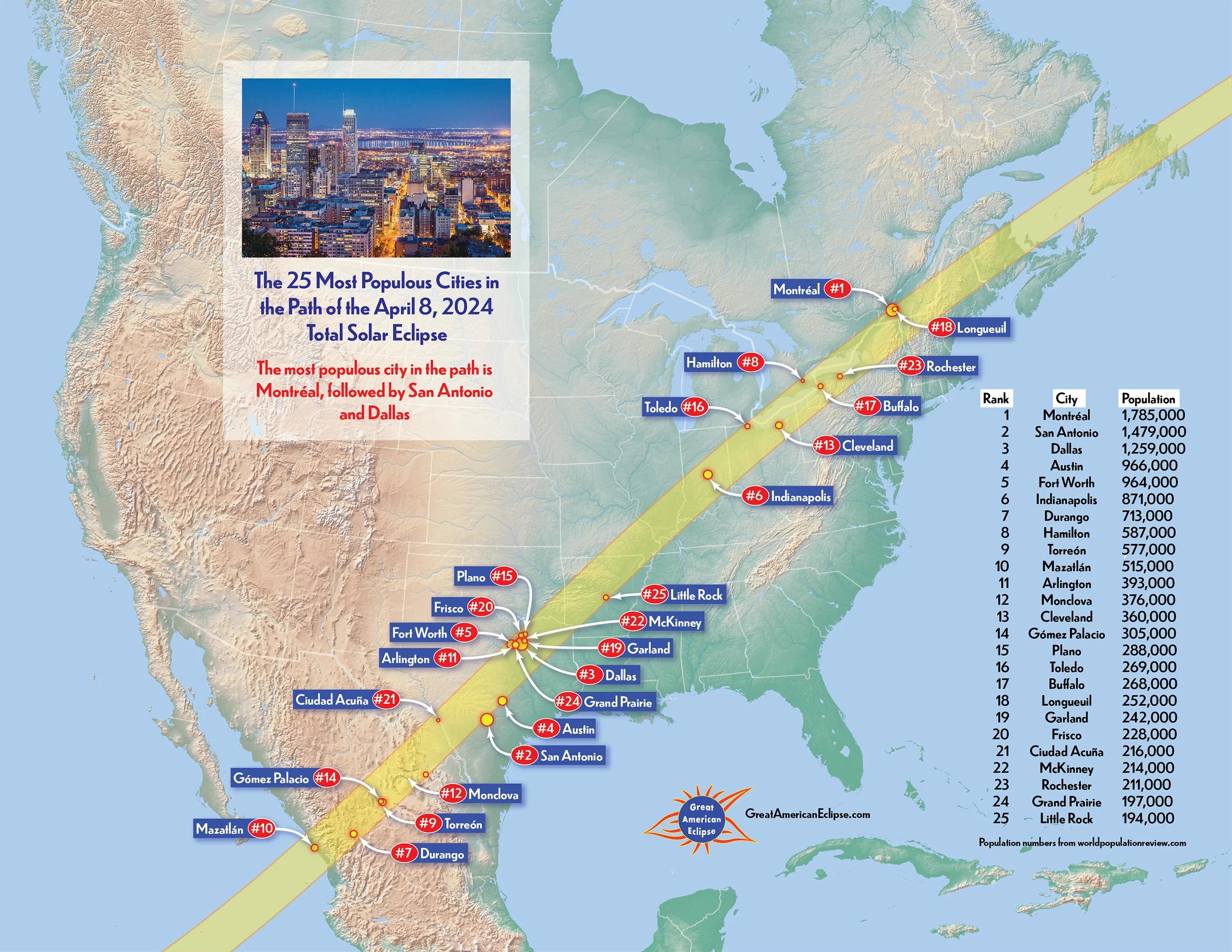
The 25 Most Populous Cities
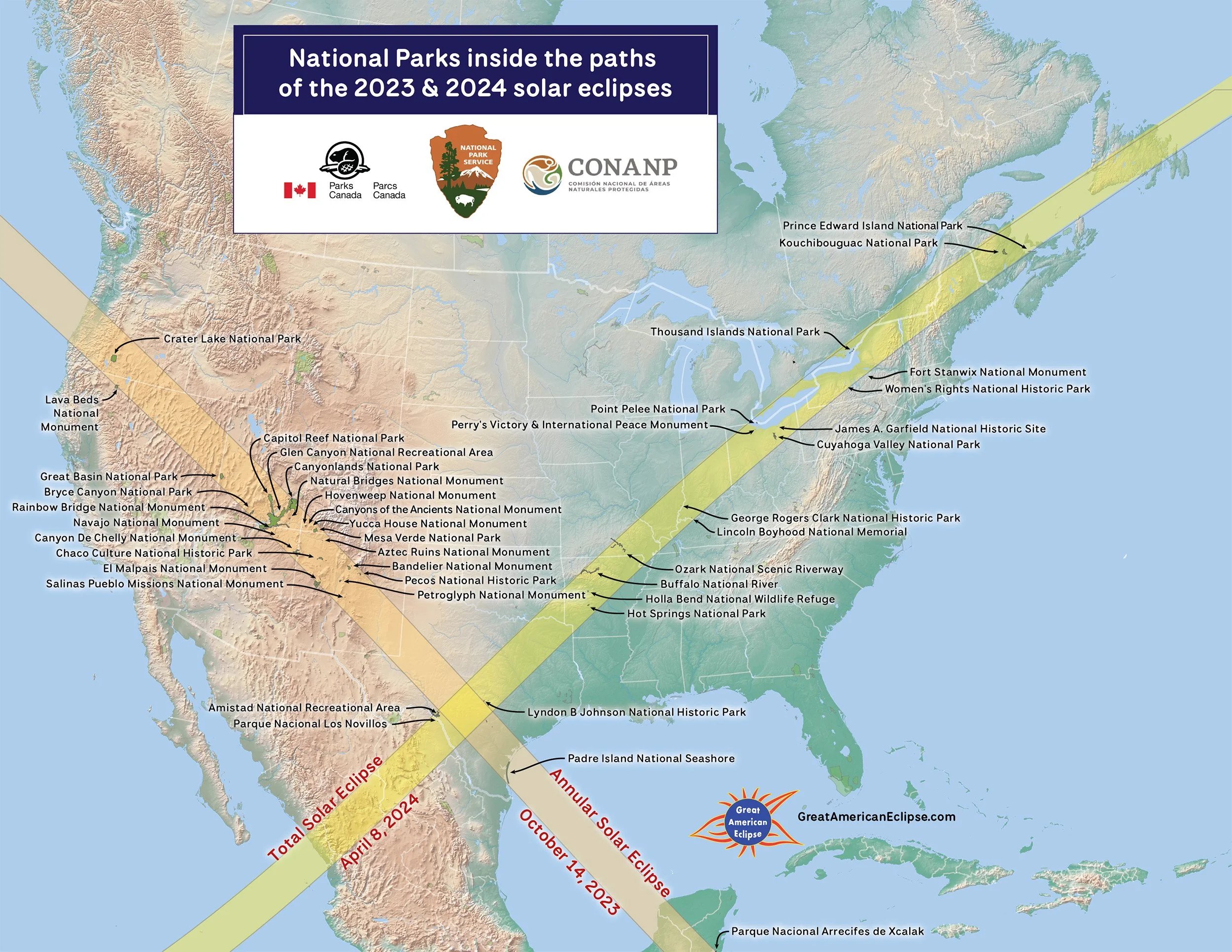
National Parks inside the paths of the 2023 & 2024 solar eclipses
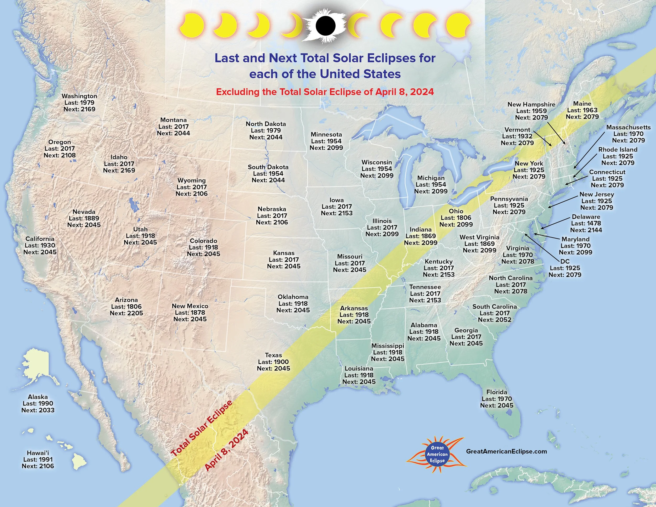
Last and Next Total Solar Eclipses for each other the United States
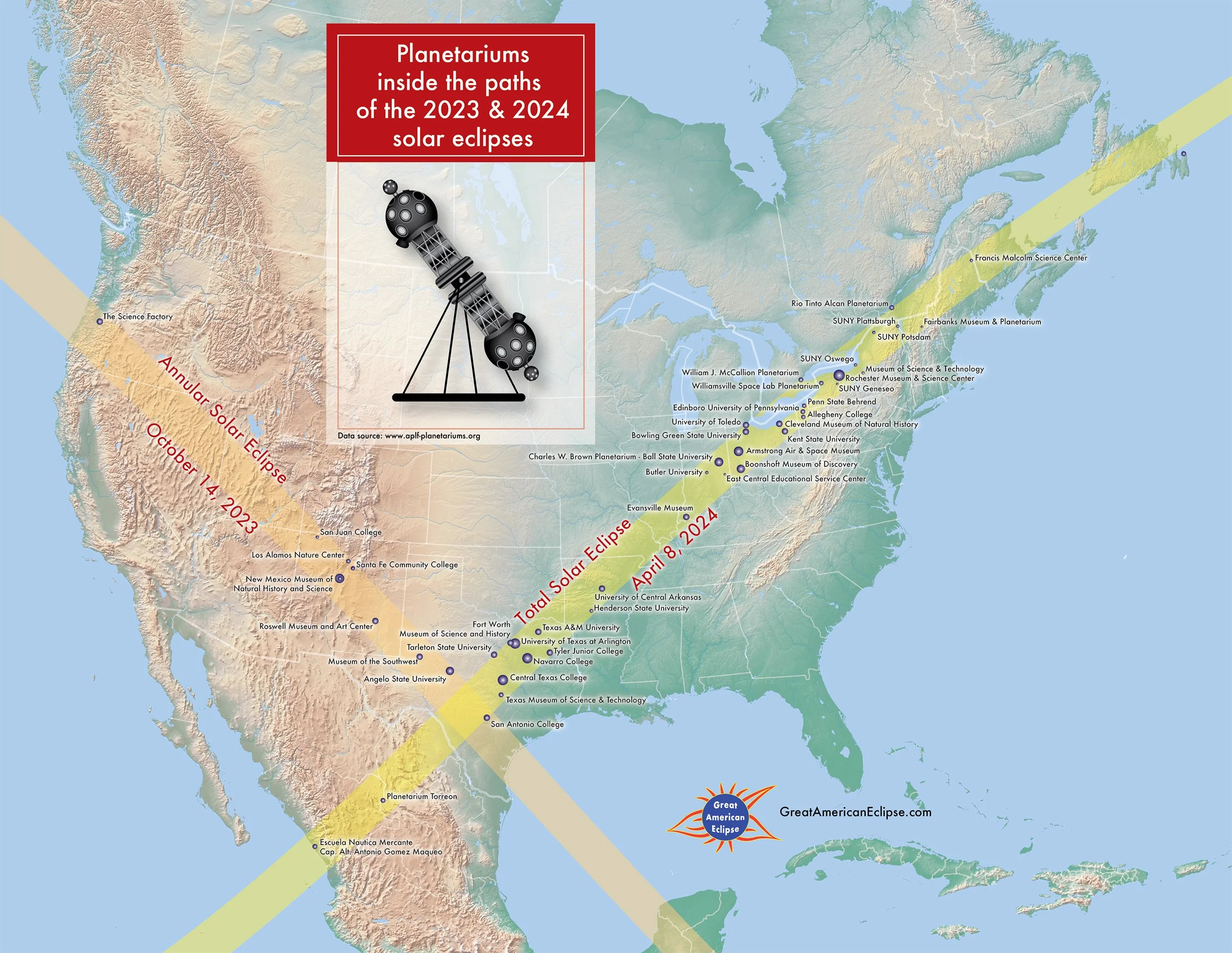
Planetariums inside the path of the 2023 & 2024 solar eclipses

Eclipse-related place names throughout North America
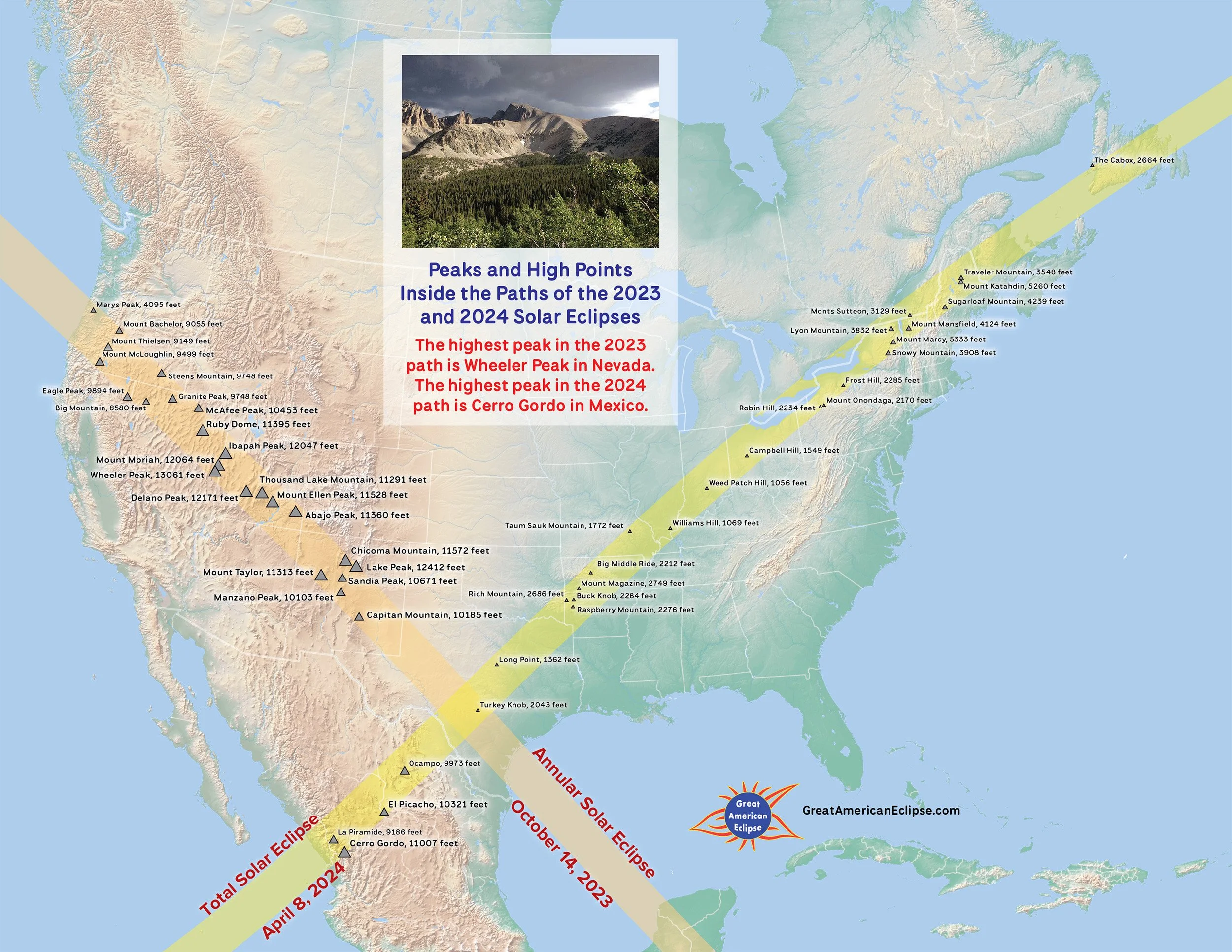
Peaks and High Points inside the paths of the 2023 and 2024 Solar Eclipses
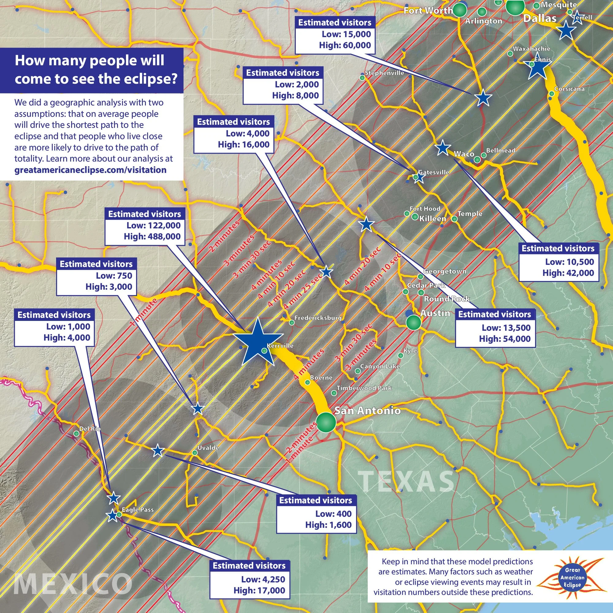
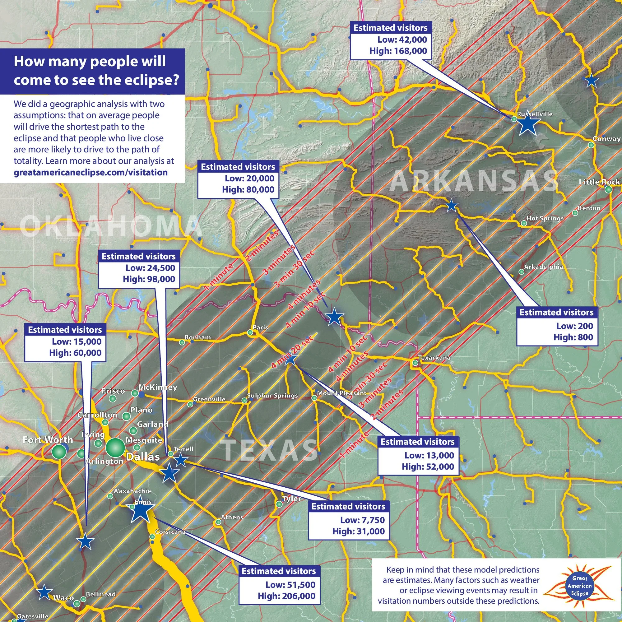
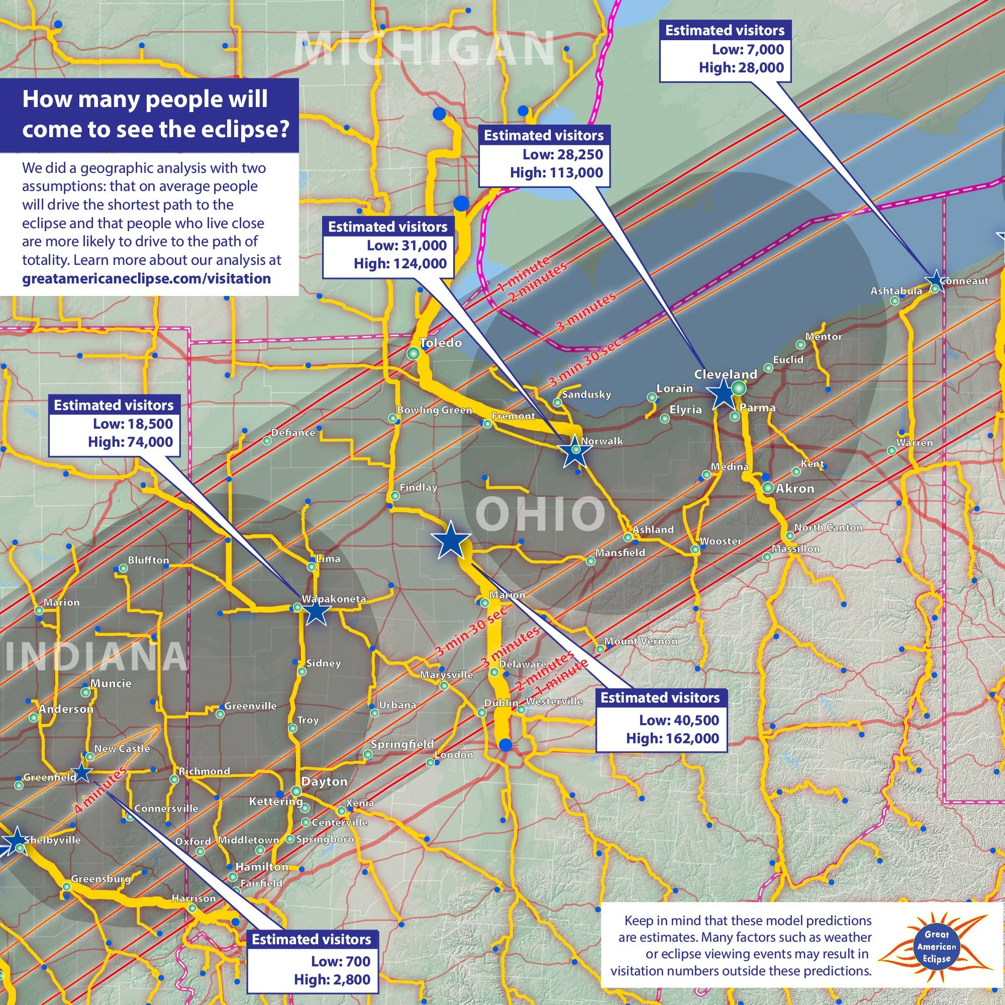
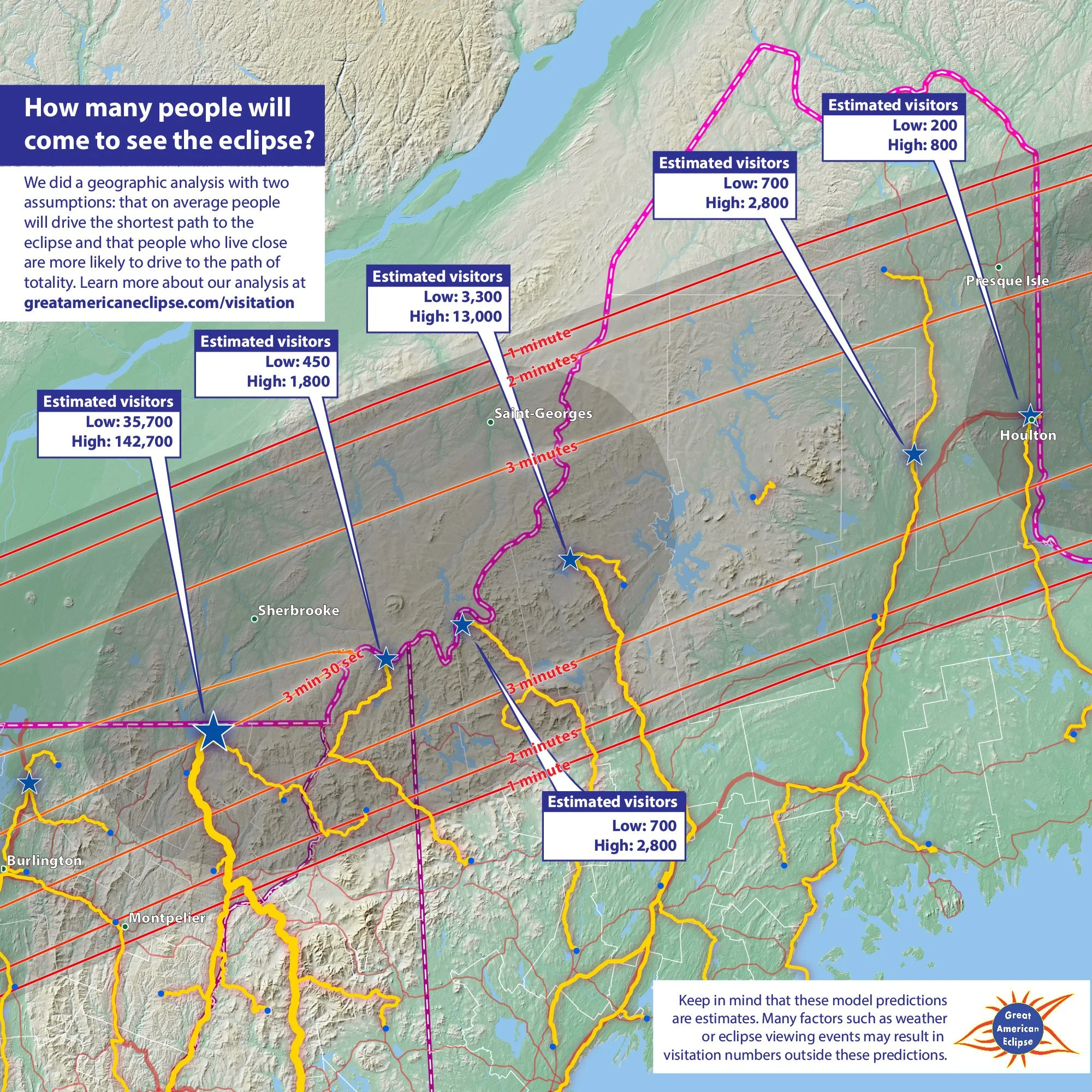
Maps of eclipse visitation
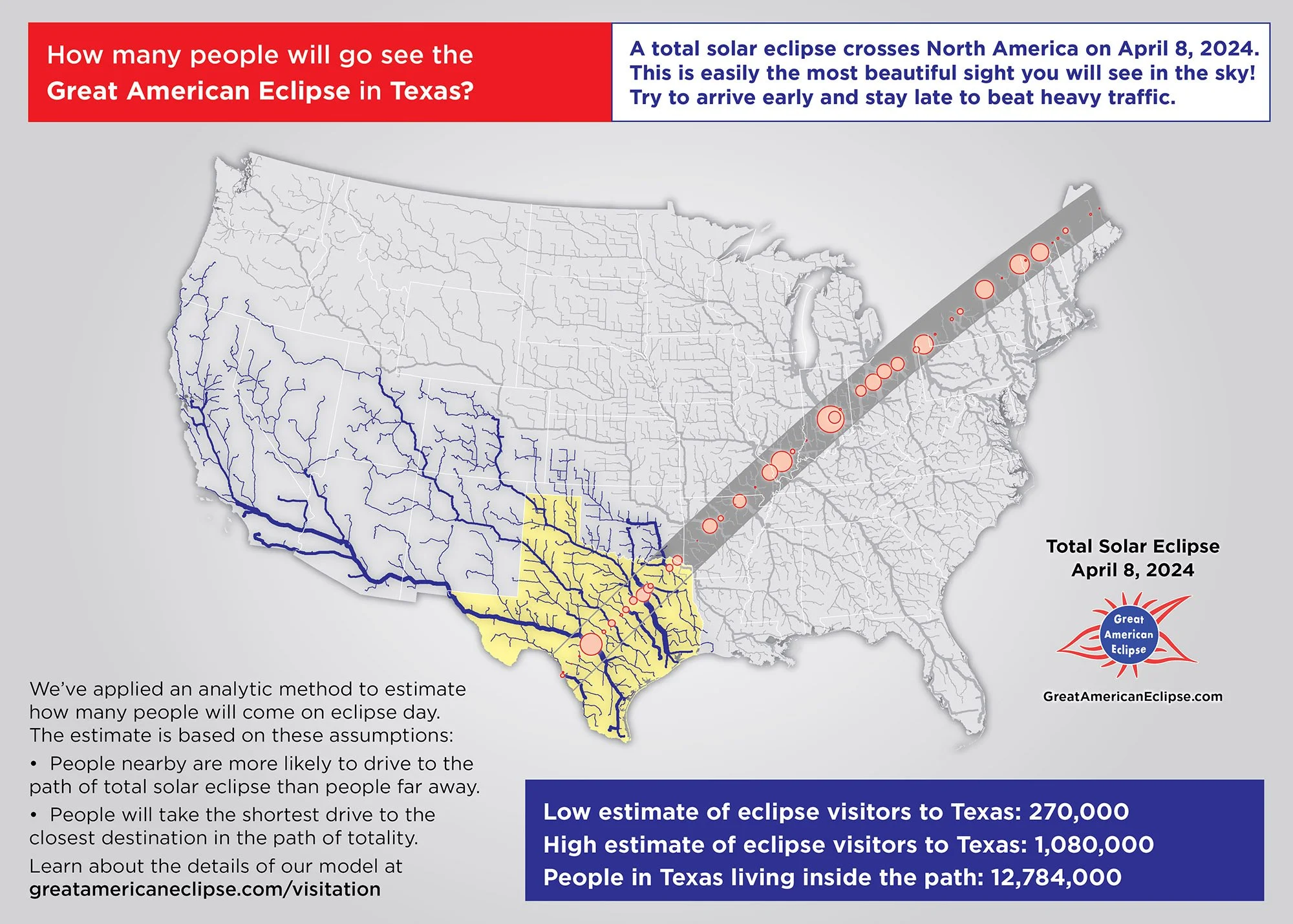
Eclipse visitation to Texas
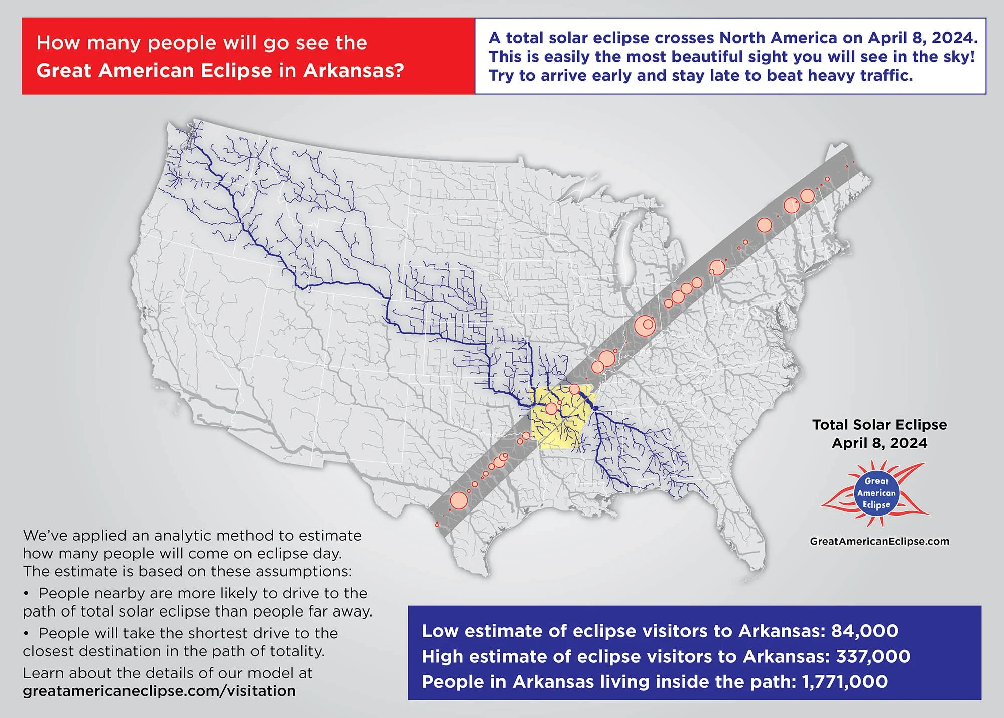
Eclipse visitation to Arkanas
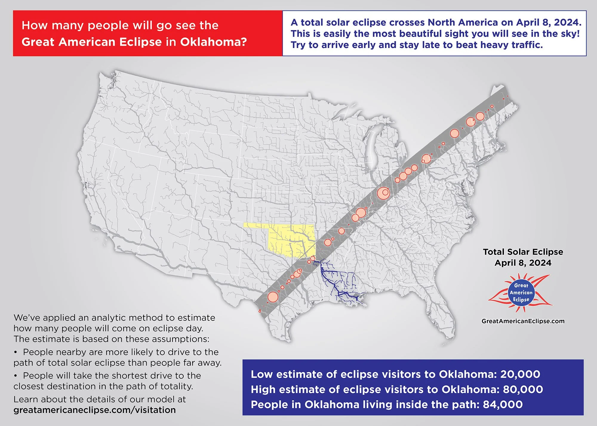
Eclipse visitation to Oklahoma

Eclipse visitation to Missouri
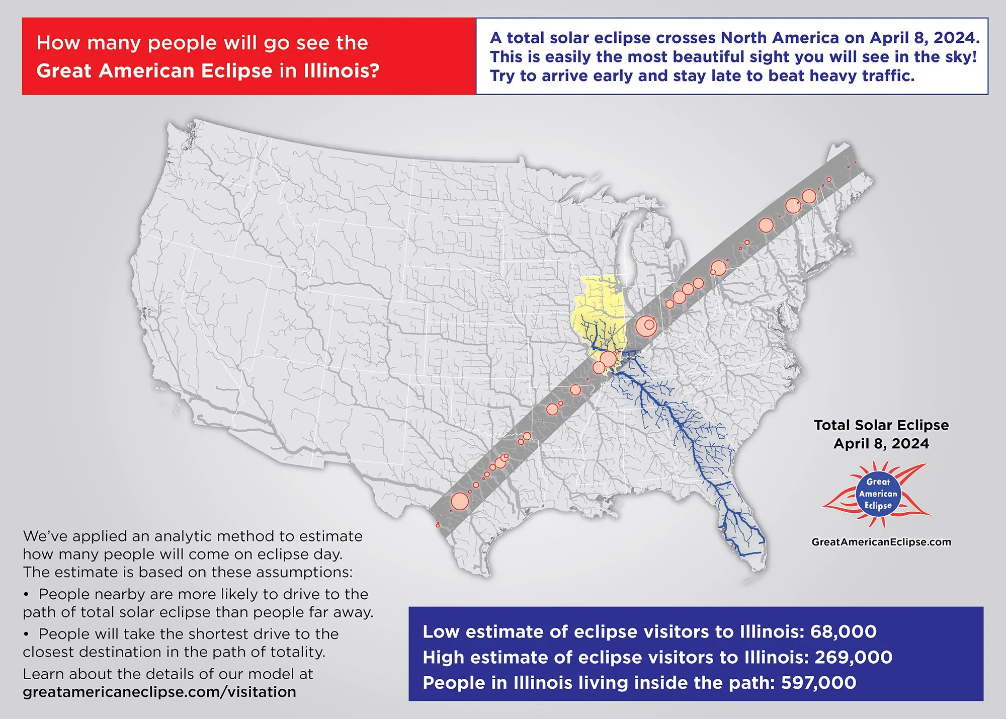
Eclipse visitation to Illinois

Eclipse visitation to Indiana
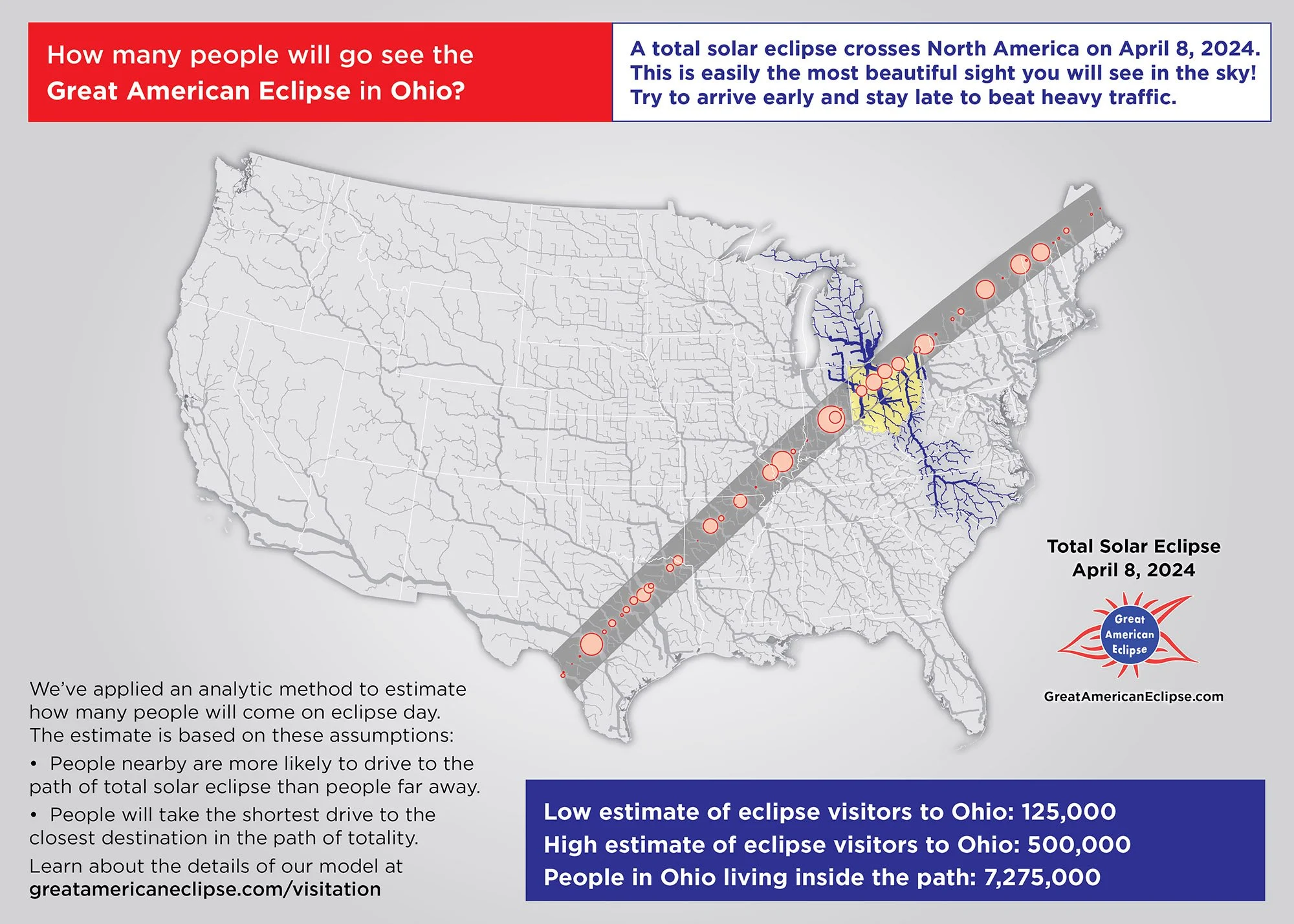
Eclipse visitation to Ohio
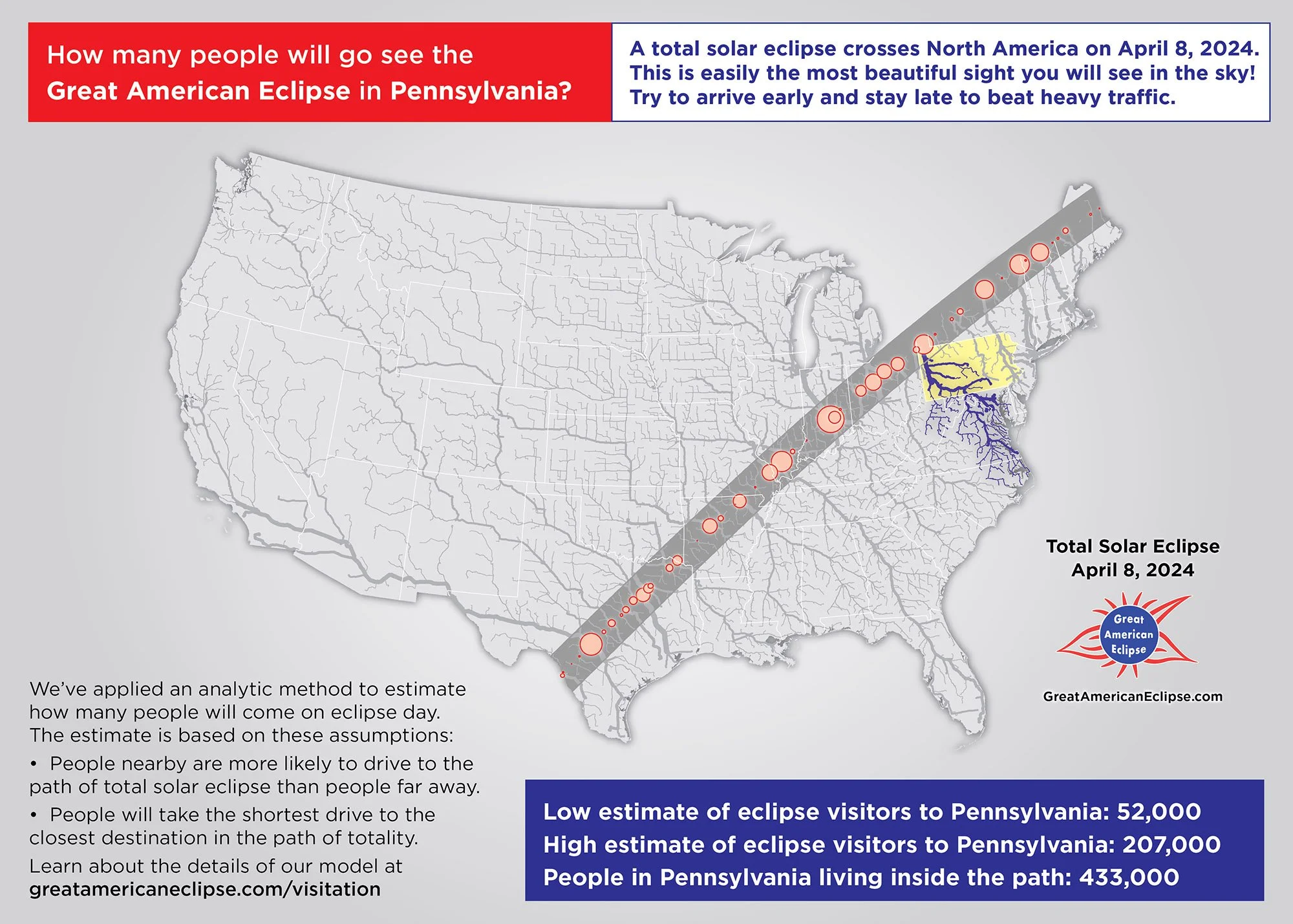
Eclipse visitation to Pennsylvania

Eclipse visitation to New York
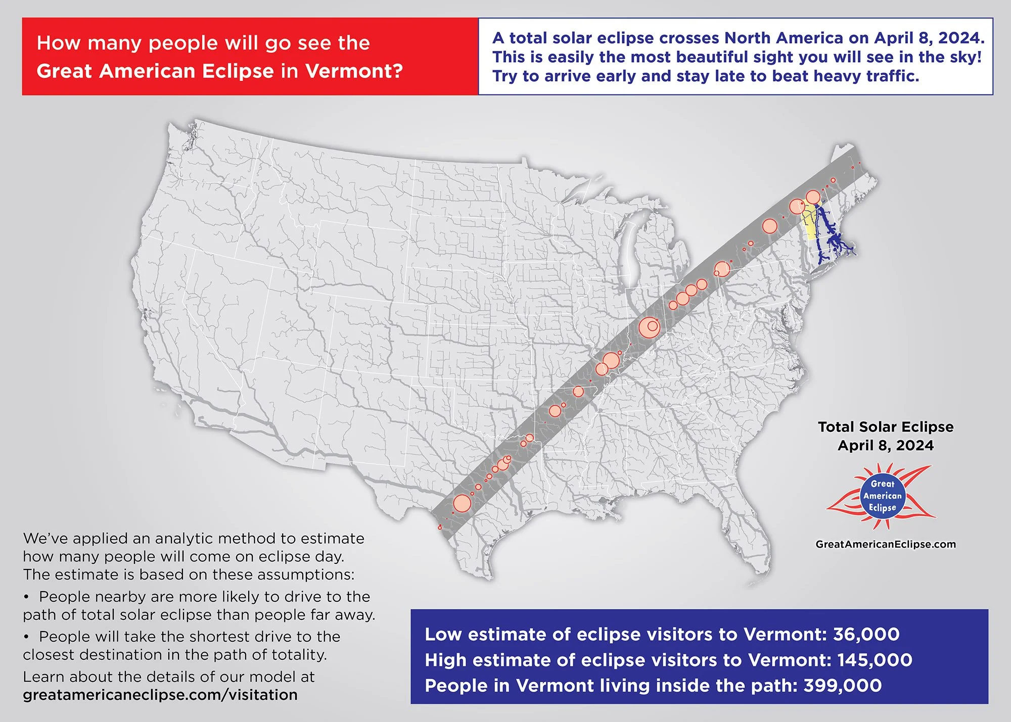
Eclipse visitation to Vermont
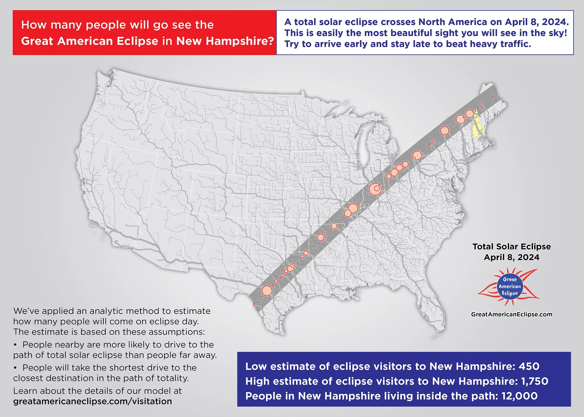
Eclipse visitation to New Hampshire

Eclipse visitation to Maine


Duration and times of eclipse
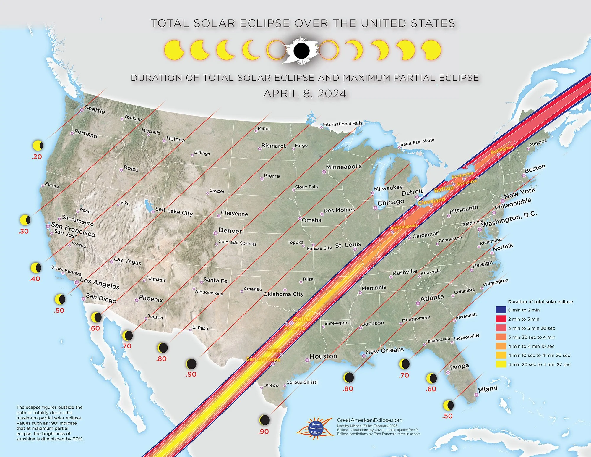
Duration of total solar eclipse and maximum partial eclipse
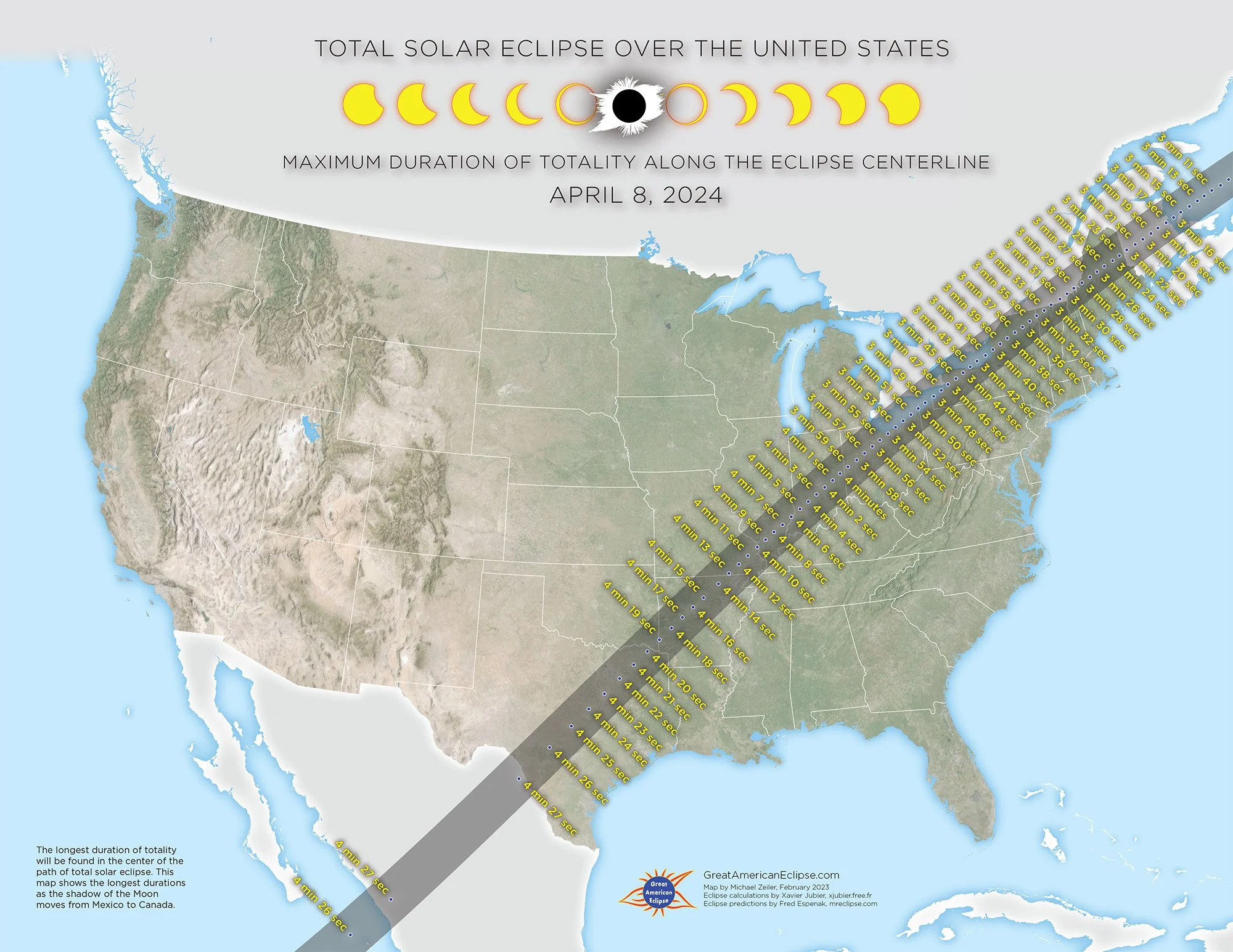
Maximum duration of totality along the eclipse centerline
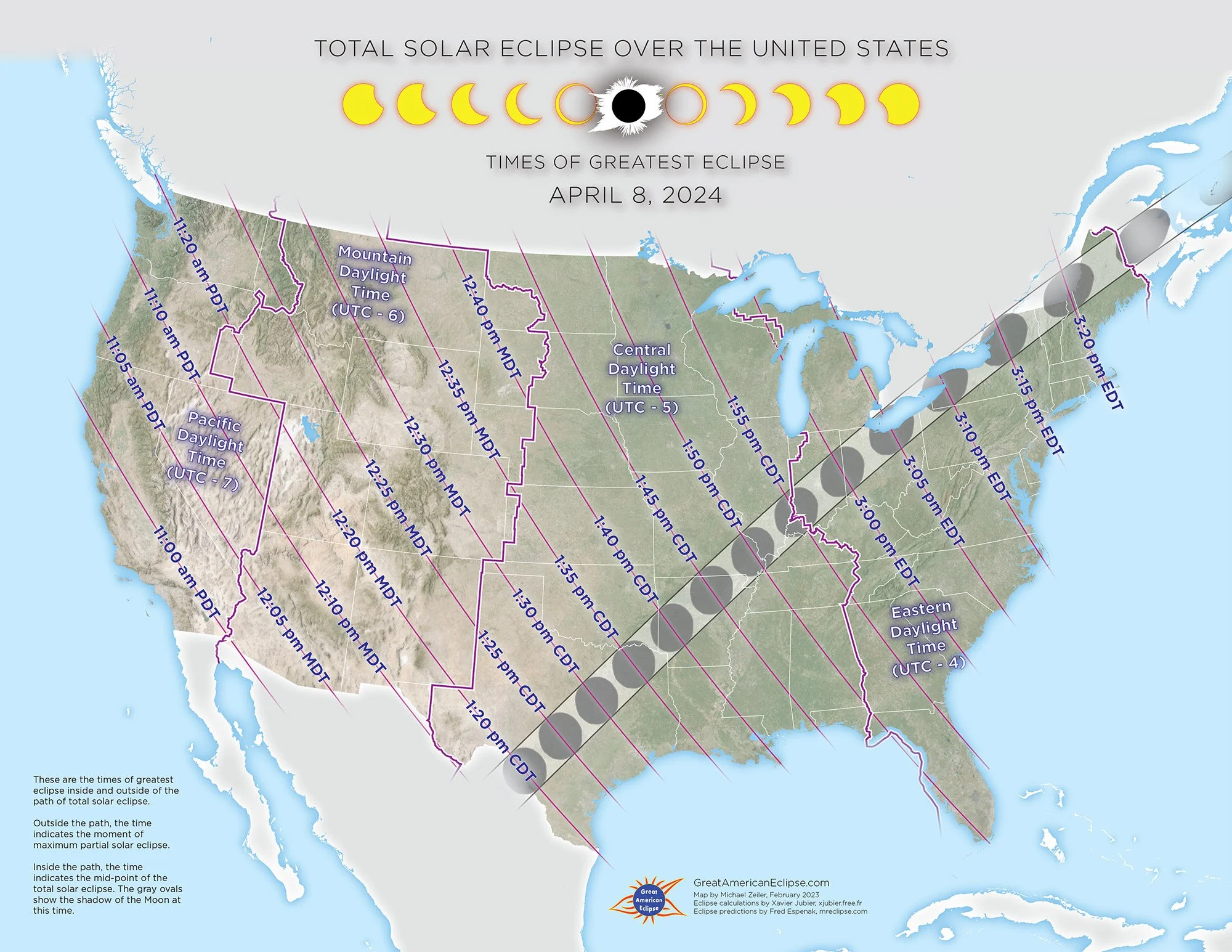
Times of greatest eclipse
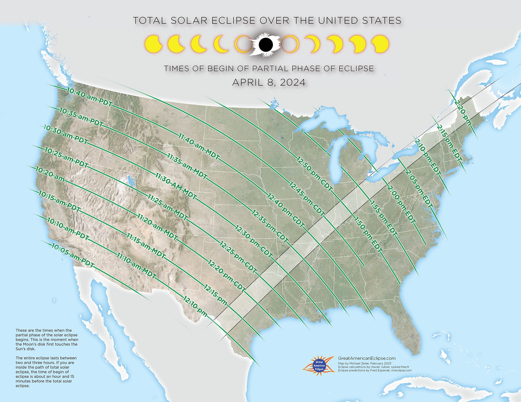
Times of begin of partial phase of eclipse
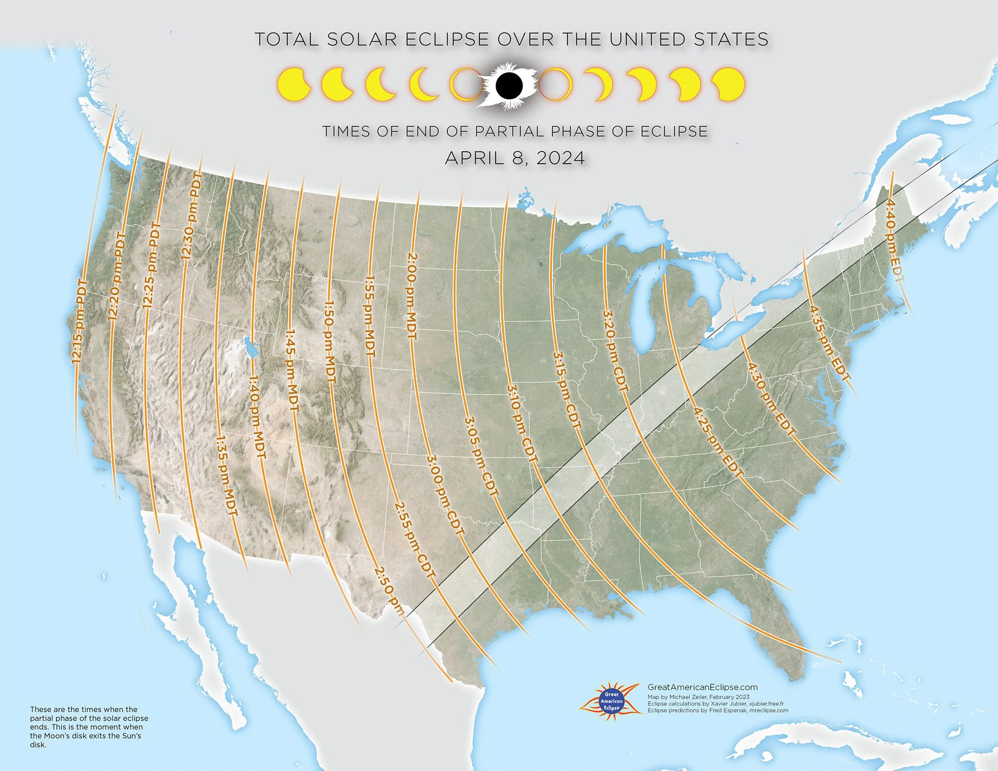
Times of end of partial phase of eclipse
Print maps of the eclipse by state
We published and sold these maps on GreatAmericanEclipse.com

Mexico
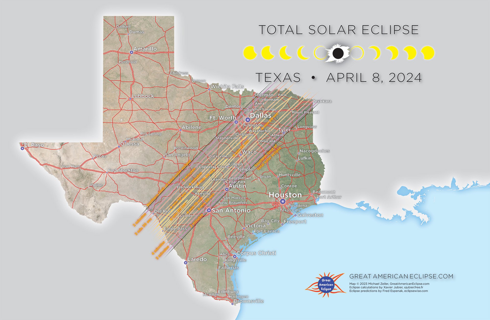
Texas
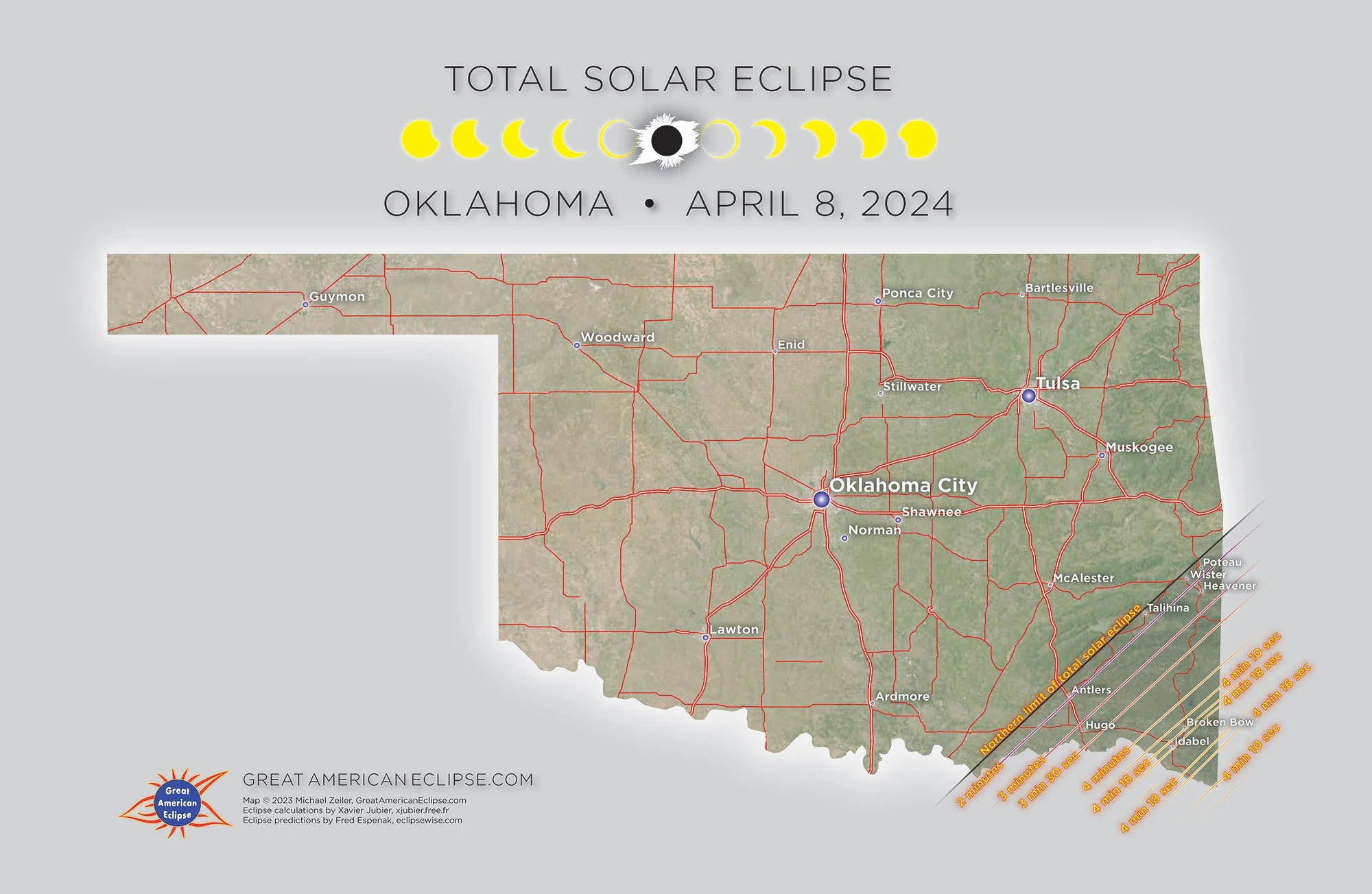
Oklahoma

Arkanas

Missouri
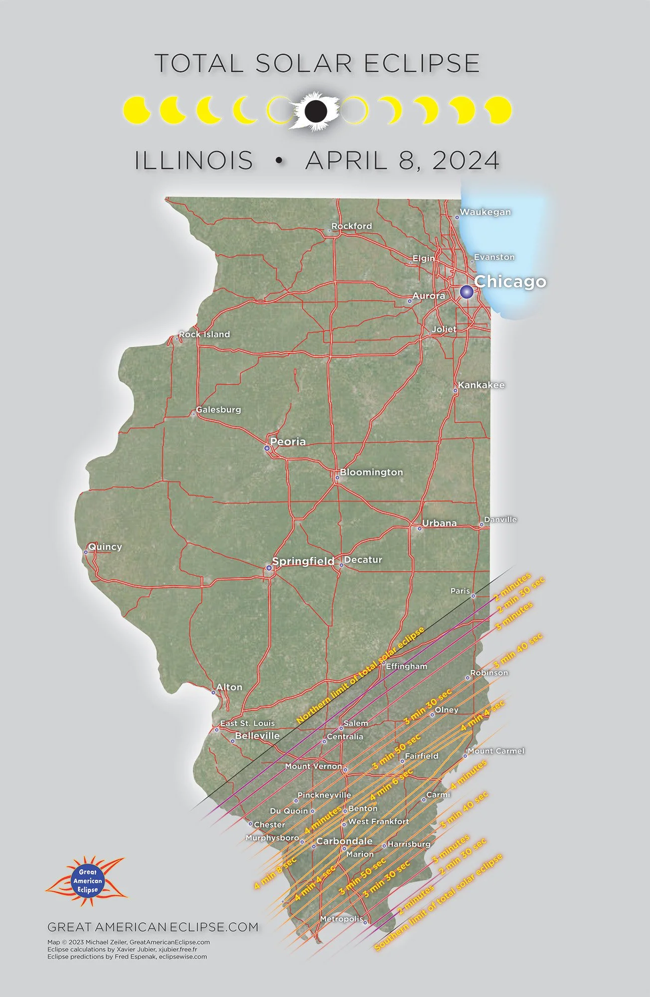
Illinois

Indiana
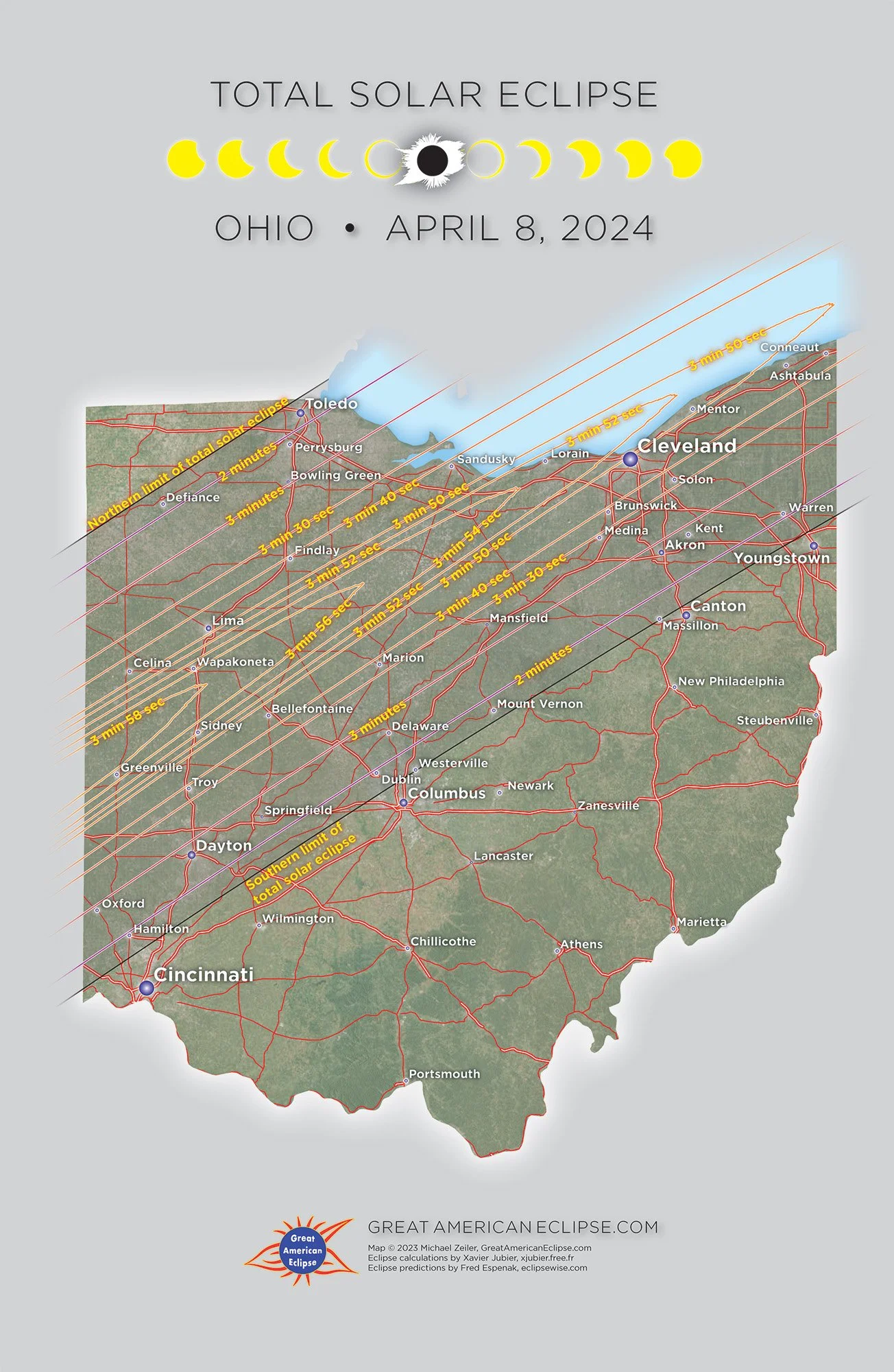
Ohio

Ontario
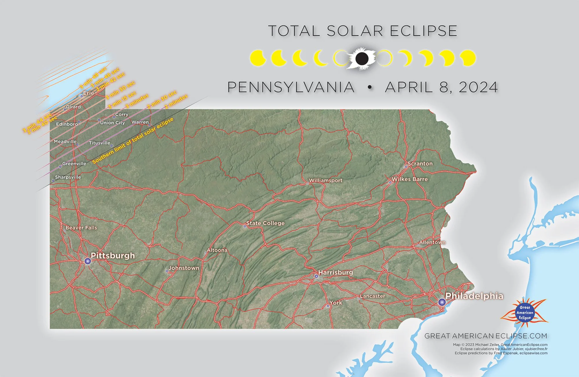
Pennsylvania

New York
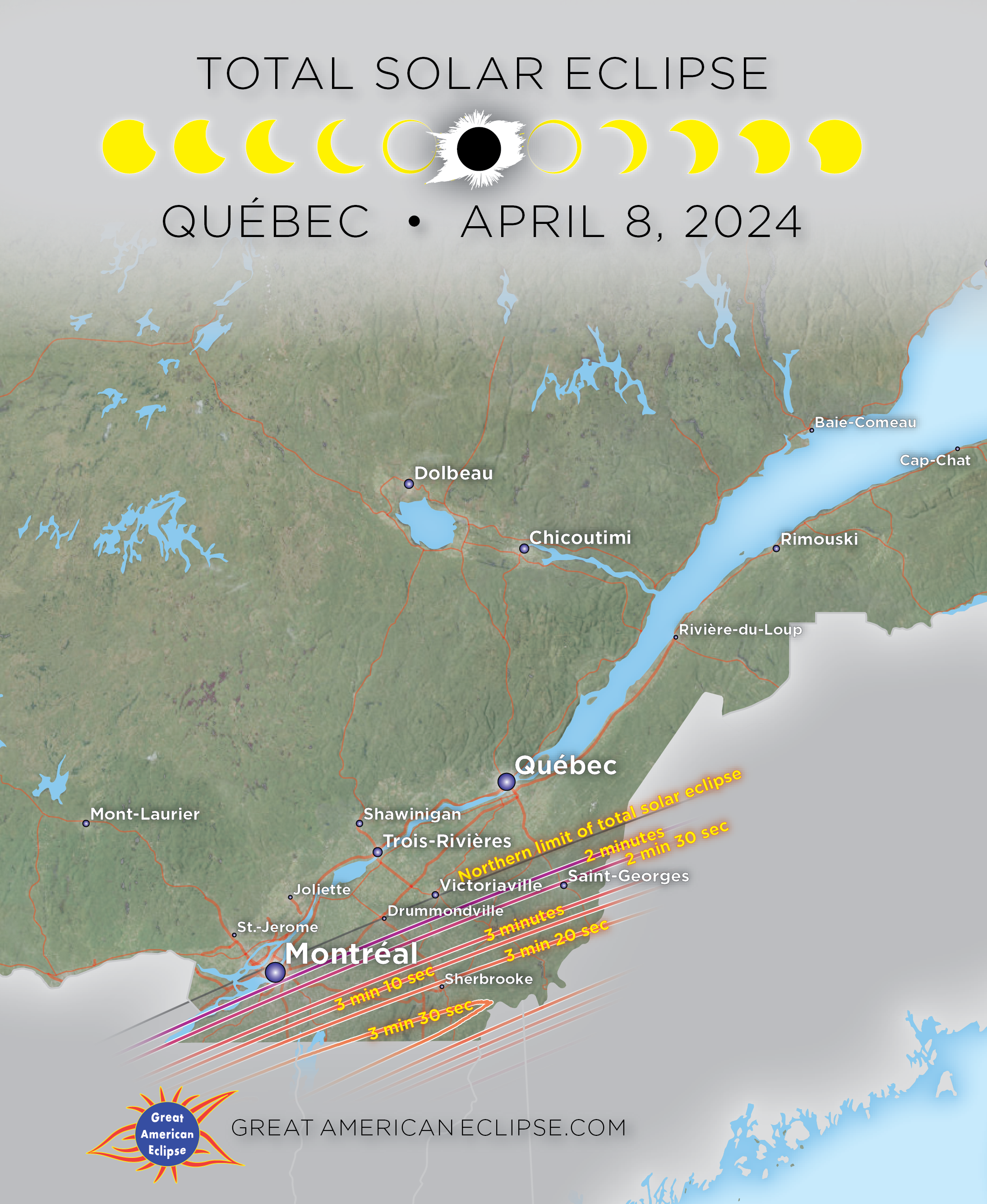
Québec
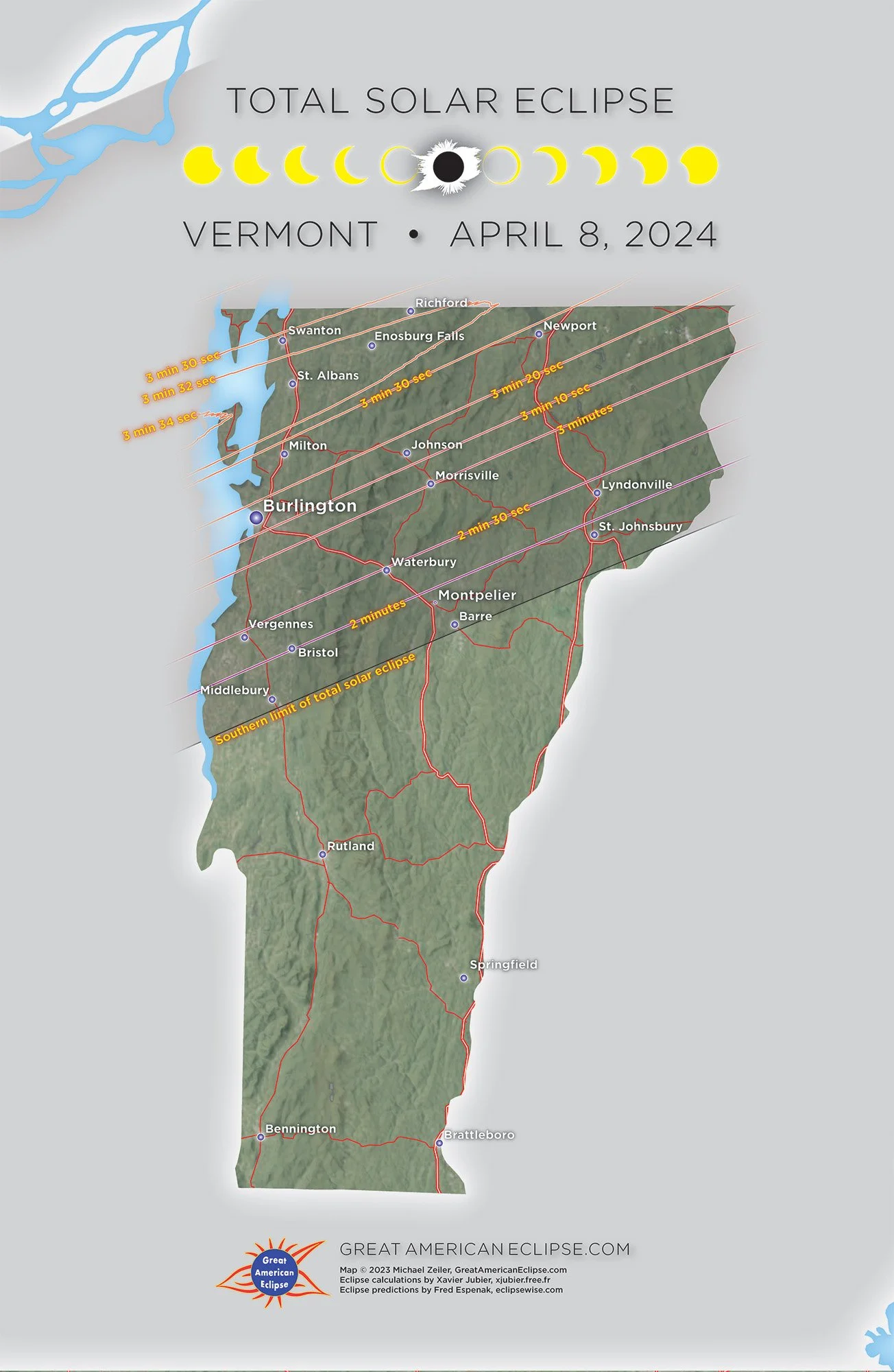
Vermont

New Hampshire

Maine
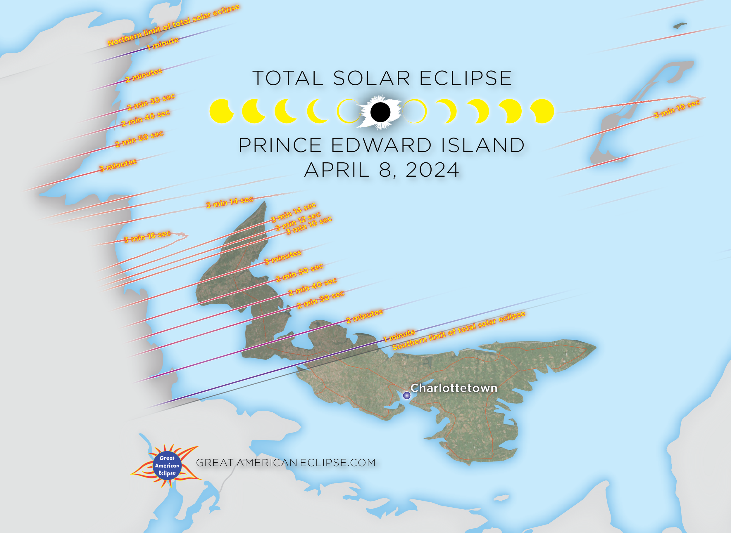
Prince Edward Island

New Brunswick

Newfoundland and Labrador
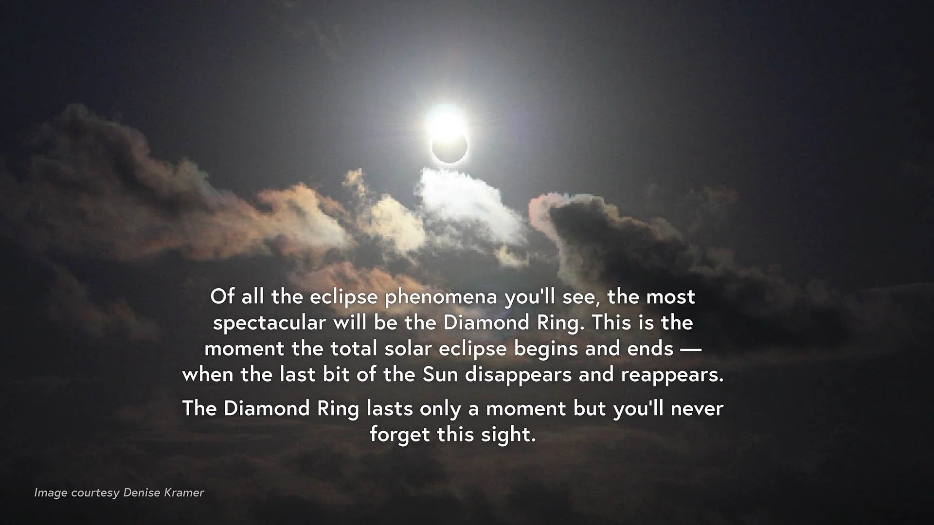
Maps to find the double-diamond ring
Our maps are developed to high-accuracy accounting for the Moon’s irregular limb. We realized that we were able to calculate where the elusive and beautiful double-diamond ring effect could be seen. These are the first type of this eclipse map published.
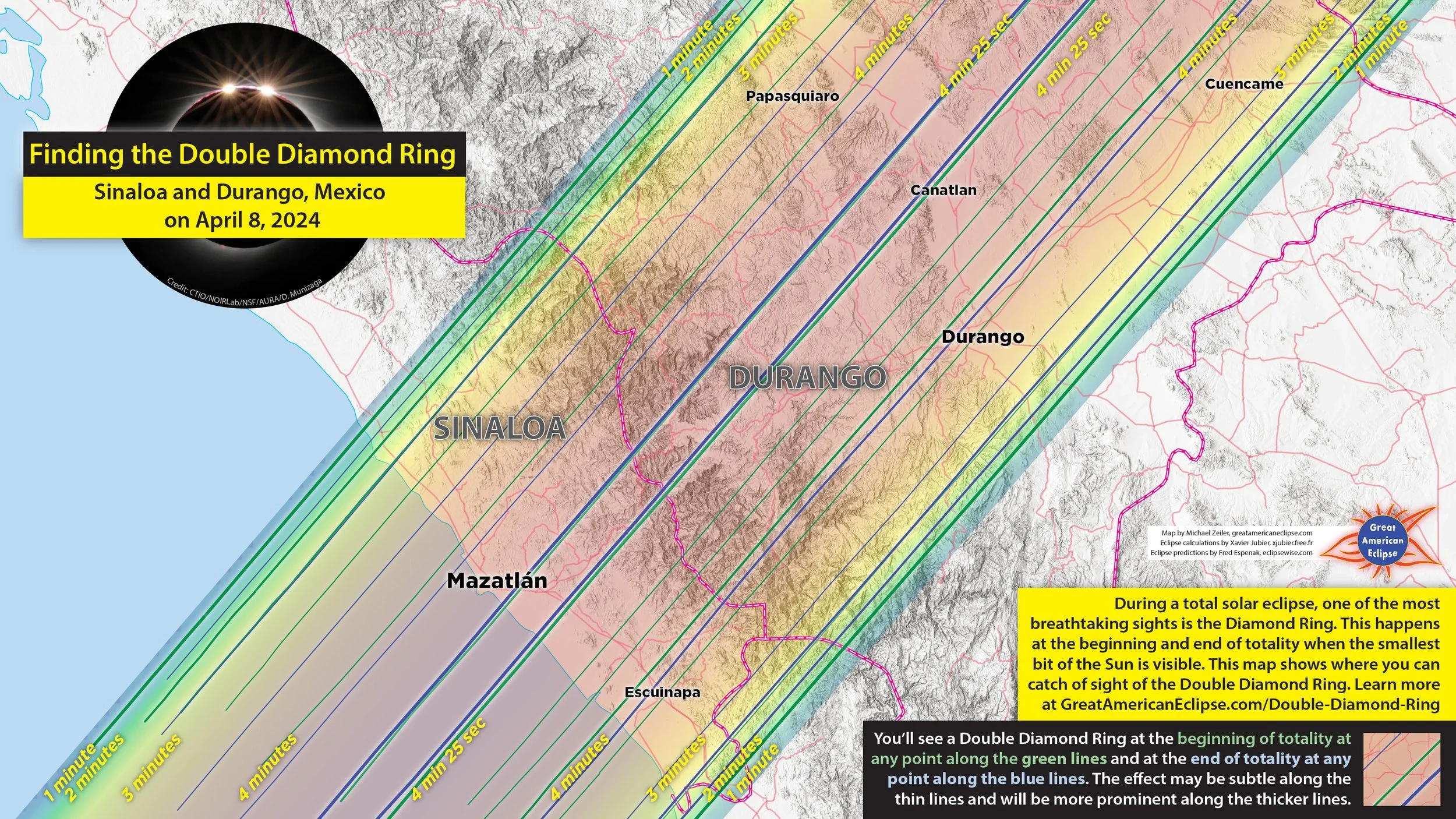
Double diamond ring in Nayarit and Durango
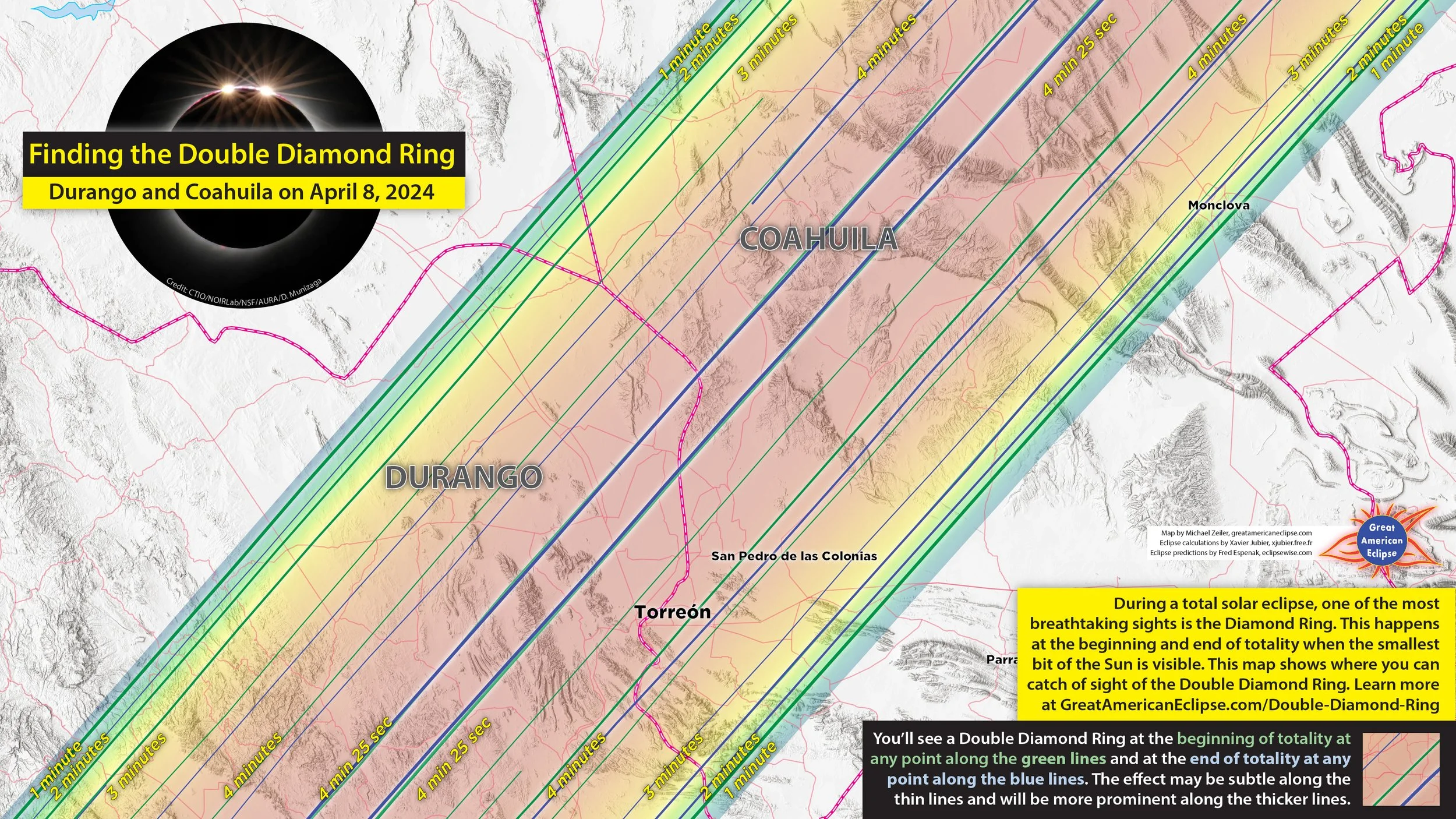
Double diamond ring in Durango and Coahuila
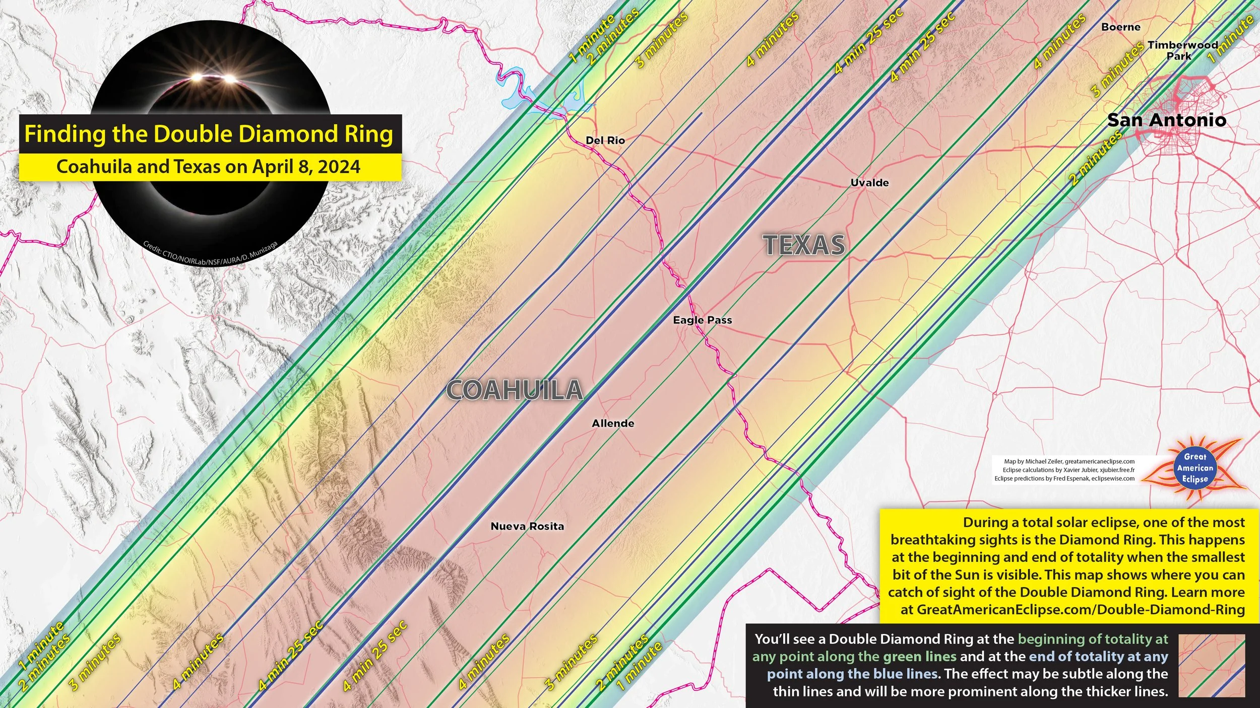
Double diamond ring in Coahuila and Texas
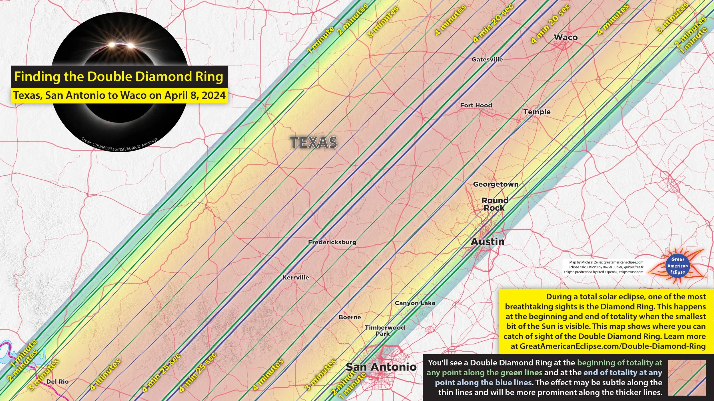
Double diamond ring in Texas
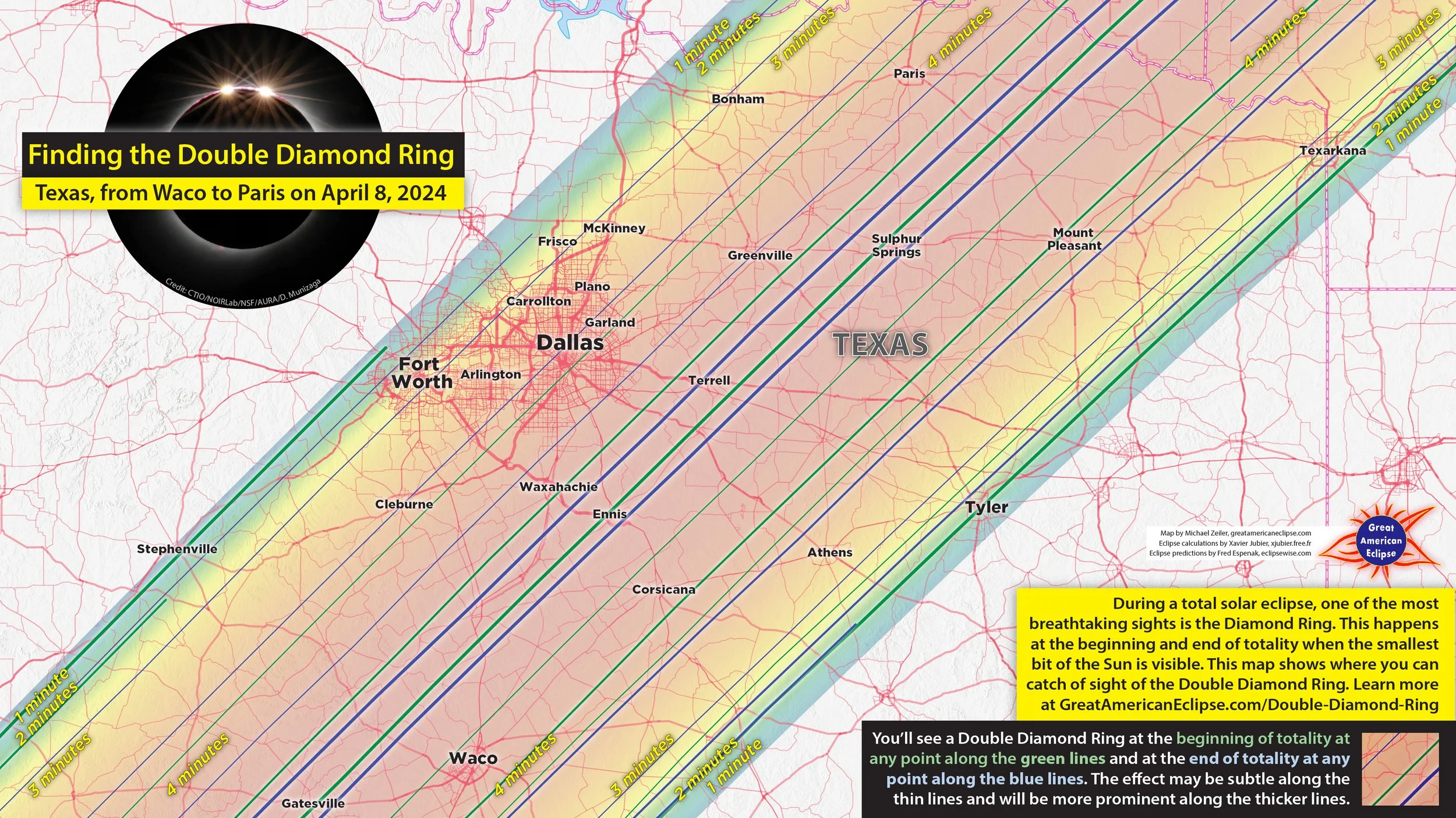
Double diamond ring in Texas

Double diamond ring in Oklahoma and Arkansas
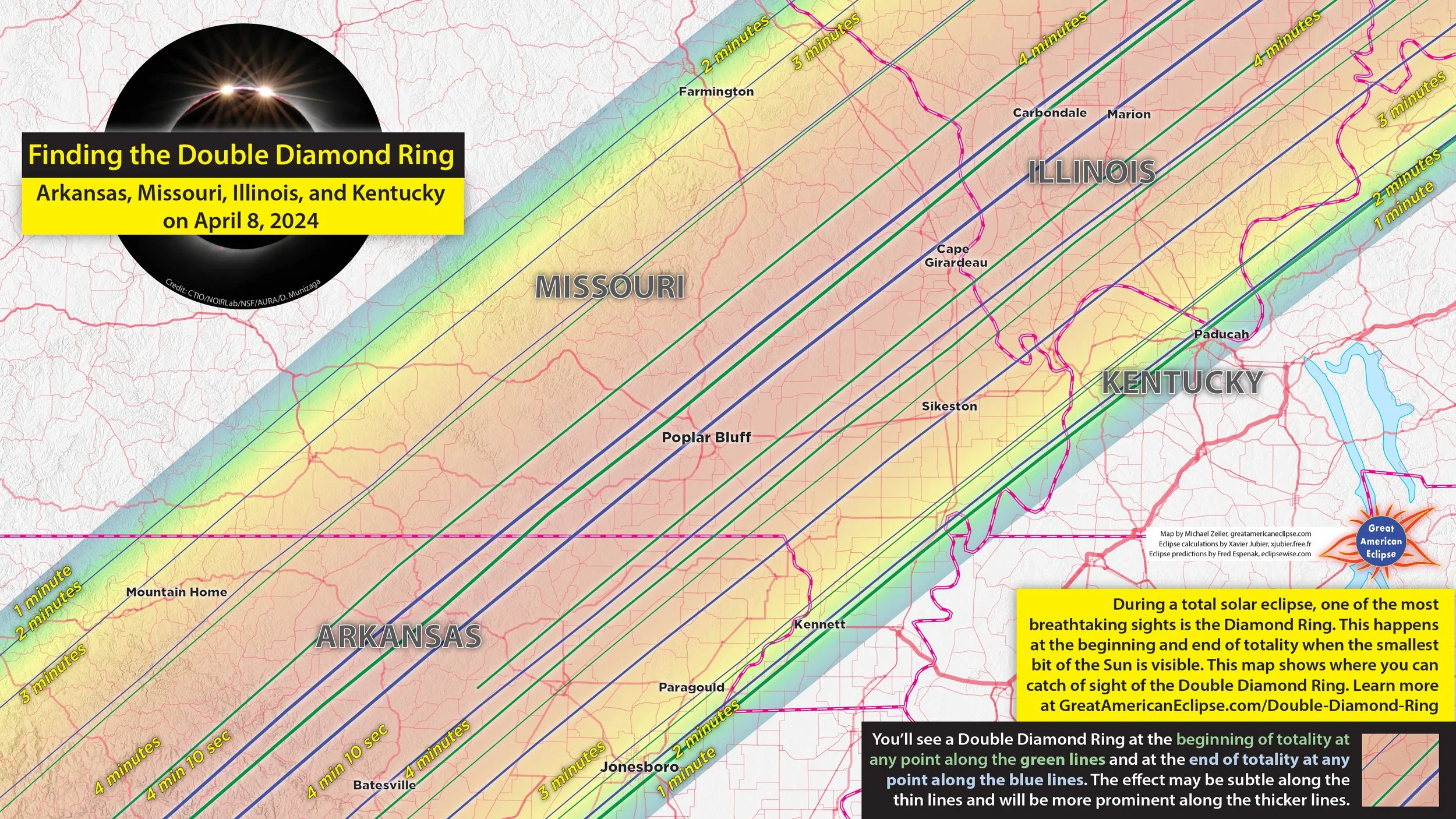
Double diamond ring in Arkansas, Missouri, Illinois, and Kentucky

Double diamond ring in Illinois and Indiana
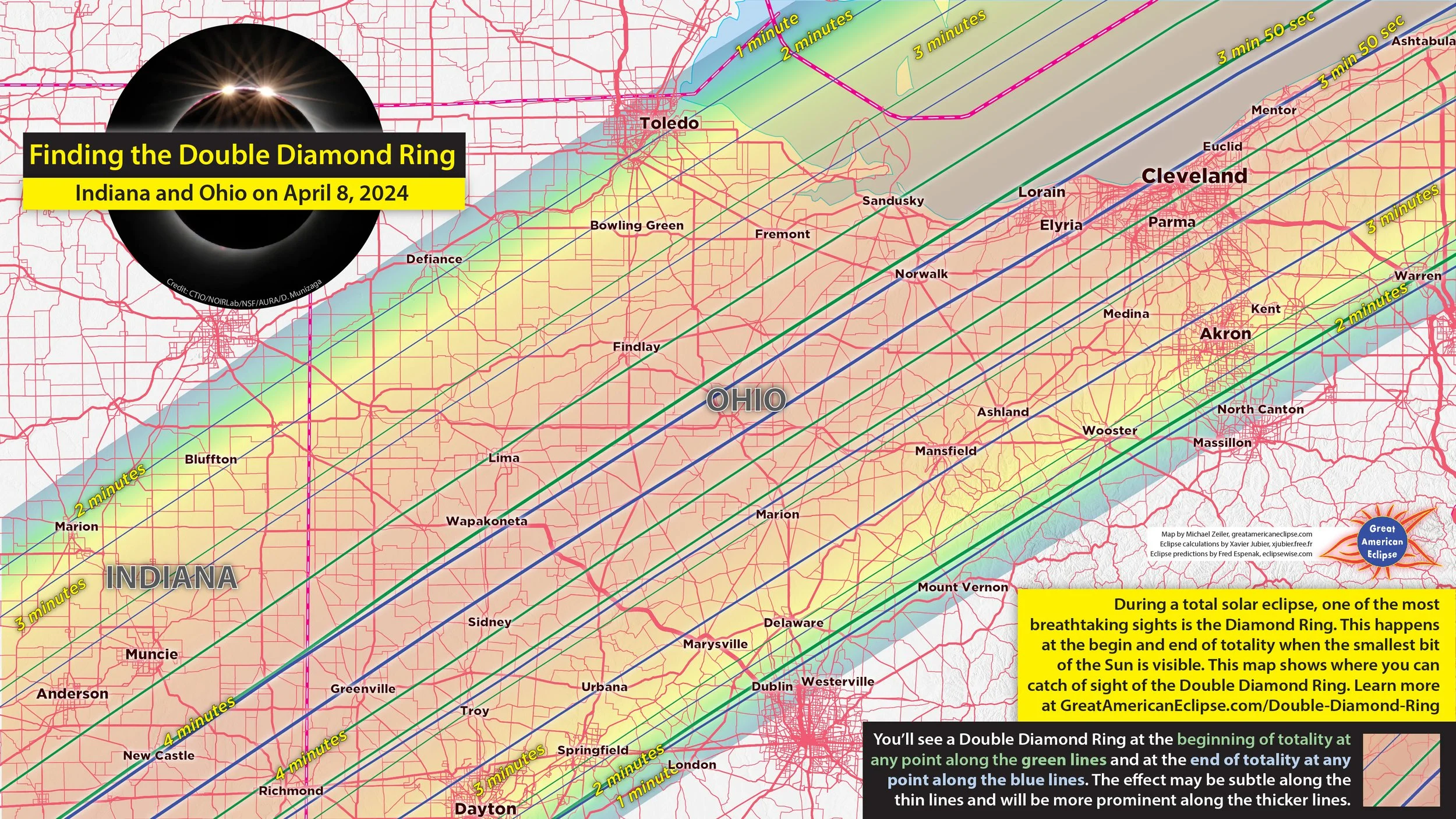
Double diamond ring in Indiana and Ohio
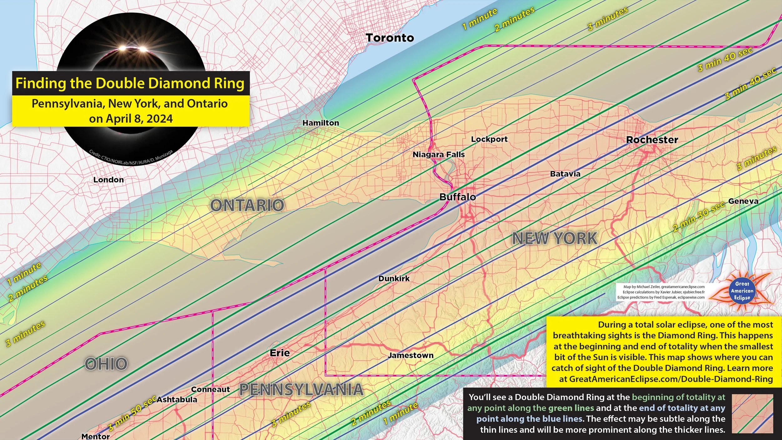
Double diamond ring in Pennsylvania, New York, and Ontario
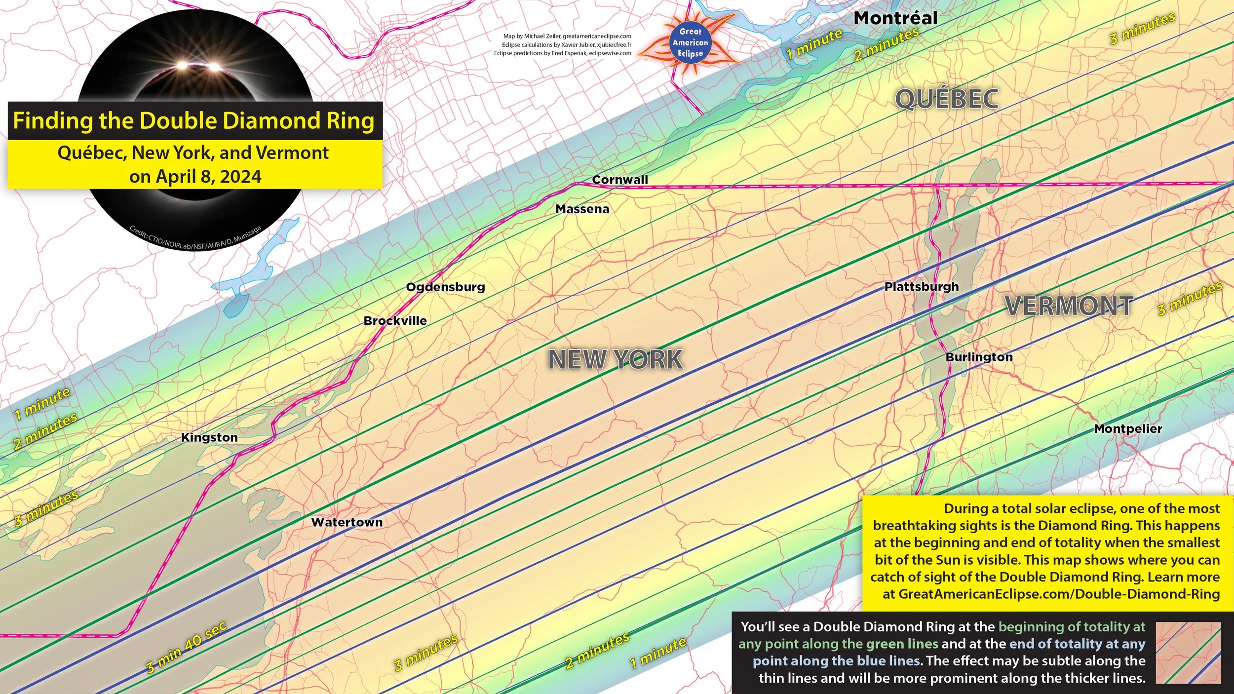
Double diamond ring in Québec, New York, and Vermont

Double diamond ring in Québec and Maine
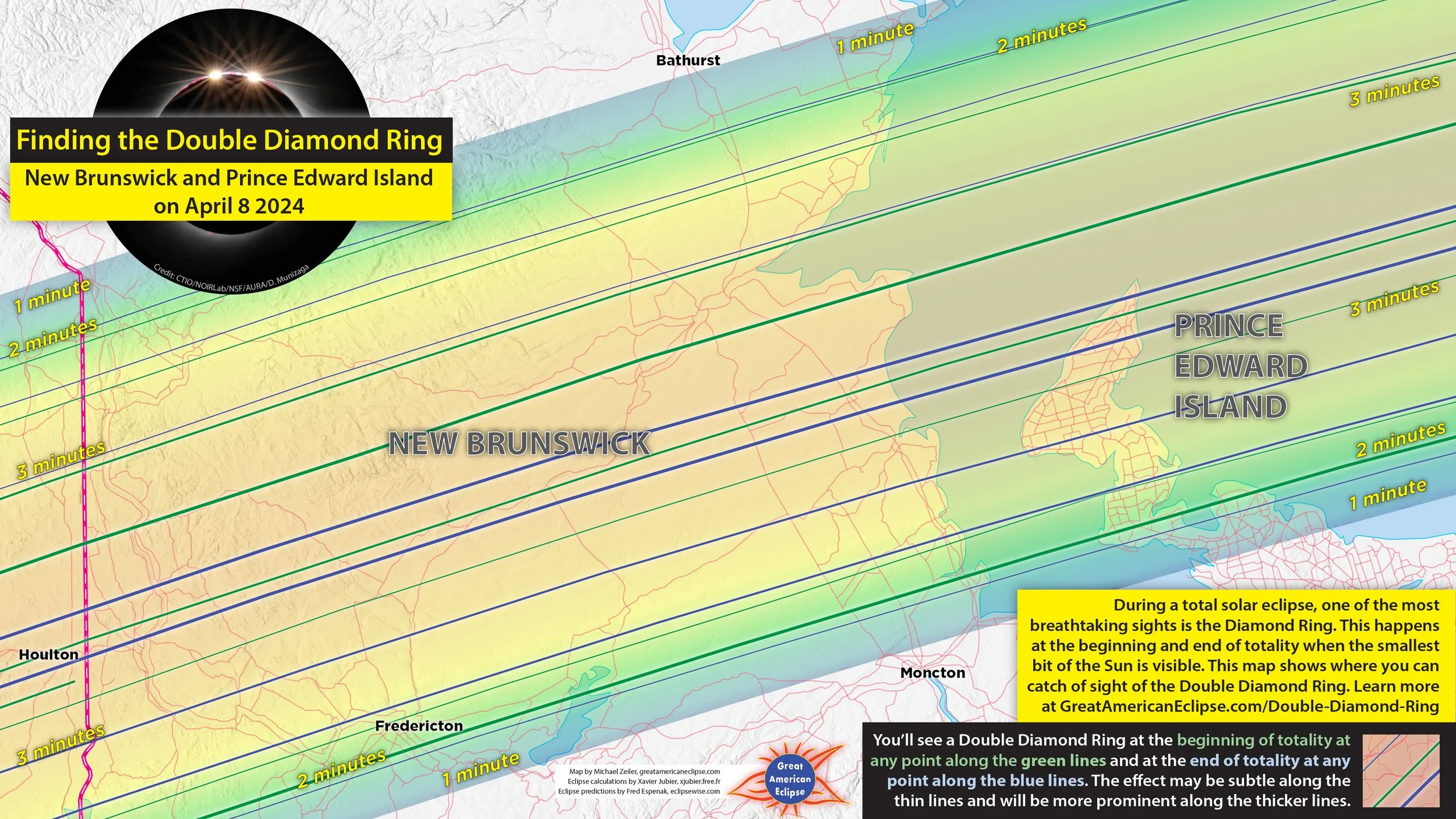
Double diamond ring in New Brunswick and Prince Edward Island
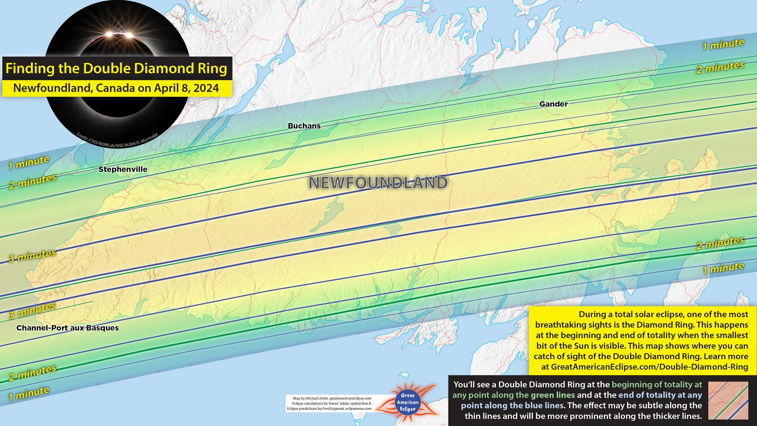
Double diamond ring in Newfoundland
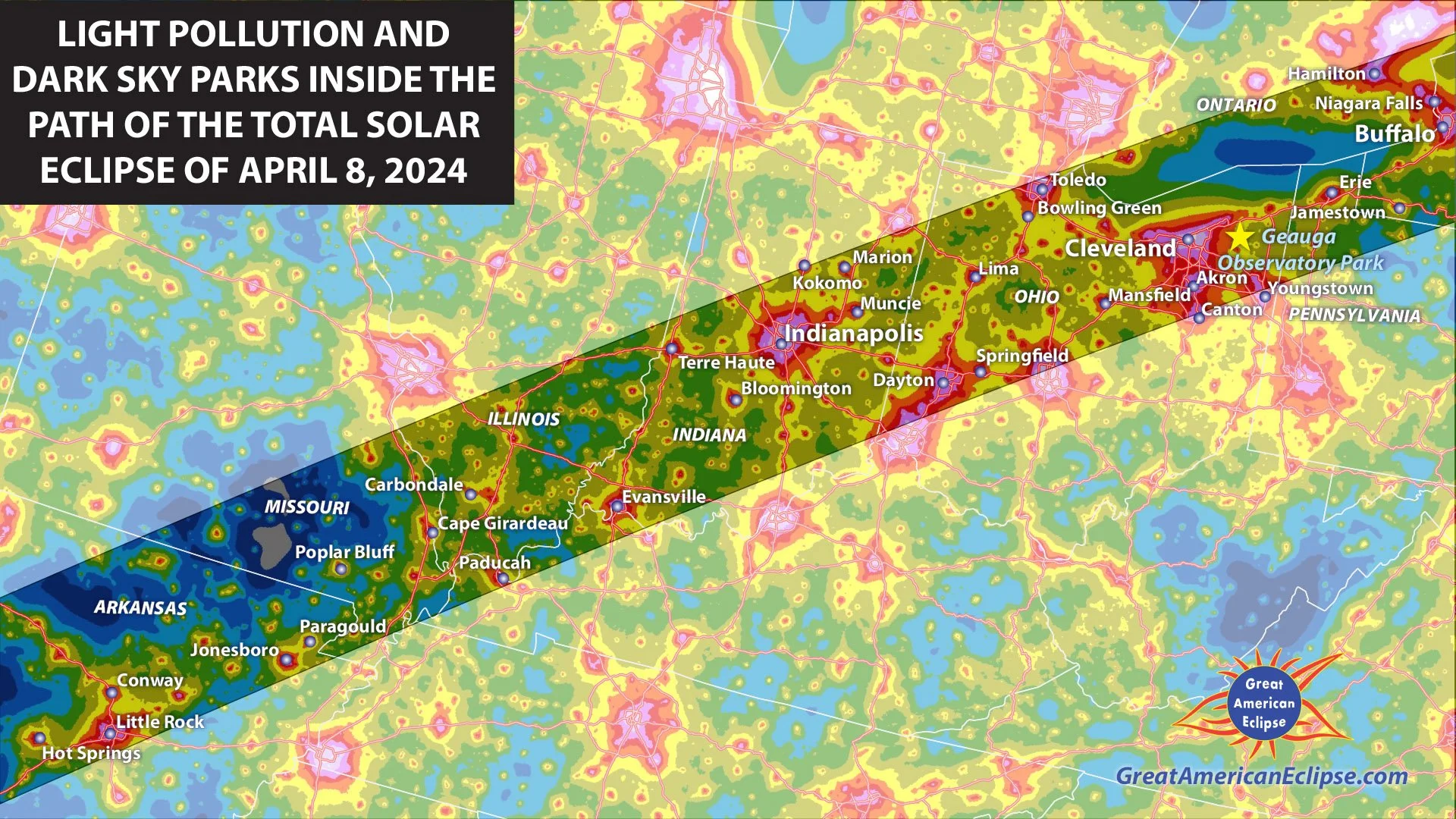
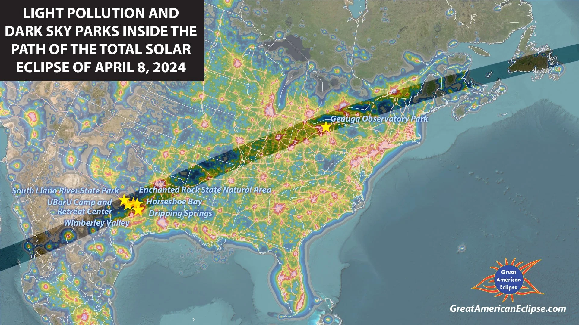
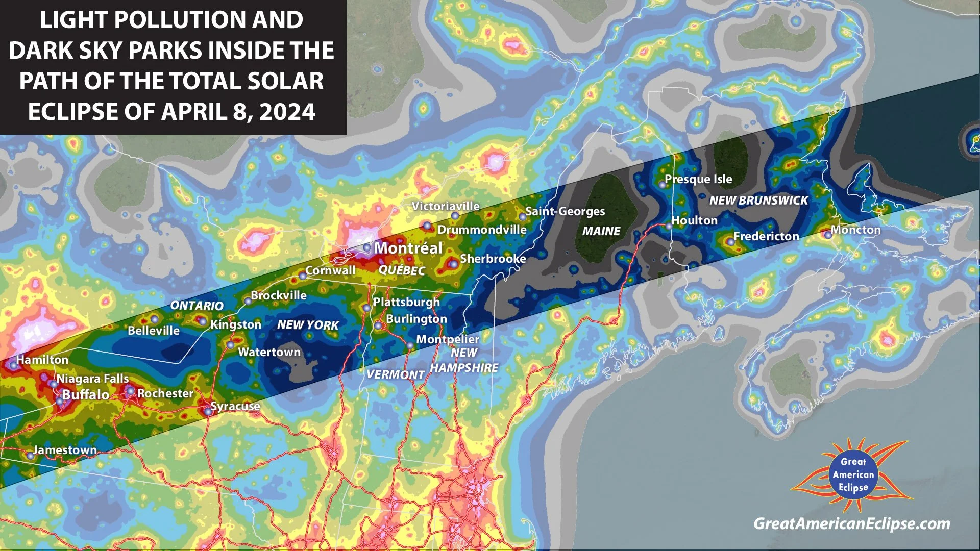
Light pollution maps in the path of totality
Many people travel to dark sky locations where they might have a dramatic view of the Milky Way. These maps assist in finding dark locations